


Why visit Cameley
Townapedia lists 3 parks and trails, 6 places to eat, 1 place to stay and 2 attractions in and around town.
Highlights include Stephen's Vale Nature Reserve.
Weather in Cameley
Forecast from MET Norway (CC BY 4.0). Full forecast
About Cameley
Cameley is a village in the civil parish of Temple Cloud with Cameley, within the Chew Valley in Somerset, and on the northern slopes of the Mendip Hills, in the Bath and North East Somerset Council area just off the A37 road. It is located 11 miles (18 km) from Bristol, Bath and Wells. The nearest town is Midsomer Norton, which is 6 miles (10 km) away. The parish has a population of 1,292 and includes the village of Temple Cloud.
From the Wikipedia article Cameley (this version), under CC BY-SA 4.0.
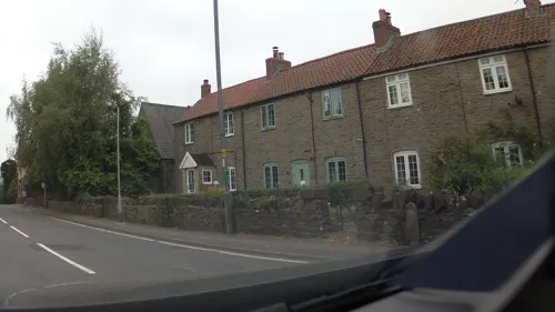
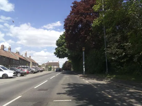
Photos of Cameley


Things to do2

Parks, trails and playgrounds3

Stephen's Vale Nature Reserve
Park · 1.7 mi
Nature reserve in Somerset, England

Restaurants and cafes6


Where to stay1

History
It lies on Cam Brook. According to Robinson it was listed as Camelie in the 1086 Domesday Book and the name means 'The curved river meadow' from the Celtic cam and Old English leah.
About 1150 the manor was given to Bath Abbey by the Alnes (or d'Alneto) family. In the 13th century it was held by the Marisco family, better known for their connection with Lundy, and then passed into the control of the Knights Templar, which was confirmed in a grant of 1201. During the 13th and early 14th century the manor was again under the control of the de Marisco family.
From the History section of Cameley on Wikipedia, under CC BY-SA 4.0.
Churches and places of worship15
Church of St Nicholas and the Blessed Virgin Mary, Stowey
Church · 1.3 mi
Shopping2
Gas and EV charging1
Schools, colleges and libraries2
Map of Cameley
32 places. The map loads OpenStreetMap tiles when you open it.
Getting there and nearby towns
Bristol Airport (BRS) is the nearest airport with scheduled flights listed in OpenStreetMap, 8 miles away.
- Bishop Sutton 2 mi northwest, about 3 min by car
- Midsomer Norton 4 mi southeast, about 6 min by car
- Chew Magna 4 mi northwest, about 7 min by car
- Winford 6 mi northwest, about 10 min by car
- Keynsham 7 mi north, about 12 min by car
- Blagdon 7 mi west, about 11 min by car
- Wells 8 mi southwest, about 14 min by car
- Shepton Mallet 9 mi south, about 14 min by car
- Bristol 10 mi north, about 16 min by car
- Bath 10 mi northeast, about 15 min by car
Drive times are estimates from straight-line distance, not routes.
Towns near Cameley


Keep exploring
Local news
Headlines from INDB.
Reviews, tips and questions
Loading what members have shared...
Sources and licences
- GeoNames (CC BY 4.0): population, coordinates, regions and time zone
- Mapillary (see each image): photos
- OpenStreetMap contributors (ODbL 1.0): places, airports, map data
- Wikidata (CC0 1.0): elevation, founding date, time zone, website, landmarks and historic places
- Wikimedia Commons (see each image): photos
- Wikipedia (CC BY-SA 4.0): overview and history text
Photo credits
- Cameley church 2, Rodw at English Wikipedia, CC BY-SA 3.0
- The memorial to John Rees-Mogg in the Church of St James, Cameley, Somerset (4250311999), Robert Cutts from Bristol, England, UK, CC BY 2.0
- Church of St James, Cameley tower 2, Rodw, CC BY-SA 3.0
- Church of St James, Cameley 4, Rodw, CC BY-SA 3.0
- Church of St James, Cameley 9, Rodw, CC BY-SA 3.0
- Church of St James, Cameley side, Rodw, CC BY-SA 3.0
- Church of St James, Cameley 3, Rodw, CC BY-SA 3.0
- Church of St James, Cameley 6, Rodw, CC BY-SA 3.0
- Church of St James, Cameley tower, Rodw, CC BY-SA 3.0
- Church of St James, Cameley 5, Rodw, CC BY-SA 3.0
- Cameley Church (St. James), hugh llewelyn, CC BY-SA 2.0
- Clutton church, Rodw at English Wikipedia, CC BY-SA 3.0
- Temple cloud cameley eglise, Velvet, CC BY-SA 3.0
- St Laurence, East Harptree (52049475208), The National Churches Trust, CC BY 2.0
- Ston Easton church, Dr Duncan Pepper, CC BY-SA 2.0
- Litton church, Rodw at English Wikipedia, Public domain
- West harptree church, Rodw at English Wikipedia, Public domain
- Paulton church, Rodw at English Wikipedia Rod Ward, Public domain
- Hinton blewett church, Rodw at English Wikipedia, CC BY-SA 3.0
- Church of St Nicholas and St Mary, Stowey from south, Rodw, CC BY-SA 3.0
- Street-level photo, southglos, CC BY-SA 4.0
- Street-level photo, southglos, CC BY-SA 4.0
- Street-level photo, southglos, CC BY-SA 4.0
- Street-level photo, southglos, CC BY-SA 4.0
- Street-level photo, southglos, CC BY-SA 4.0
- Street-level photo, southglos, CC BY-SA 4.0


Page built November 10, 2026. Spotted a mistake? Tell us or suggest a place.