


Why visit Runcorn
Townapedia lists 18 museums and landmarks, 26 parks and trails, 95 places to eat, 4 places to stay and 10 attractions in and around town.
Highlights include Brindley Theatre, Hale Head Lighthouse, Catalyst Museum and Runcorn War Memorial.
Weather in Runcorn
Forecast from MET Norway (CC BY 4.0). Full forecast
About Runcorn
Runcorn is an industrial town and cargo port within the Borough of Halton in Cheshire, England. It lies on the south bank of the River Mersey, where the estuary narrows to form the Runcorn Gap, and is located approximately 15 miles (24 km) southeast of Liverpool and 29 miles (47 km) southwest of Manchester. The Runcorn built-up area had a population of 61,145 at the 2021 census.
From the Wikipedia article Runcorn (this version), under CC BY-SA 4.0.
Travel tips from other travellers: Runcorn on Wikivoyage (CC BY-SA 4.0).
Photos of Runcorn


Things to do10


Mersey Gateway Bridge
Bridge · 1.1 mi
Toll bridge over the River Mersey

Old Quay Bridge
Bridge · 0.4 mi
Grade II listed swing bridge in Wigg Island, Runcorn, Cheshire, England, United Kingdom

Runcorn Railway Bridge
Bridge · 0.5 mi
Bridge in Halton, Cheshire, England, UK
The Brindley
Cinema and theater
Arts centre in Runcorn, Cheshire, England
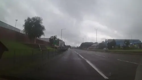

Silver Jubilee Bridge
Bridge · 0.4 mi
Grade II listed through arch bridge in Runcorn/Widnes, UK

Museums and landmarks18


Runcorn War Memorial
Monument and historic site · 0.7 mi
War memorial in Runcorn, Cheshire, England, UK

The Seneschal's House
Monument and historic site · 1.5 mi
Main Street, Runcorn
Catalyst Science Discovery Centre
Museum · 0.7 mi
Science centre and museum devoted to the chemical industry in the United Kingdom

Norton Priory Museum and Gardens
Museum · 2.1 mi
Historic site in Norton, Runcorn, Cheshire, England, United Kingdom

Widnes War Memorial
Monument and historic site · 2.3 mi
War memorial in Widnes, Cheshire, England, UK



ICI General Chemicals, Widnes Research Laboratory
Monument and historic site · 0.7 mi
6 more on the map.
Parks, trails and playgrounds26
Wigg Island
Park · 1.2 mi
Nature reserve in Runcorn, Cheshire, England


Hale Duck Decoy
Park · 2.2 mi
Duck decoy and nature reserve in Halton, Cheshire, England, UK


Victoria Park, Widnes
Park · 2.3 mi
Park in Widnes, Cheshire, England, United Kingdom




14 more on the map.
Restaurants and cafes95
Costa
Cafe · Coffee Shop
Crosville Way, Runcorn
Mo 07:30-19:00; Tu-Fr 06:00-20:00; Sa 06:00-19:00; Su 08:00-19:00

Desii Indian Cuisine
Restaurant · Indian · 1.4 mi
7-15 Alforde Street, Widnes
Fr-Sa 17:00-23:00; Su-Th 17:00-22:00
La Cantina
Restaurant · Spanish · 1.4 mi
19 Alforde Street, Widnes
Tu-Th 16:00-22:30; Fr-Sa 16:00-23:00; Su 12:30-19:00



83 more on the map.
History
The earliest written reference to the town is in the Anglo-Saxon Chronicle, where it is spelled "Rumcofan", literally meaning "a wide cove or bay". This word is derived from the Old English words "rúm" ("wide" or "broad") and "cofa" ("cave" or "cove"). Other historical spellings of Runcorn include "Rumcoven", "Ronchestorn", "Runckhorne", and "Runcorne".
Little is known about the early history of the settlement but isolated findings of objects from the Stone, Bronze, and Iron Ages have been made and there is evidence of a Roman presence in the area.
The first recorded event in its history is the building by Æthelflæd of a fortification at Runcorn to protect the northern frontier of her kingdom of Mercia against the Vikings in 915. The fort was built on Castle Rock overlooking the River Mersey at Runcorn Gap.
Following the Norman Conquest, Runcorn was not mentioned in the 1086 Domesday survey, although surrounding settlements were. William the Conqueror granted the earldom of Chester to Hugh d'Avranches, who granted the barony of Halton to Nigel of Cotentin. It is likely that Nigel erected a motte and bailey castle on Halton Hill in the 1070s.
Read more of the history
In 1115, Nigel's son, William fitz Nigel, founded an Augustinian priory at Runcorn. In 1134, the priory was moved to Norton, about 3+1⁄2 miles (6 kilometres) away. In 1391, the priory was raised to the higher status of abbey. In 1536, the monastery was dissolved, and around nine years later, the buildings and some of the monastic lands were sold to Sir Richard Brooke who converted the habitable part of the abbey into a house.
In 1565, Rocksavage, an Elizabethan Hall, was constructed for Sir John Savage in Clifton, now part of Runcorn.
During the Civil War, Halton Castle was held for the Royalists by John Savage, 2nd Earl Rivers, the Steward of Halton. It fell twice to Parliamentarian Roundheads. The first siege was led by Sir William Brereton in 1643; the second was in 1644. Following this, a "Council of War" was held in Warrington in 1646 at which it was decided that the castle should be slighted.
In 1656, Runcorn was described as "nothing but a fair parish church, a parsonage and a few scattered tenements". And so it remained for over a century; an isolated and poor hamlet. The only through traffic used the ferry which crossed from Runcorn to the north bank of the River Mersey.
During the 18th century, water transport had been improved in the area by the Mersey and Irwell Navigation, the Bridgewater Canal and the Trent and Mersey Canal. This gave Runcorn waterway connections with most of the interior of England through the canal system and with the sea along the River Mersey, thus forming the basis for the development of the Port of Runcorn. Later came the Runcorn to Latchford Canal linking with the Mersey and Irwell Navigation, and the Weston Canal which gave better access to the Weaver Navigation system. Industries began to develop within and around the town, in particular shipbuilding, engineering, chemical manufacturing, tanning, and sandstone quarrying.
Towards the end of the 18th century and in the early years of the 19th century, the town was a health resort. The growth of industry did not diminish Runcorn's late 18th and early 19th century reputation as a health resort and the "Montpelier of England". In 1822 the town's first Saltwater Baths opened followed by new visitor accommodation in Belvedere Terrace in 1831. In the middle of the century, the growing wealth of the town and its industrialists saw the construction of several new landmarks, including Halton Grange, St Paul's Methodist Chapel and All Saints' Church.
Runcorn was becoming an industrialised and highly polluted town. During the later 19th century the town became increasingly dominated by the chemical and tanning industries. In the 1880s a pipeline was opened between Northwich and Weston Point, supplying brine to the salt works and in 1896 the Castner Kellner chemical works was established. In 1894 the Manchester Ship Canal was opened throughout its length. This allowed ocean-going ships to travel inland as far as Salford, some of them calling at the port of Runcorn. The rise in population between 1881 and 1891 and the drop by 1901 is explained by the number of people involved in constructing the ship canal.
For hundreds of years, the only means of crossing the River Mersey at this point had been by the Runcorn ferry. Thomas Telford proposed a 1,000 ft (300 m) single span suspension bridge as early as 1817, but not until 1868 did the first bridge, Runcorn Railway Bridge, open across the Mersey at Runcorn. This gave the town direct rail links with Liverpool and the rest of the country. In 1905, the Widnes–Runcorn Transporter Bridge opened, giving a direct link for vehicular traffic for the first time between the two towns. This would not be replaced until 1961 with the construction of Runcorn Road Bridge (since renamed the Silver Jubilee Bridge) which allowed a more efficient means of road traffic across Runcorn Gap.
During the first half of the 20th century, the town's industry continued to be dominated by chemicals and tanning. This growth was largely due to government fixed-priced cost contracts for tanned hides. In 1926, four chemical companies merged to form Imperial Chemical Industries (ICI). In 1937, ICI began to build a new factory for mustard gas production at their Randle plant on Wigg Island. The ICI chemical plants at Runcorn featured in the Gestapo Black Book as a company of special interest but although the works at Weston Point were discussed at Luftwaffe briefings in 1940, the town was never deliberately targeted and was subject only to very limited bombing. During the second half of the 20th century, the tanneries closed (the last to close was the Highfield Tannery in the late 1960s) and the chemical industry declined. At the same time, light industry developed together with warehouses and distribution centres.
From the History section of Runcorn on Wikipedia, under CC BY-SA 4.0.
More about Runcorn
Geography
Runcorn is on a spur projecting into the River Mersey, which flows to the north and then to the west of the town. On the river's north bank is another spur forming the West Bank area of Widnes; together these form Runcorn Gap, a narrowing of the River Mersey. The town is bounded to the southwest by the Weaver Navigation; to the south by the Chester–Manchester and Crewe–Liverpool railway lines; and to the east by the West Coast Main Line until the village of Moore. A series of valleys is formed by high points at Runcorn Hill (75m AOD), Halton Castle (75m AOD), Windmill Hill (70m AOD) and Keckwick Hill (75m AOD).
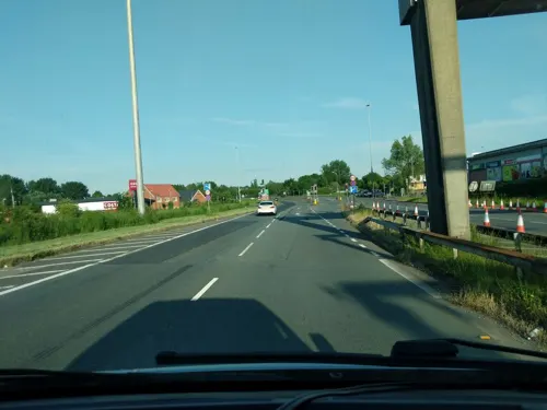
Runcorn Gap is crossed by three bridges: Runcorn Railway Bridge (which carries the Liverpool branch of the West Coast Main Line), the Silver Jubilee Bridge and the Mersey Gateway which carries the A533. A system of dual carriageways called 'expressways' form a figure of 8 around the town. The Central Expressway runs through the centre of the town in a north–south direction and is the main through-road. It connects to the M56 motorway which cuts into the south of the town.
Economy
In 2020, the GVA for the Runcorn Built-up Area Sub-division was £2.86 billion.
Runcorn has a higher proportion of people working in manufacturing, logistics, and wholesale and retail than the average for England. Chemical manufacturing has been the town's dominant sector since the 19th century, but the local economy has increasingly diversified into other advanced manufacturing sectors, such as aerospace and automotive, as well as services and logistics.
The main industrial areas of the town are Astmoor, Manor Park, Whitehouse, the Heath and Weston Point. Sci-Tech Daresbury is to the southeast of the town. The main retail and leisure area is Shopping City in the centre of the town with a smaller district centre at the old town.
Arts and culture
The Brindley is a theatre and arts centre which opened in 2004. It is in the old town and named after James Brindley, engineer of the adjacent Bridgewater Canal. It contains a proscenium theatre seating 420 and a multi-purpose theatre seating 108, The Studio, which doubles as a cinema. There is an exhibition space for art installations, a small café and multi-purpose rooms. The centre is owned and administered by Halton Borough Council, which runs community events in the building. In 2007, it won 'Best Arts Project in the UK' at the National Lottery Awards. A multiplex cinema was run by Cineworld at Trident Retail Park until its closure in 2023.
Runcorn is served by two weekly newspapers: the Runcorn & Widnes Weekly News, published by Trinity Mirror North West & North Wales and hosted online by the Liverpool Echo, and the Runcorn and Widnes World, published by Newsquest. The town is also home to Halton Community Radio, a volunteer-run radio station that broadcasts over the Runcorn and Widnes area. It launched in 2008 with a five-year licence to broadcast. The station has stopped broadcasting as of 2025.
From the Wikipedia article Runcorn, under CC BY-SA 4.0.
Notable people from Runcorn
 Hall CaineBritish novelist and playwright (1853-1931)Photo: Unknown author Unknown author, Public domain
 John BishopEnglish comedian and actorPhoto: Dudley Council from England, CC BY 2.0
 Shauna CoxseyEnglish rock climberPhoto: Henning Schlottmann, User:H-stt, CC BY-SA 4.0
 Michael JacksonEnglish professional football defender (born 1973)Photo: Timmy96, CC0
 Jimmy McNultyScottish association football player (born 1985)Photo: Joe Vitale 5, CC BY-SA 4.0
 Phil CollinsEnglish visual artist; b. 1970 (born 1970)Photo: Lenacorner, CC BY-SA 3.0
 Kenny LuntFootballer (born 1979)Photo: Paul W, CC BY-SA 4.0
 Thomas HazlehurstBritish philanthropist (1816-1876)Photo: No machine-readable author provided...., Public domain
- Graham AbelEnglish football defender (born 1960)
- Robert DoneEnglish footballer (1904-1982)
- Alistair TaylorPersonal assistant and general manager (1935–2004)
- Scott BrownEnglish association football player (born May 1985)
Born in Runcorn, according to Wikidata (CC0). Each name links to its Wikipedia article.
Where to stay4
Churches and places of worship34
Shopping17
Gas and EV charging6
Schools, colleges and libraries22
Blessed Carlo Acutis Catholic and Church of England Academy
School · Anglican, Roman Catholic · 1.4 mi
Grangeway, Runcorn
St Gerard's Catholic Primary and Nursery School
School · Roman Catholic · 1.5 mi
Lugsdale Road, Widnes
Healthcare10
Map of Runcorn
242 places. The map loads OpenStreetMap tiles when you open it.
Getting there and nearby towns
Liverpool John Lennon Airport (LPL) is the nearest airport with scheduled flights listed in OpenStreetMap, 5 miles away.
- Widnes 1 mi north, about 2 min by car
- Halewood 4 mi west, about 7 min by car
- Speke 5 mi west, about 7 min by car
- Rainhill 5 mi north, about 9 min by car
- Whiston 6 mi northwest, about 10 min by car
- Woolton 6 mi west, about 10 min by car
- Warrington 7 mi northeast, about 12 min by car
- St Helens 7 mi north, about 12 min by car
- Allerton 7 mi west, about 11 min by car
- Childwall 8 mi northwest, about 13 min by car
Drive times are estimates from straight-line distance, not routes.
Towns near Runcorn


Keep exploring
Local news
Headlines from INDB.
Reviews, tips and questions
Loading what members have shared...
Sources and licences
- GeoNames (CC BY 4.0): population, coordinates, regions and time zone
- Mapillary (see each image): photos
- OpenStreetMap contributors (ODbL 1.0): places, airports, map data
- Wikidata (CC0 1.0): elevation, founding date, time zone, website, landmarks and historic places
- Wikimedia Commons (see each image): photos
- Wikipedia (CC BY-SA 4.0): overview and history text
Photo credits
- Silver Jubilee Bridge, user:Peter I. Vardy, Public domain
- The Royal Public House Runcorn - panoramio, Joe Blundell, CC BY-SA 3.0
- Old Police Station, Runcorn, David Peace, CC BY-SA 4.0
- Old Town Hall Runcorn - panoramio, Joe Blundell, CC BY-SA 3.0
- Hale Lighthouse, Peter I. Vardy, Public domain
- The Mersey Gateway Bridge viewed from Halton Castle in Runcorn, Cheshire, England, David Peace, CC BY-SA 4.0
- Old Quay Bridge Closed, Outwivcamera, CC BY-SA 4.0
- Runcorn Railway Bridge, Unknown author, Public domain
- Runcorn War Memorial, Peter I. Vardy, CC BY-SA 4.0
- Norton Priory, Unknown author, Public domain
- Victoria Park, Widnes (13), Rept0n1x, CC BY-SA 3.0
- Hale-Duck Decoy 2, No machine-readable author provided. Peter I. Vardy assumed (based on copyright claims)., Public domain
- Climbing Boulders with Norton Water Tower In the Background (Town Park) Runcorn - panoramio, Joe Blundell, CC BY-SA 3.0
- Victoria Park, Widnes (3), Rept0n1x, CC BY-SA 3.0
- Christ Church, Weston Point 2, George Robinson, CC BY-SA 2.0
- Widnes St Bede, Peter I. Vardy, Public domain
- St John's, Weston, Unknown author, Public domain
- Widnes Farnworth St Luke 2, Peter I. Vardy, Public domain
- Widnes St Marie 1, Peter I. Vardy, Public domain
- Hale Church 1, Peter I. Vardy, Public domain
- Brindley Arts Centre, Runcorn, Peter I. Vardy, Public domain
- Catalyst 2149, Chemical Engineer, CC BY-SA 3.0
- A remnant of the Runcorn and Latchford canal on Wigg Island, Ian Greig, CC BY-SA 2.0
- Runcorn All Saints 1, No machine-readable author provided. Peter I. Vardy assumed (based on copyright claims)., Public domain
- Widnes St Mary's, Peter I. Vardy, Public domain
- Senechal's House 2, No machine-readable author provided. Peter I. Vardy assumed (based on copyright claims)., Public domain
- Spike Island, Peter I. Vardy, Public domain
- Brookfield Farm, No machine-readable author provided. Peter I. Vardy assumed (based on copyright claims)., Public domain
- The Elms, Runcorn, Unknown author, Public domain
- Runcorn Town Hall Park (1), Rept0n1x, CC BY-SA 3.0
- Catalyst building 2015 6, Photograph by Mike Peel ( www.mikepeel.net )., CC BY-SA 4.0
- Floodbrook Clough, Runcorn 1, Dgp4004, CC0
- Phoenix Park, Runcorn - DSC06736, Rept0n1x, CC BY-SA 3.0
- The Royal Public House - panoramio, Joe Blundell, CC BY-SA 3.0
- Selwyns Travel 124 YJ04HHY (8710520900), Alan Sansbury from Liverpool, England, CC BY 2.0
- Ashcrofts Travel LJI3799 (9093511134), Alan Sansbury from Liverpool, England, CC BY 2.0
- Street-level photo, rikwilson, CC BY-SA 4.0
- Street-level photo, rikwilson, CC BY-SA 4.0
- Street-level photo, trigpoint, CC BY-SA 4.0
- Street-level photo, rikwilson, CC BY-SA 4.0
- Street-level photo, rikwilson, CC BY-SA 4.0
- Street-level photo, rikwilson, CC BY-SA 4.0
- Street-level photo, trigpoint, CC BY-SA 4.0
- Street-level photo, trigpoint, CC BY-SA 4.0


Page built November 10, 2026. Spotted a mistake? Tell us or suggest a place.