


Chesterfield, United Kingdom
Chesterfield is a city of 113,057 people in England, United Kingdom, founded in 1204.
Why visit Chesterfield
Townapedia lists 33 museums and landmarks, 62 parks and trails, 233 places to eat, 18 places to stay and 8 attractions in and around town.
Highlights include Boythorpe Viaduct, Doe Lea Viaduct, Bolsover Castle and Danesmoor War Memorial.
Weather in Chesterfield
Forecast from MET Norway (CC BY 4.0). Full forecast
About Chesterfield
Chesterfield is a market and industrial town in the county of Derbyshire, England. It is 24 miles (39 km) north of Derby and 11 miles (18 km) south of Sheffield at the confluence of the Rivers Rother and Hipper. The wider Borough of Chesterfield had a population of 103,569 in the 2021 Census. The town itself had a population of 76,402.
From the Wikipedia article Chesterfield, Derbyshire (this version), under CC BY-SA 4.0.
Travel tips from other travellers: Chesterfield on Wikivoyage (CC BY-SA 4.0).
Things to do8






Museums and landmarks33


Danesmoor War Memorial
Monument and historic site · 6.0 mi
Grade II listed war memorial in Clay Cross, North East Derbyshire, England, UK

Renishaw Hall
Museum · 4.6 mi
Grade I listed historic house museum in North East Derbyshire, England, UK

Stainsby Mill
Museum · 6.1 mi
Grade II listed watermill in Stainsby, Ault Hucknall, Bolsover, England, UK




Holymoorside & Walton North East Boundary Stone
Monument and historic site · 3.0 mi
BS Low Years Northeast 2000AD
21 more on the map.
Parks, trails and playgrounds62

Poolsbrook Country Park
Park · 2.9 mi
Park in Staveley, United Kingdom

Oakes Park
Park · 6.0 mi
Privately owned park in Sheffield, South Yorkshire, England, UK




Eastwood Park
Park · 1.9 mi
Nov-Feb: 07:00-18:00; Mar,Oct: 07:00-19:00; Apr,Sep: 07:00-20:00;...

50 more on the map.
Restaurants and cafes233
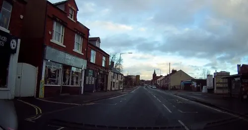
Caffè Nero
Cafe · Coffee Shop · 1.1 mi
9-11 Low Pavement, Chesterfield
Mo-Sa 07:00-18:30; Su 08:30-17:30
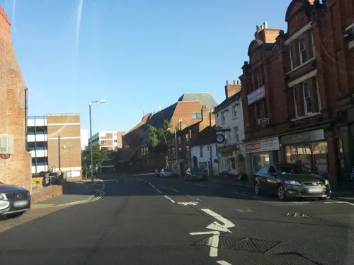
Spread Eagle
Bar and pub · 1.2 mi
7 Beetwell Street, Chesterfield
Mo-Th 12:00-22:00; Fr-Sa 12:00-23:00; Su 12:00-22:00
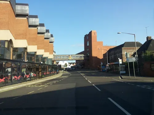
The Portland Hotel
Bar and pub · 1.2 mi
West Bars, Chesterfield
Mo,Tu,We,Th,Su 07:00-24:00; Fr,Sa 07:00-25:00

Figaro
Restaurant · Pizza, Coffee Shop, Sandwich, Cake · 3.5 mi
Unit 2 Allendale Road, Chesterfield
We-Fr 09:00-17:00; Sa 09:00-22:00; Su 10:00-16:00

St Thomas' Church Coffee Bar
Cafe · Coffee Shop · 2.2 mi
Chatsworth Road, Chesterfield
Mo-Fr 08:30-16:00; Sa 09:00-16:00
The Star of Sall
Restaurant · Indian · 0.7 mi
411 Sheffield Road, Chesterfield
Mo,We,Th,Su 17:30-23:00; Fr,Sa 17:30-24:00

221 more on the map.
History
Chesterfield was in the Hundred of Scarsdale. The town received its market charter in 1204 from King John, which constituted the town as a free borough, granting the burgesses of Chesterfield the privileges of those of Nottingham and Derby. In 1266, the Battle of Chesterfield saw a band of rebel barons defeated by a royalist army.
Elizabeth I granted a charter in either 1594 or 1598, creating a corporation of a mayor, six aldermen, six brethren, and twelve capital burgesses. This remained its charter until the borough was reshaped under the Municipal Corporations Act 1835. It originally consisted only of the township of Chesterfield but absorbed some surrounding townships in 1892. There was a major extension when the borough absorbed New Whittington and Newbold urban district in 1920. Chesterfield's current boundaries date from 1 April 1974, when the Borough of Chesterfield was formed under the Local Government Act 1972 by amalgamating the municipal borough of Chesterfield, the urban district of Staveley and the parish of Brimington from Chesterfield Rural District.
Read more of the history
Chesterfield benefitted much from the building of the Chesterfield Line – part of the Derby to Leeds railway (North Midland Line) begun in 1837 by George Stephenson. During the work, a sizeable seam of coal was discovered while the Clay Cross Tunnel was constructed. George then founded the Clay Cross company producing coal, iron ore, and limestone.
During his time in Chesterfield, Stephenson lived at Tapton House, remaining there until his death in 1848. He is interred in Trinity Church. A statue of him was erected outside Chesterfield railway station in 2006.
From the History section of Chesterfield, Derbyshire on Wikipedia, under CC BY-SA 4.0.
More about Chesterfield
Geography
Chesterfield lies at the confluence of the River Rother and River Hipper at the Nottinghamshire, Derbyshire and Yorkshire Coalfield, in the eastern foothills of the Pennines. It is sometimes described as the "Gateway to the Peak", with the Peak District National Park to the west of the town.
Nearby areas of the South and West Yorkshire Green Belt can serve to block urban sprawl. Other local greenfield frameworks include "strategic gaps" to maintain the openness and landscape qualities of large open areas, and "green wedges" penetrating urban areas with recreational facilities.
The wider Chesterfield Urban Area had a population of 112,664 at the 2021 Census, this included the town of Chesterfield along with its surrounding suburbs and the outlying villages and towns of Wingerworth, Staveley, Cutthorpe and Holymoorside.
Economy
Since the cessation of coal mining, the economy around Chesterfield has undergone major change. The employment base has moved from the primary and secondary sectors towards the tertiary. The area sits on an old, large coalfield which had many collieries, including those in outlying areas which were historically part of Chesterfield Rural District: Clay Cross, Arkwright Town, Bolsover, Grassmoor, North Wingfield and Holmewood.
Between 1981 and 2002, 15,000 jobs in the coal industry were lost and all collieries closed, although open cast mining took place at Arkwright Town for a few years from November 1993. Many mine sites were restored by a contractor for Derbyshire County Council. Little evidence of mining remains. A cyclists' and walkers' route, the "Five Pits Trail", links some former mines; most are now indistinguishable from the surrounding countryside.
From the Wikipedia article Chesterfield, Derbyshire, under CC BY-SA 4.0.
Notable people from Chesterfield
 John HurtBritish actor (1940–2017)Photo: David Shankbone, CC BY 3.0
 Matthew LowtonEnglish association football player (born 1989)Photo: Ben Sutherland, CC BY 2.0
 Bob WilsonScotland footballer and broadcaster (born 1941)Photo: Bob_Wilson_in_2009.jpg : Hilton..., CC BY-SA 3.0
 Ernie HarperBritish athlete (1902-1979)Photo: Hallamshire Harriers and Athletic Club, Public domain
 Francis FrithEnglish photographer (1822–1898)Photo: Francis Frith, Public domain
 Ben BarnicoatBritish racing driverPhoto: DriverDatabase1, CC BY-SA 4.0
 Emma Millerunion organizer, suffragist, founder of Australian Labour Party (1839-1917)Photo: Unknown author, Public domain
- Robert RobinsonEnglish chemist (1886-1975)
- Olave Baden-Powell(1889-1977) World Chief Guide
- Phil TaylorEnglish rock drummer (1954–2015)
- Barbara CastleBritish politician (1910–2002)
- Fred DavisEnglish snooker and billiards player (1913–1998)
Born in Chesterfield, according to Wikidata (CC0). Each name links to its Wikipedia article.
Where to stay18
Churches and places of worship74
Shopping60
Gas and EV charging14
Schools, colleges and libraries60
St Joseph's Catholic and CofE (VA) Primary School
School · Anglican, Roman Catholic · 2.5 mi
Calver Crescent, Chesterfield
St Mary's Catholic High School, A Catholic Voluntary Academy
School · Roman Catholic · 1.7 mi
Newbold Road, Chesterfield
Healthcare19
Peak Pharmacy
Clinic and pharmacy · 3.5 mi
190 North Wingfield Road, Chesterfield
Map of Chesterfield
250 places. The map loads OpenStreetMap tiles when you open it.
Getting there and nearby towns
Nottingham City Airport (NQT) is the nearest airport with scheduled flights listed in OpenStreetMap, 27 miles away.
- Sheffield 9 mi north, about 15 min by car
- Mansfield 12 mi southeast, about 19 min by car
- Rotherham 13 mi north, about 20 min by car
- Doncaster 22 mi northeast, about 36 min by car
- Derby 23 mi south, about 37 min by car
- Nottingham 23 mi southeast, about 37 min by car
- Wakefield 30 mi north, about 48 min by car
- Huddersfield 31 mi northwest, about 51 min by car
- Stockport 33 mi west, about 52 min by car
- Oldham 35 mi northwest, about 57 min by car
Drive times are estimates from straight-line distance, not routes.
Towns near Chesterfield


Keep exploring
Local news
Headlines from INDB.
Reviews, tips and questions
Loading what members have shared...
Sources and licences
- GeoNames (CC BY 4.0): population, coordinates, regions and time zone
- Mapillary (see each image): photos
- OpenStreetMap contributors (ODbL 1.0): places, airports, map data
- Wikidata (CC0 1.0): elevation, founding date, time zone, website, landmarks and historic places
- Wikimedia Commons (see each image): photos
- Wikipedia (CC BY-SA 4.0): overview and history text
Photo credits
- Chesterfield, Jon Bennett, CC BY 2.0
- War memorial, Danesmoor, Phil Sangwell from United Kingdom, CC BY 2.0
- Renishaw Hall 2, DAVID M GOODWIN, CC BY-SA 2.0
- Poolsbrook Country Park, Frombowen, CC BY-SA 4.0
- The Oakes Norton, Harold Armitage, Public domain
- St Thomas' Church, Brampton, Andrew Hill, CC BY-SA 2.0
- Christ Church , Chesterfield,s hidden gem (3526861934), Phil Sangwell from United Kingdom, CC BY 2.0
- Nwingfield, Unknown author, CC BY-SA 3.0
- St-Laurence-Bolsover-2, Immanuel Giel, CC BY-SA 3.0
- Brampton - Parish Church of St Peter and St Paul - 20220907151732, Mark Rickus, CC BY-SA 4.0
- Queen's Park, Chesterfield, Schumi555, CC BY-SA 3.0
- Cock and Pynot, Jon, CC BY 2.0
- Hasland Playhouse, Silverfish, CC BY-SA 4.0
- Winding Wheel, Chesterfield, Derbys (2), Enchufla Con Clave, CC BY-SA 4.0
- Bolsover Castle - panoramio, PJMarriott, CC BY 3.0
- Stainsby Mill, John Fielding, CC BY-SA 2.0
- 87 New Square, Chesterfield, Alan Murray-Rust, CC BY-SA 2.0
- Street-level photo, endszbrxns, CC BY-SA 4.0
- Street-level photo, tallguy, CC BY-SA 4.0
- Street-level photo, tallguy, CC BY-SA 4.0
- Street-level photo, sk53_quint, CC BY-SA 4.0
- Street-level photo, endszbrxns, CC BY-SA 4.0
- Street-level photo, endszbrxns, CC BY-SA 4.0
- Street-level photo, tallguy, CC BY-SA 4.0
- Street-level photo, tallguy, CC BY-SA 4.0
- Street-level photo, laye, CC BY-SA 4.0
- Street-level photo, endszbrxns, CC BY-SA 4.0
- Street-level photo, endszbrxns, CC BY-SA 4.0


Page built November 10, 2026. Spotted a mistake? Tell us or suggest a place.