


Chilwell, United Kingdom
Chilwell is a town of 12,864 people in England, United Kingdom.
Why visit Chilwell
Townapedia lists 45 museums and landmarks, 29 parks and trails, 125 places to eat, 5 places to stay and 4 attractions in and around town.
Highlights include New Theatre, Clifton Bridge, Village Cross and War Memorial Cross, Beeston.
Weather in Chilwell
Forecast from MET Norway (CC BY 4.0). Full forecast
About Chilwell
Chilwell is a suburban area in the borough of Broxtowe in Nottinghamshire, England. It lies on the west side of the town of Beeston and is 4 miles (6.4 km) south-west of the centre of Nottingham.
From the Wikipedia article Chilwell (this version), under CC BY-SA 4.0.
Photos of Chilwell


Things to do4
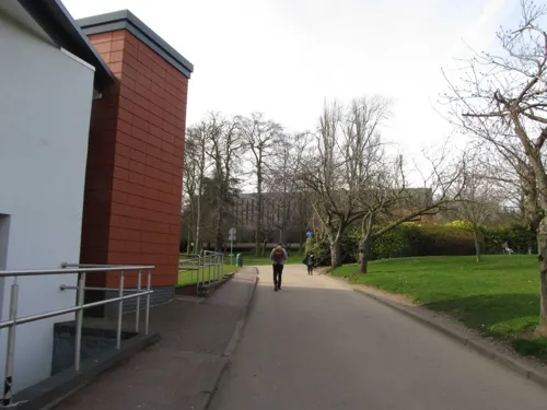
New Theatre
Cinema and theater · 2.5 mi
Theatre on University Park Campus, Nottingham, England



Museums and landmarks45

Village Cross
Monument and historic site · 1.3 mi
Shaft of Beeston's 14th century village cross
War Memorial Cross, Beeston
Monument and historic site · 1.2 mi
Grade II listed war memorial in Broxtowe, United Kingdom
War Memorial to 6 Metres South West of St Laurences's Church
Monument and historic site · 1.7 mi
War memorial in Erewash, Derbyshire, England, UK

Wollaton Hall
Museum · 2.7 mi
Country house museum in Nottingham, England



National Shell Filling Factory Memorial
Monument and historic site · 0.4 mi
War memorial in Broxtowe, Nottinghamshire, England, UK

Nottingham Industrial Museum
Museum · 2.6 mi
Museum in the 17th century stables block of Wollaton Hall, Nottingham, England
33 more on the map.
Parks, trails and playgrounds29

Highfields Park, Nottingham
Park · 2.7 mi
Park in Nottingham, Nottinghamshire, England, UK



Attenborough Nature Reserve
Park · 0.8 mi
Nature reserve in the United Kingdom


17 more on the map.
Restaurants and cafes125
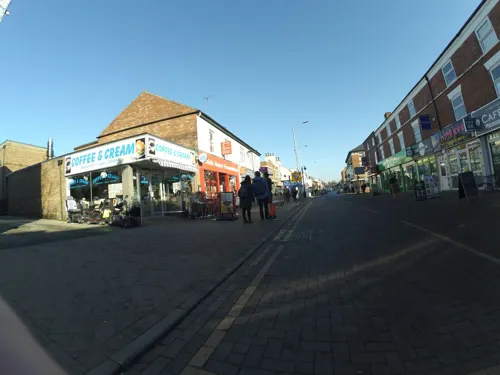
The Pudding Pantry
Restaurant · Cake · 1.5 mi
83 High Road, Nottingham
Mo-Fr 08:30-16:30; Sa 08:30-17:30; Su 08:30-17:00
The Beeston Social
Restaurant · 1.3 mi
2 Station Road, Nottingham
Mo-Th 11:30-00:00; Fr 11:30-02:00; Sa 10:00-02:00; Su 10:00-00:00


Bendigo Lounge
Restaurant · British · 1.5 mi
55-57 High Road, Nottingham
Su-Th 09:00-23:00; Fr-Sa 09:00-00:00
113 more on the map.
History
Roman buildings, pottery and coins have been found in Chilwell.
Chilwell was originally a hamlet on the road from Nottingham to Ashby-de-la-Zouch. It is mentioned in the Domesday Book of 1086, but along with Toton it became part of the parish of Attenborough. Suburban development spread gradually from Beeston along Chilwell High Road.
The area's population grew substantially during the First World War, when most of the area of level ground between Chilwell and Toton was occupied by the National Shell Filling Factory No. 6 and the original direct route between Chilwell and Toton became a gated military road, now known as Chetwynd Road.
On 1 July 1918, 134 people were killed and over 250 people were injured in an explosion at the factory. This tragedy remains the largest number of deaths caused by an explosion in Britain. The memorial to the dead can be found in nearby church yard of St Mary's, Attenborough. The army continued to dominate the area with the factory becoming a major depot site for the Royal Army Ordnance Corps, and more recently for the Royal Engineers. The Chilwell Bypass Road was constructed in the 1930s to take army traffic out of the village centre.
Read more of the history
Chilwell had a number of pubs in its centre on Chilwell High Road. The Original Chequers Inn is on the border with Beeston and is a turn of the century pub that was once a coaching house. The Charlton Arms is named after a local landowning family who formerly lived in the demolished Chilwell Hall. The Cadland is named after a locally trained racehorse that won The Derby in 1828.
Chilwell has had a long-standing non-conformist population. The Chilwell Methodist Church was founded in 1798 as the Methodist First Connection Chapel at Hallams Lane. Its Sunday School (provided jointly with local Baptists) provided the first free education for the poor of the area. The chapel moved to land provided by Squire Charlton in 1857. Christ Church, Chilwell was built in 1903 to provide an Anglican church to serve the growing population, although it did not become a separate ecclesiastical parish from Attenborough until 1975.
The Inham Nook estate (including the Inham Nook pub) was built by Beeston and Stapleford Urban District Council on land to the west of Bramcote Lane from the 1950s; St Barnabas's Church was constructed in 1957 as a "mission church" to serve the new population. For many years, Inham Nook's council housing was in sharp contrast to the surrounding areas of middle class suburban owner-occupation. Since the 1980s right to buy legislation, tenure has been more mixed, but Inham Nook remains relatively deprived compared to other areas in the southern part of Broxtowe borough. The council, in partnership with NET, have recently spent £100,000 on refurbishment works to the Inham Nook sports pavilion to help improve local facilities for the community. The works included updating the changing facilities for local football teams, and improving the bowls facilities and accessibility to the pavilion. The works were carried out by local contractor GPS Construction (Nottingham). Chilwell Manor Golf Club was established in 1906 on land formerly belonging to the Manor. The Manor House and nearby Chilwell Green remained intact until 1965 when the bland Clarkes Lane development of large detached houses started construction.
Chilwell War Memorial Hall and Institute was opened on 3 May 1924. It was built to commemorate the memory of the gallant men of the village who sacrificed their lives during the Great War. The Hall and Institute was established to be a place for assembly and recreation for the community and surrounding neighbourhoods, and still offers many activities to meet this aim.
Chilwell School is located off Queens Road West adjacent to the golf course. It shares a site and facilities with the Chilwell Olympia Sports Centre. Prior to construction of the school in the 1970s, this area was Kirk's Farm. It had remained undeveloped as the land has a high water table and poor drainage. A hectare of the school grounds was not drained for playing fields and is now the Chilwell Meadow nature reserve managed by the Nottinghamshire Wildlife Trust as a rare example of a "wet meadow" of unimproved grassland.
Parts of the golf course are also sites of importance for nature conservation; there has been some work in recent years to remove non-native species in the golf course planting, to improve native biodiversity.
From the History section of Chilwell on Wikipedia, under CC BY-SA 4.0.
Notable people from Chilwell
 Henry John PearsonBritish industrialist and ornithologistPhoto: Southern Broxtowe Blue Plaque Group, CC BY-SA 4.0
- Thomas BignallEnglish cricketer (1842-1898)
Born in Chilwell, according to Wikidata (CC0). Each name links to its Wikipedia article.
Where to stay5
Churches and places of worship42
Shopping21
Gas and EV charging5
Schools, colleges and libraries23
Healthcare8
Map of Chilwell
250 places. The map loads OpenStreetMap tiles when you open it.
Getting there and nearby towns
Nottingham City Airport (NQT) is the nearest airport with scheduled flights listed in OpenStreetMap, 6 miles away.
- Stapleford 1 mi west, about 2 min by car
- Nottingham 5 mi northeast, about 7 min by car
- Kimberley 5 mi north, about 8 min by car
- Eastwood 7 mi northwest, about 11 min by car
- Hucknall 9 mi north, about 14 min by car
- Heanor 9 mi northwest, about 14 min by car
- Derby 10 mi west, about 16 min by car
- Shepshed 10 mi south, about 17 min by car
- Ripley 11 mi northwest, about 17 min by car
- Kirkby in Ashfield 13 mi north, about 21 min by car
Drive times are estimates from straight-line distance, not routes.
Towns near Chilwell


Keep exploring
Local news
Headlines from INDB.
Reviews, tips and questions
Loading what members have shared...
Sources and licences
- GeoNames (CC BY 4.0): population, coordinates, regions and time zone
- Mapillary (see each image): photos
- OpenStreetMap contributors (ODbL 1.0): places, airports, map data
- Wikidata (CC0 1.0): elevation, founding date, time zone, website, landmarks and historic places
- Wikimedia Commons (see each image): photos
- Wikipedia (CC BY-SA 4.0): overview and history text
Photo credits
- Chilwell Explosion Orchard Cottage plaque, Southern Broxtowe Blue Plaque Group, CC BY-SA 4.0
- Wollaton Hall, Nottingham (1), Harry Mitchell, CC BY-SA 3.0
- Highfields Park Cascade 9121, Photograph by Clem Rutter, Rochester, Kent. ( www.clemrutter.net )., CC BY-SA 3.0
- All Saints Risley, Oxymoron, CC BY-SA 2.0
- ChristChurchChilwell, Andrewrabbott ( talk ), Public domain
- St.John the Baptist Beeston, Andrewrabbott ( talk ), Public domain
- StMaryAttenborough, Andrewrabbott ( talk ), Public domain
- Crimean War Memorial, Beeston, Notts, Michaelfromtheuk, CC BY-SA 4.0
- Village Cross, Beeston, Notts (with plaque), Michaelfromtheuk, CC BY-SA 4.0
- St John the Baptist's Church, Chilwell Road, Beeston (NHLE Code 1263823) (June 2025) (3), User:Hassocks5489, CC0
- GJB05079 DxO, Crapat2hu, CC BY-SA 4.0
- Looking towards Attenborough at sunrise - panoramio, Tim Tregenza, CC BY-SA 3.0
- Ten Bell plaque, Southern Broxtowe Blue Plaque Group, CC BY-SA 4.0
- Flickr - Duncan~ - Beeston Marina, Duncan Harris from Nottingham, UK, CC BY 2.0
- Street-level photo, matth81, CC BY-SA 4.0
- Street-level photo, Lapscle, CC BY-SA 4.0
- Street-level photo, adam2, CC BY-SA 4.0
- Street-level photo, gness, CC BY-SA 4.0
- Street-level photo, adam2, CC BY-SA 4.0
- Street-level photo, matth81, CC BY-SA 4.0
- Street-level photo, adam2, CC BY-SA 4.0
- Street-level photo, matth81, CC BY-SA 4.0
- Street-level photo, mappo2, CC BY-SA 4.0
- Street-level photo, mappo2, CC BY-SA 4.0
- Street-level photo, adam2, CC BY-SA 4.0
- Street-level photo, adam2, CC BY-SA 4.0
- Street-level photo, matth81, CC BY-SA 4.0
- Street-level photo, mappo2, CC BY-SA 4.0
- Street-level photo, mappo2, CC BY-SA 4.0
- Street-level photo, mappo2, CC BY-SA 4.0
- Street-level photo, adam2, CC BY-SA 4.0
- Street-level photo, adam2, CC BY-SA 4.0
- Street-level photo, sk53, CC BY-SA 4.0
- Street-level photo, adam2, CC BY-SA 4.0

Page built November 10, 2026. Spotted a mistake? Tell us or suggest a place.