
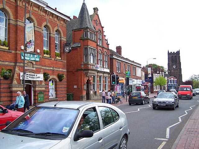


Why visit Heanor
Townapedia lists 9 museums and landmarks, 15 parks and trails, 74 places to eat, 1 place to stay and 3 attractions in and around town.
Highlights include Bennerley Viaduct, Giltbrook Viaduct, D.H. Lawrence Birthplace Museum and Vacuum Cleaner Museum and Repairer.
Weather in Heanor
Forecast from MET Norway (CC BY 4.0). Full forecast
About Heanor
Heanor (/ˈhiːnə/) is a town in the Amber Valley district of Derbyshire, England. It lies 8 miles (13 km) north-east of Derby and forms, with the adjacent village of Loscoe, the civil parish and town council-administered area of Heanor and Loscoe, which had a population of 17,251 in the 2011 census.
From the Wikipedia article Heanor (this version), under CC BY-SA 4.0.
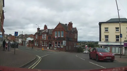
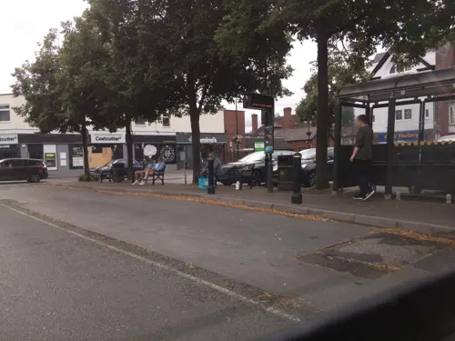
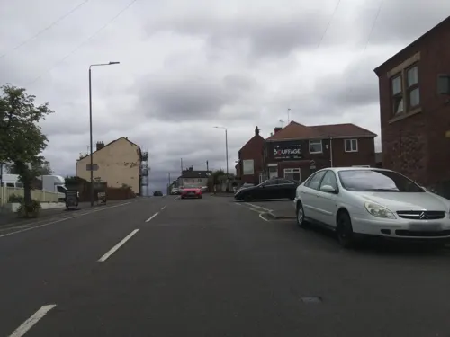
Photos of Heanor

Things to do3

Bennerley Viaduct
Bridge · 2.9 mi
Railway viaduct spanning the Erewash Valley

Giltbrook Viaduct
Bridge · 3.4 mi
Bridge in Greasley and Kimberley, Nottinghamshire

The American Adventure Theme Park
Monument and historic site · 1.5 mi
Former theme park in Ilkeston, Derbyshire, England
Museums and landmarks9

D.H. Lawrence Birthplace Museum
Museum · 2.0 mi
Museum in Nottingham, England, United Kingdom

Cromford Canal
Monument and historic site · 1.3 mi
Plaque commemorating the Cromford Canal, attached to a wall under the bridge


Parks, trails and playgrounds15





3 more on the map.
Restaurants and cafes74



Cherrywood Smokehouse
Bar and pub · 1.4 mi
246 Nottingham Road, Nottingham
Mo-Fr 12:00-23:00; Sa-Su 12:00-00:00

Hop Wright Inn
Bar and pub
8 Ray Street, Heanor
Tu-Th 16:00-22:00; Fr-Sa 14:00-23:00; Su 12:00-21:00
62 more on the map.
History
The name Heanor derives from the Old English hēan (the dative form of hēah) and ofer, and means "[place at] the high ridge". In the Domesday Book of 1086 it was recorded as Hainoure, with its entry stating:
6M In CODNOR and Heanor and Langley [in Heanor] and 'Smithycote' [in Codnor Park] 8 thegns had 7 carucates of land to the geld [before 1066]. [There is] land for as many ploughs. There are now 3 ploughs in demesne, and 11 villains and 2 bordars and 3 sokemen having 5½ ploughs. There is a church and 1 mill [rendering] 12d and 35 acres (140,000 m2) of meadow [and] woodland pasture 2 leagues long and 3 furlongs broad. TRE worth £4 sterling; now 41s 4d [£2.2] per year. Warner holds it.
Read more of the history
Samuel Lewis's A Topographical Dictionary of England, published in 1848, states that Heanor parish "abounds with coal and ironstone, both worked extensively, the collieries alone affording employment to more than 2000 persons. The town is pleasantly situated upon an eminence, on the road from Derby to Mansfield. The principal articles of manufacture are silk and cotton goods, hosiery, and bobbinet lace, providing occupation to about 800 persons." The parish then covered 7,000 acres (2,800 ha) and was in the union of Basford and the hundred of Morleston and Litchurch, with Heanor town itself covering 1,500 acres (610 ha) with 3,058 inhabitants. The parish church, dedicated to St Mary, was "a very ancient edifice, with a lofty substantial tower, from which is an extensive view", though the dictionary noted there were also "places of worship for Baptists, Independents, Wesleyans, and Ranters".
Heanor Market Place developed in the 1890s after the break-up of the Heanor Hall estate by the Miller Mundy family of nearby Shipley Hall. The Market Place site had been part of Heanor Hall Park and the main focus of trading activity hitherto Tag Hill.
From the History section of Heanor on Wikipedia, under CC BY-SA 4.0.
More about Heanor
Geography
Measured directly, Heanor town is 8 miles (13 km) north-east of Derby and 9.5 miles (15.3 km) west-north-west of Nottingham. It stands on a hill between 65 metres (213 ft) and 125 metres (410 ft) above sea-level. It lies within the Nottinghamshire, Derbyshire and Yorkshire Coalfield National Character Area as defined by Natural England.
Heanor and Loscoe civil parish includes all Heanor town except Heanor Gate Spencer Academy and a few surrounding streets on the western edge of town (near the road to Smalley), Heanor Gate Industrial Estate to the south west, and a small area of houses on the town's south-eastern fringe near the main road to Ilkeston. The college and surrounding streets and half the industrial estate are in Smalley civil parish, the other areas in Shipley civil parish.
Heanor and Loscoe civil parish contains no conservation areas, but 30 per cent of the area lies in a green belt. The one nature reserve and four wildlife sites are all of local significance.
Economy
The most important economic sector in the town, employing more than 20 per cent of the working population, is manufacturing, with the retail sector employing over 17 per cent. Coal mining and textiles used to be major industries, but both declined. In December 2013 the unemployment rate was 2.3 per cent in Heanor East and Heanor and Loscoe wards and 3.5 per cent in Heanor West ward. The average for England at the time was 2.8 per cent.
The Matthew Walker factory in Heanor Gate Industrial Park, famous for the production of Christmas puddings, was sold in 1992 to the Northern Foods Group. Other companies on the park include Advanced Composites Group, Cullum Detuners Ltd and Isolated Systems Ltd. In 2011 the 2 Sisters Food Group purchased Northern Foods. The Matthew Walker factory is now a part of the 2 Sisters Chilled Division.
Retail chains with a presence include Tesco, Aldi, and Boyes. A small outdoor market is held on Fridays and Saturdays.
Education
Heanor has two infant schools (Corfield Church of England Infant School and Marlpool Infant School), three primary schools (Coppice Primary School, Howitt Primary Community School and Loscoe Church of England Primary School), two junior schools (Marlpool Junior School and Mundy Church of England Voluntary Controlled Junior School) and one secondary school (Heanor Gate Spencer Academy). Heanor Grammar School, which was just to the east of the market place, was latterly part of Derby College but is currently closed. The site of the former school was purchased from private ownership by Amber Valley Borough Council, with assistance of a Future High Streets Fund grant.
From the Wikipedia article Heanor, under CC BY-SA 4.0.
Notable people from Heanor
 Henry GarnetEnglish Jesuit, executed because of his involvement in the Gunpowder Plot of 5 November 1605Photo: anonymous, European School., Public domain
 William HowittBritish writer (1792–1879)Photo: Ernest Edwards, Public domain
 Edward SmithBritish physician and botanist (1819–1874)Photo: Barraud & Jerrard, Photographers, Public domain
 William Cubleypainter, educator (1816-1896)Photo: William Cubley, Public domain
- John AckroydFootballer (1868-1927)
- Dale HolmesEnglish bicycle motocross rider
- Billy BestwickEnglish cricketer (1875-1938)
- Eddie BarksEnglish footballer (1921-1989)
- Archibald Ackroydcricketer (1897-1968)
- Peter HillEnglish professional footballer (1931-2015)
- Ernie Brooksassociation football player (1892-1975)
- Andrew BrownEnglish cricketer, born 1964
Born in Heanor, according to Wikidata (CC0). Each name links to its Wikipedia article.
Where to stay1
Churches and places of worship22
Shopping10
Gas and EV charging4
Schools, colleges and libraries15
Healthcare6
Map of Heanor
159 places. The map loads OpenStreetMap tiles when you open it.
Getting there and nearby towns
East Midlands Airport (EMA) is the nearest airport with scheduled flights listed in OpenStreetMap, 13 miles away.
- Ripley 2 mi northwest, about 4 min by car
- Kimberley 4 mi southeast, about 7 min by car
- Pinxton 6 mi north, about 9 min by car
- Hucknall 7 mi east, about 11 min by car
- Derby 8 mi southwest, about 13 min by car
- Kirkby in Ashfield 8 mi northeast, about 12 min by car
- Stapleford 8 mi southeast, about 12 min by car
- Nottingham 9 mi southeast, about 15 min by car
- Mansfield 10 mi northeast, about 17 min by car
- Matlock 12 mi northwest, about 19 min by car
Drive times are estimates from straight-line distance, not routes.
Towns near Heanor


Keep exploring
Local news
Headlines from INDB.
Reviews, tips and questions
Loading what members have shared...
Sources and licences
- GeoNames (CC BY 4.0): population, coordinates, regions and time zone
- Mapillary (see each image): photos
- OpenStreetMap contributors (ODbL 1.0): places, airports, map data
- Wikidata (CC0 1.0): elevation, founding date, time zone, website, landmarks and historic places
- Wikimedia Commons (see each image): photos
- Wikipedia (CC BY-SA 4.0): overview and history text
Photo credits
- Heanor 016154 f6154fd4, Garth Newton, CC BY-SA 2.0
- Heanor Market Place tRH, Russ Hamer, CC BY-SA 3.0
- Market Place, Heanor, Martin Froggatt, CC BY-SA 2.0
- Bennerley Viaduct Ilkeston, Grant Shaw, CC BY-SA 3.0
- Denby - church tower and nave, Dave Bevis, CC BY-SA 2.0
- St Wilfrid's West Hallam, Russ Hamer, CC BY-SA 3.0
- St James, Cross Hill (i), PaleCloudedWhite, CC BY-SA 4.0
- St Mary's, Westwood, David Lally, CC BY-SA 2.0
- St Andrew's Church, Langley Mill, Roger Templeman, CC BY-SA 2.0
- Heanor gate science college, Victuallers, CC BY-SA 3.0
- Derby Lodge, Shipley Park, Alan Murray-Rust, CC BY-SA 2.0
- TBTN828, Hyebone, CC BY 4.0
- D. H. Lawrence Birthplace Museum, Graham Hogg, CC BY-SA 2.0
- Cromford Canal narrowboat - 30 May 2026, Aethonatic, CC0
- Langley Mill (Great Northern) basin of the Erewash Canal - panoramio - mattjenniepearson, mattjenniepearson, CC BY 3.0
- Shipley Woodside Colliery - 5 June 2026, Aethonatic, CC0
- Shipley Country Park plaque - 5 June 2026, Aethonatic, CC0
- Trees on Shipley Hill - panoramio, kevin_11114, CC BY-SA 3.0
- Street-level photo, southglos, CC BY-SA 4.0
- Street-level photo, southglos, CC BY-SA 4.0
- Street-level photo, southglos, CC BY-SA 4.0
- Street-level photo, southglos, CC BY-SA 4.0
- Street-level photo, southglos, CC BY-SA 4.0
- Street-level photo, southglos, CC BY-SA 4.0
- Street-level photo, southglos, CC BY-SA 4.0
- Street-level photo, southglos, CC BY-SA 4.0
- Street-level photo, southglos, CC BY-SA 4.0
- Street-level photo, southglos, CC BY-SA 4.0
- Street-level photo, southglos, CC BY-SA 4.0
- Street-level photo, southglos, CC BY-SA 4.0
- Street-level photo, southglos, CC BY-SA 4.0
- Street-level photo, southglos, CC BY-SA 4.0
- Street-level photo, southglos, CC BY-SA 4.0
- Street-level photo, southglos, CC BY-SA 4.0
- Street-level photo, southglos, CC BY-SA 4.0
- Street-level photo, orangutanclyde, CC BY-SA 4.0
- Street-level photo, southglos, CC BY-SA 4.0
- Street-level photo, southglos, CC BY-SA 4.0
- Street-level photo, orangutanclyde, CC BY-SA 4.0


Page built November 10, 2026. Spotted a mistake? Tell us or suggest a place.