


Eastwood, United Kingdom
Eastwood is a town of 18,612 people in England, United Kingdom.
Why visit Eastwood
Townapedia lists 10 museums and landmarks, 17 parks and trails, 124 places to eat, 2 places to stay and 4 attractions in and around town.
Highlights include Bennerley Viaduct, Giltbrook Viaduct, D.H. Lawrence Birthplace Museum and Erewash Museum.
Weather in Eastwood
Forecast from MET Norway (CC BY 4.0). Full forecast
About Eastwood
Eastwood is a town and civil parish in the Broxtowe district of Nottinghamshire, England, 9 miles (14 km) northwest of Nottingham. Mentioned in Domesday Book, it expanded rapidly during the Industrial Revolution. The Midland Railway was formed here and it is the birthplace of D. H.
From the Wikipedia article Eastwood, Nottinghamshire (this version), under CC BY-SA 4.0.
Photos of Eastwood


Things to do4

Bennerley Viaduct
Bridge · 0.7 mi
Railway viaduct spanning the Erewash Valley

Giltbrook Viaduct
Bridge · 1.0 mi
Bridge in Greasley and Kimberley, Nottinghamshire

The American Adventure Theme Park
Monument and historic site · 1.5 mi
Former theme park in Ilkeston, Derbyshire, England

Museums and landmarks10

D.H. Lawrence Birthplace Museum
Museum · 1.3 mi
Museum in Nottingham, England, United Kingdom
Victoria Street, Nottingham

Erewash Museum
Museum · 2.0 mi
Museum in Ilkeston, Derbyshire, United Kingdom

David Greenhalgh, Rebecca Moss, Desmond Ball
Monument and historic site · 0.8 mi
Lt Colonel Brian Duncan Shaw MM BSc PhD DSc (Hon) 1898-1999
Monument and historic site · 1.6 mi
Parks, trails and playgrounds17



5 more on the map.
Restaurants and cafes124
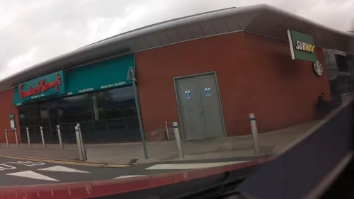
Frankie & Benny's
Diner · American · 0.8 mi
Ikea Way, Nottingham
Mo-Th 09:00-21:30; Fr-Sa 09:00-22:30; Su 09:00-21:30
The Humble Rutland
Cafe · 1.5 mi
5 Mundy Street, Ilkeston
Mo-Sa 08:00-13:00; Su off




Ilkeston Junction Cafe
Cafe · 1.5 mi
15 Station Street, Ilkeston
Tu-Fr 08:30-14:30; Sa 08:30-14:00; Su,Mo off
112 more on the map.
History
"Eastwood" is a hybrid place-name, formed from Old English Est, for "East", and Old Norse Þveit , for "meadow", "cleared meadow", or "clearing in a wood." This is a common element in English place-names, often found as "Thwaite". "Eastwood" might mean eastern clearing, possibly originating as a Viking-age clearing in Sherwood Forest.
There is some evidence to suggest that the land around Eastwood was occupied in the Middle and Late Palǣolithic periods.
The location of the settlement is due primarily to the availability of rich agricultural land, the proximity of the River Erewash and—most importantly—the extensive and easily mined coal deposits. It is mentioned in Domesday Book as Estewic, part of the fee of William Peverel:
In Estewic [Ulfketel] had 4 bovates of land [assessed] to the geld. [There is] land [...] It is waste. William [Peverel] has the custody of it. [There is] woodland pasture 3 furlongs long and 3 broad. In King Edward's time it was worth 5 shillings.
During The Anarchy, the 12th century civil war between Stephen of Blois and supporters of Matilde, the mother of the eventual king, Henry II, Peveral's son, William Peverel the Younger, forfeited these to the Crown in 1155. The estate, called the Peverel Honour, was eventually divided, and much of the land around Eastwood was granted to the Greys of Codnor Castle.
Read more of the history
Tenant farming prevailed throughout the Middle Ages, whilst common pasture was mainly used for grazing.
When King James VI of Scotland became King James I of England in 1603, Eastwood had a population of about 170, and it remained a small village until the 18th century when, in 1779, the Trent Navigation Company opened the Erewash Canal. This was one of the first man made waterways in England, with locks at Beeston linking Eastwood to the River Trent and Nottingham, and its arrival led to a rapid expansion of the local coal mining industry. Other industries soon followed, including framework knitting, corn milling, pottery, brewing, rope making and brick making.
The town expanded rapidly during the Industrial Revolution, and in the 19th century it experienced the greatest increase in population density of any parish in Nottinghamshire. By 1880 the population had increased to 4,500.
Factories were built to accommodate the new industries, land becoming available for them as the rural population moved to urban areas. This industrialisation of the countryside was only restricted from the early 19th century, when, somewhat belatedly, the effect of the Enclosures began to be felt in Nottinghamshire. In a local manifestation of this period of upheaval, marchers of the Pentrich Revolution of 1817 passed through the town, and were met by soldiers at nearby Giltbrook: the residents of Eastwood boarded up their houses and hid in the woods.
In 1832, a historic meeting took place at the Sun Inn (built 1750), which resulted in the creation of the Midland Counties Railway, and the construction of a line from Pinxton to Leicester. Industrialisation continued with the opening in 1868 of Moorgreen Colliery, and in 1875 the demand for coal resulted in a railway station in Eastwood, with services to Nottingham on the Great Northern Railway.
D. H. Lawrence was born in Eastwood in 1885. Although the local area is mentioned in many of his novels, it is especially featured in The White Peacock, against a backdrop of industrialisation. There were ten coal mines, or "pits", within easy walking distance of Lawrence's home, and the overwhelming majority of the local male population were colliers. Although the coal boom ended during Lawrence's childhood, Eastwood continued to expand, Nottingham Road and its feeder streets became established as a shopping area, and in 1908 the local Urban District Council opened its offices. However, few jobs remained outside what remained of the coal industry. Most women were housewives, and boys were desperate to reach the age of fourteen, when they could start working in the mines. In the early 20th century, trams provided a new means of transport between Nottingham, Ripley and Heanor. Lawrence lived next to the line, and described it as the most dangerous tram service in England.
Eastwood coal, metal castings, rope, wire and agricultural products made valuable contributions to Britain's war effort during the two world wars. In the Second World War, Eastwood supplied soldiers to the Sherwood Foresters Regiment. A memorial on Nottingham Road commemorates Eastwood residents who gave their lives in both world wars.
In 1946, the coal industry was nationalised, and the new National Coal Board acquired Eastwood Hall as their Area Office. This later became their National Office, and served as the crisis meeting location during the national Miners' Strike of the 1980s, it is now a hotel. At the height of its production in 1963, Moorgreen Colliery alone produced one million tons of coal, but the last coal mine in the area closed in 1985.
In recent years, tourism has become increasingly important. Lawrence's birthplace is now a museum, and a painted line on the pavement, called the "Blue Line Trail," guides visitors around eleven sites of local interest including three of Lawrence's homes. The trail was the first of its kind in England, the concept being based on the Freedom Trail in Boston, United States.
From the History section of Eastwood, Nottinghamshire on Wikipedia, under CC BY-SA 4.0.
More about Eastwood
Geography
Surrounded by gently rolling countryside, Eastwood is 8 miles to the Northwest of the City of Nottingham in Nottinghamshire and close to the county boundary with Derbyshire.
...I was born nearly forty-four-year ago, in Eastwood, a mining village of some three thousand souls about eight miles from Nottingham, and one mile from the small stream, the Erewash, which divides Nottinghamshire from Derbyshire. It is hilly country, looking west to Crich and towards Matlock, sixteen miles away and east and northeast towards Mansfield and the Sherwood Forest district. To me it seemed, and still seems an extremely beautiful countryside, just between the red sandstone and oak trees of Nottingham and the cold limestone, the ash trees, the stone fences of Derbyshire
The area contains coal measures, with shale, mudstone, and sandstone, overlain by yellow clay. Alluvial deposits from the River Erewash run roughly north–south.
Arts and culture
Eastwood Collieries' Male Voice Choir formed in 1919. They appeared on BBC television in 1963, and are one of the oldest surviving colliery choirs in the United Kingdom.
The local newspaper is the Eastwood and Kimberley Advertiser.
Eastwood Theatre is home to local, national and international theatre. Its programme showcases dance, music and drama from professional and amateur performers.
Education
There are five primary schools in the area, including Florence Nightingale Academy, Greasley Beauvale Primary School (which D.H Lawrence attended), Lawrence View Primary School, The Priory Catholic Primary School and Springbank Academy (formerly known as Eastwood Infant and Junior School).
Most older local students attend Hall Park Academy which was formerly known as Eastwood Comprehensive School.
Eastwood Skills Shop offers courses including IT, Arts & Crafts, Spanish and Interior Design.
Eastwood Library, in the centre of the town, provides traditional book loans, but also has free internet access, CDRoms and a range of information services.
Eastwood Community Sports Centre has a four-court sports hall, and 2 junior and 2 full sized football pitches.
From the Wikipedia article Eastwood, Nottinghamshire, under CC BY-SA 4.0.
Notable people from Eastwood
 D. H. LawrenceEnglish writer and poet (1885–1930)Photo: Unknown author Unknown author..., Public domain
 Jeff AstleEnglish footballer (1942-2002)Photo: Chapitas, Public domain
- Tony WoodcockEnglish footballer (born 1955)
- William A. PickeringBritish colonial administrator (1840–1907)
- Steve BuckleyEnglish footballer (born 1953)
- Colin DanielEnglish footballer (born 1988)
- Dick ButlerBritish footballer (1911-1984)
- Robert CarlinEnglish cricketer (1871-1950)
- William BarberBritish cricketer (1881-1971)
- John AtkinsonEnglish cricketer (1878-1951)
- Mary Carlintrade unionist.
- Stef Frostprofessional footballer (born 1989)
Born in Eastwood, according to Wikidata (CC0). Each name links to its Wikipedia article.
Where to stay2
Churches and places of worship28
Shopping18
Gas and EV charging4
Schools, colleges and libraries18
Healthcare8
Map of Eastwood
233 places. The map loads OpenStreetMap tiles when you open it.
Getting there and nearby towns
Nottingham City Airport (NQT) is the nearest airport with scheduled flights listed in OpenStreetMap, 11 miles away.
- Kimberley 2 mi southeast, about 3 min by car
- Heanor 2 mi northwest, about 4 min by car
- Hucknall 5 mi northeast, about 8 min by car
- Ripley 5 mi northwest, about 8 min by car
- Stapleford 6 mi south, about 10 min by car
- Pinxton 6 mi north, about 10 min by car
- Nottingham 7 mi southeast, about 11 min by car
- Kirkby in Ashfield 7 mi north, about 12 min by car
- Derby 9 mi southwest, about 15 min by car
- Mansfield 10 mi northeast, about 16 min by car
Drive times are estimates from straight-line distance, not routes.
Towns near Eastwood


Keep exploring
Local news
Headlines from INDB.
Reviews, tips and questions
Loading what members have shared...
Sources and licences
- GeoNames (CC BY 4.0): population, coordinates, regions and time zone
- Mapillary (see each image): photos
- OpenStreetMap contributors (ODbL 1.0): places, airports, map data
- Wikidata (CC0 1.0): elevation, founding date, time zone, website, landmarks and historic places
- Wikimedia Commons (see each image): photos
- Wikipedia (CC BY-SA 4.0): overview and history text
Photo credits
- EastwoodShops4, Victuallers, Public domain
- Bennerley Viaduct Ilkeston, Grant Shaw, CC BY-SA 3.0
- Erewash Museum - 20 June 2025, Aethonatic, CC0
- Kirk Hallam Church, Garth Newton, CC BY-SA 2.0
- St Andrew's Church, Langley Mill, Roger Templeman, CC BY-SA 2.0
- St Mary's Church, Ilkeston, Derbyshire, Russ Hamer, CC BY-SA 3.0
- St Wilfrid's West Hallam, Russ Hamer, CC BY-SA 3.0
- Cossall St Catherine's Church, Russ Hamer, CC BY-SA 3.0
- Greasley St Mary from ENE GeoUK5967241, Alan Murray-Rust, CC BY-SA 2.0
- Hall Park Academy Exterior, Ashleary, CC BY-SA 4.0
- Awsworth public footpath (3) - 30 May 2026, Aethonatic, CC0
- Awsworth public footpath (4) - 30 May 2026, Aethonatic, CC0
- Awsworth field (12) - 30 May 2026, Aethonatic, CC0
- Awsworth forest (2) - 30 May 2026, Aethonatic, CC0
- Train on the Erewash Valley Line - 30 May 2026, Aethonatic, CC0
- Awsworth field (11) - 30 May 2026, Aethonatic, CC0
- Awsworth field (10) - 30 May 2026, Aethonatic, CC0
- Awsworth field (8) - 30 May 2026, Aethonatic, CC0
- Awsworth field (9) - 30 May 2026, Aethonatic, CC0
- Newthorpe wind turbine (3) - 30 May 2026, Aethonatic, CC0
- Awsworth field (13) - 30 May 2026, Aethonatic, CC0
- Newthorpe wind turbine (4) - 30 May 2026, Aethonatic, CC0
- Awsworth field (7) - 30 May 2026, Aethonatic, CC0
- Awsworth field (14) - 30 May 2026, Aethonatic, CC0
- Newthorpe wind turbine (5) - 30 May 2026, Aethonatic, CC0
- Awsworth field (6) - 30 May 2026, Aethonatic, CC0
- Awsworth field (5) - 30 May 2026, Aethonatic, CC0
- Awsworth forest (1) - 30 May 2026, Aethonatic, CC0
- Awsworth public footpath (2) - 30 May 2026, Aethonatic, CC0
- Awsworth field (4) - 30 May 2026, Aethonatic, CC0
- Awsworth field (15) - 30 May 2026, Aethonatic, CC0
- Awsworth public footpath (5) - 30 May 2026, Aethonatic, CC0
- Awsworth field (3) - 30 May 2026, Aethonatic, CC0
- Awsworth field (2) - 30 May 2026, Aethonatic, CC0
- Awsworth public footpath (1) - 30 May 2026, Aethonatic, CC0
- Erewash Valley Trail (21) - 30 May 2026, Aethonatic, CC0
- Erewash Valley Trail (22) - 30 May 2026, Aethonatic, CC0
- Awsworth farm (1) - 30 May 2026, Aethonatic, CC0
- Watering trough - 30 May 2026, Aethonatic, CC0
- Newthorpe wind turbine (2) - 30 May 2026, Aethonatic, CC0
- D. H. Lawrence Birthplace Museum, Graham Hogg, CC BY-SA 2.0
- Shipley Woodside Colliery - 5 June 2026, Aethonatic, CC0
- Cotmanhay Linear Park - 10 August 2026, Aethonatic, CC0
- Street-level photo, adam2, CC BY-SA 4.0
- Street-level photo, adam2, CC BY-SA 4.0
- Street-level photo, adam2, CC BY-SA 4.0
- Street-level photo, southglos, CC BY-SA 4.0
- Street-level photo, adam2, CC BY-SA 4.0
- Street-level photo, southglos, CC BY-SA 4.0
- Street-level photo, adam2, CC BY-SA 4.0
- Street-level photo, adam2, CC BY-SA 4.0
- Street-level photo, adam2, CC BY-SA 4.0
- Street-level photo, tallguy, CC BY-SA 4.0
- Street-level photo, adam2, CC BY-SA 4.0
- Street-level photo, adam2, CC BY-SA 4.0
- Street-level photo, adam2, CC BY-SA 4.0
- Street-level photo, tallguy, CC BY-SA 4.0
- Street-level photo, tallguy, CC BY-SA 4.0
- Street-level photo, adam2, CC BY-SA 4.0


Page built November 10, 2026. Spotted a mistake? Tell us or suggest a place.