


Chingford, United Kingdom
Chingford is a town of 70,583 people in England, United Kingdom.
Why visit Chingford
Townapedia lists 21 museums and landmarks, 21 parks and trails, 128 places to eat, 16 places to stay and 9 attractions in and around town.
Highlights include Pole Hill, OrganicLea Farm Stall, Queen Elizabeth's Hunting Lodge and Anti-Air War Memorial.
Weather in Chingford
Forecast from MET Norway (CC BY 4.0). Full forecast
About Chingford
Chingford is a suburban town in east London, England, within the London Borough of Waltham Forest. Situated in the Lea Valley, around 9+1⁄2 miles (15 kilometres) north-east of Charing Cross, it lies between the River Lea in the west and Epping Forest in the north and east. It borders Waltham Abbey to the north; Loughton, Buckhurst Hill, and Woodford to the east; and Walthamstow to the south, with Edmonton and Enfield to the west. At the 2021 census, it had a population of approximately 70,583.
From the Wikipedia article Chingford (this version), under CC BY-SA 4.0.
Photos of Chingford


Things to do9





Museums and landmarks21

Queen Elizabeth's Hunting Lodge
Monument and historic site · 0.8 mi
Hunting lodge
6 Ranger's Road, London
Tu-Su 11:00-13:00,14:00-16:00

Anti-Air War Memorial
Monument and historic site · 1.4 mi
Memorial in Woodford Green, London

Chingford War Memorial
Monument and historic site
War memorial in London


Vestry House Museum
Museum · 3.2 mi
Museum in Walthamstow, London, United Kingdom

William Morris Gallery
Museum · 2.8 mi
Museum in Walthamstow, London, United Kingdom


9 more on the map.
Parks, trails and playgrounds21




Roding Valley Meadows
Park · 2.8 mi
Essex Wildlife Trust Nature reserve
9 more on the map.
Restaurants and cafes128
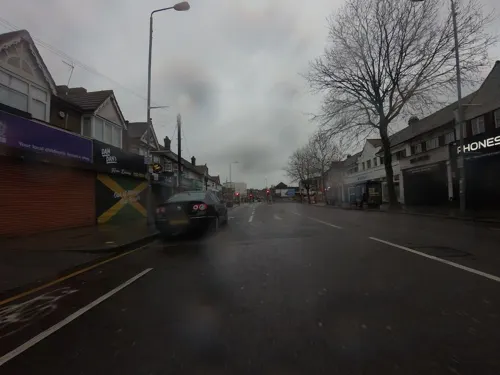

Rusty Bike
Bar and pub · Thai · 0.4 mi
134-138 Station Road, London
We-Th 12:00-24:00; Fr-Sa 12:00-01:00; Su-Tu 12:00-23:00
Spice Station
Bar and pub · Indian · 0.5 mi
140 Station Road, London
Su-Th 17:30-23:30; Fr-Sa 17:30-00:00

Sushi Monster
Restaurant · Japanese · 0.4 mi
134-138 Station Road, London
Th-Mo 12:00-22:00; We 17:00-22:00

The Larder at the Butler's Retreat
Cafe · Breakfast, Cake, Sandwich · 0.8 mi
12 Ranger's Road, London
09:00-17:00
Gina
Restaurant · British · 0.4 mi
92 Station Road, London
Tu 17:00-21:30; We-Sa 12:00-14:30, 17:00-21:30; Su 12:00-16:30
Robins Pie and Mash
Restaurant · Pie And Mash
50 Station Road, London
Mo-Th 10:00-17:00; Fr-Sa 10:00-18:00; Su 11:00-16:00


116 more on the map.
History
The first record of the manors of Chingford, is as Cingeford, in 913AD. It was also recorded with the spelling Cingefort in the Domesday Book of 1086. The meaning of the name is not certain.
It is thought that, similarly to how Kingston upon Thames appears in Domesday Book of 1086AD as Chingestone and Chingetun(e), with ching being old English for the king, that Chingford could refer to the King's river, and Kings Ford. There is evidence of King Harold Harefoot having lived in Chingford and the environs in the 11th century, a date which ties in with the Old English use of "ching" for "king".
Another suggestion is that the settlement's name has its origin as "Shingly Ford"—that is, a ford over a waterway containing shingles. However, this is likely to be incorrect, as the usage of the placename name "Cingefort" in the Doomsday book predates the coining of the word "Shingle." The earliest known usage of the Middle English word shingle is 1200AD and the word was not used to describe loose stones on a waterway until three centuries later in the 1500s.
Read more of the history
The ford referred to in the place name may have been a ford used to cross either the River Ching or the River Lea. Chingford is close to a number of fords of the Ching. However, old maps and descriptions give a name for the settlement long before the river has a name and it is likely that the name of the river as "Ching" arose long after the settlement was named.
The alternative view is that the ford crossed the Lea, and a location near Cook's Ferry has been suggested. This may be supported by the form Chagingeford recorded in 1204, which may mean the ford of the dwellers by the stumps. The remains of pile dwellings, covering a considerable area, were found near the mouth of the Ching between 1869 and 1901, when the reservoirs were being built.
At Domesday, the manors of Chingford are recorded as being in the Waltham hundred of Essex. Manors were landholdings which initially also had an administrative role. Later the manors would be served by the ancient parish of Chingford. The civil parish was granted urban district status in 1894, and municipal borough status, as the Municipal Borough of Chingford, in 1938. Its administrative headquarters were at Chingford Town Hall.
The Borough of Chingford's politics were dominated by the Chingford Ratepayers' Association, which was nominally independent, but against whom the Conservative Party did not field candidates.
In 1965 Chingford merged with the Municipal Boroughs of Leyton and Walthamstow to form a new borough, Waltham Forest, within the new Greater London.
Chingford Station opened in 1873 and brought with it a huge increase in visitors to the area, many of whom used the town as a gateway to Epping Forest. The forest was given to the people by Queen Victoria in 1878 under the Epping Forest Act, which ensured it was kept unenclosed for public enjoyment.
The Royal Forest Hotel opened in 1880, and its location in Ranger's Road meant it soon became popular among day-trippers visiting Epping Forest. It is situated next to the historic Queen Elizabeth's Hunting Lodge, which the royal family used while hunting deer in the forest during the 1600s.
The area was almost entirely rural until development began in earnest in the late 19th century. forming part of the conurbation of London. The area was included in the Metropolitan Police District in 1840 and became part of London's postal district upon its inception in 1856, with the NE postcode area replaced with E in 1866. The E area was subdivided in 1917 with Chingford approximating to the southern part of E4. Development accelerated after World War I.
From the History section of Chingford on Wikipedia, under CC BY-SA 4.0.
More about Chingford
Geography
The area covered by the former ancient parish and subsequent Municipal Borough of Chingford includes Chingford Green, Chingford Hatch, Chingford Mount, Friday Hill, North Chingford and South Chingford.
The area of the parish and borough approximates to the southern part of the E4 Postal Area. This also roughly approximates to six Waltham Forest wards that lie north of the North Circular Road. The ward areas north of the North Circular also takes in Hale End and Highams Park, that were part of the parish and borough of Walthamstow.
The highest point, Pole Hill, has an elevation of 299 feet above sea level.
Walthamstow (also part of Waltham Forest) is located to the south, with Woodford in the London Borough of Redbridge to the east, the borough boundary runs through Epping Forest.
The borough boundary with Epping Forest District in Essex, to the north, also runs through Epping Forest with nearby Essex towns in Epping Forest District include Sewardstone, Waltham Abbey, Loughton and Buckhurst Hill. Edmonton and Enfield are located west of the River Lea in the London Borough of Enfield.
From the Wikipedia article Chingford, under CC BY-SA 4.0.
Notable people from Chingford
 Paul Di'AnnoBritish heavy metal singer (1958–2024)Photo: As fotos da Virada!, CC BY-SA 2.0
 Kaikhosru Shapurji SorabjiEnglish composer, music critic, pianist and writer (1892–1988)Photo: Ernest Walter Histed (1862–1947), Public domain
 Joe DeverBritish writer and game designer (1956-2016)Photo: Joedever, CC BY-SA 3.0
 Russell Lissacklead guitarist of London based indie rock band Bloc PartyPhoto: Tom dl, Public domain
 Giles WatlingBritish actor and politician (born 1953)Photo: David Woolfall, CC BY 3.0
 Simon Khanprofessional golferPhoto: Ken123, CC BY-SA 3.0
 Craig DobsonBritish footballer (born 1984)Photo: James Boyes from UK, CC BY 2.0
 Oliver Fisherprofessional golferPhoto: Pvt pauline, CC BY-SA 3.0
- Nina WadiaBritish actress
- Louisa Aldrich-BlakeBritish surgeon and medical school dean
- Jodi AlbertBritish singer-songwriter, actress, model
- Jack WatlingBritish actor (1923–2001)
Born in Chingford, according to Wikidata (CC0). Each name links to its Wikipedia article.
Where to stay16
Churches and places of worship40
Parish Church of Saint Edmund, Chingford
Church · Anglican · 1.3 mi
Larkswood Road, London
All Saints Church of England Highams Park
Church · Anglican · 1.4 mi
Castle Avenue, London
Shopping27
Gas and EV charging3
Schools, colleges and libraries33
Trinity Catholic High School (Upper Site)
School · Roman Catholic · 1.3 mi
Mornington Road, Woodford Green
Healthcare13
Waltham Forest Rehabilitation Services
Clinic and pharmacy · 0.7 mi
3 Friars Close, London
Map of Chingford
250 places. The map loads OpenStreetMap tiles when you open it.
Getting there and nearby towns
London City Airport (LCY) is the nearest airport with scheduled flights listed in OpenStreetMap, 9 miles away.
- Buckhurst Hill 1 mi east, about 2 min by car
- Woodford Green 2 mi southeast, about 3 min by car
- Ponders End 2 mi northwest, about 4 min by car
- Edmonton 3 mi west, about 4 min by car
- Walthamstow 3 mi south, about 5 min by car
- Enfield Lock 3 mi northwest, about 5 min by car
- Tottenham 3 mi southwest, about 6 min by car
- Snaresbrook 3 mi south, about 5 min by car
- Chigwell 3 mi east, about 5 min by car
- Enfield Town 4 mi west, about 6 min by car
Drive times are estimates from straight-line distance, not routes.
Towns near Chingford


Keep exploring
Local news
Headlines from INDB.
Reviews, tips and questions
Loading what members have shared...
Sources and licences
- GeoNames (CC BY 4.0): population, coordinates, regions and time zone
- Mapillary (see each image): photos
- OpenStreetMap contributors (ODbL 1.0): places, airports, map data
- Wikidata (CC0 1.0): elevation, founding date, time zone, website, landmarks and historic places
- Wikimedia Commons (see each image): photos
- Wikipedia (CC BY-SA 4.0): overview and history text
Photo credits
- The Bull & Crown, Chingford - a touch of the Loire valley in E4 . Closed 2009, sludgegulper, CC BY-SA 2.0
- Bull on the Green, Chingford, E4, Ewan-M, CC BY-SA 2.0
- Bull and Crown, Chingford 02, Edwardx, CC BY-SA 3.0
- Bull and Crown, Chingford 03, Edwardx, CC BY-SA 3.0
- Bull and Crown, Chingford 01, Edwardx, CC BY-SA 3.0
- Bull and Crown, Chingford 04, Edwardx, CC BY-SA 3.0
- Bull and Crown - 1 The Green Chingford London E4 7EX, Spudgun67, CC BY-SA 4.0
- Former Chingford Fire Station - 2 Kings Road Chingford London E4 7EY, Spudgun67, CC BY-SA 4.0
- Former Chingford Fire Station (Waltham Forest Heritage), Spudgun67, CC BY-SA 4.0
- Bull & Crown Chingford (1), Ricardalovesmonuments, CC BY-SA 4.0
- Bull & Crown Chingford (2), Ricardalovesmonuments, CC BY-SA 4.0
- Pankhurst Memorial, 29 May 2011 (4), RolandR, CC BY-SA 3.0
- Chingford War Memorial 07, Edwardx, CC BY-SA 3.0
- God's Own Junkyard 10100775327306884, JRennocks, CC BY 4.0
- William Morris Gallery-001, ProfDEH, CC BY-SA 3.0
- Ainslie Wood 1, Dudley Miles, CC BY-SA 3.0
- Tottenham Marshes from Northumberland Park footbridge, Iridescent, CC BY-SA 3.0
- Linder's Field 1, Dudley Miles, CC BY-SA 3.0
- Pymmes Park1, Northmetpit, Public domain
- Chingford United Reformed Church 05, Edwardx, CC BY-SA 3.0
- St Paul's Church, Woodford Bridge - 2022-07-31, The wub, CC BY-SA 4.0
- St Peter-in-the-Forest - 02, The wub, CC BY-SA 4.0
- Braeside School from the air, Oak-Tree Group of Schools, CC BY-SA 4.0
- Trinity Catholic High School, Woodford Green, The wub, CC BY-SA 3.0
- Hunting Lodge Chingford, P Ingerson at English Wikipedia, Public domain
- St Edmund, Chingford 03, Edwardx, CC BY-SA 3.0
- The Highams Park, The wub, CC BY-SA 3.0
- Pole Hill Obelisk Epping Forest Public Space Chingford, Spudgun67, CC BY-SA 4.0
- Bancrofts School, User:JoannaScott, CC BY-SA 3.0
- Pole Hill, Danny Robinson, CC BY-SA 2.0
- Queen Elizabeth's Hunting Lodge exterior, Ethan Doyle White, CC BY-SA 4.0
- Our Lady of Grace & St Teresa (1), Ricardalovesmonuments, CC BY-SA 4.0
- Bull and Crown (Waltham Forest Heritage), Spudgun67, CC BY-SA 4.0
- Church of St Peter and St Paul Churchyard Gate and Gatepiers (South of Church), The wub, CC BY-SA 3.0
- Our Lady of Grace & St Teresa (2), Ricardalovesmonuments, CC BY-SA 4.0
- Old Timber framed House on Station Road London, Ricardalovesmonuments, CC BY-SA 4.0
- The Cage - Vestry House Museum Vestry Rd Walthamstow London E17 9NH, Spudgun67, CC BY-SA 4.0
- Street-level photo, rskedgell, CC BY-SA 4.0
- Street-level photo, rskedgell, CC BY-SA 4.0
- Street-level photo, rskedgell, CC BY-SA 4.0
- Street-level photo, rskedgell, CC BY-SA 4.0
- Street-level photo, rskedgell, CC BY-SA 4.0
- Street-level photo, gness, CC BY-SA 4.0
- Street-level photo, rskedgell, CC BY-SA 4.0
- Street-level photo, rskedgell, CC BY-SA 4.0
- Street-level photo, gness, CC BY-SA 4.0
- Street-level photo, rskedgell, CC BY-SA 4.0
- Street-level photo, rskedgell, CC BY-SA 4.0
- Street-level photo, rskedgell, CC BY-SA 4.0
- Street-level photo, essexboy, CC BY-SA 4.0
- Street-level photo, dankarran, CC BY-SA 4.0


Page built November 10, 2026. Spotted a mistake? Tell us or suggest a place.