


Tottenham, United Kingdom
Tottenham is a city of 130,000 people in England, United Kingdom.
Why visit Tottenham
Townapedia lists 25 museums and landmarks, 72 parks and trails, 244 places to eat, 2 places to stay and 12 attractions in and around town.
Highlights include Bernie Grant Arts Centre, Alexandra Palace, Bruce Castle and Bruce Castle Museum.
Weather in Tottenham
Forecast from MET Norway (CC BY 4.0). Full forecast
About Tottenham
Tottenham, is a district in north London, England, within the London Borough of Haringey. It is located in the ceremonial county of Greater London. Tottenham is centred 6 mi (10 km) north-northeast of Charing Cross, bordering Edmonton to the north, Walthamstow, across the River Lea, to the east, and Stamford Hill to the south, with Wood Green and Harringay to the west.
From the Wikipedia article Tottenham (this version), under CC BY-SA 4.0.
Photos of Tottenham


Things to do12

Bernie Grant Arts Centre
Cinema and theater · 1.1 mi
Arts centre in Tottenham, London

Alexandra Palace
Cinema and theater · 2.8 mi
Entertainment venue in Alexandra Park, London

Alexandra Palace Theatre
Cinema and theater · 2.7 mi
Venue in Haringey, North London

Hornsey Town Hall
Cinema and theater · 2.9 mi
A public building and former town hall in Crouch End area of Hornsey, London



Intimate Theatre
Cinema and theater · 2.1 mi
Theatre in Palmers Green, London
Millfield Theatre
Cinema and theater · 1.0 mi
Theatre in Enfield, London
Park Theatre
Cinema and theater · 3.2 mi
Theatre in Finsbury Park, London, England

Museums and landmarks25

Bruce Castle
Monument and historic site · 0.4 mi
Manor house in London, United Kingdom


Hornsey War Memorial
Monument and historic site · 3.0 mi
War memorial in London

Vestry House Museum
Museum · 2.7 mi
Museum in Walthamstow, London, United Kingdom


William Morris Gallery
Museum · 2.2 mi
Museum in Walthamstow, London, United Kingdom

Wood Green War Memorial
Monument and historic site · 1.9 mi
War memorial in London

Markfield Beam Engine & Museum
Museum · 1.5 mi
Grade 2 listed engine hall housing a restored, working steam-powered beam engine dating from 1888

13 more on the map.
Parks, trails and playgrounds72


Finsbury Park
Park · 2.7 mi
Public park in the London Borough of Haringey, England
60 more on the map.
Restaurants and cafes244

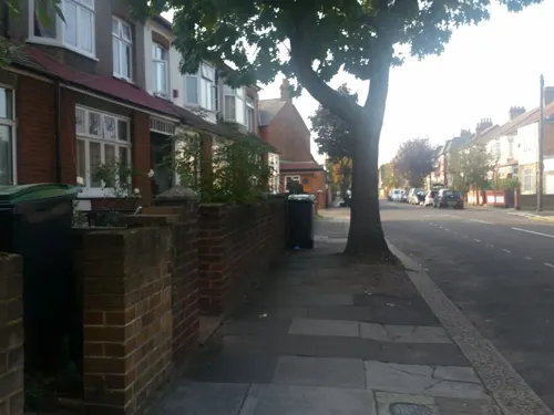
The Beehive
Bar and pub · Burger, Chicken · 0.8 mi
Stoneleigh Road, London
Mo-Th 15:00-23:00; Fr-Sa 12:00-01:00; Su 12:00-22:30

Bolland and Crust
Cafe · Breakfast, Coffee Shop, Local · 1.2 mi
38 Crawley Road, London
We-Th 10:00-15:00; Fr-Sa 09:00-16:00; Su 10:00-16:00
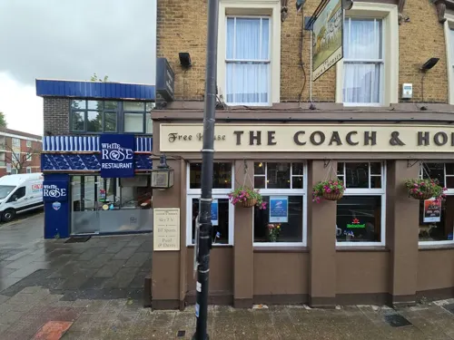
White Rose
Restaurant · Turkish
864 High Road, London
Mo-Th 08:30-23:30; Fr-Sa 08:30-00:00; Su 11:30-00:00
40ft Brewery
Bar and pub · 1.3 mi
10 Lockwood Way, London
Th-Fr 17:00-23:00; Sa 12:00-23:00; Su 12:00-20:00
Chuku‘s
Restaurant · Nigerian · 1.2 mi
274 High Road, London
Tu-Fr 17:30-22:00; Sa 12:00-22:30; Su 12:00-20:30

Bruce Burgers
Restaurant · Chicken, Burger · 0.6 mi
93 Bruce Grove, London
Mo-Th 17:00-00:00; Fr-Sa 17:00-01:00; Su 17:00-00:00


Big Penny Social
Bar and pub · 1.5 mi
1 Priestley Way, London
Mo-We 12:00-23:00; Th 12:00-00:00; Fr,Sa 12:00-01:00; Su 12:00-22:00

232 more on the map.
History
Tottenham is believed to have been named after Tota, a farmer, whose hamlet was mentioned in the Domesday Book. 'Tota's hamlet', it is thought, developed into 'Tottenham'. The settlement was recorded in the Domesday Book as Toteham, in the ancient hundred of Edmonton. It is not related to Tottenham Court Road in Central London, though the two names share a similar-sounding root.
There has been a settlement at Tottenham for over a thousand years. It grew up along the old Roman road, Ermine Street (some of which is part of the present A10 road), and between High Cross and Tottenham Hale, the present Monument Way.
When the Domesday Book was compiled in 1086, about 70 families lived within the area of the manor, mostly labourers working for the lord of the manor. A humorous poem entitled the Tournament of Tottenham, written around 1400, describes a mock battle between peasants vying for the reeve's daughter.
Read more of the history
The River Lea (or Lee) was the eastern boundary between the Municipal Boroughs of Tottenham and Walthamstow. It is the ancient boundary between Middlesex and Essex and also formed the western boundary of the Viking controlled Danelaw. Today it is the boundary between the London Boroughs of Haringey and Waltham Forest. A major tributary of the Lea, the River Moselle, also crosses the borough from west to east, and often caused serious flooding until it was mostly covered in the 19th century.
From the Tudor period onwards, Tottenham became a popular recreation and leisure destination for wealthy Londoners. Henry VIII is known to have visited Bruce Castle and also hunted in Tottenham Wood. A rural Tottenham also featured in Izaak Walton's book The Compleat Angler, published in 1653. The area became noted for its large Quaker population and its schools (including Rowland Hill at Bruce Castle). Tottenham remained a semi-rural and upper middle class area until the 1870s.
In late 1870s, the Great Eastern Railway introduced special workman's trains and fares on its newly opened Enfield and Walthamstow branch lines. Tottenham's low-lying fields and market gardens were then rapidly transformed into cheap housing for the lower middle and working classes, who were able to commute cheaply to inner London. The workman's fare policy stimulated the relatively early development of the area into a London suburb.
In 1894, Tottenham was made an urban district and on 27 September 1934 it became a municipal borough. As from 1 April 1965, the municipal borough formed part of the London Borough of Haringey together with Hornsey and Wood Green.
An incident occurred on 23 January 1909, which was at the time known as the Tottenham Outrage. Two armed robbers, Latvian Jews of Russian extraction, held up the wages clerk of rubber works in Chestnut Road. They made their getaway via Tottenham Marshes and fled across the Lea. On the opposite bank of the river, they hijacked a Walthamstow Corporation tramcar, hotly pursued by the police on another tram. The hijacked tram was stopped but the robbers continued their flight on foot. After firing their weapons and killing two people, Ralph Joscelyne, aged 10, and PC William Tyler, they were eventually cornered by the police and shot themselves rather than be captured. Fourteen other people were wounded during the chase. The incident later became the subject of a silent film.
During the Second World War Tottenham was one of the many targets of the German air offensive against Britain. Bombs fell in the borough (Elmar Road) during the first air raid on London on 24 August 1940. The borough also received V-1 (four incidents) and V-2 hits, the last of which occurred on 15 March 1945. Wartime shortages led to the creation of Tottenham Pudding, a mixture of household waste food which was converted into feeding stuff for pigs and poultry. The "pudding" was named by Queen Mary on a visit to Tottenham Refuse Works. Production continued into the post-war period, its demise coinciding with the merging of the borough into the new London Borough of Haringey.
The Broadwater Farm riot occurred around the Broadwater Farm Estate on 6 October 1985 following the death of Cynthia Jarrett. Jarrett was a resident of Tottenham who lived about one mile (two kilometres) from the estate, who died of heart failure during a police search of her home. The tension between local black youths and the largely white Metropolitan Police had been high due to a combination of local issues and the aftermath of riots in Brixton which had occurred in the previous week. The response of some of the black community in Tottenham and surrounding areas culminated in a riot beginning on Tottenham High Road and ending in Broadwater Farm Estate. One police officer, Keith Blakelock, was murdered; 58 policemen and 24 other people were injured in the fighting. Two of the policemen were injured by gunshots during the riot, the first time that firearms had been used in that type of confrontation.
From the History section of Tottenham on Wikipedia, under CC BY-SA 4.0.
More about Tottenham
Geography
Tottenham's elevation is approximately 33 ft (10 m) above sea level.
Because of Tottenham's long history as a borough, the Tottenham name is used by some to this day to describe the whole of the area formerly covered by the old borough, incorporating the N17 postcode area and part of N15. However, there are differing views as to what constitutes the Tottenham neighbourhood in the present day. Many think of Tottenham today as most of the area covered by the N17 post code, sometimes using the phrase 'Tottenham Proper' to describe it and to distinguish it from the other parts of the old borough.
North: This area stretches along Tottenham High Road from the Edmonton border in the north to Lordship Lane in the south: districts include Little Russia and Northumberland Park.
Central: Continuing along the high road, the central area includes Tottenham Hale, as well as Tottenham Hale station and retail park.
West: To the west of the area are Broadwater Farm and the Tower Gardens Estate.
South: Further along the A10 road until St Ann's Road, including South Tottenham and Seven Sisters.
From the Wikipedia article Tottenham, under CC BY-SA 4.0.
Notable people from Tottenham
 AdeleEnglish singer-songwriter (born 1988)Photo: Marc E., CC BY 2.0
 SkeptaBritish-Nigerian rapper and record producerPhoto: Raph_PH, CC BY 4.0
 Charles ConderAustralian painter, lithographer and fan-designer (1868-1909)Photo: H. Barnett, Public domain
 Lloyd HildebrandBritish racing cyclist, competitor for France (1870–1924)Photo: La Vie au grand air, Public domain
 Kate MarsdenBritish nurse (1859–1931)Photo: unknown but in 1906, Public domain
 Dave ClarkBritish drummer, rock singer, songwriter, record producerPhoto: ABC Television, Public domain
 Chris CrossEnglish bass guitarist (1952–2024)Photo: Thargol, Public domain
 Rebel MCEnglish music producerPhoto: Saverios1, CC BY-SA 3.0
 Wojciech GiertychRoman Catholic priestPhoto: John Paul Sonnen, CC BY-SA 3.0
- Leslie PhillipsBritish actor (1924–2022)
- Mark HollisBritish singer (1955–2019)
- Alfie WhitemanEnglish association football player
Born in Tottenham, according to Wikidata (CC0). Each name links to its Wikipedia article.
Where to stay2
Churches and places of worship80
Shopping43
Gas and EV charging11
Schools, colleges and libraries52
Healthcare21
Map of Tottenham
250 places. The map loads OpenStreetMap tiles when you open it.
Getting there and nearby towns
London City Airport (LCY) is the nearest airport with scheduled flights listed in OpenStreetMap, 9 miles away.
- Walthamstow 2 mi southeast, about 4 min by car
- Edmonton 2 mi north, about 3 min by car
- Southgate 2 mi northwest, about 3 min by car
- Harringay 2 mi southwest, about 3 min by car
- Wood Green 2 mi west, about 3 min by car
- London 7 mi south, about 11 min by car
- City of Westminster 8 mi south, about 13 min by car
- Watford 15 mi west, about 23 min by car
- Woking 29 mi southwest, about 46 min by car
- Worthing 56 mi south, about 1 h 30 min by car
Drive times are estimates from straight-line distance, not routes.
Towns near Tottenham


Keep exploring
Local news
Headlines from INDB.
Reviews, tips and questions
Loading what members have shared...
Sources and licences
- GeoNames (CC BY 4.0): population, coordinates, regions and time zone
- Mapillary (see each image): photos
- OpenStreetMap contributors (ODbL 1.0): places, airports, map data
- Wikidata (CC0 1.0): elevation, founding date, time zone, website, landmarks and historic places
- Wikimedia Commons (see each image): photos
- Wikipedia (CC BY-SA 4.0): overview and history text
Photo credits
- Tottenham Hotspur v AFC Bournemouth, 15 April 2023 (G), Thomas Dahlstrøm Nielsen, CC BY-SA 4.0
- Valentino's, Tottenham, N17, Ewan-M, CC BY-SA 2.0
- Grow lights over the pitch at Tottenham Hotspur Stadium, Daniel, CC BY 2.0
- Home dressing room at Tottenham Hotspur Stadium, Daniel, CC BY 2.0
- Tottenham Hotspur Stadium - South Stand and pitch with grow lights, Daniel, CC BY 2.0
- Tottenham 2 - 7 Bayern Munich scoreboard, Govvy, CC BY-SA 4.0
- Whitehall Tavern, Tottenham, N17, Ewan-M, CC BY-SA 2.0
- Tottenham v Vitesse Europa Conference League at Tottenham Hotspur Stadium, Daniel ( photos · photo sets ), CC BY 2.0
- Outside Tottenham Hotspur Stadium (49063367003), Daniel from Glasgow, United Kingdom, CC BY 2.0
- Outside Tottenham Hotspur Stadium (49063367098), Daniel from Glasgow, United Kingdom, CC BY 2.0
- The Tottenham Experience (49080339517), Daniel from Glasgow, United Kingdom, CC BY 2.0
- Outside Tottenham Hotspur Stadium (49063880886), Daniel from Glasgow, United Kingdom, CC BY 2.0
- The Tottenham Experience (49080132466), Daniel from Glasgow, United Kingdom, CC BY 2.0
- The Tottenham Experience (49079603258), Daniel from Glasgow, United Kingdom, CC BY 2.0
- The Tottenham Experience (49079608113), Daniel from Glasgow, United Kingdom, CC BY 2.0
- The Tottenham Experience (49079604103), Daniel from Glasgow, United Kingdom, CC BY 2.0
- The Tottenham Experience (49080132956), Daniel from Glasgow, United Kingdom, CC BY 2.0
- Bernie Grant Arts Centre JL 001, Berniegrantcentre, CC BY 3.0
- APalace 1, Jack Rose, CC BY-SA 4.0
- Lea Bridge Station re-opening after 31 years (26432053793), Sludge G, CC BY-SA 2.0
- Wilmer Way bridge 02, Philafrenzy, CC BY-SA 4.0
- Bruce Castle front 2024-02-24 (2), The wub, CC BY-SA 4.0
- God's Own Junkyard 10100775327306884, JRennocks, CC BY 4.0
- Hornsey War Memorial 10, Philafrenzy, CC BY-SA 4.0
- Thae Walthamstow Pumphouse Museum Building, Electrolux2, CC BY-SA 3.0
- William Morris Gallery-001, ProfDEH, CC BY-SA 3.0
- Wood Green War Memorial 20170706 131924 (49368979152), Irid Escent, CC BY-SA 2.0
- Downhills Park, Sheriff Of Nothing, CC BY 2.0
- Pymmes Park1, Northmetpit, Public domain
- Ainslie Wood 1, Dudley Miles, CC BY-SA 3.0
- Broomfield Park garden, Dudley Miles, CC BY-SA 3.0
- Ducketts Common, Mx. Granger, CC0
- New River at Enfield Town Park, Smerus, CC BY-SA 3.0
- Walking in Finsbury Park, Hjuk at en.wikipedia, CC BY-SA 3.0
- Bsc, Ohsimone, CC BY-SA 3.0
- Abney park chapel, Tarquin Binary, CC BY-SA 2.5
- Braemar Avenue Baptist Church, Wood Green 02, Philafrenzy, CC BY-SA 4.0
- All Hallows, Tottenham, Alan Stanton, CC BY-SA 2.0
- Main Entrance - 4850786721, Alan Stanton, CC BY-SA 2.0
- St Benet Fink 2008-10-22 09-04-10, Arbus Driver, CC BY-SA 2.0 uk
- Mammogram, National Cancer Institute, Public domain
- St Philip the Apostle, Tottenham, Brian Collins, CC BY-SA 4.0
- Ferry Inn Public House, Emma Chan, CC BY-SA 4.0
- Abney Park 3, Mx. Granger, CC0
- Campbell Works, Mx. Granger, CC0
- Aerial view of Walthamstow Reservoirs from the north, Russss, CC BY-SA 4.0
- Stage Machinery at Alexandra Palace Theatre, CuriosityScribe, CC BY-SA 4.0
- Hornsey Town Hall 2026-03-26, Tom Page, CC BY-SA 4.0
- Bruce Castle Museum - J.A.P. bike, Alan Stanton, CC BY-SA 2.0
- The Cage - Vestry House Museum Vestry Rd Walthamstow London E17 9NH, Spudgun67, CC BY-SA 4.0
- London from Alexandra Park in the early morning (2012) - panoramio, Alexander Kachkaev, CC BY 3.0
- Chestnuts Park Entrance With Plaque, Paul Carpenter, CC BY-SA 4.0
- Flickr - Duncan~ - Clissold Park Lions, Duncan Harris from Nottingham, UK, CC BY 2.0
- Raining Again - Stoneleigh Road N17 near the Beehive pub, Alan Stanton, CC BY-SA 2.0
- Street-level photo, rskedgell, CC BY-SA 4.0
- Street-level photo, rskedgell, CC BY-SA 4.0
- Street-level photo, pbb, CC BY-SA 4.0
- Street-level photo, pbb, CC BY-SA 4.0
- Street-level photo, matth81, CC BY-SA 4.0
- Street-level photo, matth81, CC BY-SA 4.0
- Street-level photo, matth81, CC BY-SA 4.0
- Street-level photo, LionsBreath, CC BY-SA 4.0
- Street-level photo, rskedgell, CC BY-SA 4.0
- Street-level photo, smsm1, CC BY-SA 4.0
- Street-level photo, pbb, CC BY-SA 4.0
- Street-level photo, pbb, CC BY-SA 4.0
- Street-level photo, gness, CC BY-SA 4.0
- Street-level photo, LionsBreath, CC BY-SA 4.0
- Street-level photo, LionsBreath, CC BY-SA 4.0
- Street-level photo, rskedgell, CC BY-SA 4.0
- Street-level photo, IpswichEdits, CC BY-SA 4.0
- Street-level photo, matth81, CC BY-SA 4.0
- Street-level photo, wasd42, CC BY-SA 4.0
- Street-level photo, wasd42, CC BY-SA 4.0


Page built November 10, 2026. Spotted a mistake? Tell us or suggest a place.