


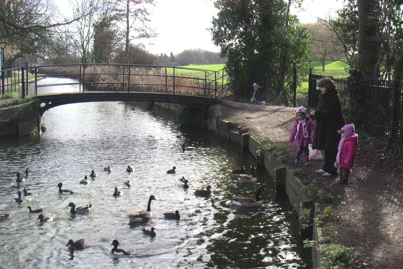


Enfield Town, United Kingdom
Enfield Town is a city of 156,858 people in England, United Kingdom.
Why visit Enfield Town
Townapedia lists 17 museums and landmarks, 33 parks and trails, 171 places to eat, 2 places to stay and 7 attractions in and around town.
Highlights include Wilmer Way footbridge, Cineworld Enfield, Cockfosters War Memorial and East Barnet War Memorial.
Weather in Enfield Town
Forecast from MET Norway (CC BY 4.0). Full forecast
About Enfield Town
Enfield is a large town in north London, England, and the principal town of the wider London Borough of Enfield. With a population of 156,858 in 2018, it includes the areas of Botany Bay, Brimsdown, Bulls Cross, Bullsmoor, Bush Hill Park, Clay Hill, Crews Hill, Enfield Highway, Enfield Lock, Enfield Town, Enfield Wash, Forty Hill, Freezywater, Gordon Hill, Grange Park, Hadley Wood, Ponders End, and World's End. The centre of Enfield Town is 10.2 miles (16.4 km) north of Charing Cross.
From the Wikipedia article Enfield, London (this version), under CC BY-SA 4.0.
Photos of Enfield Town


Things to do7


Intimate Theatre
Cinema and theater · 2.0 mi
Theatre in Palmers Green, London
Millfield Theatre
Cinema and theater · 2.4 mi
Theatre in Enfield, London


Museums and landmarks17

Cockfosters War Memorial
Monument and historic site · 2.9 mi
War memorial in London

East Barnet War Memorial
Monument and historic site · 3.4 mi
War memorial in London

Forty Hall
Museum · 1.4 mi
Grade I listed historic house museum in the London Borough of Enfield, United Kingdom




Elsyng Palace
Monument and historic site · 1.7 mi
Archaeological site in London Borough of Enfield, Greater London, England, UK
Enfield Living Memorial
Monument and historic site
The Enfield Living Memorial project has created a living tribute for those lost locally during the covid pandemic. It marks the...
5 more on the map.
Parks, trails and playgrounds33


Belmont Open Space
Park · 3.1 mi
Public park in Cockfosters in the London Borough of Barnet


Cedars Park
Park · 3.3 mi
Historic public park originally the site of Theobalds Palace in Hertfordshire, England

Grovelands Park
Park · 1.8 mi
Park in the London Borough of Enfield, UK

Oak Hill Park
Park · 3.1 mi
Park in London Borough of Barnet, United Kingdom

Oak Hill Wood
Park · 3.0 mi
Woodland in the London Borough of Barnet, England, UK


Trent Park
Park · 2.2 mi
Park in the London Borough of Enfield, UK; in WW2 Camp for highranking enemy officers

The Queen Elizabeth Stadium
Sports field and stadium · 1.1 mi
Donkey Lane, Enfield

Oakwood Park, Enfield
Park · 1.7 mi
Park located in Oakwood, London, United Kingdom
21 more on the map.
Restaurants and cafes171





Holtwhites Bakery
Bakery · 0.5 mi
119 Chase Side, Enfield
Mo-Fr 08:00-16:00; Sa 08:00-15:00; Su 08:00-14:00
Mary Madden's
Bar and pub
29 Silver Street, Enfield
Mo-We 11:00-00:00; Th 11:00-01:00; Fr 11:00-02:00; Su 12:00-24:00
Rose and Crown
Bar and pub · 1.4 mi
185 Clay Hill, Enfield
Mo-Sa 12:00-23:00; Su 12:00-22:30

159 more on the map.
History
In Anglo-Saxon times, the manor of Enfield was held by Ansgar the Staller (c. 1025 – 1085), a nobleman and staller to King Edward the Confessor (r. 1042–1066). The name 'Enfield' most likely came from Old English Ēanafeld or similar, meaning "open land belonging to a man called Ēana". At the time of the Domesday Book in 1086, the manor of Enfield, spelt 'Enfelde', was the property of Geoffrey de Mandeville, a powerful Norman granted large estates by William the Conqueror.
Proximity to the megalopolis of London saw Enfield "engulfed" by the capital in the inter-war period of the 20th century.
The parish church, located on the north side of the marketplace, is dedicated to St Andrew. While some masonry from the thirteenth century remains, the nave, north aisle, choir, and tower constructed of random rubble and flint, date from the late fourteenth century. The clerestory was added in the early sixteenth century, and the south aisle was rebuilt in brick in 1824. Adjacent to the church is the old school building of the Tudor period, Enfield Grammar School, which expanded over the years and became a large comprehensive school in the late 1960s.
From the History section of Enfield, London on Wikipedia, under CC BY-SA 4.0.
Notable people from Enfield Town
 Ethan NwaneriEnglish association football player (born 2007)Photo: WorldWide1z, CC BY 3.0
 Ryan MasonEnglish association football player and managerPhoto: Timmy96, CC0
 Jake LivermoreEnglish association football player (born 1989)Photo: https://www.flickr.com/photos/37972999@N07/, CC BY 2.0
 Neil Etheridgeassociation football player (born 1990)Photo: Explicit, CC BY-SA 4.0
 Henri LansburyEnglish association football player (born 1990)Photo: Nottingham Forest F.C., CC0
 Julia McKenzieBritish actress, presenter, director, writerPhoto: User:Ronhjones, CC BY-SA 2.0
 Norman TebbitBritish politician (1931–2025)Photo: Roger Harris, CC BY 3.0
 Alison GoldfrappEnglish musician and record producer (born 1966)Photo: Greenwich Photography, CC BY-SA 2.0
 Robert GrabarzBritish high jumperPhoto: Erik van Leeuwen, attribution: Erik..., GFDL
 David LloydBritish comics artistPhoto: Qwertzu111111, CC BY-SA 4.0
 Andre BoucaudTrinidad and Tobago footballer (born 1984)Photo: https://www.flickr.com/photos/vagueonthehow/, CC BY 2.0
- Brian HartBritish racing driver and engineer
Born in Enfield Town, according to Wikidata (CC0). Each name links to its Wikipedia article.
Where to stay2
Churches and places of worship49
Shopping30
Gas and EV charging10
Schools, colleges and libraries41
Healthcare18
Enfield Osteopathic Clinic
Clinic and pharmacy · 1.0 mi
93 St Mark's Road, Enfield
Map of Enfield Town
250 places. The map loads OpenStreetMap tiles when you open it.
Getting there and nearby towns
London City Airport (LCY) is the nearest airport with scheduled flights listed in OpenStreetMap, 12 miles away.
- Tottenham 3 mi south, about 5 min by car
- Walthamstow 5 mi southeast, about 8 min by car
- Islington 8 mi south, about 13 min by car
- Ilford 9 mi southeast, about 15 min by car
- London 10 mi south, about 16 min by car
- City of Westminster 11 mi south, about 17 min by car
- Harrow 12 mi southwest, about 19 min by car
- Watford 13 mi west, about 21 min by car
- Luton 21 mi northwest, about 34 min by car
- Sutton 21 mi south, about 34 min by car
Drive times are estimates from straight-line distance, not routes.
Towns near Enfield Town


Keep exploring
Local news
Headlines from INDB.
Reviews, tips and questions
Loading what members have shared...
Sources and licences
- GeoNames (CC BY 4.0): population, coordinates, regions and time zone
- Mapillary (see each image): photos
- OpenStreetMap contributors (ODbL 1.0): places, airports, map data
- Wikidata (CC0 1.0): elevation, founding date, time zone, website, landmarks and historic places
- Wikimedia Commons (see each image): photos
- Wikipedia (CC BY-SA 4.0): overview and history text
Photo credits
- Wilmer Way bridge 02, Philafrenzy, CC BY-SA 4.0
- Cockfosters war memorial May 2019, Philafrenzy, CC BY-SA 4.0
- East Barnet war memorial 7, Philafrenzy, CC BY-SA 4.0
- New River at Enfield Town Park, Smerus, CC BY-SA 3.0
- Belmont Open Space Cockfosters, Dudley Miles, Public domain
- Broomfield Park garden, Dudley Miles, CC BY-SA 3.0
- Grovelands House, The Bourne, Southgate, N14, Stu's Images, CC BY-SA 3.0
- Oak Hill Wood meadow, Dudley Miles, Public domain
- Pymmes Park1, Northmetpit, Public domain
- Charred, Alan Myers, CC BY 2.0
- Christ Church, Cockfosters, Philafrenzy, CC BY-SA 4.0
- Forty Hall, Enfield - panoramio, Stu's Images, CC BY-SA 3.0
- St Andrew's Enfield 02, Philafrenzy, CC BY-SA 4.0
- Chace Community School, TheCannonOfClips, CC BY-SA 3.0
- Enfield County School 03, Philafrenzy, CC BY-SA 4.0
- The Dugdale Centre - Enfield Town 2014-08-10 07-28, User:Millfield Manager, CC BY-SA 3.0
- St Michael and All Angels church, Enfield 02, Philafrenzy, CC BY-SA 4.0
- Enfield War Memorial Sept 2016, Philafrenzy, CC BY-SA 4.0
- St Luke the Evangelist, Phipps Hatch Lane, Enfield, Stu's Images, CC BY-SA 3.0
- Queen Elizabeth Stadium Enfield Town, Mcsony, CC BY-SA 3.0
- Moon Under Water, Enfield 20180118 123015 (49775503958), Irid Escent, CC BY-SA 2.0
- Chase Farm Hospital (3), James Cracknell, CC BY-SA 4.0
- Forty Hall 1, Mx. Granger, CC0
- British press reaction to the Taliban takeover of Afghanistan August 2021, Philafrenzy, CC BY-SA 4.0
- Palace Gardens, Enfield, trade entrance, Philafrenzy, CC BY-SA 4.0
- Close-up of the inscription (OpenBenches 1246), Anonymous Unknown author, CC BY-SA 4.0
- Close-up of the inscription (OpenBenches 1245), Anonymous Unknown author, CC BY-SA 4.0
- Adult colouring books, W.H. Smith, Enfield, Philafrenzy, CC BY-SA 4.0
- Mills & Boon books, W.H. Smith, Enfield, Philafrenzy, CC BY-SA 4.0
- Close-up of the inscription (OpenBenches 1247), Anonymous Unknown author, CC BY-SA 4.0
- Long shot of the bench (OpenBenches 1246-1), Anonymous Unknown author, CC BY-SA 4.0
- Long shot of the bench (OpenBenches 1245-1), Anonymous Unknown author, CC BY-SA 4.0
- Ordnance Survey maps, W.H. Smith, Enfield, Philafrenzy, CC BY-SA 4.0
- Oxford University Press dictionaries, W.H. Smith, Enfield, Philafrenzy, CC BY-SA 4.0
- Collins dictionaries, W.H. Smith, Enfield, Philafrenzy, CC BY-SA 4.0
- Cedar's Park flint archway, leading to maze, Martinericbailey, CC BY 4.0
- Tractor, Oak Hill Park, Philafrenzy, CC BY-SA 4.0
- Model of Trent Park House interior 2026-07-20, Matt Brown, CC BY 4.0
- Street-level photo, matth81, CC BY-SA 4.0


Page built November 10, 2026. Spotted a mistake? Tell us or suggest a place.