


Edmonton, United Kingdom
Edmonton is a town of 82,000 people in England, United Kingdom.
Why visit Edmonton
Townapedia lists 14 museums and landmarks, 34 parks and trails, 113 places to eat, 3 places to stay and 6 attractions in and around town.
Highlights include Odeon Lee Valley, Bernie Grant Arts Centre, Bruce Castle and Chingford War Memorial.
Weather in Edmonton
Forecast from MET Norway (CC BY 4.0). Full forecast
About Edmonton
Edmonton is a town in north London, England within the London Borough of Enfield, a local government district of Greater London. The northern part of the town is known as Lower Edmonton or Edmonton Green, and the southern part as Upper Edmonton or The Angel. Situated 8.4 miles (13.5 km) north-northeast of Charing Cross, it borders Enfield to the north, Chingford to the east, and Tottenham to the south, with Palmers Green and Winchmore Hill to the west. The population of Edmonton was 82,472 as of 2011.
From the Wikipedia article Edmonton, London (this version), under CC BY-SA 4.0.
Photos of Edmonton


Things to do6


Bernie Grant Arts Centre
Cinema and theater · 2.7 mi
Arts centre in Tottenham, London
Intimate Theatre
Cinema and theater · 1.9 mi
Theatre in Palmers Green, London


Millfield Theatre
Cinema and theater · 1.1 mi
Theatre in Enfield, London
Museums and landmarks14


Chingford War Memorial
Monument and historic site · 2.5 mi
War memorial in London

Forty Hall
Museum · 3.1 mi
Grade I listed historic house museum in the London Borough of Enfield, United Kingdom


William Morris Gallery
Museum · 2.9 mi
Museum in Walthamstow, London, United Kingdom

Wood Green War Memorial
Monument and historic site · 2.9 mi
War memorial in London



Elsyng Palace
Monument and historic site · 3.2 mi
Archaeological site in London Borough of Enfield, Greater London, England, UK

2 more on the map.
Parks, trails and playgrounds34


Grovelands Park
Park · 2.5 mi
Park in the London Borough of Enfield, UK




Oakwood Park, Enfield
Park · 2.9 mi
Park located in Oakwood, London, United Kingdom
22 more on the map.
Restaurants and cafes113
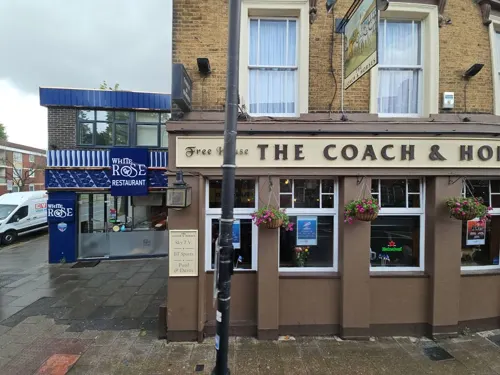
White Rose
Restaurant · Turkish · 1.3 mi
864 High Road, London
Mo-Th 08:30-23:30; Fr-Sa 08:30-00:00; Su 11:30-00:00




The Lincoln
Bar and pub · 1.5 mi
155 Percival Road, Enfield
Mo-Th 13:00-23:00; Fr-Sa 12:00-01:00; Su 12:00-22:00
101 more on the map.
History
The main Roman road, Ermine Street, passed through what is today Edmonton. It ran from London to Lincoln and on to York. Edmonton appears in the Domesday Book of 1086, where it is recorded as Adelmetone—'a farmstead or estate of a man called Ēadhelm', from an Old English personal name and tūn.
Edmonton Hundred was a division of the historic county of Middlesex from Saxon times, an area of some 31,000 acres (130 km2) stretching up the west bank of the Lea from Tottenham to the county boundary south of Waltham Cross, and west into what is now Hertfordshire as far as South Mimms. Local government in the modern sense began in 1837 with the Edmonton Union, set up under the Poor Law Amendment Act 1834. This body also covered a wide district of 47,102 acres (190.62 km2), including the modern boroughs of Haringey and Enfield, plus Cheshunt, Waltham Abbey and Waltham Cross. The town hall was built in 1884 and extended in 1903. The crenelated perpendicular Edmonton Town Hall was built in 1884 to the designs of George Eedes Eachus. The building was enlarged in 1902–3 by W. Gilbee Scott, who added public swimming baths. The baths were replaced by the Edmonton Green Swimming Pool in 1970 and the town hall was demolished in 1989.
Read more of the history
The population of this area grew rapidly, reaching 445,875 by 1911 and would today be about 615,000. As the population mushroomed, smaller areas within Middlesex were used for local government, with a local board being formed for the 3,894 acres (15.76 km2) parish of Edmonton in 1850, which eventually achieved the status of municipal borough as the Municipal Borough of Edmonton in 1937. At the 1961 census the borough had a population of 91,956. This was absorbed into the London Borough of Enfield in 1965, and the former town hall and civic buildings were controversially demolished by Enfield Council in 1989.
Pymmes Park with its historic walled garden is Upper Edmonton's park. Pymmes Park originated as a private estate. In the late 16th century it was owned by the powerful Cecil family. In 1589 Robert Cecil, later 1st Earl of Salisbury, spent his honeymoon at Pymmes. Cecil was a protege of Francis Walsingham, Elizabeth I's chief spymaster and he succeeded him as Secretary of State in 1590. The estate was eventually acquired by Edmonton Council and opened as a public park in 1906. Pymmes House was destroyed by fire during the Second World War and the remains were demolished.
In the 17th century the then rural Edmonton had a reputation for supernatural activities. In approximately 1600, a play entitled The Merry Devil of Edmonton was performed in London about a wizard who lived there. In 1621 the villagers accused an old woman, Elizabeth Sawyer, of witchcraft and she was subsequently executed at Tyburn; her story was told in a pamphlet by Henry Goodcole, and in a 1621 play entitled The Witch of Edmonton.
The historic All Saints' Church is in Church Street as is Lamb's Cottage, which was home to writers Charles Lamb and Mary Lamb.
John Keats, the poet, was apprenticed to surgeon Dr. Hammond in Church Street between 1810 and 1816. The house was demolished in 1931 to be replaced by Keats Parade. An extant shop carries a blue plaque in commemoration.
Edmonton was the home town of Sir James Winter Lake, director of the Hudson's Bay Company. The company's trading outpost named after Edmonton is now the capital of the Canadian province of Alberta.
In his 1782 poem, The Diverting History of John Gilpin, William Cowper relates the comic tale of John Gilpin a linen draper of Cheapside London, who was probably based on a Mr Beyer, a linen draper of the Cheapside corner of Paternoster Row.
Gilpin's spouse decides she and her husband should spend their twentieth wedding anniversary at The Bell Inn, Fore Street, Edmonton. The journey is beset with misfortune from start to finish. Gilpin loses control of his horse which carries him on to the town of Ware ten miles (16 km) distant. On the return journey, Gilpin is still unable to handle his steed, as he once again he fails to stop at The Bell. The horse gallops back to Cheapside much to the dismay of his concerned spouse.
Gilpin is remembered in Edmonton by the statue at Fore Street, the ex-Wetherspoons outlet the Gilpin's Bell public house opposite the site of the original inn and the 1950s council housing Gilpin House in Upper Fore Street.
Edmonton was home to many industries which included manufacturing of gas appliances, electrical components and furniture. Most of this was lost in the latter part of the twentieth century. Household names that produced goods here included MK electric, Ever Ready batteries, British Oxygen, Glover and Main gas appliances.
Eley Industrial Estate was named after Eley Brothers the firearms cartridge manufacturer. Its shot tower was a distinctive landmark on the skyline until being demolished the late twentieth century. Due to its close proximity to the River Lee Navigation, timber was transported by barge from the London Docks and stored in riverside wharves. As a result, many furniture makers including Nathans, Beautility and Homeworthy established factories. Today, Parker-Knoll products are manufactured at the former B&I Nathan factory on the Eley Industrial Estate. As of 2013, the area is dominated by the 100 metre Edmonton Incinerator chimney which was built in 1971. Other major employers include Coca-Cola.
The railway arrived in 1840 with the opening of the first section of the Lea Valley Line from Stratford to Broxbourne. A station was provided in Water Lane (Angel Road). As the station was badly sited and the trains were slow and expensive, few people used the railway in the early days, preferring the horse buses. In 1845 there were buses every 15 minutes along Fore Street, travelling alternately to Bishopsgate and Holborn.
From the History section of Edmonton, London on Wikipedia, under CC BY-SA 4.0.
More about Edmonton
Geography
Edmonton is 8.4 miles (13.5 km) north-northeast of Charing Cross and stretches from just south of the North Circular Road, where it borders Tottenham, to its boundary with Ponders End to the north. Bush Hill Park, Winchmore Hill and Palmers Green adjoin the western boundary along the Great Cambridge Road, while the River Lee Diversion forms Edmonton's eastern boundary with Chingford. The northern part of Edmonton, known as Lower Edmonton, corresponds to the N9 postcode area. Upper Edmonton, the southern part of the town, corresponds to the N18 postcode area. Edmonton lies about 52 feet (16 m) above sea level. The largest public parks are Pymmes Park and Jubilee Park.
From the Wikipedia article Edmonton, London, under CC BY-SA 4.0.
Notable people from Edmonton
 Anthony Giddens, Baron GiddensBritish sociologist (born 1938)Photo: Szusi, CC BY-SA 3.0
 Brook TaylorEnglish mathematician (1685–1731)Photo: Hans Hysing, Public domain
 Kyle Walker-PetersEnglish association football playerPhoto: Amy Martin Photography, CC BY-SA 4.0
 Angel GomesEnglish association football player (born 2000)Photo: Supporterhéninois, CC0
 Jay SimpsonEnglish association football player (born 1988)Photo: Noah Salzman, CC BY-SA 4.0
 Bruce ForsythBritish presenter, actor, comedian, singer, dancer, and screenwriter (1928–2017)Photo: Associated Press, Public domain
 Jobi McAnuffBritish footballer (born 1981)Photo: https://www.flickr.com/photos/34517490@N00/, CC BY 2.0
 Kate MarsdenBritish nurse (1859–1931)Photo: unknown but in 1906, Public domain
 Eric PowellBritish rower and artist (1886-1933)Photo: Grindel1, CC BY-SA 3.0
 Tion WayneBritish rapper and disc jockey (born 1993)Photo: Oier Etxebarria, CC BY-SA 4.0
- Norman SmithBritish recording engineer, producer, musician (1923-2008)
- David JasonBritish actor (born 1940)
Born in Edmonton, according to Wikidata (CC0). Each name links to its Wikipedia article.
Where to stay3
Churches and places of worship60
Shopping25
Gas and EV charging9
Schools, colleges and libraries42
Healthcare23
Enfield Osteopathic Clinic
Clinic and pharmacy · 1.3 mi
93 St Mark's Road, Enfield
Forest Road Primary Care Centre
Clinic and pharmacy · 0.6 mi
308A Hertford Road, London
Map of Edmonton
250 places. The map loads OpenStreetMap tiles when you open it.
Getting there and nearby towns
London City Airport (LCY) is the nearest airport with scheduled flights listed in OpenStreetMap, 10 miles away.
- Ponders End 1 mi north, about 2 min by car
- Tottenham 2 mi south, about 3 min by car
- Enfield Town 2 mi northwest, about 3 min by car
- Southgate 2 mi west, about 3 min by car
- Palmers Green 2 mi west, about 4 min by car
- Walthamstow 3 mi southeast, about 5 min by car
- Wood Green 3 mi southwest, about 5 min by car
- Enfield Lock 3 mi northeast, about 5 min by car
- Harringay 3 mi southwest, about 6 min by car
- Woodford Green 4 mi east, about 6 min by car
Drive times are estimates from straight-line distance, not routes.
Towns near Edmonton


Keep exploring
Local news
Headlines from INDB.
Reviews, tips and questions
Loading what members have shared...
Sources and licences
- GeoNames (CC BY 4.0): population, coordinates, regions and time zone
- Mapillary (see each image): photos
- OpenStreetMap contributors (ODbL 1.0): places, airports, map data
- Wikidata (CC0 1.0): elevation, founding date, time zone, website, landmarks and historic places
- Wikimedia Commons (see each image): photos
- Wikipedia (CC BY-SA 4.0): overview and history text
Photo credits
- Railway Tavern, Lower Edmonton, N9, Ewan-M, CC BY-SA 2.0
- Edmonton Green Shopping Centre - 26th June 2024, Zodiahk, CC BY-SA 4.0
- Exhibition, Lower Edmonton, N9, Ewan-M, CC BY-SA 2.0
- LJ13 CDK, The Broadway, Edmonton Green, August 24th 2023, Matt Taylor, CC BY-SA 4.0
- Edmonton Green station, Ewan-M, CC BY-SA 2.0
- Edmontongreen, Stephen Dawson, CC BY-SA 2.0
- Edmonton Green station 2007-09-26, steve_w, CC BY 2.0
- Fireworks at Edmonton Green - panoramio, Steve Sea, CC BY 3.0
- Bernie Grant Arts Centre JL 001, Berniegrantcentre, CC BY 3.0
- Wilmer Way bridge 02, Philafrenzy, CC BY-SA 4.0
- Bruce Castle front 2024-02-24 (2), The wub, CC BY-SA 4.0
- Chingford War Memorial 07, Edwardx, CC BY-SA 3.0
- Forty Hall, Enfield - panoramio, Stu's Images, CC BY-SA 3.0
- William Morris Gallery-001, ProfDEH, CC BY-SA 3.0
- Wood Green War Memorial 20170706 131924 (49368979152), Irid Escent, CC BY-SA 2.0
- Pymmes Park1, Northmetpit, Public domain
- Ainslie Wood 1, Dudley Miles, CC BY-SA 3.0
- Broomfield Park garden, Dudley Miles, CC BY-SA 3.0
- Downhills Park, Sheriff Of Nothing, CC BY 2.0
- Ducketts Common, Mx. Granger, CC0
- New River at Enfield Town Park, Smerus, CC BY-SA 3.0
- Grovelands House, The Bourne, Southgate, N14, Stu's Images, CC BY-SA 3.0
- Woodside Park. Wood Green, London, HughJLF, CC BY-SA 4.0
- Charred, Alan Myers, CC BY 2.0
- All Hallows, Tottenham, Alan Stanton, CC BY-SA 2.0
- Braemar Avenue Baptist Church, Wood Green 02, Philafrenzy, CC BY-SA 4.0
- Bsc, Ohsimone, CC BY-SA 3.0
- Chingford United Reformed Church 05, Edwardx, CC BY-SA 3.0
- St Andrew's Enfield 02, Philafrenzy, CC BY-SA 4.0
- Millfield House, Christine Matthews, CC BY-SA 2.0
- Main Entrance - 4850786721, Alan Stanton, CC BY-SA 2.0
- St Edmunds School, Northmetpit, Public domain
- Mammogram, National Cancer Institute, Public domain
- Lee Valley Cinema, Jack Hill, CC BY-SA 2.0
- London Tottenham Hotspur Stadium, Arne Müseler, CC BY-SA 3.0 de
- LJ13 CDK, The Broadway, Edmunton Green, August 24th 2023, Matt Taylor, CC BY-SA 4.0
- November 5th 2015 - panoramio, Steve Sea, CC BY 3.0
- Lightning over Enfield - panoramio, Steve Sea, CC BY 3.0
- Panorama of West view - panoramio, Steve Sea, CC BY 3.0
- Travel Lodge Hotel - panoramio, Steve Sea, CC BY 3.0
- The Markfield Beam Engine and Museum, Markfield Park, Loz Pycock, CC BY-SA 2.0
- Two Brewers Memorial Garden (1), James Cracknell, CC BY-SA 4.0
- Chestnuts Park Entrance With Plaque, Paul Carpenter, CC BY-SA 4.0
- Street-level photo, pbb, CC BY-SA 4.0
- Street-level photo, rskedgell, CC BY-SA 4.0
- Street-level photo, rskedgell, CC BY-SA 4.0
- Street-level photo, pbb, CC BY-SA 4.0
- Street-level photo, pbb, CC BY-SA 4.0
- Street-level photo, pbb, CC BY-SA 4.0
- Street-level photo, southglos, CC BY-SA 4.0
- Street-level photo, IpswichEdits, CC BY-SA 4.0
- Street-level photo, rskedgell, CC BY-SA 4.0
- Street-level photo, matth81, CC BY-SA 4.0
- Street-level photo, rskedgell, CC BY-SA 4.0
- Street-level photo, themadcabbie, CC BY-SA 4.0
- Street-level photo, zymurgic, CC BY-SA 4.0
- Street-level photo, erias, CC BY-SA 4.0
- Street-level photo, matth81, CC BY-SA 4.0


Page built November 10, 2026. Spotted a mistake? Tell us or suggest a place.