


Costessey, United Kingdom
Costessey is a town of 2,381 people in England, United Kingdom.
Why visit Costessey
Townapedia lists 10 museums and landmarks, 33 parks and trails, 55 places to eat, 7 places to stay and 9 attractions in and around town.
Highlights include Blackfriar's Bridge, Fye Bridge, Sainsbury Centre and Strangers' Hall.
Weather in Costessey
Forecast from MET Norway (CC BY 4.0). Full forecast
About Costessey
Costessey is a town and civil parish in the South Norfolk district of Norfolk, England, and is 4 miles (6.4 km) north west of Norwich. The civil parish forms part of the Norwich Urban Area. It includes the residential suburb of Queen's Hills.
From the Wikipedia article Costessey (this version), under CC BY-SA 4.0.
Things to do9

Blackfriar's Bridge
Bridge · 4.0 mi
Bridge in Norwich, Norfolk, England, UK


Maddermarket Theatre
Cinema and theater · 4.0 mi
Theatre in Norwich, England

Norwich Playhouse
Cinema and theater · 4.0 mi
Theatre in Norwich, Norfolk, England

Sewell Barn Theatre
Cinema and theater · 3.8 mi
Theatre in Norwich, England

St Crispin's Bridge
Bridge · 3.7 mi
Bridge in Norwich, Norfolk, England, UK

Theatre Royal, Norwich
Cinema and theater · 4.0 mi
Theatre in Norwich, England


St Miles Bridge
Bridge · 3.9 mi
Bridge in Norwich, Norfolk, England, UK
Museums and landmarks10

Sainsbury Centre
Museum · 2.9 mi
Art gallery and museum at the University of East Anglia, Norwich, England, United Kingdom

Strangers' Hall
Museum · 4.0 mi
Grade I listed building in Norwich, England

Norwich War Memorial
Monument and historic site · 4.1 mi
War memorial in Norwich, England
Drayton Lodge
Monument and historic site · 1.3 mi
Repaired remains of C15 brick hunting lodge listed Grade II*
Parks, trails and playgrounds33


Earlham Park Woods
Park · 2.7 mi
Nature reserve in Norwich, Norfolk, England, UK


Wensum Local Nature Reserve
Park · 2.7 mi
Local nature Reserve in Norwich, England




21 more on the map.
Restaurants and cafes55
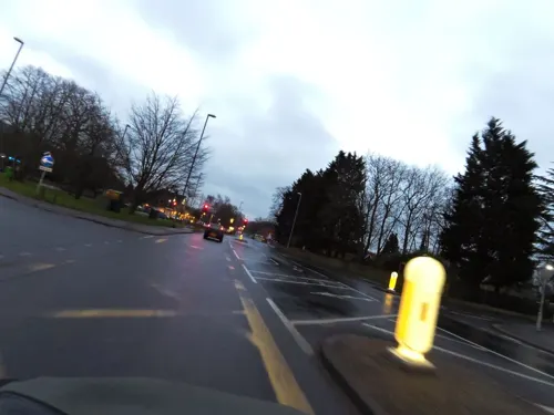
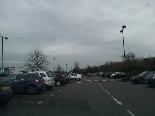
Costa
Cafe · Coffee Shop · 1.3 mi
William Frost Way, Norwich
Mo-Fr 09:00-20:30; Sa 09:00-19:30; Su 10:00-16:00
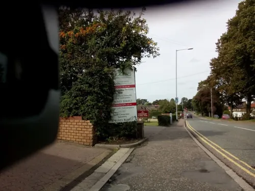


The Rembrandt
Restaurant · Fish And Chips · 2.2 mi
61-65 Dereham Road, Norwich
Tu-Sa 11:30-13:30,16:30-22:00,Su-Mo 16:30-22:00

Starbucks
Cafe · Coffee Shop · 1.0 mi
Ernest Gage Avenue, Norwich
Mo-Fr 06:00-22:00; Sa 07:00-21:00; Su 08:00-20:00
The Bush
Bar and pub
55 The Street, Norwich
Mo-Th 12:00-15:00,18:30-23:00; Fr 12:00-16:00,18:30-23:30; Sa...
43 more on the map.
History
Costessey lies in the valleys of the rivers Wensum and Tud. Archaeological records indicate that there was a strong farming community on this site during the late Bronze Age and Roman times. Anglo-Saxon settlers established a community at some point after 600 AD, and it is generally believed that the name Costessey, meaning Kost's Island, dates from this time. Furthermore, records from 1648 recount that Oliver Cromwell referred to the village and estate as Cossey, indicating that the current pronunciation of the name has long existed. There is also evidence to suggest that the spelling was changed from Cossey to Costessey in the 19th century.
Costessey features in the legend of St Walstan, the little-known patron saint of farm labourers, who is remembered in villages across Norfolk and north Suffolk. According to legend, Walstan was born into the nobility at neighbouring Bawburgh – then part of the Costessey estate – circa 970, but relinquished his privileges, choosing instead to spend most of his life working as a farm labourer in Taverham. It is said that his initial route took him on foot from Bawburgh to Taverham through Costessey Park, where he donated his fine garments to some passing peasants. Following his death and the return of his body by cart to Bawburgh, springs of holy water are said to have arisen at three sites in Taverham, Costessey and Bawburgh.
Read more of the history
In the Domesday Book of 1086, the village of Costesela appears in the hundred of Forehoe, with mention of a mill, and of a manor with over of estate across Norfolk, including the only listed hunting park in Norfolk. This formerly belonged to Earl Gyrth Godwinson but was awarded by William the Conqueror to his Breton relative, Count Alan Rufus. Here began a 500-year period in which ownership of the manor passed through a variety of families, regularly being reverted to the Crown and reallocated.
In 1546, Henry VIII granted the manor to Anne of Cleves, his fourth wife, although evidence suggests that she never actually occupied Costessey Hall. A surviving early Tudor building sited in what remains of Costessey Park is thought by some to be the hall granted by Henry. In 1555, Queen Mary granted Costessey Manor to Sir Henry Jerningham, heralding a long period of occupancy by the Jernegans, Jerninghams and Stafford Jerninghams. Sir Henry commissioned the building of a new Tudor Hall on Costessey Park, beginning his residency there in 1565.
In 1827, Sir George William Jerningham, 8th Baron Stafford, commissioned large-scale grand and elaborate expansions of Sir Henry's Hall, with many towers and mock-Tudor windows. The project was ongoing over several decades, continued by the 9th Baron Stafford from 1851, and although many features of the new design were realised, completion was ultimately prevented by dwindling funds. The 10th Baron Stafford, who inherited the title in 1884, was certified as a lunatic; during his ownership, the estate was held by the Lunacy Commission. The generous and reclusive Sir FitzOsbert Stafford Jerningham, 11th Baron Stafford, resided at Costessey Hall until his death in 1913, upon which the Hall's contents were auctioned at a high-profile sale.
From the History section of Costessey on Wikipedia, under CC BY-SA 4.0.
Notable people from Costessey
- Simon WilkinEnglish editor, Browne scholar, entomologist
- Alice BakerLong-lived World War I veteran (1898-2006)
Born in Costessey, according to Wikidata (CC0). Each name links to its Wikipedia article.
Where to stay7
Churches and places of worship38
Shopping15
Gas and EV charging8
Schools, colleges and libraries29
Healthcare12
Norfolk & Norwich Kidney Centre
Clinic and pharmacy · 1.1 mi
Francis Way, Norwich
Map of Costessey
216 places. The map loads OpenStreetMap tiles when you open it.
Getting there and nearby towns
Norwich Airport (NWI) is the nearest airport with scheduled flights listed in OpenStreetMap, 3 miles away.
- Bowthorpe 1 mi south, about 2 min by car
- Norwich 4 mi southeast, about 7 min by car
- Cringleford 4 mi south, about 6 min by car
- Rackheath 7 mi east, about 12 min by car
- Mattishall 7 mi west, about 12 min by car
- Buxton 7 mi northeast, about 12 min by car
- Cawston 8 mi north, about 12 min by car
- Reepham 8 mi northwest, about 13 min by car
- Hingham 11 mi southwest, about 18 min by car
- East Dereham 12 mi west, about 19 min by car
Drive times are estimates from straight-line distance, not routes.
Towns near Costessey


Keep exploring
Local news
Headlines from INDB.
Reviews, tips and questions
Loading what members have shared...
Sources and licences
- GeoNames (CC BY 4.0): population, coordinates, regions and time zone
- Mapillary (see each image): photos
- OpenStreetMap contributors (ODbL 1.0): places, airports, map data
- Wikidata (CC0 1.0): elevation, founding date, time zone, website, landmarks and historic places
- Wikimedia Commons (see each image): photos
- Wikipedia (CC BY-SA 4.0): overview and history text
Photo credits
- Blackfriars Bridge Norwich, Northmetpit, CC BY-SA 3.0
- Norwich - Fye Bridge - 20220911135036, Barrymyles, CC BY-SA 4.0
- Maddermarket, Cameron Self, aka C1self at en.wikipedia, CC BY 2.5
- NorwichPlayhouse, Cameron Self, CC BY 2.5
- SewellBarn, Cameron Self, CC BY 2.5
- -2018-07-14 City Station (St Crispin's) Bridge, Norwich, Norfolk (1), Evelyn Simak, CC BY-SA 2.0
- Norwich Theatre Royal, Northmetpit, Public domain
- Sainsbury Centre for Visual Arts, Oxyman, CC BY 2.5
- Strangers' Hall - Charing Cross, Norwich - museum windows, Elliott Brown, CC BY 2.0
- Catton Park, Northmetpit, Public domain
- Earlham Park Woods 1, Dudley Miles, CC BY-SA 4.0
- Heigham Park Norwich 2, Northmetpit, CC BY-SA 4.0
- Waterloo Park Norwich Bandstand & Pavilion, Northmetpit, CC0
- Church of St Martin at Oak, nicola j patron, CC BY-SA 3.0
- Church of St. Mary Coslany, nicola j patron, CC BY-SA 3.0
- Taverham-g2, Bernd Jatzwauk Pommes104, CC BY-SA 3.0
- Bawburgh-g1, Bernd Jatzwauk Pommes104, CC BY-SA 3.0
- Wensum Local Nature Reserve, Northmetpit, Public domain
- -2011-03-24 Bandstand, Chapelfield gardens, Norwich, Norfolk, Tanya Dedyukhina, CC BY 3.0
- Street-level photo, smsm1, CC BY-SA 4.0
- Street-level photo, mrssmsm1, CC BY-SA 4.0
- Street-level photo, adam2, CC BY-SA 4.0
- Street-level photo, mrssmsm1, CC BY-SA 4.0
- Street-level photo, adam2, CC BY-SA 4.0
- Street-level photo, smsm1, CC BY-SA 4.0
- Street-level photo, smsm1, CC BY-SA 4.0
- Street-level photo, mrssmsm1, CC BY-SA 4.0
- Street-level photo, mrssmsm1, CC BY-SA 4.0
- Street-level photo, adam2, CC BY-SA 4.0


Page built November 10, 2026. Spotted a mistake? Tell us or suggest a place.