


Cranleigh, United Kingdom
Cranleigh is a town of 11,082 people in England, United Kingdom.
Why visit Cranleigh
Townapedia lists 16 museums and landmarks, 11 parks and trails, 31 places to eat, 2 places to stay and 4 attractions in and around town.
Highlights include Cranleigh Arts Centre, Rydinghurst, Cucknell's Wood and Sayer's Croft LNR.
Weather in Cranleigh
Forecast from MET Norway (CC BY 4.0). Full forecast
About Cranleigh
Cranleigh is a village and civil parish in the Borough of Waverley, Surrey, England. It lies 8 miles (13 km) southeast of Guildford on a minor road east of the A281, which links Guildford with Horsham. It is in the north-west corner of the Weald, a large remnant forest, the main local remnant being Winterfold Forest directly north-west on the northern Greensand Ridge. In 2011 it had a population of just over 11,000.
From the Wikipedia article Cranleigh (this version), under CC BY-SA 4.0.
Photos of Cranleigh

Things to do4


Museums and landmarks16

ROMAN ROAD - Margary 151 - Rowhook to Farley Heath
Monument and historic site · 1.8 mi
4 more on the map.
Parks, trails and playgrounds11







Restaurants and cafes31


19 more on the map.
History
Partly on the Greensand Ridge, where it rises to 700 feet (210 m) at Winterfold Hill, but mainly on the clay and sandstone Lower Weald, Cranleigh has little of prehistoric or Roman interest, whereas just across the east border Wykehurst and Rapley Farms have Roman buildings and Roman Tile Kilns – in the parish of Ewhurst. A spur of the Roman road between London and Chichester runs north west to Guildford past nearby Farley Heath in Farley Green, a temple site. Cranleigh was not mentioned in the Domesday Book, at that time being part of the manor of Shere.
The Anglican parish church of St Nicolas dates the first building on its site from around 1170, and the building was in its present form by the mid-14th century. It was extensively restored in 1847. The church has a gargoyle, on a pillar inside the church, which is said to have inspired Lewis Carroll, who lived in Guildford, to create the Cheshire Cat. With the growth of the village, a "daughter" church, St Andrew's, opened at the west end of the village in 1900 but it closed some sixty years later. The parish is in the Diocese of Guildford.
Read more of the history
The 16th century Boy & Donkey pub, on Knowle Road outside the village, was taken over in the mid-19th century by Hodgsons of Kingston, later Courage, and remained in business until the early 1990s. It was sold to Morland of Abingdon who later closed it. The building was converted into a private home.
Oliver Cromwell visited Knowle House in 1657, his soldiers being billeted in houses in the village.
Growth came due to improvements in transport; in 1813 the Wey and Arun Canal was authorised. Three years later it opened, passing a few miles to the west of the village. This route linked London (via the Thames and the Wey) with Littlehampton (via the Arun). However, the canal traffic was completely eclipsed by the Horsham to Guildford railway which opened in 1865, and the canal fell into disuse. A turnpike road was also built between Guildford and Horsham, assent for the project being given in 1818. The opening is commemorated by an obelisk at the junction of the roads to Horsham and to Ewhurst. The Prince Regent used the route when travelling between Windsor and Brighton, the distances to which are given on the plaque on the obelisk.
Three people played a major part in the development of the village during the 19th century: Reverend John Henry Sapte, Dr Albert Napper and Stephen Rowland. Sapte arrived in Cranleigh in 1846 as the rector. He played a major role in setting up the National School in 1847 and Cranleigh School in 1865. He was appointed Archdeacon of Surrey and remained in the village until his death in 1906.
Together with Napper, Sapte set up the first cottage hospital in the country in 1859. It has survived many attempts to close it, through fundraising by the local community. However it lost its beds for in-patients in May 2006.
Stephen Rowland was a resident who had a major role in the development of the infrastructure of the village. He formed the Cranleigh Gas Company in 1876, and arranged for a mains water supply in 1886. In 1894 he laid out an estate between the Horsham and Ewhurst Roads, building New Park Road, Avenue Road, Mead Road, Mount Road and Bridge Road. He also set up a grocery store. His name is commemorated in that of Rowland Road.
The cricket field has been used for that purpose since 1843. Cranleigh Lawn Tennis Tournament was held there in August from 1922 until 1998, when it moved to the grounds of Cranleigh School.
David Mann's department store opened in 1887. The store closed in October 2021 and the business went into liquidation.
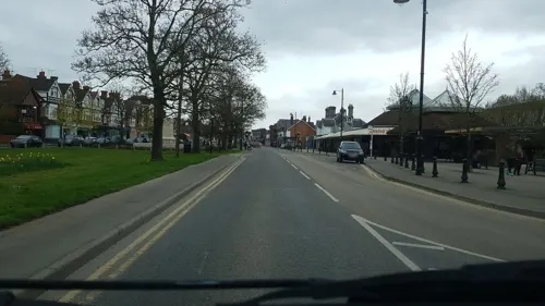
A distinctive row of maple trees which lines the High Street between the cricket field and the Rowland Road junction was planted in 1890, and not by Canadian servicemen in World War I as is widely believed.
The Regal Cinema opened on 30 October 1936. It survived for over sixty years, finally closing on 14 March 2002. The site is now occupied by a block of flats.
Winterfold House near Cranleigh was requisitioned by the British Government and used by SOE Special Operations Executive, as a training school designated STS 4 and later STS 7 as the location of the Student Assessment Board. Its primary use during the war was to whittle out those not suited to undercover work and begin initial training for those that progressed. Amongst the many recruits that attended Winterfold included Muriel Byck, Andrée Borrel, Denise Bloch, Noor Inyat Khan (Nora Baker) – a descendant of Indian Muslim royalty and Violette Szabo GC. A film Carve Her Name with Pride was made in 1958 about Szabo's wartime life in the SOE. In November 2011, a Memorial to the SOE was unveiled at Winterfold House, Surrey, initiated by British military historian, writer and author Paul McCue and others. The unveiling was attended by Tania Szabó, the daughter of Violette Szabo, together with representatives from the US, Dutch and French embassies and the Canadian High Commission.
During the later part of World War II, on 27 August 1944, the infants school was hit by a V-1 flying bomb and demolished, as was the stained glass east window of the nearby St. Nicolas Church. This occurred early on a Sunday morning, and the school was empty. The only casualty was the Rector, who was in his garden not far away and was injured. Another flying bomb hit the gasholder on the Common, destroying both the structure and a nearby cottage, whose occupant was killed.
Cranleigh railway station was closed under the Beeching axe in 1965 after almost exactly a hundred years of operation.
From the History section of Cranleigh on Wikipedia, under CC BY-SA 4.0.
More about Cranleigh
Geography
Cranleigh village is 7.7 miles (12.4 km) southeast of the county town of Surrey, Guildford, and 6.2 miles (10.0 km) ESE of Godalming, which is the administrative centre of the borough of Waverley. In the centre of the civil parish are the greatest number of buildings, fanning out in many side roads and on the high street. Cranleigh Waters also known as the Cranleigh Water, drains the village, before flowing to Shalford where it joins the River Wey, specifically in the small, formerly marsh-like locality of Peasmarsh, which still has water meadows lining the bank itself. Winterfold Forest, a remaining higher part of the forest that occupies the northeast is on the Greensand Ridge, which can be explored using in places roads or by the long-distance path, the Greensand Way.
Rowly is a neighbourhood 0.8 miles (1.3 km) NNW of the edge of the contiguous suburban part of Cranleigh that architecturally contains three Grade II listed buildings.
Three surrounding farms have listed farmhouses, and one of these has a listed granary. Rowly is separated from Cranleigh by Manfield Park and Hollyhocks House.
Arts and culture
The Cranleigh Arts Centre runs a full programme of feature film screenings, live music, theatre productions, adult and children's activities, exhibitions and workshops. Regular community arts projects and work with local schools are undertaken to reach and develop new audiences. The centre is a registered charity and is run by a team of volunteers.
A gym and leisure centre (which incorporates an indoor swimming pool) is centrally just off the High Street.
Snoxhall Fields incorporates a few fields very near to the centre of Cranleigh, accessed by car via Knowle Lane. Across the road lies the Bruce McKenzie Memorial Field where Cranleigh Parkrun is organised on a weekly basis. Running through Snoxhall Fields is the path of the disused railway line which is now commonly used for cycling and walking.
The football club, Cranleigh F.C. currently play in the Surrey Elite West Division and previously at times in the Combined Counties League.
Cranleigh Hockey Club is a field hockey club that play at Cranleigh School, and compete in the South East Hockey League.
Every year the Cranleigh & South Eastern Agricultural Society host the Cranleigh Show, a traditional agricultural show.
In 2023 a 60-acre country park was opened at Knowle Park to the south of the High Street. It included a lake, business kiosks, walks and children’s playground.
Education
Cranleigh School, an independent boarding school, is in the village. It opened in 1865 and was originally known as "The Surrey County School".
State schools include Glebelands School (a secondary school), Cranleigh C of E Primary School and Park Mead Primary School. There is also St Cuthbert Mayne Catholic Primary School. Cranleigh C of E Primary School opened in September 2008 as an amalgamation of Cranleigh Infants School and St. Nicolas Junior School.
In 1847 the National School opened in the present Arts Centre, replacing earlier dame schools. During the twentieth century, separate infant and secondary schools were formed and moved to their own premises (leaving the C of E Junior School which moved to new buildings in 1964).
From the Wikipedia article Cranleigh, under CC BY-SA 4.0.
Notable people from Cranleigh
 Rupert VansittartEnglish actorPhoto: Gage Skidmore, CC BY-SA 3.0
 Mark Parsonssoccer managerPhoto: Hameltion, CC BY-SA 4.0
 Richard Onslow, 1st Baron OnslowEnglish Speaker of the House of Commons (1654-1717)Photo: attributed to Thomas Athow (active..., Public domain
- G.H. HardyBritish mathematician (1877–1947)
- Robert L. J. Elleryastronomer (1827-1908)
- Alex EvansEnglish actress and model
- James StreetEnglish cricketer (1839-1906)
- Donald WatsonScottish ornithologist and artist (1918–2005)
- Nicholas BirkmyreBritish rower
- Robin LeesEnglish cricketer
Born in Cranleigh, according to Wikidata (CC0). Each name links to its Wikipedia article.
Where to stay2
Churches and places of worship13
Shopping7
Gas and EV charging4
Schools, colleges and libraries14
Cranleigh Church of England Primary School (Upper School)
School · Anglican
Parsonage Road, Cranleigh
Healthcare3
Map of Cranleigh
105 places. The map loads OpenStreetMap tiles when you open it.
Getting there and nearby towns
London Gatwick Airport (LGW) is the nearest airport with scheduled flights listed in OpenStreetMap, 13 miles away.
- Godalming 6 mi northwest, about 10 min by car
- Dorking 9 mi northeast, about 14 min by car
- Haslemere 10 mi west, about 17 min by car
- Great Bookham 11 mi northeast, about 17 min by car
- Woking 13 mi north, about 20 min by car
- Crawley 13 mi east, about 21 min by car
- Reigate 14 mi northeast, about 22 min by car
- Horley 14 mi east, about 23 min by car
- Epsom 16 mi northeast, about 26 min by car
- Weybridge 16 mi north, about 26 min by car
Drive times are estimates from straight-line distance, not routes.
Towns near Cranleigh


Keep exploring
Local news
Headlines from INDB.
Reviews, tips and questions
Loading what members have shared...
Sources and licences
- GeoNames (CC BY 4.0): population, coordinates, regions and time zone
- Mapillary (see each image): photos
- OpenStreetMap contributors (ODbL 1.0): places, airports, map data
- Wikidata (CC0 1.0): elevation, founding date, time zone, website, landmarks and historic places
- Wikimedia Commons (see each image): photos
- Wikipedia (CC BY-SA 4.0): overview and history text
Photo credits
- Cucknell's Wood (1), Dudley Miles, CC BY-SA 4.0
- Sayer's Croft (2), Dudley Miles, CC BY-SA 4.0
- St Peter's Church, School Lane, Hascombe (April 2015) (12), Hassocks5489, CC0
- Holy Trinity Rudgwick - from the north west, Martinking73, CC BY-SA 3.0
- Christ Church, Cranleigh Road, Shamley Green (May 2014) (2), Hassocks5489, CC0
- Cranleigh School from the south east, Cranleigh, Surrey - April 2026 - 06, Mertbiol, CC0
- Parish Church of St Peter and St Paul, Ewhurst, Surrey - April 2026, eebAMDG, CC BY-SA 4.0
- 1044371 StNicholas Cranleigh, Switchwitch2007, CC BY-SA 3.0
- Cranleigh School from the south east, Cranleigh, Surrey - April 2026 - 03, Mertbiol, CC0
- Cranleigh Arts Centre, High Street, Cranleigh, Surrey - June 2025 - 02, Mertbiol, CC0
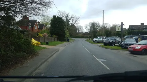
- Street-level photo, richardc, CC BY-SA 4.0
- Street-level photo, richardc, CC BY-SA 4.0
- Street-level photo, richardc, CC BY-SA 4.0
- Street-level photo, richardc, CC BY-SA 4.0
- Street-level photo, richardc, CC BY-SA 4.0
- Street-level photo, richardc, CC BY-SA 4.0
- Street-level photo, richardc, CC BY-SA 4.0
- Street-level photo, richardc, CC BY-SA 4.0
- Street-level photo, richardc, CC BY-SA 4.0
- Street-level photo, richardc, CC BY-SA 4.0
- Street-level photo, richardc, CC BY-SA 4.0
- Street-level photo, richardc, CC BY-SA 4.0
- Street-level photo, richardc, CC BY-SA 4.0
- Street-level photo, richardc, CC BY-SA 4.0
- Street-level photo, richardc, CC BY-SA 4.0
- Street-level photo, richardc, CC BY-SA 4.0
- Street-level photo, richardc, CC BY-SA 4.0
- Street-level photo, richardc, CC BY-SA 4.0
- Street-level photo, richardc, CC BY-SA 4.0
- Street-level photo, richardc, CC BY-SA 4.0
- Street-level photo, richardc, CC BY-SA 4.0
- Street-level photo, richardc, CC BY-SA 4.0
- Street-level photo, richardc, CC BY-SA 4.0
- Street-level photo, richardc, CC BY-SA 4.0
- Street-level photo, richardc, CC BY-SA 4.0
- Street-level photo, richardc, CC BY-SA 4.0
- Street-level photo, richardc, CC BY-SA 4.0


Page built November 10, 2026. Spotted a mistake? Tell us or suggest a place.