


Curdworth, United Kingdom
Curdworth is a town of 1,115 people in England, United Kingdom.
Why visit Curdworth
Townapedia lists 3 museums and landmarks, 15 parks and trails, 20 places to eat, 3 places to stay and 1 attraction in and around town.
Highlights include Marston Box Rail Bridge, Grimstock Hill Romano-British settlement, Peddimore Hall and Castle Bromwich Hall Gardens.
Weather in Curdworth
Forecast from MET Norway (CC BY 4.0). Full forecast
About Curdworth
Curdworth is a village and civil parish in the North Warwickshire district of the county of Warwickshire in England. The population taken at the 2021 census was 1,146.
From the Wikipedia article Curdworth (this version), under CC BY-SA 4.0.
Photos of Curdworth


Things to do1
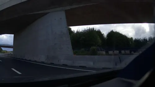
Museums and landmarks3

Grimstock Hill Romano-British settlement
Monument and historic site · 1.8 mi
Romano-British settlement site in Warwickshire
Parks, trails and playgrounds15

Castle Bromwich Hall Gardens
Park · 3.0 mi
Restored Jacobean gardens near Birmingham, England

Kingsbury Water Park
Park · 2.4 mi
Country park in North Warwickshire


New Hall Valley Country Park
Park · 3.2 mi
Country park in Birmingham, England

Plantsbrook Local Nature Reserve
Park · 2.5 mi
Park in Birmingham, United Kingdom


Lea Marston Golf Course
Golf course · 1.4 mi
9 hole Par 31 + 9 hole Pitch & Putt
Haunch Lane, Lea Marston
Yorks Wood
Park · 3.1 mi
Woodland and nature reserve in Kingshurst, West Midlands, England, UK
3 more on the map.
Restaurants and cafes20

Silver Tree Bakery
Bakery · 1.2 mi
Water Orton Lane, Sutton Coldfield
Tu-Sa 08:30-14:30; Su 09:00-14:00



8 more on the map.
History
Curdworth and Minworth originated in the 6th or 7th centuries, established by Anglian settlers, and are historically associated with the Arden family (William Shakespeare's maternal relations). Crida's Worth probably corrupts the village. Worth means property of, and the Mercian Crida owned land here. Curdworth is mentioned in the Domesday Book (1086). The local Church of St Nicholas and St Peter ad Vincula is dedicated to St Nicholas and St Peter ad Vincula. Adjacent to the churchyard is the King George V Playing Fields, which was originally a raised clay and pebble base for a medieval Saxon manor complex, which was attached to the church.
This site and the moated Curdworth Hall, also a Saxon structure located at the top of Farthing Lane, were important in the area. Ralph Ardern inherited the manor of Curdworth between 1382 (the death of his father, Henry de Ardern) and 1408 (the death of his mother). The remains of a moat associated with the Ardens are now buried under the M42. This site was considered their home before they moved to Park Hall in Castle Bromwich. At the edge of the playing fields is 'The Bomb Hole', as locals know, a marl pit, where a fertiliser consisting of clay and calcium carbonate was extracted.
Read more of the history
In August 1642, the first skirmish between the Roundheads and Cavaliers of the Civil War (1642–51) took place in the fields to the south of Curdworth, the Battle of Curdworth Bridge. One of the musket balls fired left a mark in a nave window of the church. Some of the casualties are supposed to be buried in the graveyard. In 1995 and 2000, Curdworth earned the Best Kept Village title in Warwickshire, a large village class. The village also earned the title in 2007 of Best Kept Village in North Warwickshire, in the medium-sized village class.
From the History section of Curdworth on Wikipedia, under CC BY-SA 4.0.
Where to stay3
Churches and places of worship15
Shopping2
Schools, colleges and libraries4
Map of Curdworth
63 places. The map loads OpenStreetMap tiles when you open it.
Getting there and nearby towns
Birmingham Airport (BHX) is the nearest airport with scheduled flights listed in OpenStreetMap, 6 miles away.
- Castle Vale 3 mi west, about 4 min by car
- Sutton Coldfield 4 mi northwest, about 7 min by car
- Chelmsley Wood 4 mi south, about 6 min by car
- Tamworth 7 mi north, about 11 min by car
- Streetly 7 mi northwest, about 11 min by car
- Birmingham 8 mi southwest, about 12 min by car
- Solihull 8 mi south, about 14 min by car
- Atherstone 8 mi east, about 14 min by car
- Hampton in Arden 8 mi south, about 12 min by car
- Aldridge 9 mi northwest, about 15 min by car
Drive times are estimates from straight-line distance, not routes.
Towns near Curdworth


Keep exploring
Local news
Headlines from INDB.
Reviews, tips and questions
Loading what members have shared...
Sources and licences
- GeoNames (CC BY 4.0): population, coordinates, regions and time zone
- Mapillary (see each image): photos
- OpenStreetMap contributors (ODbL 1.0): places, airports, map data
- Wikidata (CC0 1.0): elevation, founding date, time zone, website, landmarks and historic places
- Wikimedia Commons (see each image): photos
- Wikipedia (CC BY-SA 4.0): overview and history text
Photo credits
- St Nicholas and St Peter Ad Vincula's Church, Curdworth, Andrewrabbott, CC BY-SA 4.0
- Stained glass window by Geoffrey Webb in Curdworth Church, Andrewrabbott, CC BY-SA 4.0
- Wall painting in Curdworth Church, Andrewrabbott, CC BY-SA 4.0
- Millennium stained glass window by Lawrence and Co, 2001, in Curdworth Church, Andrewrabbott, CC BY-SA 4.0
- Chancel screen and organ in Curdworth Church, Andrewrabbott, CC BY-SA 4.0
- Curdworth font - north front, Andrewrabbott, CC BY-SA 4.0
- Curdworth font - west front, Andrewrabbott, CC BY-SA 4.0
- Curdworth font - east front, Andrewrabbott, CC BY-SA 4.0
- Nave of Curdworth church, Andrewrabbott, CC BY-SA 4.0
- Curdworth font - south front, Andrewrabbott, CC BY-SA 4.0
- Curdworth, Sutton Coldfield B76, UK - panoramio (3), logopop, CC BY-SA 3.0
- Castle Bromwich Hall Gardens Parterre - North Garden, Graham High, CC BY 3.0
- Kingsbury Water park water, Scarfneck, Public domain
- Fordbridge - Meriden Park Lake, Carl Baker, CC BY-SA 2.0
- New Hall Valley Country Park, Erebus555 at English Wikipedia, CC BY-SA 3.0
- Plantsbrook Nature Reserve (14 March 2007), Roy Shakespeare, CC BY-SA 2.0
- St John the Baptist Church, Middleton, Jimfbleak, CC BY-SA 3.0
- Coleshill Church, Mark Walton, CC BY-SA 2.0
- Water Orton SS Peter and Paul, MaryCleary, CC BY-SA 3.0
- Memorial to Lancelot Mitchell, Andrewrabbott, CC BY-SA 4.0
- Street-level photo, southglos, CC BY-SA 4.0
- Street-level photo, southglos, CC BY-SA 4.0
- Street-level photo, southglos, CC BY-SA 4.0
- Street-level photo, southglos, CC BY-SA 4.0
- Street-level photo, southglos, CC BY-SA 4.0
- Street-level photo, southglos, CC BY-SA 4.0


Page built November 10, 2026. Spotted a mistake? Tell us or suggest a place.