


Castle Vale, United Kingdom
Castle Vale is a town of 10,000 people in England, United Kingdom.
Why visit Castle Vale
Townapedia lists 14 museums and landmarks, 20 parks and trails, 66 places to eat, 7 places to stay and 3 attractions in and around town.
Highlights include Bromford Viaduct, Aston Church Road Overbridge, Castle Bromwich Hall and Blakesley Hall.
Weather in Castle Vale
Forecast from MET Norway (CC BY 4.0). Full forecast
About Castle Vale
Castle Vale is a housing estate located between Erdington, Minworth and Castle Bromwich. Currently Castle Vale makes up the Castle Vale Ward of Birmingham City Council which is part of Erdington constituency (having previously been part of Hodge Hill constituency until recent times), 6 miles (9 km) northeast of Birmingham city centre in England. The area has an approximate population of 10,000 people and has a distinctly modern residential character stemming from its history as a postwar overspill estate.
From the Wikipedia article Castle Vale (this version), under CC BY-SA 4.0.
Photos of Castle Vale


Things to do3
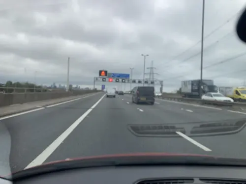
Bromford Viaduct
Bridge · 1.6 mi
Elevated section of motorway in Birmingham, England

Aston Church Road Overbridge
Bridge · 2.9 mi
Bridge in Birmingham, England

Highbury Theatre Centre
Cinema and theater · 2.1 mi
Theatre in Sutton Coldfield, Birmingham, England
Museums and landmarks14

Castle Bromwich Hall
Monument and historic site · 0.9 mi
Chester Road, Birmingham

Blakesley Hall
Museum · 3.2 mi
Tudor hall in Yardley, Birmingham, England; now a museum

2 more on the map.
Parks, trails and playgrounds20


Kingfisher Country Park
Park · 1.7 mi
Park in Birmingham, United Kingdom

New Hall Valley Country Park
Park · 2.2 mi
Country park in Birmingham, England

Plantsbrook Local Nature Reserve
Park · 0.6 mi
Park in Birmingham, United Kingdom

Short Heath Park
Park · 2.4 mi
Public park in Birmingham, United Kingdom


Yorks Wood
Park · 2.4 mi
Woodland and nature reserve in Kingshurst, West Midlands, England, UK
8 more on the map.
Restaurants and cafes66


Manor Farm - Dining & Carvery
Bar and pub · 0.6 mi
Dunlop Way, Birmingham
Su-We 09:00-22:00; Th-Sa 09:00-23:00
Only Foods and Sauces
Cafe · Coffee Shop, Local · 0.4 mi
900 Kingsbury Road, Birmingham
Mo-Sa 06:00-14:15; Su 07:00-13:15


54 more on the map.
History
The site has historically been a wooded area with a post-Domesday manor, although its construction date is not known. In 1160, the Manor of Berwood was given to the Abbey of St. Mary de Pratis at Leicester by the Arden family. A moated house, St Mary's Chapel, a hermitage, a bake house and farm buildings were built for them, although St Mary's Chapel was demolished in the 15th century after it fell into disrepair. Under the ownership of Leicester Abbey, the Arden family became tenants, despite having owned the land previously. In 1356–7, Sir John de Arderne briefly gained ownership of the property but the abbey regained it in 1360.
In 1789, the Birmingham and Fazeley Canal was completed to the north of the area which gradually encouraged an industrial presence along it. In 1881, W. W. Bagot sold 344 acres (1 km2) of land in Berwood to the Birmingham, Tame and Rea District Drainage Board, and a further 358 acres (1 km2) were sold to the Board on 29 September 1888. Home Farm was in the north west corner, near Tyburn House, and the land consisted of a large orchard, however its main function was to spread sewage brought from the City of Birmingham over the rest of the land. In 1898, filter beds were constructed as the volume of sewage was becoming too much with the rest of the land becoming farmland or swamp, surrounded by forest.
From the History section of Castle Vale on Wikipedia, under CC BY-SA 4.0.
More about Castle Vale
Education
To serve the needs of the community in the 1960s, five schools were constructed on the estate; four primary schools and one secondary school. These schools continue to operate, despite past instances of poor student numbers.
Chivenor Junior and Infant School is a co-educational primary school constructed during the 1960s. As Birmingham City Council was not willing to demolish the primary school during the regeneration of the estate in the 1990s, the Chivenor House tower block constructed above the primary school was saved from demolition and refurbished. Upon the last OFSTED inspection of the school in February 2007, there were approximately 330 pupils and the headteacher was S. Holloway. The pupil population of the school was found to be mostly British White with one fifth of pupils being of an ethnic minority. Those requiring free school meals was "exceptionally high".
From the Wikipedia article Castle Vale, under CC BY-SA 4.0.
Where to stay7
Ramada Birmingham Sutton Coldfield
Motel and hotel · 1.3 mi
Penns Lane, Sutton Coldfield
Churches and places of worship40
Greek Orthodox Church of the Holy Trinity and St Luke
Church · 3.0 mi
Church of St Nicholas and St Peter ad Vincula, Curdworth
Church · 2.6 mi
England Birmingham Mission
Church · Mormon · 1.3 mi
187 Penns Lane, Sutton Coldfield
Shopping17
Gas and EV charging5
Schools, colleges and libraries27
St Peter and St Paul RC Junior and Infant School
School · Roman Catholic · 1.1 mi
Kingsbury Road, Birmingham
St Wilfrid's Catholic Junior and Infant School
School · Roman Catholic · 1.0 mi
Shawsdale Road, Birmingham
Healthcare9
Map of Castle Vale
208 places. The map loads OpenStreetMap tiles when you open it.
Getting there and nearby towns
Birmingham Airport (BHX) is the nearest airport with scheduled flights listed in OpenStreetMap, 5 miles away.
- Sutton Coldfield 3 mi north, about 5 min by car
- Chelmsley Wood 4 mi southeast, about 6 min by car
- Birmingham 5 mi southwest, about 8 min by car
- Streetly 6 mi northwest, about 9 min by car
- Solihull 7 mi south, about 12 min by car
- West Bromwich 8 mi west, about 13 min by car
- Aldridge 8 mi northwest, about 13 min by car
- Walsall 9 mi northwest, about 15 min by car
- Oldbury 9 mi west, about 15 min by car
- Wednesbury 10 mi west, about 16 min by car
Drive times are estimates from straight-line distance, not routes.
Towns near Castle Vale


Keep exploring
Local news
Headlines from INDB.
Reviews, tips and questions
Loading what members have shared...
Sources and licences
- GeoNames (CC BY 4.0): population, coordinates, regions and time zone
- Mapillary (see each image): photos
- OpenStreetMap contributors (ODbL 1.0): places, airports, map data
- Wikidata (CC0 1.0): elevation, founding date, time zone, website, landmarks and historic places
- Wikimedia Commons (see each image): photos
- Wikipedia (CC BY-SA 4.0): overview and history text
Photo credits
- Blakesley Hall (1), Tony Hisgett from Birmingham, England, CC BY 2.0
- Castle Bromwich Hall Gardens Parterre - North Garden, Graham High, CC BY 3.0
- Bleak Hill Park - 2011-01-29, Voice of Clam, Public domain
- Fordbridge - Meriden Park Lake, Carl Baker, CC BY-SA 2.0
- New Hall Valley Country Park, Erebus555 at English Wikipedia, CC BY-SA 3.0
- Short Heath Park - 2011-01-29, Voice of Clam, Public domain
- Ward End Park House (8771180867), Tony Hisgett from Birmingham, UK, CC BY 2.0
- All Saints Church in Gravelly Hill, Birmingham, Geoff Pick, CC BY-SA 2.0
- Christ Church, Burney Lane, Birmingham - South-facing door, Oosoom at English Wikipedia, CC BY-SA 3.0
- Erdington Abbey - 2011-01-29, Voice of Clam, Public domain
- Holy Trinity Church, Sutton Coldfield2, Erebus555 at English Wikipedia, CC BY-SA 3.0
- Plantsbrook Nature Reserve (14 March 2007), Roy Shakespeare, CC BY-SA 2.0
- Castle Bromwich Hall1, Unknown author, CC BY-SA 3.0
- Penns Hall 03, Andy Mabbett, CC BY-SA 3.0
- 7.5.16 Castle Bromwich 40s Day 021 (26806306012), donald judge, CC BY 2.0
- Birmingham, UK - panoramio (227), logopop, CC BY-SA 3.0
- Birmingham, UK - panoramio (229), logopop, CC BY-SA 3.0
- Dunelm rug guide - 2023-07-20 - Andy Mabbett, Andy Mabbett, CC BY-SA 4.0
- Duck and Reed sculptures at Brookvale Park (49279018331), Elliott Brown from Birmingham, United Kingdom, CC BY-SA 2.0
- Street-level photo, southglos, CC BY-SA 4.0
- Street-level photo, southglos, CC BY-SA 4.0
- Street-level photo, southglos, CC BY-SA 4.0
- Street-level photo, southglos, CC BY-SA 4.0
- Street-level photo, southglos, CC BY-SA 4.0
- Street-level photo, adam2, CC BY-SA 4.0
- Street-level photo, southglos, CC BY-SA 4.0
- Street-level photo, southglos, CC BY-SA 4.0
- Street-level photo, rac_uk2, CC BY-SA 4.0


Page built November 10, 2026. Spotted a mistake? Tell us or suggest a place.