


Aldridge, United Kingdom
Aldridge is a town of 26,896 people in England, United Kingdom.
Why visit Aldridge
Townapedia lists 11 museums and landmarks, 27 parks and trails, 70 places to eat, 3 places to stay and 5 attractions in and around town.
Highlights include Oak Tree Children's Farm, School Farm Shop, Cenotaph and Little Aston Hall.
Weather in Aldridge
Forecast from MET Norway (CC BY 4.0). Full forecast
About Aldridge
Aldridge is a town in the Metropolitan Borough of Walsall in the West Midlands, England. It was historically a village, which was part of Staffordshire until 1974. The town is three miles (five kilometres) from Brownhills, five miles (eight kilometres) from Walsall, six miles (ten kilometres) from Sutton Coldfield and seven miles (eleven kilometres) from Lichfield.
From the Wikipedia article Aldridge (this version), under CC BY-SA 4.0.
Photos of Aldridge


Things to do5




Museums and landmarks11


The New Art Gallery Walsall
Museum · 3.2 mi
Modern and contemporary art gallery in Walsall, England, United Kingdom

Walsall Leather Museum
Museum · 3.0 mi
Municipal museum in Walsall, England, United Kingdom


Walsall Castle
Monument and historic site · 3.8 mi
Manor house in Walsall, West Midlands, England
Walsall Wood Colliery Pit Head Monument
Monument and historic site · 1.9 mi
At 10+ tonnes, and one steel Racing Pigeon (Break Away, Walsall Wood world record breaker), the replica Headgear, life-sized and...

Parks, trails and playgrounds27

Walsall Arboretum
Park · 2.4 mi
Victorian public park located close to Walsall town centre in the West Midlands of England




15 more on the map.
Restaurants and cafes70
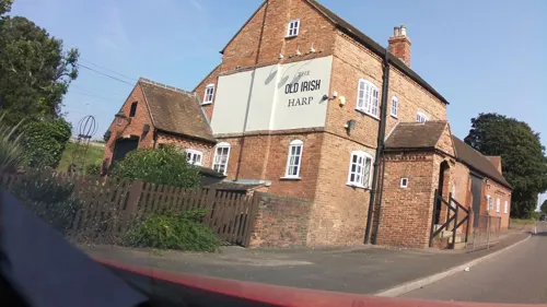
The Hardwick Arms
Bar and pub · 1.8 mi
Mo-Th 11:00-23:00; Fr 11:00-24:00; Sa 10:00-24:00; Su 10:00-23:00

Hong Kong
Restaurant · Chinese
17 Anchor Road, Walsall
Tu closed, Fr-Sa 17:00-23:30, Mo,We-Th,Su 17:00-23:00



58 more on the map.
History
The name "Aldridge" is derived from the Anglo-Saxon alr or alre + wīc meaning 'alder (tree) + village'. Another suggestion is that the name "Aldridge" means "outlying farm among alder-trees", from the Old English alor and wīc. It was recorded as Alrewic in the Domesday Book of 1086 when it was valued at 15 shillings and had a population of seven households; the Lord was Robert (d'Oilly) and the tenant-in-chief was William son of Ansculf. The name was recorded as Alrewich and Allerwych in the 12th century.
Aldridge began as a small agricultural settlement, with farming being the most common occupation up until the 19th century.
In the 1800s, Aldridge became an industrial town with coal mines and lime kilns. The coal and clay in the area prompted many to set up collieries and brickworks. Aldridge clay is especially useful in the manufacture of blue bricks. The 1881 census shows that the mines and brickworks were major employers. Because the coal and clay beneath the eastern side of Aldridge (towards Stonnall) is located much deeper under the surface, extraction of this coal and clay would not have been economically viable. As a result, farms continued to dominate the eastern part, though a sand quarry was set up and remains on Birch Lane.
Read more of the history
Nineteenth and early twentieth century Ordnance Survey maps show an area named Pool Green to the south of Aldridge, across the railway line from Aldridge railway station. A large pool was drained and filled in when the railway line was constructed. Pool Green may have been the site of a Saxon settlement, though no finds have been reported and the area has since been redeveloped.
During the 20th century, modern shops were built in the centre of Aldridge, as well as council buildings. During the Second World War, the small Aldridge Airport was used for military planes. It was subsequently used for passenger services for a time.
Aldridge became an urban district in Staffordshire in 1934. As well as the parish of Aldridge the urban district contained the parishes of Great Barr, Pelsall and Rushall. Other villages within the district included Walsall Wood, Clayhanger and Streetly. These areas began to grow substantially with private house buildings from the 1930s, mostly bought by families relocating from the central areas of Walsall.
The urban district of Aldridge merged with Brownhills on 1 April 1966 to form Aldridge-Brownhills, parts also went to the County Borough of West Bromwich, Lichfield Rural District, Cannock Urban District, the County Borough of Walsall and the County Borough of Birmingham. On 1 April 1966 the parish was also abolished to form "Aldridge Brownhills", parts also went to Birmingham, Shenstone, Walsall and West Bromwich. In 1961 the parish had a population of 51,046. It then became part of an expanded Metropolitan Borough of Walsall in 1974.
From the History section of Aldridge on Wikipedia, under CC BY-SA 4.0.
More about Aldridge
Education
Primary schools are Cooper and Jordan Church of England Primary School, Leighswood, St Mary of the Angels (Roman Catholic), and Whetstone Field. Redhouse Primary School closed in 2006. Secondary schools are Aldridge School and St Francis of Assisi Catholic College.
From the Wikipedia article Aldridge, under CC BY-SA 4.0.
Notable people from Aldridge
- Charles HollandBritish road bicycle racer (1908–1989)
- Isabel DeanEnglish actress (1918–1997)
- Richard Holmesmilitary historian and TV presenter (1946-2011)
- Peter GillBritish professional golfer
- Bob GriffithsFootballer (born 1942)
- Lee SinnottBritish footballer and football manager (born 1965)
- Gavin FrostAmerican author and Wiccan (1930-2016)
- Alf WoodFootballer, goalkeeper, football manager (1915-2001)
- Keith RussellFootballer (born 1974)
- Richard SinnottBritish actor
Born in Aldridge, according to Wikidata (CC0). Each name links to its Wikipedia article.
Where to stay3
Churches and places of worship34
St Mary's, Aldridge Parish Church
Church · Anglican
The Green, Walsall
Shopping10
Gas and EV charging7
Schools, colleges and libraries23
St Mary of the Angels Catholic Primary School
School · Roman Catholic · 0.4 mi
Weston Crescent, Walsall
Healthcare10
Little Aston Hospital
Hospital · 1.8 mi
Little Aston Hall Drive, Sutton Coldfield
Walsall Child Development Centre
Clinic and pharmacy · 1.7 mi
Coalheath Lane, Walsall
Map of Aldridge
200 places. The map loads OpenStreetMap tiles when you open it.
Getting there and nearby towns
Birmingham Airport (BHX) is the nearest airport with scheduled flights listed in OpenStreetMap, 12 miles away.
- Brownhills 2 mi north, about 3 min by car
- Streetly 2 mi southeast, about 3 min by car
- Pelsall 3 mi northwest, about 4 min by car
- Walsall 3 mi southwest, about 5 min by car
- Sutton Coldfield 5 mi southeast, about 8 min by car
- Burntwood 5 mi north, about 8 min by car
- Great Wyrley 6 mi northwest, about 9 min by car
- Wednesbury 6 mi southwest, about 9 min by car
- West Bromwich 7 mi southwest, about 11 min by car
- Birmingham 9 mi south, about 14 min by car
Drive times are estimates from straight-line distance, not routes.
Towns near Aldridge


Keep exploring
Local news
Headlines from INDB.
Reviews, tips and questions
Loading what members have shared...
Sources and licences
- GeoNames (CC BY 4.0): population, coordinates, regions and time zone
- Mapillary (see each image): photos
- OpenStreetMap contributors (ODbL 1.0): places, airports, map data
- Wikidata (CC0 1.0): elevation, founding date, time zone, website, landmarks and historic places
- Wikimedia Commons (see each image): photos
- Wikipedia (CC BY-SA 4.0): overview and history text
Photo credits
- Aldridge war memorial - 01, Andy Mabbett, CC BY-SA 3.0
- Aldridge gold post box, Oosoom, CC BY-SA 3.0
- Aldridge war memorial - 07, Andy Mabbett, CC BY-SA 3.0
- Aldridge war memorial - 10, Andy Mabbett, CC BY-SA 3.0
- Aldridge war memorial - 04, Andy Mabbett, CC BY-SA 3.0
- Aldridge war memorial - 08, Andy Mabbett, CC BY-SA 3.0
- Aldridge war memorial - 11, Andy Mabbett, CC BY-SA 3.0
- Aldridge war memorial - 06, Andy Mabbett, CC BY-SA 3.0
- Aldridge war memorial - 05, Andy Mabbett, CC BY-SA 3.0
- Walsall Leather Museum, Brianboru100, CC BY-SA 3.0
- All Saints Bloxwich, Martin Neylon, CC BY-SA 4.0
- Barr Beacon Hill Monument, Mnnngchris at English Wikipedia, Public domain
- The Gardeners' chronicle - a weekly illustrated journal of horticulture and allied subjects (1880) (14597656509), Internet Archive Book Images, No restrictions
- Holbrook ,Walsall Arboretum - panoramio, shakestd, CC BY 3.0
- Midland Red Buses at Aston Manor, Michael Bevan, CC BY-SA 4.0
- Heartlands Bus bus 108 (HE51 BUS), 28 August 2010, Sherpa_536, CC BY 2.0
- Postbox WS9 304D seaside topper - 2025-10-21 - Andy Mabbett - 01, Andy Mabbett, CC BY-SA 4.0
- Postbox WS9 304D seaside topper - 2025-10-21 - Andy Mabbett - 04, Andy Mabbett, CC BY-SA 4.0
- Postbox WS9 304D seaside topper - 2025-10-21 - Andy Mabbett - 02, Andy Mabbett, CC BY-SA 4.0
- Postbox WS9 304D seaside topper - 2025-10-21 - Andy Mabbett - 03, Andy Mabbett, CC BY-SA 4.0
- New Art Gallery Walsall - interior 11 - barrier tape, Andy Mabbett, CC BY-SA 3.0
- Street-level photo, southglos, CC BY-SA 4.0
- Street-level photo, southglos, CC BY-SA 4.0
- Street-level photo, adam2, CC BY-SA 4.0
- Street-level photo, adam2, CC BY-SA 4.0
- Street-level photo, southglos, CC BY-SA 4.0
- Street-level photo, southglos, CC BY-SA 4.0
- Street-level photo, southglos, CC BY-SA 4.0
- Street-level photo, southglos, CC BY-SA 4.0
- Street-level photo, southglos, CC BY-SA 4.0


Page built November 10, 2026. Spotted a mistake? Tell us or suggest a place.