


Streetly, United Kingdom
Streetly is a town of 13,251 people in England, United Kingdom.
Why visit Streetly
Townapedia lists 6 museums and landmarks, 12 parks and trails, 19 places to eat, 3 places to stay and 2 attractions in and around town.
Highlights include Barr Beacon, Little Aston Hall, Sutton Park and Sutton Park National Nature Reserve.
Weather in Streetly
Forecast from MET Norway (CC BY 4.0). Full forecast
About Streetly
Streetly is an area in the county of West Midlands, England which lies around 7 miles (11 km) to the north of Birmingham City Centre. It is uniquely located within the borders of Birmingham, Lichfield and Walsall district authorities, and is part of the West Midlands conurbation. It is adjacent to, New Oscott, Great Barr, Four Oaks, Little Aston and Aldridge.
From the Wikipedia article Streetly (this version), under CC BY-SA 4.0.
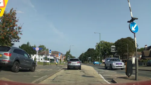
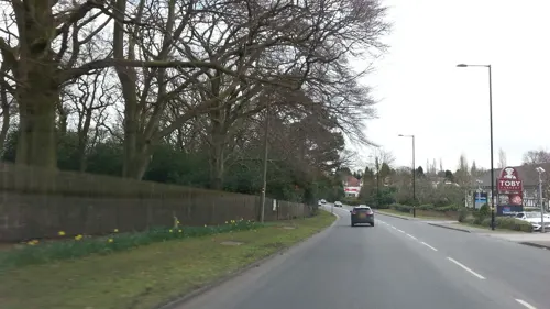
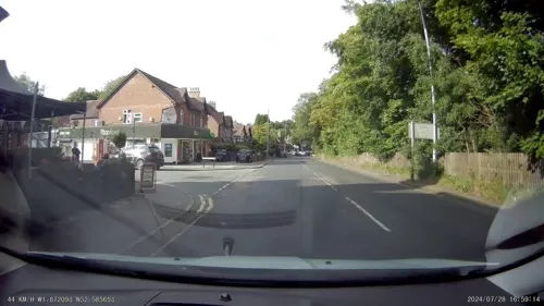
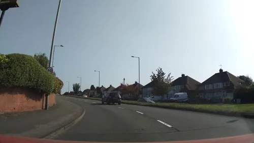
Photos of Streetly


Things to do2


Museums and landmarks6


Parks, trails and playgrounds12




Barr Beacon Local Nature Reserve Black Country Geosite
Hiking and trails · 1.3 mi

Restaurants and cafes19


Brewhouse micropub
Bar and pub · 0.8 mi
49 Boundary Road, Sutton Coldfield
Mo Closed, Tu-Th 17:00 - 22:30, Fr 15:00 - 22:30, Sa 12:00 -...


7 more on the map.
History
Streetly is named after Icknield Street, a Roman road, of which parts can still be found in Sutton Park. Streetly was a rural area of Staffordshire until the 1950s when the character of the area became suburban due to the mass construction of modern housing in response to the urbanisation of Birmingham. Streetly was in Aldridge-Brownhills Urban District until the creation of the metropolitan West Midlands county in 1974.
The history of Streetly in the 20th century is regularly discussed in a local history Facebook page and the Birmingham History Forum. These resources include links to further online information including the personal recollections of previous residents.
From the History section of Streetly on Wikipedia, under CC BY-SA 4.0.
More about Streetly
Education
There is one 11–18 secondary school in Streetly, and four primary schools for children aged up to 11 years:
From September 1972, Streetly and other areas of the then Aldridge-Brownhills Urban District operated a system of 5-9 first, 9-13 middle and 13-18 secondary schools. However, from September 1986 the area reverted to the conventional system of 5-11 primary schools and 11-18 secondary schools following a decision by Walsall Metropolitan Borough Council to bring the former Aldridge-Brownhills Urban District area schools into line with the rest of the borough.
Since September 1992, pupils transferring from primary schools in Streetly have had the option of transferring to secondary schools in neighbouring Sutton Coldfield (since 1974 part of Birmingham) following that area's reduction in the secondary school age from 12 to 11.
From the Wikipedia article Streetly, under CC BY-SA 4.0.
Notable people from Streetly
 Connie TalbotBritish singerPhoto: Waynehough13, CC0
- Diane LeatherBritish middle-distance runner
- Janet BeatBritish composer
- Graham CrabbBritish musician
Born in Streetly, according to Wikidata (CC0). Each name links to its Wikipedia article.
Where to stay3
Churches and places of worship14
Streetly Methodist Church
Church · Methodist · 0.7 mi
Thornhill Road, Sutton Coldfield
All Saints Parish Church, Streetly
Church · Anglican
Foley Road East, Sutton Coldfield
St. Anne's R.C. Church
Church · Roman Catholic · 0.5 mi
Bridle Lane, Sutton Coldfield
Shopping3
Gas and EV charging3
Schools, colleges and libraries6
Healthcare2
Little Aston Hospital
Hospital · 1.2 mi
Little Aston Hall Drive, Sutton Coldfield
Map of Streetly
70 places. The map loads OpenStreetMap tiles when you open it.
Getting there and nearby towns
Birmingham Airport (BHX) is the nearest airport with scheduled flights listed in OpenStreetMap, 11 miles away.
- Sutton Coldfield 3 mi east, about 5 min by car
- Walsall 4 mi west, about 7 min by car
- West Bromwich 6 mi southwest, about 10 min by car
- Wednesbury 6 mi west, about 10 min by car
- Birmingham 7 mi south, about 11 min by car
- Wolverhampton 10 mi west, about 16 min by car
- Dudley 10 mi southwest, about 16 min by car
- Solihull 12 mi south, about 20 min by car
- Wombourne 13 mi west, about 21 min by car
- Burton upon Trent 18 mi northeast, about 30 min by car
Drive times are estimates from straight-line distance, not routes.
Towns near Streetly


Keep exploring
Local news
Headlines from INDB.
Reviews, tips and questions
Loading what members have shared...
Sources and licences
- GeoNames (CC BY 4.0): population, coordinates, regions and time zone
- Mapillary (see each image): photos
- OpenStreetMap contributors (ODbL 1.0): places, airports, map data
- Wikidata (CC0 1.0): elevation, founding date, time zone, website, landmarks and historic places
- Wikimedia Commons (see each image): photos
- Wikipedia (CC BY-SA 4.0): overview and history text
Photo credits
- 56080 & 31209 at Streetly, Tutenkhamun Sleeping, CC BY 2.0
- 56080 at Streetly - 5265247309, Tutenkhamun Sleeping, CC BY 2.0
- 56080 at Streetly - 5265860280, Tutenkhamun Sleeping, CC BY 2.0
- 56080 at Streetly - 5265247121, Tutenkhamun Sleeping, CC BY 2.0
- 31209 at Streetly, Tutenkhamun Sleeping, CC BY 2.0
- 56080 trapped in the snow at Streetly, Tutenkhamun Sleeping, CC BY 2.0
- 47182 passing the old Midland Railway station at Streetly, Tutenkhamun Sleeping, CC BY 2.0
- 31210 at Streetly, Tutenkhamun Sleeping, CC BY 2.0
- Holy Trinity Church, Sutton Coldfield2, Erebus555 at English Wikipedia, CC BY-SA 3.0
- St. Matthew's, Perry Beeches - 2025-05-13 - Andy Mabbett - 02, Andy Mabbett, CC BY-SA 4.0
- Sutton Park Walk 807 (N595), Ted and Jen, CC BY 2.0
- Barr Beacon Hill Monument, Mnnngchris at English Wikipedia, Public domain
- The Gardeners' chronicle - a weekly illustrated journal of horticulture and allied subjects (1880) (14597656509), Internet Archive Book Images, No restrictions
- St Peter's Church, Little Aston, Andy Mabbett, CC BY-SA 3.0
- Longmoor Pool - Summer 2007, Lee Jordan, CC BY-SA 2.0
- South Staffordshire Water - Foley Road West site - 01, Andy Mabbett, CC BY-SA 3.0
- South Staffordshire Water - Foley Road West site - 03, Andy Mabbett, CC BY-SA 3.0
- South Staffordshire Water - Foley Road West site - 02, Andy Mabbett, CC BY-SA 3.0
- The Old Irish Harp - panoramio, shakestd, CC BY 3.0
- Street-level photo, aidan573, CC BY-SA 4.0
- Street-level photo, adam2, CC BY-SA 4.0
- Street-level photo, adam2, CC BY-SA 4.0
- Street-level photo, southglos, CC BY-SA 4.0
- Street-level photo, adam2, CC BY-SA 4.0
- Street-level photo, adam2, CC BY-SA 4.0
- Street-level photo, southglos, CC BY-SA 4.0
- Street-level photo, aidan573, CC BY-SA 4.0
- Street-level photo, aidan573, CC BY-SA 4.0
- Street-level photo, southglos, CC BY-SA 4.0
- Street-level photo, southglos, CC BY-SA 4.0


Page built November 10, 2026. Spotted a mistake? Tell us or suggest a place.