


Glen Parva, United Kingdom
Glen Parva is a town of 17,189 people in England, United Kingdom.
Why visit Glen Parva
Townapedia lists 5 museums and landmarks, 17 parks and trails, 95 places to eat, 3 places to stay and 1 attraction in and around town.
Highlights include Braunstone Gate Bridge, Arch of Remembrance, Gas Museum and Aylestone Meadows.
Weather in Glen Parva
Forecast from MET Norway (CC BY 4.0). Full forecast
About Glen Parva
Glen Parva is a civil parish in the Blaby district of Leicestershire, England, with a population of over 17,000. The population of the civil parish, including Eyres Monsell was 17,189 in the 2011 census. To the north it runs into Aylestone and to the east South Wigston. To the south and west, it is not immediately adjacent to development.
From the Wikipedia article Glen Parva (this version), under CC BY-SA 4.0.
Things to do1

Museums and landmarks5

Arch of Remembrance
Monument and historic site · 3.3 mi
War memorial in Leicester, Leicestershire, England, UK


Raw Dykes
Monument and historic site · 2.6 mi
Archaeological site in City of Leicester, Leicestershire, England, UK

Parks, trails and playgrounds17
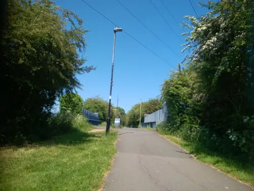


Victoria Park
Park · 3.3 mi
Public park in Leicester, Leicestershire, England, UK




5 more on the map.
Restaurants and cafes95
Tim Hortons
Cafe · Coffee Shop · 1.1 mi
Grove Farm Triangle, Leicester
Mo-Su 06:00-24:00

Asda Café
Cafe · Coffee Shop · 1.0 mi
Narborough Road South, Leicester
Mo-Sa 08:30-18:00; Su 10:00-16:00

The Bakers Arms
Bar and pub · 0.7 mi
The Green, Blaby
Su-Th 12:00-23:00, Fr,Sa 12:00-24:00

Black Horse
Bar and pub · 0.7 mi
Sycamore Street, Blaby
Mo-Th 12:00-23:00, Fr 12:00-01:00, Sa 11:30-01:00, Su 11:30-23:00
Jenno's Coffee House
Cafe · 0.7 mi
21 Leicester Road, Blaby
Mo-Fr 07:30-18:30; Sa 08:00-18:00; Su 09:00-17:00

83 more on the map.
History
The original settlement was undoubtedly near The Ford by the River Sence, which is known locally as Glen Ford. There is strong evidence of the existence of a medieval village in this area. Glen Parva ("little Glen") is called so to distinguish it from Great Glen, rarely Glen Magna. Under the Local Government Act 1894, Glen Parva became a civil parish within the rural District of Blaby. Previously it was included in the Aylestone Ecclesiastical Parish. Glen Parva Barracks, which became an important military installation in the 1960s, were opened in 1881.
Eyres Monsell became included in the parish of Glen Parva when the area of land was purchased by Bolton-Eyres Monsell, an area that is named after him. The land was originally owned by Glen Parva Parish Council, so they are responsible along with Leicester City Council for everything in the area. Therefore, Eyres Monsell is an Urban District Of Leicester and is included In the Leicester Urban Area.
Carvers Corner is named after the Carver family, specifically Stephen James Harold Carver and his eldest son Stephen Graham Carver, who owned the row and ran the post office and newsagents until the late 1980s.
From the History section of Glen Parva on Wikipedia, under CC BY-SA 4.0.
Notable people from Glen Parva
 Tom FordEnglish snooker playerPhoto: Benutzer:Bill da Flute, CC BY-SA 3.0
Born in Glen Parva, according to Wikidata (CC0). Each name links to its Wikipedia article.
Where to stay3
Churches and places of worship22
Shopping16
Gas and EV charging4
Schools, colleges and libraries18
St Peter's Church of England Primary School Whetstone
School · Anglican · 1.0 mi
Wale Road, Leicester
Healthcare10
Sturdee Community Rehabilitation Hospital
Hospital · 1.0 mi
58-62 Runcorn Road, Leicester
Village Pharmacy Narborough
Clinic and pharmacy · 1.6 mi
2 Victoria Street, Leicester
Map of Glen Parva
191 places. The map loads OpenStreetMap tiles when you open it.
Getting there and nearby towns
East Midlands Airport (EMA) is the nearest airport with scheduled flights listed in OpenStreetMap, 18 miles away.
- Leicester 4 mi northeast, about 6 min by car
- Oadby 4 mi east, about 6 min by car
- Glenfield 4 mi north, about 7 min by car
- Syston 8 mi northeast, about 13 min by car
- Mountsorrel 9 mi north, about 15 min by car
- Market Harborough 13 mi southeast, about 21 min by car
- Shepshed 13 mi north, about 22 min by car
- Hartshill 15 mi west, about 24 min by car
- Melton Mowbray 17 mi northeast, about 28 min by car
- Coventry 19 mi southwest, about 30 min by car
Drive times are estimates from straight-line distance, not routes.
Towns near Glen Parva


Keep exploring
Local news
Headlines from INDB.
Reviews, tips and questions
Loading what members have shared...
Sources and licences
- GeoNames (CC BY 4.0): population, coordinates, regions and time zone
- Mapillary (see each image): photos
- OpenStreetMap contributors (ODbL 1.0): places, airports, map data
- Wikidata (CC0 1.0): elevation, founding date, time zone, website, landmarks and historic places
- Wikimedia Commons (see each image): photos
- Wikipedia (CC BY-SA 4.0): overview and history text
Photo credits
- Braunstone Gate Bridge, Tim Hallam, CC BY-SA 2.0
- War Memorial Leicester, Summer 2009, NotFromUtrecht, CC BY-SA 3.0
- GasMuseumMay2010, Chemical Engineer, Public domain
- Knighton Spinney 4, Dudley Miles, CC BY-SA 4.0
- Nelson Mandela Park, Joshuajohnlee ., CC BY 3.0
- Victoria Park Leicester from Queens Road, NotFromUtrecht, CC BY-SA 3.0
- Narborough parish church, Narborough, Leicestershire, UK, Kev747 at English Wikipedia, Public domain
- 188565 Leicester St Andrews Church 2, Simon Armstrong, CC BY-SA 3.0
- Clarendon Park Congregational Church, Tom Parnell, CC BY-SA 4.0
- Hawthorn Building2, Jack O'Sullivan, CC BY 2.0
- University of Leicester towers 2010, NotFromUtrecht, CC BY-SA 3.0
- Blaby Parish Church, Chemical Engineer, CC0
- Narborough Bog 1, Dudley Miles, CC BY-SA 4.0
- Raw Dykes north end, NotFromUtrecht, CC BY-SA 3.0
- Street-level photo, shadycraig, CC BY-SA 4.0
- Street-level photo, adam2, CC BY-SA 4.0
- Street-level photo, toby, CC BY-SA 4.0
- Street-level photo, toby, CC BY-SA 4.0
- Street-level photo, adam2, CC BY-SA 4.0
- Street-level photo, adam2, CC BY-SA 4.0
- Street-level photo, toby, CC BY-SA 4.0
- Street-level photo, adam2, CC BY-SA 4.0
- Street-level photo, adam2, CC BY-SA 4.0
- Street-level photo, cyclestreets, CC BY-SA 4.0
- Street-level photo, adam2, CC BY-SA 4.0
- Street-level photo, adam2, CC BY-SA 4.0
- Street-level photo, adam2, CC BY-SA 4.0
- Street-level photo, toby, CC BY-SA 4.0


Page built November 10, 2026. Spotted a mistake? Tell us or suggest a place.