


Leicester, United Kingdom
Leicester is a city of 368,600 people in England, United Kingdom.
Why visit Leicester
Townapedia lists 94 museums and landmarks, 85 parks and trails, 134 places to eat, 35 places to stay and 20 attractions in and around town.
Highlights include Curve, De Montfort Hall, National Space Centre and Newarke Houses Museum.
Weather in Leicester
Forecast from MET Norway (CC BY 4.0). Full forecast
About Leicester
Leicester is a city, unitary authority area, and the county town of Leicestershire, in the East Midlands of England. It is the largest city in the East Midlands, with a population of 383,116 in 2025. The greater Leicester urban area had a population of 559,017 in 2021, making it the 11th most populous in England, and the 13th most populous in the United Kingdom. For three years running, the annual Good Growth for Cities Index has ranked Leicester as the best place to live and work in the East Midlands.
From the Wikipedia article Leicester (this version), under CC BY-SA 4.0.
Travel tips from other travellers: Leicester on Wikivoyage (CC BY-SA 4.0).
Photos of Leicester


Things to do20


De Montfort Hall
Cinema and theater · 1.0 mi
Music and performance venue in Leicester, United Kingdom
Granville Road

Phoenix
Cinema and theater · 0.4 mi
4 Midland Street, Leicester
Mo-Fr 09:00-23:00, Sa,Su,PH 10:00-23:00


Leicester Haymarket Theatre
Cinema and theater
Theatre in Leicester, England

Little Theatre, Leicester
Cinema and theater · 0.5 mi
Theatre in Leicester, England, originally a Baptist chapel

Sue Townsend Theatre
Cinema and theater · 0.5 mi
Theatre and music venue in Leicester, England

Peepul Centre
Cinema and theater · 0.6 mi
Orchardson Avenue, Leicester


8 more on the map.
Museums and landmarks94


Newarke Houses Museum
Museum · 0.6 mi
Public museum in Leicester, England, United Kingdom
The Newarke, Leicester
Mo-Sa 10:00-16:00; Su 11:00-16:00


Leicester Museum and Art Gallery
Museum · 0.7 mi
53 New Walk, Leicester
Mo-Fr 11:00-16:30; Sa,Su 11:00-17:00

King Richard III Visitor Centre
Museum · 0.4 mi
Museum in Leicester, England
4A St Martins, Leicester
Mo-Fr,Su 10:00-16:00; Sa 10:00-17:00

Arch of Remembrance
Monument and historic site · 1.1 mi
War memorial in Leicester, Leicestershire, England, UK

Jewry Wall Museum
Museum · 0.5 mi
Museum in Leicester, England, United Kingdom

Leicester Abbey
Monument and historic site · 0.7 mi
Grade I listed building in Leicester, Leicestershire, England, UK
Abbey Park Road, Leicester

Leicester Castle
Monument and historic site · 0.6 mi
Castle in Leicester, England, UK

Raw Dykes
Monument and historic site · 1.5 mi
Archaeological site in City of Leicester, Leicestershire, England, UK

82 more on the map.
Parks, trails and playgrounds85

King Power Stadium
Sports field and stadium · 1.3 mi
A football stadium serving as the home ground for Leicester City Football Club.
Filbert Way, Leicester


Victoria Park
Park · 1.2 mi
Public park in Leicester, Leicestershire, England, UK



73 more on the map.
Restaurants and cafes134
Peter Pizzeria
Restaurant · Sandwich, Pizza · 0.5 mi
9 Welford Place, Leicester
Th-Su 12:00-22:30; Mo-We 12:00-21:30

Feast India
Restaurant · Italian,india,chinese · 2.0 mi
411 Melton Road, Leicester
Mo-Fr 18:00-23:00; Sa 17:00-23:00; Su 12:30-15:00,16:00-22:00
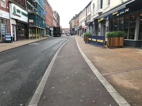
Las Iguanas
Restaurant · Latin American · 0.4 mi
13-15 Belvoir Street, Leicester
Mo-Th 11:00-22:00; Fr 11:00-22:30; Sa 11:00-23:00; Su 11:00-22:00
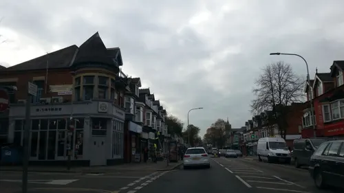
Mithaas
Restaurant · Indian · 1.1 mi
103-105 Narborough Road, Leicester
Mo off; Tu-Su 10:00-22:00; PH 10:00-22:00


Asda Café
Cafe · Coffee Shop · 1.0 mi
1 Exploration Drive, Leicester
Mo-Sa 08:30-18:00; Su 10:00-16:00
Asda Café
Cafe · Coffee Shop · 3.3 mi
Narborough Road South, Leicester
Mo-Sa 08:30-18:00; Su 10:00-16:00
Grays Coffee Shop & Kitchen @ LCB Depot
Cafe · Coffee Shop
31 Rutland Street, Leicester
Mo-Fr 08:30-17:30; Sa 10:00-16:00; Su off
KREM
Cafe · Sandwich, Coffee Shop, Ice Cream, Breakfast, Lunch, Cake · 1.1 mi
East Park Road, Leicester
Mo-Su 10:00-16:00
122 more on the map.
History
Leicester is one of the oldest cities in England, with a history going back at least two millennia. The native Iron Age settlement encountered by the Romans at the site seems to have developed in the 2nd or 1st centuries BC, around a century or so before the arrival of the Romans. Little is known about this settlement or the condition of the River Soar at this time, although roundhouses excavated from this era seem to have clustered along roughly 8 hectares (20 acres) of the east bank of the Soar. This area of the Soar was split into two channels: a main stream to the east and a narrower channel on the west, with a presumably marshy island between. The settlement seems to have controlled a ford across the larger channel. The later Roman name was a latinate form of the Brittonic word for "ramparts" (cf. Gaelic rath and the nearby villages of Ratby and Ratcliffe), suggesting the site was an oppidum. The plural form of the name suggests it was initially composed of several villages. The Celtic tribe holding the area was later recorded as the "Coritanians" but an inscription recovered in 1983 showed this to have been a corruption of the original "Corieltauvians". The Corieltauvians may have ruled over roughly the area of the East Midlands.
Read more of the history
It is believed that the Romans arrived in the Leicester area around AD 47, during their conquest of southern Britain. The Corieltauvian settlement lay near a bridge on the Fosse Way, a Roman road between the legionary camps at Isca (Exeter) and Lindum (Lincoln). It remains unclear whether the Romans fortified and garrisoned the location, but it slowly developed from around the year 50 onwards as the tribal capital of the Corieltauvians under the name Ratae Corieltauvorum. In the 2nd century, it received a forum and bathhouse. In 2013, the discovery of a Roman cemetery found just outside the old city walls and dating back to AD 300 was announced. The remains of the baths of Roman Leicester can be seen at the Jewry Wall; recovered artifacts are displayed at the adjacent museum.
Knowledge of the town following the Roman withdrawal from Britain is limited. It seems to have been continually occupied after Roman protection ceased through the 5th and 6th centuries, although with a significantly reduced population. Its memory was preserved as the Cair Lerion of the History of the Britons. Following the Saxon invasion of Britain, Leicester was occupied by the Middle Angles and subsequently administered by the kingdom of Mercia. It was elevated to a bishopric in either 679 or 680; this see survived until the 9th century, when Leicester was captured by Danish Vikings. Their settlement became one of the Five Burghs of the Danelaw, although this position was short-lived. The Saxon bishop, meanwhile, fled to Dorchester-on-Thames and Leicester did not become a bishopric again until the parish church of St Martin became Leicester Cathedral in 1927. The settlement was recorded under the name Ligeraceaster in the early 10th century.
Following the Norman conquest, Leicester was recorded by William's Domesday Book as Ledecestre. It was noted as a city (civitas) but lost this status in the 11th century owing to power struggles between the Church and the aristocracy and did not become a legal city again until 1919.
Geoffrey of Monmouth composed his History of the Kings of Britain around the year 1136, naming a King Leir as an eponymous founder figure. According to Geoffrey's narrative, Cordelia had buried her father beneath the river in a chamber dedicated to Janus and his feast day was an annual celebration.
When Simon de Montfort became Earl of Leicester in 1231, he gave the borough a grant to expel the Jewish population "in my time or in the time of any of my heirs to the end of the world". He justified his action as being "for the good of my soul, and for the souls of my ancestors and successors". Leicester's Jews were allowed to move to the eastern suburbs, which were controlled by de Montfort's great-aunt and rival, Margaret, Countess of Winchester, after she took advice from the scholar and cleric Robert Grosseteste, at that time Archdeacon of Leicester. It would appear, however, that the expulsion was largely effective, and there is no evidence of any Jews remaining in Leicester. De Montfort's acts of anti-Jewish persecution in Leicester and elsewhere were part of a wider pattern that led to the expulsion of the Jewish population from England in 1290.
From the History section of Leicester on Wikipedia, under CC BY-SA 4.0.
More about Leicester
Geography
The Office for National Statistics has defined a Leicester Urban Area (LUA); broadly the immediate Leicester conurbation, although without administrative status. The LUA contains the unitary authority area and several towns, villages and suburbs outside the city's administrative boundaries.
Suburbs and districts of Leicester (ancient villages now incorporated into the city are shown in bold)
Leicester experiences a maritime climate with mild to warm summers and cool winters, rain spread throughout the year, and low sunshine levels. The nearest official Weather Station was Newtown Linford, about 5 miles (8.0 km) northwest of Leicester city centre and just outside the edge of the urban area. However, observations stopped there in 2003. The current nearest weather station is Market Bosworth, about 10 miles (16 km) west of the city centre.
The highest temperature recorded at Newtown Linford was 34.5 °C (94.1 °F) during August 1990, although a temperature of 35.1 °C (95.2 °F) was achieved at Leicester University during August 2003. However, the highest temperature since records began in Leicester is 36.7 °C (98.1 °F) on 15 July 1868. More typically the highest temperature would reach 28.7 °C (83.7 °F) – the average annual maximum. 11.3 days of the year should attain a temperature of 25.1 °C (77.2 °F) or above.
Economy
Leicester has the second largest economy in the East Midlands, after Nottingham.
Companies that have their principal offices or significant sites in Leicester and the surrounding area include; Brantano Footwear, Dunelm Mill, Next, Shoe Zone, Everards brewing and associated businesses, KPMG, Mazars, Cambridge & Counties Bank, HSBC and Santander banking, Hastings Insurance, British Gas, British Telecom, Caterpillar (Inc.), Topps Tiles and DHL.
The city of Leicester is regularly rated as the best place to live and work in the East Midlands. The Good Growth for Cities Index is an annual study which ranks UK cities based on a range of economic factors. In 2022, the Index placed Leicester 14th out of 50 UK cities and the best performing city in the East Midlands. In 2023, the index ranked Leicester first of seven East Midlands cities, and 16th overall across the country. In 2024, the Good Growth for Cities Index again rated Leicester as the best performing city in the East Midlands, and 20th overall out of 52 other UK cities.
The city of Leicester is considered to be one of the birthplaces of popular tourism. Visit Leicester, who are based at the King Richard III Visitor Centre, define the city as 'The Place Where Tourism Began.'
Arts and culture
The city hosts annually a Caribbean Carnival and parade (the largest in the UK outside London), Diwali celebrations (the largest outside of India), the largest comedy festival in the UK Leicester Comedy Festival and a Pride Parade (Leicester Pride). Belgrave Road, not far from the city centre, is colloquially known as "The Golden Mile" because of the number of Jewellers.
The Leicester International Short Film Festival is an annual event; it commenced in 1996 under the banner title of "Seconds Out". It has become one of the most important short film festivals in the UK and usually runs in early November, with venues including the Phoenix Cinema and Arts Centre.
Curve: Purpose-designed performing arts centre, designed by Rafael Viñoly, opened in Autumn 2008,
The Peepul Centre, Designed by Andrzej Blonski Architects, the £15 million building was opened in 2005 and houses an auditorium, restaurant, cyber café, gym and dance studio for the local people, as well as being used for conferences and events. The centre has even been host to former Prime Minister Gordon Brown and other senior Labour Party figures for hustings during the deputy leadership contest.
Phoenix Cinema and Arts Centre, in Midland street opened in 2009.
The Sue Townsend Theatre in Upper Brown Street– which opened in the former Phoenix Arts Centre.
Education
Leicester is home to a number of comprehensive schools and independent schools. There are three sixth form colleges, all of which were previously grammar schools.
The Leicester City Local Education Authority initially had a troubled history when formed in 1997 as part of the local government reorganisation – a 1999 Ofsted inspection found "few strengths and many weaknesses", although there has been considerable improvement since then.
Tudor Grange Samworth Academy an academy whose catchment area includes the Saffron and Eyres Monsell estates, was co-sponsored by the Church of England and David Samworth, chairman of Samworth Brothers pasty makers.
Under the "Building Schools for the Future" project, Leicester City Council has contracted with developers Miller Consortium for £315 million to rebuild Beaumont Leys School, Judgemeadow Community College, the City of Leicester College in Evington, and Soar Valley College in Rushey Mead, and to refurbish Fullhurst Community College in Braunstone.
Leicester City Council underwent a major reorganisation of children's services in 2006, creating a new Children and Young People's Services department.
From the Wikipedia article Leicester, under CC BY-SA 4.0.
Notable people from Leicester
 Julian BarnesEnglish writer (born 1946)Photo: WanderingTrad, CC BY-SA 4.0
 John DeaconBritish musician, bassist and songwriter (born 1951)Photo: Christopher Hopper; Distributed by..., Public domain
 Jon LordEnglish composer, pianist, and Hammond organ player (1941–2012)Photo: Fredamas, CC BY-SA 4.0
 Greg WinterBritish biochemist (born 1951)Photo: Aga Machaj, CC BY-SA 4.0
 Joseph MerrickBritish man with severe deformities known as the Elephant ManPhoto: Unknown Unknown I (..., Public domain
 George FoxEnglish founder of Quakers (1624–1691)Photo: attributed to Peter Lely, Public domain
 Stephen FrearsBritish film director and producer (born 1941)Photo: Andriy Makukha ( Amakuha ), CC BY-SA 4.0
- Gary LinekerEnglish football pundit and former player
- Peter ShiltonEnglish footballer (born 1949)
- Emile HeskeyEnglish association football player
- Mark SelbyEnglish snooker player
- C. P. SnowEnglish novelist and physical chemist (1905–1980)
Born in Leicester, according to Wikidata (CC0). Each name links to its Wikipedia article.
Where to stay35
Churches and places of worship67
Al Furqan Islamic Da'wah Association (FIDA)
Place of worship · Sunni · 1.3 mi
33 Rowsley Street, Leicester
Shopping69
Gas and EV charging27
Schools, colleges and libraries37
Healthcare33
Map of Leicester
250 places. The map loads OpenStreetMap tiles when you open it.
Getting there and nearby towns
East Midlands Airport (EMA) is the nearest airport with scheduled flights listed in OpenStreetMap, 16 miles away.
- Nottingham 22 mi north, about 35 min by car
- Northampton 29 mi south, about 46 min by car
- Sutton Coldfield 29 mi west, about 47 min by car
- Solihull 31 mi southwest, about 51 min by car
- Birmingham 34 mi west, about 55 min by car
- Mansfield 34 mi north, about 55 min by car
- Walsall 36 mi west, about 58 min by car
- Peterborough 37 mi east, about 1 h by car
- West Bromwich 37 mi west, about 1 h by car
- Wolverhampton 42 mi west, about 1 h by car
Drive times are estimates from straight-line distance, not routes.
Towns near Leicester


Keep exploring
Local news
Headlines from INDB.
Reviews, tips and questions
Loading what members have shared...
Sources and licences
- GeoNames (CC BY 4.0): population, coordinates, regions and time zone
- Mapillary (see each image): photos
- OpenStreetMap contributors (ODbL 1.0): places, airports, map data
- Wikidata (CC0 1.0): elevation, founding date, time zone, website, landmarks and historic places
- Wikimedia Commons (see each image): photos
- Wikipedia (CC BY-SA 4.0): overview and history text
Photo credits
- Leicester landmarks montage, Own work, CC BY-SA 3.0
- Leicester Pride 2026 - Belgrave Gate (3) - 5 September 2026, Aethonatic, CC0
- Leicester Pride 2026 - Belgrave Gate (4) - 5 September 2026, Aethonatic, CC0
- Belgrave Gate, Leicester (1) - 5 September 2026, Aethonatic, CC0
- First Leicester (71007 - CMZ 5307) - 30 April 2025, Aethonatic, CC0
- Savoy Street, Leicester - 2 March 2026, Aethonatic, CC0
- Leicester Haymarket Theatre - 2 March 2026, Aethonatic, CC0
- Leicester Pride 2026 - Belgrave Gate (2) - 5 September 2026, Aethonatic, CC0
- Belgrave Gate, Leicester - 5 September 2026, Aethonatic, CC0
- First Leicester (63541 - BK23 HFR) - 30 April 2025, Aethonatic, CC0
- Curve Leicester full panorama, NotFromUtrecht, CC BY-SA 3.0
- De Montfort Hall, NotFromUtrecht, CC BY-SA 3.0
- Braunstone Gate Bridge, Tim Hallam, CC BY-SA 2.0
- Teatr Mały w Leicester, Kris1973, CC BY-SA 4.0
- Phoenix Arts Centre Leicester, NotFromUtrecht, CC BY-SA 3.0
- Newarke Houses Museum Leicester, NotFromUtrecht, CC BY-SA 3.0
- Dynasty Death and Discovery, Richard III museum entrance, RobinLeicester, CC BY-SA 4.0
- War Memorial Leicester, Summer 2009, NotFromUtrecht, CC BY-SA 3.0
- Jewry Wall ruins panorama 3, NotFromUtrecht, CC BY-SA 3.0
- Abbeyruins Leicester, Kev747 at English Wikipedia, CC BY-SA 3.0
- Brama wjazdowa do zamku od strony zewnętrznej, Kris1973, CC BY-SA 4.0
- Abbey Park Leicester entrance gate, NotFromUtrecht, CC BY-SA 3.0
- Deer in Bradgate Park, Duncharris, CC BY-SA 3.0
- Knighton Spinney 4, Dudley Miles, CC BY-SA 4.0
- Lucas Marsh 2, Dudley Miles, CC BY-SA 4.0
- Nelson Mandela Park, Joshuajohnlee ., CC BY 3.0
- Victoria Park Leicester from Queens Road, NotFromUtrecht, CC BY-SA 3.0
- Birstall Meadows 5, Dudley Miles, CC BY-SA 4.0
- Leicester Haymarket Theatre entrance, Cordyceps-Zombie, CC BY-SA 4.0
- King Power Stadium wide view, Pottercomuneo, CC BY-SA 4.0
- Leicester Cathedral panorama (small crop), NotFromUtrecht, CC BY-SA 3.0
- Abbey Pumping station, Jonnic1 at English Wikipedia, Public domain
- All Saints Church - widok od południowej strony, Kris1973, CC BY-SA 4.0
- St Mary de Castro from Castle Yard, NotFromUtrecht, CC BY-SA 3.0
- Highcross Leicester, NotFromUtrecht, CC BY-SA 3.0
- Leicester - Corn Exchange, Flamenc, CC BY-SA 3.0
- Leicester infirmary, Victuallers, CC BY-SA 3.0
- Masjid Umar, Leicester (cropped), NotFromUtrecht, CC BY-SA 3.0
- New Walk Museum main entrance, NotFromUtrecht, CC BY-SA 3.0
- Leicester Baptist Church, Steve Cadman from London, U.K., CC BY-SA 2.0
- Winstanley House, Maypm, CC BY-SA 4.0
- The Peepul Centre, Belgrave, Leicester, HIDEHIH0DIH0, CC BY-SA 4.0
- Raw Dykes north end, NotFromUtrecht, CC BY-SA 3.0
- Phoenix Square Leicester west side, NotFromUtrecht, CC BY-SA 3.0
- National Space Centre (28967294791), Amanda Slater from Coventry, West Midlands, UK, CC BY-SA 2.0
- Western park teniss courts, http-www.leicestertravel.co.uk - panoramio, Leicester Holyday, CC BY 3.0
- Street-level photo, southglos, CC BY-SA 4.0
- Street-level photo, toby, CC BY-SA 4.0
- Street-level photo, toby, CC BY-SA 4.0
- Street-level photo, sk53, CC BY-SA 4.0
- Street-level photo, adam2, CC BY-SA 4.0
- Street-level photo, sk53, CC BY-SA 4.0
- Street-level photo, toby, CC BY-SA 4.0
- Street-level photo, sk53, CC BY-SA 4.0
- Street-level photo, cyclestreets, CC BY-SA 4.0
- Street-level photo, cyclestreets, CC BY-SA 4.0
- Street-level photo, cyclestreets, CC BY-SA 4.0
- Street-level photo, toby, CC BY-SA 4.0
- Street-level photo, adam2, CC BY-SA 4.0
- Street-level photo, adam2, CC BY-SA 4.0
- Street-level photo, adam2, CC BY-SA 4.0
- Street-level photo, adam2, CC BY-SA 4.0
- Street-level photo, trigpoint, CC BY-SA 4.0
- Street-level photo, trigpoint, CC BY-SA 4.0
- Street-level photo, rskedgell, CC BY-SA 4.0
- Street-level photo, adam2, CC BY-SA 4.0
- Street-level photo, adam2, CC BY-SA 4.0
- Street-level photo, adam2, CC BY-SA 4.0
- Street-level photo, adam2, CC BY-SA 4.0
- Street-level photo, shadycraig, CC BY-SA 4.0
- Street-level photo, sk53, CC BY-SA 4.0


Page built November 10, 2026. Spotted a mistake? Tell us or suggest a place.