
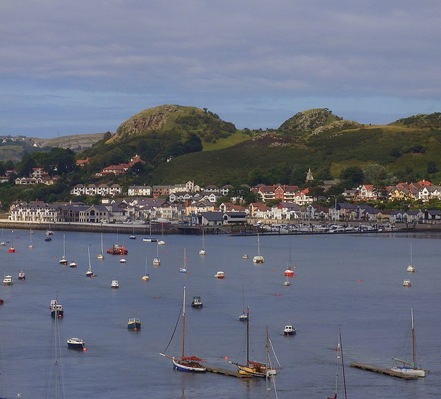


Why visit Deganwy
Townapedia lists 18 museums and landmarks, 16 parks and trails, 142 places to eat, 150 places to stay and 11 attractions in and around town.
Highlights include Venue Cymru, Conwy Railway Bridge, Mostyn and Deganwy Castle.
Weather in Deganwy
Forecast from MET Norway (CC BY 4.0). Full forecast
About Deganwy
Deganwy is a town and electoral ward in the community of Conwy in Conwy County Borough in Wales. It lies in the Creuddyn Peninsula alongside Llandudno (to the north) and Rhos-on-Sea (to its east). Historically part of Caernarfonshire, the peninsula is in a region of north Wales where as many as 1 in 3 residents can speak Welsh, and is home to some of the most expensive streets in Wales. Deganwy is located on the east bank of the River Conwy.
From the Wikipedia article Deganwy (this version), under CC BY-SA 4.0.
Photos of Deganwy

Things to do11


Conwy Railway Bridge
Bridge · 1.7 mi
Grade I listed bridge in Conwy, Wales

Conwy Suspension Bridge
Bridge · 1.7 mi
Grade I listed bridge in Conwy, Wales

Great Orme Lighthouse
Lighthouse · 3.1 mi
Former lighthouse in Conwy, Wales

Palladium, Llandudno
Cinema and theater · 1.4 mi
Former theatre, now a pub, in Llandudno, Wales


Pier Pavilion Theatre
Cinema and theater · 1.6 mi
Former theatre in Llandudno, Wales

Museums and landmarks18

Mostyn
Museum · 1.2 mi
Art gallery in Llandudno, north Wales
12 Vaughan Street, Llandudno
Tu-Su 10:30-16:00


Royal Cambrian Academy of Art
Museum · 1.6 mi
UK charitable organization
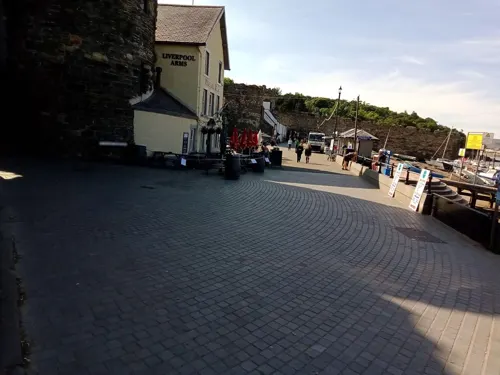

Smallest House in Great Britain
Museum · 1.5 mi
House in Conwy, Wales; smallest inhabitable house in the UK
The Smallest House in Great Britain
Monument and historic site · 1.5 mi
10 Lower Gate Street


6 more on the map.
Parks, trails and playgrounds16

Conwy RSPB reserve
Park · 2.2 mi
Royal Society for the Protection of Birds reserve on the east side of the Conwy estuary, North Wales






4 more on the map.
Restaurants and cafes142

Casanova Italian Restaurant
Restaurant · Italian · 1.4 mi
18 Chapel Street, Llandudno
Mo-Su 05:30-22:00


Café Orient-Express
Cafe · 1.5 mi
8 Gloddaeth Street, Llandudno


Asda Customer Cafe
Cafe · Coffee Shop · 1.0 mi
Conway Road, Llandudno
Mo-Sa 08:30-18:00; Su 10:00-16:00

Caffè Nero
Cafe · Coffee Shop · 1.4 mi
81-83 Mostyn Street, Llandudno
Mo-Sa 07:00-18:00; Su 07:30-17:30
130 more on the map.
Where to stay150
Churches and places of worship22
Emmanuel Christian Centre
Church · Assemblies Of God · 1.3 mi
Lloyd Street, Llandudno
Gloddaeth United Church
Church · United Reformed · 1.4 mi
Chapel Street, Llandudno
Shopping43
Gas and EV charging1
Schools, colleges and libraries12
Healthcare8
North Wales Breast Screening Centre
Clinic and pharmacy · 0.6 mi
Maesdu Road, Llandudno
Map of Deganwy
250 places. The map loads OpenStreetMap tiles when you open it.
Getting there and nearby towns
RAF Valley - Anglesey Airport (VLY) is the nearest airport with scheduled flights listed in OpenStreetMap, 29 miles away.
- Llandudno 1 mi north, about 2 min by car
- Llansantffraid Glan Conwy 3 mi southeast, about 5 min by car
- Colwyn Bay 4 mi east, about 7 min by car
- Penmaenmawr 5 mi southwest, about 8 min by car
- Llanfairfechan 7 mi southwest, about 11 min by car
- Abergele 10 mi east, about 16 min by car
- Llanrwst 11 mi south, about 18 min by car
- Tregarth 13 mi southwest, about 21 min by car
- Bangor 14 mi southwest, about 22 min by car
- Rhyl 14 mi east, about 22 min by car
Drive times are estimates from straight-line distance, not routes.
Towns near Deganwy


Keep exploring
Local news
Headlines from INDB.
Reviews, tips and questions
Loading what members have shared...
Sources and licences
- GeoNames (CC BY 4.0): population, coordinates, regions and time zone
- Mapillary (see each image): photos
- OpenStreetMap contributors (ODbL 1.0): places, airports, map data
- Wikidata (CC0 1.0): elevation, founding date, time zone, website, landmarks and historic places
- Wikimedia Commons (see each image): photos
- Wikipedia (CC BY-SA 4.0): overview and history text
Photo credits
- Deganwy town and castle, Ian Dalgliesh, CC BY-SA 2.0
- AfonConwy, No machine-readable author provided. Rhion assumed (based on copyright claims)., Public domain
- Conwy Telfords Bridge, Unknown author, CC BY-SA 3.0
- Goleudy Pen y Gogarth - Great Ormes Head Lighthouse, Llandudno, Wales 24, Llywelyn2000, CC BY-SA 4.0
- Oriel Mostyn, Llandudno, Ian S, CC BY-SA 2.0
- Royal Cambrian Academy of Art, Huwpritchard, CC BY-SA 3.0
- ConwyRSPB, Tigershrike, Public domain
- Welsh Mountain Zoo, Frombowen, CC BY-SA 4.0
- Deganwy7010254X, NoelWalley at en.wikipedia, CC BY-SA 3.0
- The Palladium (JD Wetherspoon), Huwpritchard, CC BY-SA 3.0
- Castell Degannwy Deganwy Castle Sir Ddinbych Wales 09, Llywelyn2000, CC BY-SA 4.0
- The Smallest House in Great Britain, JK the Unwise, CC BY-SA 3.0
- St David's College July 2009, Irae4dfc, Public domain
- Venue Cymru Llandudno, Original uploader was NoelWalley at en.wikipedia, CC BY-SA 3.0
- Ysgol Aberconwy, Huwpritchard, CC BY-SA 3.0
- Llandudno Museum, Huwpritchard, CC BY-SA 3.0
- 18 Chapel Street, Llandudno, Huwpritchard, CC BY-SA 3.0
- Wildings Hotel, Huwpritchard, CC BY-SA 3.0
- Emmanuel Christian Centre (35714723934), Reading Tom from Reading, UK, CC BY 2.0
- 1 Mostyn Street, Huwpritchard, CC BY-SA 3.0
- St John's Methodist Church, Llandudno, Paul the Archivist, CC BY-SA 4.0
- Montclare Hotel, Huwpritchard, CC BY-SA 3.0
- Ambassador Hotel, Llandudno, Sionk, CC BY-SA 4.0
- Bandstand (1), Huwpritchard, CC BY-SA 3.0
- 8-12 Gloddaeth Street, Llandudno, Paul the Archivist, CC BY-SA 4.0
- 92, Mostyn Street, Llandudno, Huwpritchard, CC BY-SA 3.0
- 3 Mostyn Street., Llandudno, Huwpritchard, CC BY-SA 3.0
- Cae Mor Hotel, Nos.5 & 6 Penrhyn Crescent, Huwpritchard, CC BY-SA 3.0
- Ysgol Ffordd Dyffryn, Huwpritchard, CC BY-SA 3.0
- Ysgol Tudno, Huwpritchard, CC BY-SA 3.0
- Harvey's, Huwpritchard, CC BY-SA 3.0
- The Cottage Loaf, Huwpritchard, CC BY-SA 3.0
- Cross Keys (1), Huwpritchard, CC BY-SA 3.0
- Caersalem Chapel, Huwpritchard, CC BY-SA 3.0
- The Site of Deganwy Castle - aerial 2015, Chris, CC BY-SA 2.0
- Street-level photo, trigpoint, CC BY-SA 4.0
- Street-level photo, annekaro, CC BY-SA 4.0
- Street-level photo, annekaro, CC BY-SA 4.0
- Street-level photo, malenki, CC BY-SA 4.0
- Street-level photo, annekaro, CC BY-SA 4.0
- Street-level photo, malenki, CC BY-SA 4.0


Page built November 10, 2026. Spotted a mistake? Tell us or suggest a place.