


Why visit Swanage
Townapedia lists 15 museums and landmarks, 12 parks and trails, 66 places to eat, 24 places to stay and 3 attractions in and around town.
Highlights include Anvil Point Lighthouse, The Mowlem, Swanage Museum & Heritage Centre and Rempstone Stone Circle.
Weather in Swanage
Forecast from MET Norway (CC BY 4.0). Full forecast
About Swanage
Swanage () is a coastal town and civil parish in the south-east of Dorset, England. It lies at the eastern end of the Isle of Purbeck and is one of its two towns, approximately 6+1⁄4 miles (10 km) south of Poole and 25 miles (40 km) east of Dorchester. At the 2021 census, the civil parish had a population of 9,426. Nearby are Ballard Down and Old Harry Rocks, with Studland Bay and Poole Harbour to the north; within the parish are Durlston Bay and Durlston Country Park to the south of the town.
From the Wikipedia article Swanage (this version), under CC BY-SA 4.0.
Travel tips from other travellers: Swanage on Wikivoyage (CC BY-SA 4.0).
Photos of Swanage

Things to do3

Anvil Point Lighthouse
Lighthouse · 1.1 mi
Lighthouse in Swanage, Dorset, England, UK


Museums and landmarks15
Rempstone Stone Circle
Monument and historic site · 3.1 mi
Stone circle in Corfe Castle, Dorset, England, UK
Swanage Museum and Heritage Centre
Museum
History museum and family history centre in Dorset, England, United Kingdom

Swanage Railway
Museum · 1.2 mi
Heritage railway and museum in Dorset, England, United Kingdom




3 more on the map.
Parks, trails and playgrounds12
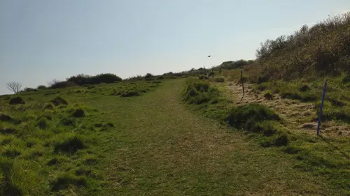
Durlston National Nature Reserve
Hiking and trails · 0.8 mi
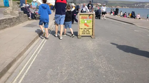
Santa-Fe Fun Park
Sports field and stadium
Mermond Place, Swanage
easter-Oct: Mo-Su 10:00-18:00; easter-Oct: SH 10:00-22:00;


Recreation Ground, Swanage
Park
Pupblic park in Swanage, Dorset, England




Restaurants and cafes66
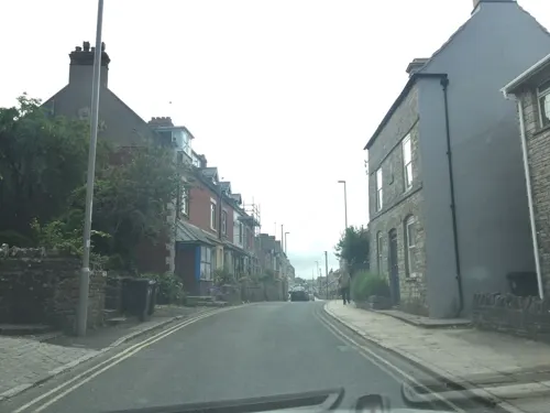
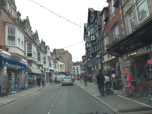
The Old Stables Delicatessen
Cafe
37 Commercial Road, Swanage
Mo-Fr 08:00-18:00, Sa 08:00-16:00, Su closed


54 more on the map.
History
While fishing is likely the town's oldest industry, quarrying has been important to the town and the local area since at least the first century AD. During the time of the Roman occupation this industry grew, with the distinctive Purbeck marble being used for decorative purposes in buildings as far away as London. When the Romans left Britain, quarrying largely ceased until the 12th century.
The town is first mentioned in historical texts in the Anglo-Saxon Chronicle of 877. It is stated as being the scene of a Danish naval disaster: "This year came the Danish army into Exeter from Wareham; whilst the navy sailed west about, until they met with a great mist at sea, and there perished one hundred and twenty ships at Swanwich." The Danish ships were driven by a storm onto Peveril Point, a shallow rocky reef outcropping from the southern end of Swanage Bay. A monument topped (historically incorrectly) by cannonballs was built in 1862 by John Mowlem at the southern end of the seafront promenade to mark this event - interpreted as great naval victory by King Alfred.
Read more of the history
In the 12th century demand for Purbeck Marble grew once again. While Purbeck marble is not suited to external use, as it does not weather well, it is however strong and suitably decorative for use as internal columns. As such the stone was used in the construction of many large churches and cathedrals being built at the time.
In contrast to the decorative Purbeck marble, Purbeck limestone, or more commonly 'Purbeck stone', has been used in construction locally since the early days of quarrying on Purbeck. Its use is less well documented as it was taken for granted as the default construction materials in the area. However, the arrival of more modern quarrying techniques in the 17th century resulted in an increase in production. The Great Fire of London in 1666 led to a period of large-scale reconstruction in the city, and Purbeck stone was extensively used for paving. It was in this time that stone first started being loaded upon ships directly from the Swanage seafront; before this time quarried stone had been first transported to Poole for shipping.
The idea that Swanage could become a tourist destination was first encouraged by a local MP William Morton Pitt in the early 19th century, who converted a mansion in the town into a luxury hotel. The hotel is noted for having been visited in 1833 by the (then) Princess Victoria, later to become queen. The building was later renamed the Royal Victoria Hotel, now the building has been converted into flats and a bar and nightclub in the left and right wings respectively.
The town's greatest prominence came during the Victorian period. John Mowlem (1788–1868), a Swanage resident, became a successful builder in London, creating the Mowlem construction company, which still existed as recently as 2006, when it was acquired by another company, Carillion.
John Mowlem made his business in London by importing stone into the city from around the country, including Purbeck limestone. Through this process, many relics and monuments were brought from London to Swanage in the 19th century by Mowlem and his nephew George Burt (1816–1894) who took over the business when Mowlem retired. It is said that these items brought from London were used as ballast for the empty vessels which transported the Purbeck stone to London.
These include the big clock tower near Peveril Point. The clock tower, commemorating the Duke of Wellington, designed by Arthur Ashpitel, was built in 1854 at the southern approach to the old London Bridge. Within 10 years it became an obstruction to traffic on the busy bridge and had to be removed. It was re-erected 1867–68 on its present site at the southern end of the bay on the sea front. A further item transported from London to Swanage is the 1860 façade of the Mercers' Hall, that was used as the façade of the Swanage Town Hall, which was designed by G. R. Crickmay (1830–1907) of Weymouth, and built during the early 1880s. Immediately behind the town hall, but pre-dating it, is the Swanage lock-up. Dating from 1803, it is a scheduled monument.
Mowlem and Burt were highly influential in the development of the town, taking an active interest in their town of birth into retirement. Between them they were responsible for the building of much of the town's infrastructure, including the town's first pier, the Mowlem Institute (a reading room), the first gas and water works, and the development of the Durlston estate and Country Park, at the southern end of the town. The Great Globe which can be found slightly south of Durlston Castle, both also designed by Crickmay, in the Durlston Country Park was completed by George Burt in 1887. It is made up of 15 sections of stone and joined with granite dowels. The Great Globe weighs 40 long tons (41 tonnes) and is 10 feet (3 m) in diameter. Burt was responsible for the erection of the first civic memorial to Prince Albert, the Prince Albert Memorial, in 1862.
Newton Manor House on the High Street was a 17th-century farmhouse, remodelled in the 18th and 19th centuries. For some centuries the house and estate belonged to the Cockram family. In c1876 it was bought by Sir John Charles Robinson, Director of the Victoria and Albert Museum.
Swanage Lighthouse was built in 1880, on the clifftop at Anvil Point, not far away from Durlston Castle.
The railways were introduced to the town in 1885 with the encouragement of Burt by the London and South Western Railway Company. By this time the town was becoming a popular resort destination for the wealthy, noted for its fine weather and clean air. The town previously had been fairly cut off due to its valley location, but the introduction of the railway made the town much more accessible to visitors, with direct services running from London. However, the greatest increase in visitors came with the building of the second 'new' pier in 1895, built primarily for use by pleasure steamers.
From the History section of Swanage on Wikipedia, under CC BY-SA 4.0.
More about Swanage
Geography
Swanage faces to the east Swanage Bay in Dorset on the south coast of England. The bay is at the eastern end of the Isle of Purbeck, approximately 6 miles (10 km) south of Poole and 25 miles (40 km) east of Dorchester. The northern headland of the bay is formed of chalk, the southern of Purbeck Limestone, with softer primarily Wealden clays forming the bay and valley in which the town is sited. The Purbeck limestone was extensively quarried with several sites to the south west showing evidence of former quarries, particularly Tilly Whim Caves and Dancing Ledge, a man-made rock shelf used for loading ships. Natural erosion has formed stacks along and at the end of the northern headland, in particular the notable Old Harry Rocks. In part through the process of quarrying, fossils from the dinosaur age have been discovered in the local rock, and the coastline up to and including Swanage Bay has been included in the Jurassic Coast World Heritage Site.
Economy
Swanage's primary sources of employment are wholesale and retail trade (including mechanics), health and social work, and accommodation and food service activities. The town has a tourism industry; however, the demand level is highly seasonal, and as such people looking for permanent work may have to commute to nearby towns such as Poole and Bournemouth.
The town centre has a few medium-sized outlets for major retailers, a collection of local retailers, a number of cafes, bars, restaurants and pubs. The seafront has two amusement arcades, several ice cream outlets, fish restaurants and cafes. The town also has a number of successful small-scale cottage industries.
There is a brickworks on the outskirts of the town that uses the Wealden Clay found in the valley for producing bricks, and quarrying still continues to the south.
During the peak summer season many people are drawn by the town's beautiful setting, the beach and other attractions. The town has numerous hotels and guest rooms though the number (particularly of hotels) has reduced slightly in recent years. Swanage has a gently sloping white sand beach which is sheltered and generally calm. The beach is well served by local businesses providing refreshments and services. For hire are deck chairs, boats, pedalos and general watersports equipment. There are amusement arcades and parks.
Arts and culture
As a small town there are no large cultural institutions based in the town, though there are a number of small clubs and groups, including the Swanage Town Band formed in the late 19th century. The largest facility in the town is the Mowlem Theatre, on the site of the former Mowlem Institute, opened in 1967. Performing a dual role as a 400-seat theatre and cinema, the complex also hosts a bar and restaurant and a small collection of shops. Typically there are around 200 film showings and 60–100 nights of live theatre.
Swanage has a detached flight of the Air Training Corps which regularly partakes in activities around the town, including charitable collections, training exercises and parades. 2185 (Swanage) DF is attached to 2185 (Wareham) Squadron ATC as its parent unit.
The town has been twinned with Rüdesheim am Rhein in Germany since 1986.
The town hosts a number of annual festivals and events. In the summer months there is a carnival week which includes a procession of floats and dancers and several firework displays, and many other attractions and small events including live music from various bands from all over Southern England, races and a regatta.
The railway used to have special Thomas the Tank Engine themed events, and other special services.
Education
Swanage has four primary schools covering academic years 1–6; St Mary's Catholic, St Mark's CE, St George's CE, and Swanage Primary School (also known by its location of Mount Scar.)
The town has a library in the town centre housed in a distinctive 1960s octagonal glass and Purbeck Stone building.
A small museum (the Swanage Museum & Heritage Centre) with artefacts and displays recounting the town and surrounding area's history is located at the square on the seafront. The museum had previously been housed in the historical Tithe Barn building; however, mounting maintenance costs forced the relocation of much of the collection to the new site, with the remainder in storage.
From the Wikipedia article Swanage, under CC BY-SA 4.0.
Notable people from Swanage
 James MeadeBritish economistPhoto: Unknown author, No restrictions
 Robert BrownBritish actor (1921–2003)Photo: Unknown author Unknown author, Public domain
- P. K. PageCanadian poet (1916–2010)
- James HuntEnglish speech therapist (1833–1869)
- Charles ChadwickBritish writer
- Henry KingAustralian photographer (1855–1923)
- Thomas Osmond SummersAmerican Methodist theologian
- Oliver ThompsonBritish guitarist
- George BurtEnglish stonemason and contractor (1816-1894)
- David RoseBritish television producer (1924-2017)
Born in Swanage, according to Wikidata (CC0). Each name links to its Wikipedia article.
Where to stay24
Churches and places of worship11
Emmanuel Baptist Church & Centre
Church · Baptist · 0.9 mi
160 Victoria Avenue, Swanage
Shopping36
Gas and EV charging1
Schools, colleges and libraries8
Healthcare2
Map of Swanage
178 places. The map loads OpenStreetMap tiles when you open it.
Getting there and nearby towns
Bournemouth Airport (BOH) is the nearest airport with scheduled flights listed in OpenStreetMap, 13 miles away.
- Poole 7 mi north, about 12 min by car
- Bournemouth 8 mi northeast, about 14 min by car
- Wimborne Minster 12 mi north, about 20 min by car
- Verwood 19 mi north, about 30 min by car
- Southampton 32 mi northeast, about 51 min by car
- Portsmouth 40 mi east, about 1 h by car
- Warminster 42 mi north, about 1 h 15 min by car
- Westbury 46 mi north, about 1 h 15 min by car
- Wells 51 mi northwest, about 1 h 15 min by car
- Bath 56 mi north, about 1 h 30 min by car
Drive times are estimates from straight-line distance, not routes.
Towns near Swanage


Keep exploring
Local news
Headlines from INDB.
Reviews, tips and questions
Loading what members have shared...
Sources and licences
- GeoNames (CC BY 4.0): population, coordinates, regions and time zone
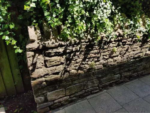
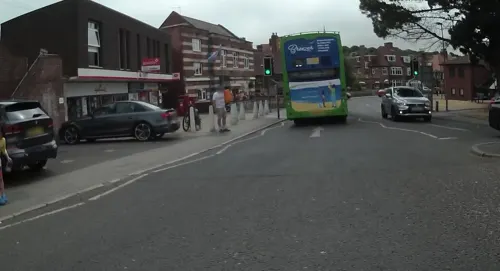
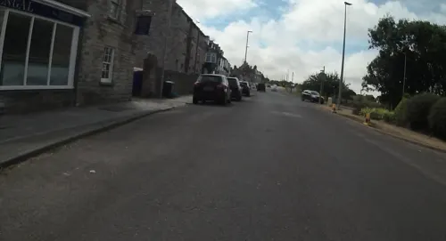
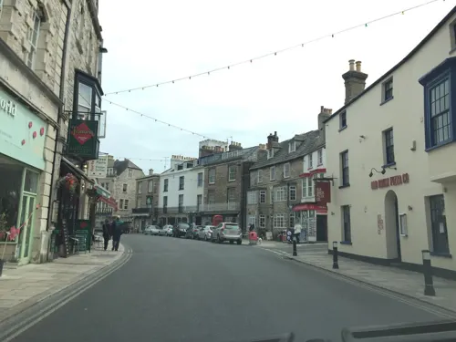
- Mapillary (see each image): photos
- OpenStreetMap contributors (ODbL 1.0): places, airports, map data
- Wikidata (CC0 1.0): elevation, founding date, time zone, website, landmarks and historic places
- Wikimedia Commons (see each image): photos
- Wikipedia (CC BY-SA 4.0): overview and history text
Photo credits
- Swanage - The Square, Tiia Monto, CC BY-SA 3.0
- Anvil point lighthouse durlston dorset, JimChampion, CC BY-SA 3.0
- Train corfecastle ontheswanage railway, LordHarris at English Wikipedia, Public domain
- Studland Parish Church, Wulfrunian1, CC BY-SA 3.0
- St Mary's Church, Swanage, Daniel Schmidt, CC BY-SA 4.0
- 2012-07-25 Durlston Castle view from rear, Huligan0, CC BY-SA 3.0
- Swanage lockup (2702), Nilfanion, CC BY-SA 4.0
- Red Lion Inn, 63 High Street, Swanage (NHLE Code 1119902) (September 2022), User:Hassocks5489, CC0
- St Mark's Church, Bell Street, Herston, Swanage (NHLE Code 1119921) (September 2022) (4), User:Hassocks5489, CC0
- Methodist Church, Swanage, Daniel Schmidt, CC BY-SA 4.0
- Alfred memorial in Swanage (2653), Nilfanion, CC BY-SA 4.0
- Swanage War Memorial, RedAuburn, CC BY-SA 4.0
- 2012-07-25 Durston Castle main entrance, Huligan0, CC BY-SA 3.0
- The Mowlem, Tiia Monto, CC BY-SA 3.0
- Swanage amphitheatre, Stevekraken, CC BY-SA 4.0
- The Great Globe at Sculpture Durlston Country Park, Thomas Fuhrmann, CC BY-SA 4.0
- Street-level photo, essexboy, CC BY-SA 4.0
- Street-level photo, essexboy, CC BY-SA 4.0
- Street-level photo, essexboy, CC BY-SA 4.0
- Street-level photo, imsi, CC BY-SA 4.0
- Street-level photo, essexboy, CC BY-SA 4.0
- Street-level photo, essexboy, CC BY-SA 4.0
- Street-level photo, essexboy, CC BY-SA 4.0
- Street-level photo, jpennycook, CC BY-SA 4.0
- Street-level photo, essexboy, CC BY-SA 4.0
- Street-level photo, jpennycook, CC BY-SA 4.0
- Street-level photo, jpennycook, CC BY-SA 4.0
- Street-level photo, essexboy, CC BY-SA 4.0
- Street-level photo, essexboy, CC BY-SA 4.0
- Street-level photo, jpennycook, CC BY-SA 4.0
- Street-level photo, jpennycook, CC BY-SA 4.0
- Street-level photo, jpennycook, CC BY-SA 4.0
- Street-level photo, essexboy, CC BY-SA 4.0
- Street-level photo, jpennycook, CC BY-SA 4.0
- Street-level photo, imsi, CC BY-SA 4.0
- Street-level photo, essexboy, CC BY-SA 4.0
- Street-level photo, essexboy, CC BY-SA 4.0
- Street-level photo, essexboy, CC BY-SA 4.0
- Street-level photo, essexboy, CC BY-SA 4.0
- Street-level photo, jpennycook, CC BY-SA 4.0
- Street-level photo, chris_debian, CC BY-SA 4.0
- Street-level photo, imsi, CC BY-SA 4.0
- Street-level photo, essexboy, CC BY-SA 4.0
- Street-level photo, jpennycook, CC BY-SA 4.0
- Street-level photo, jpennycook, CC BY-SA 4.0
- Street-level photo, jpennycook, CC BY-SA 4.0


Page built November 10, 2026. Spotted a mistake? Tell us or suggest a place.