


Why visit Hythe
Townapedia lists 10 museums and landmarks, 7 parks and trails, 45 places to eat and 8 places to stay in and around town.
Highlights include Martello Tower 14, Saltwood Castle, Brockhill Country Park and Mercure Hythe Imperial Golf Course.
Weather in Hythe
Forecast from MET Norway (CC BY 4.0). Full forecast
About Hythe
Hythe is an old market town and civil parish on the edge of Romney Marsh in Kent, England. Hythe is an Old English word meaning haven or landing place.
From the Wikipedia article Hythe, Kent (this version), under CC BY-SA 4.0.
Travel tips from other travellers: Hythe on Wikivoyage (CC BY-SA 4.0).
Museums and landmarks10




Westenhanger Castle
Museum · 2.8 mi
Grade I listed historic house museum in Shepway, United Kingdom
Parks, trails and playgrounds7





Restaurants and cafes45
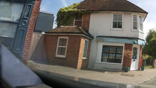
Hide and Fox Restaurant
Restaurant · British · 0.7 mi
The Green, Hythe
We-Sa 12:00-14:00,18:30-20:30; Su 12:00-14:00
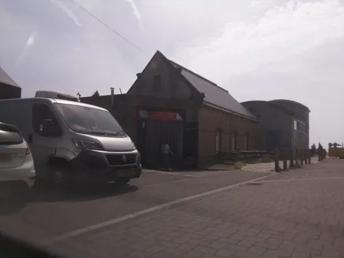
The Lazy Shack
Cafe · Seafood, Coffee Shop · 0.6 mi
Former Lifeboat House
Range Road, Hythe
Mo-Sa 08:00-17:00
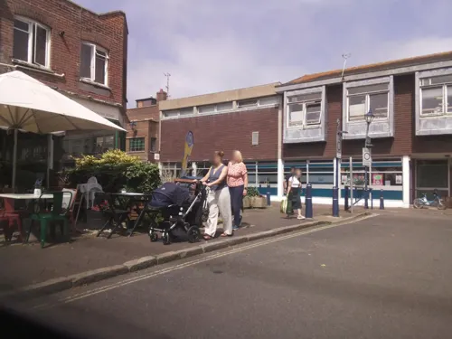


33 more on the map.
Where to stay8


History
The name Hythe derives from the Old English for 'landing place'.
The earliest reference to Hythe is in Domesday Book (1086) though there is evidence of the area having been settled since Roman times.
The town has mediaeval and Georgian buildings, as well as a Saxon/Norman church on the hill and a Victorian seafront promenade. Hythe was once defended by castles at Saltwood and Lympne. Hythe Town Hall, a neoclassical style building, was completed in 1794.
Hythe's market once took place in Market Square (now Red Lion Square) close to where there is now a farmers' market every second and fourth Saturday of the month. Hythe has gardening, horse riding, bowling, tennis, cricket, football, squash and sailing clubs. Lord Deedes was once patron of Hythe Civic Society.
As an important Cinque Port, Hythe once possessed a bustling harbour which, over the course of 300 years, has now disappeared due to silting. Hythe was the central Cinque Port, sitting between Hastings and New Romney to the west and Dover and Sandwich to the east.
According to Hasted, a French fleet approached Hythe in 1293 and landed 200 men, but "the townsmen came upon them and slew every one of them: upon which the rest of the fleet hoisted sail and made no further attempt".
In 1348, the Black Death afflicted Hythe, and in 1400 the plague further reduced the population.
Read more of the history
Hythe has no coat of arms; however, the corporation seal represents an antique vessel with one mast, two men in it (one blowing a horn) and two men lying on the yard arm.
Hythe was the home of the Mackeson Brewery, which after changes of ownership, closed in 1968. It was the birthplace of Mackeson Stout, a type of beer first brewed in 1909, which went on to become a national brand. Mackeson stout is no longer brewed locally but is produced under contract by one of the major national brewers.
Hythe Ranges is a military training ground that takes up a large section of the Hythe shoreline. Access to this section of the shore is restricted when red flags are showing.
From the History section of Hythe, Kent on Wikipedia, under CC BY-SA 4.0.
Notable people from Hythe
 Margaretta Louisa LemonBritish humanitarian, ornithologist and conservationistPhoto: Photographer unknown but likely..., Public domain
 Rose Ayling-EllisBritish actress (born 1994)Photo: JaceMerlyn, CC BY-SA 4.0
 Alan Cathcart, 3rd Earl CathcartBritish landowner and agriculturist (1828 - 1905)Photo: Bain News Service, publisher, Public domain
 Hamo HetheBishop of RochesterPhoto: Giogo, CC BY-SA 4.0
 Thomas Head RaddallCanadian historian (1903–1994)Photo: Chris Lund, Public domain
 Charles Lathamwheat farmer and politician in Western Australia (1882–1968)Photo: National Library of Australia, Public domain
 William Orfeur CavenaghBritish Indian Army generalPhoto: Unknown author Unknown author, Public domain
- Robert HoldstockBritish fantasy and science fiction author (1948-2009)
- Hugh N. KennedyBritish historian
- Francis Pettit SmithBritish inventor
- Henry H. TraversNew Zealand naturalist and botanist (1844–1928)
- Frederick MackesonBritish army officer in the East India Company
Born in Hythe, according to Wikidata (CC0). Each name links to its Wikipedia article.
Churches and places of worship9
Shopping18
Gas and EV charging1
Schools, colleges and libraries5
Healthcare1
Map of Hythe
104 places. The map loads OpenStreetMap tiles when you open it.
Getting there and nearby towns
Lydd Airport (LYX) is the nearest airport with scheduled flights listed in OpenStreetMap, 10 miles away.
- Whitstable 20 mi north, about 32 min by car
- Saint Peters 25 mi northeast, about 40 min by car
- Maidstone 28 mi northwest, about 45 min by car
- Saint Leonards-on-Sea 28 mi southwest, about 45 min by car
- Sheerness 29 mi northwest, about 47 min by car
- Gillingham 32 mi northwest, about 51 min by car
- Rochester 33 mi northwest, about 53 min by car
- Snodland 33 mi northwest, about 53 min by car
- Southend-on-Sea 36 mi northwest, about 58 min by car
- Eastbourne 41 mi southwest, about 1 h by car
Drive times are estimates from straight-line distance, not routes.
Towns near Hythe


Keep exploring
Local news
Headlines from INDB.
Reviews, tips and questions
Loading what members have shared...
Sources and licences
- GeoNames (CC BY 4.0): population, coordinates, regions and time zone
- Mapillary (see each image): photos
- OpenStreetMap contributors (ODbL 1.0): places, airports, map data
- Wikidata (CC0 1.0): elevation, founding date, time zone, website, landmarks and historic places
- Wikimedia Commons (see each image): photos
- Wikipedia (CC BY-SA 4.0): overview and history text
Photo credits
- St Leonard's church, Hythe, DeFacto, CC BY-SA 4.0
- Saltwood Castle, Edgepedia, CC BY-SA 3.0
- The beach at Hythe with Martello Towers 14 and 15, Michael Coppins, CC BY-SA 4.0
- Hythe, Kent, St Michael, Tin Tabernacle, front bis, Paul Bissegger, CC BY-SA 4.0
- Brockhill Reflection, O1ive ( talk ) ( Uploads ), CC BY-SA 3.0
- Saltwood Castle and wall, Edgepedia, CC BY-SA 3.0
- Street-level photo, southglos, CC BY-SA 4.0
- Street-level photo, southglos, CC BY-SA 4.0
- Street-level photo, tallguy, CC BY-SA 4.0
- Street-level photo, southglos, CC BY-SA 4.0
- Street-level photo, southglos, CC BY-SA 4.0
- Street-level photo, southglos, CC BY-SA 4.0
- Street-level photo, southglos, CC BY-SA 4.0
- Street-level photo, southglos, CC BY-SA 4.0
- Street-level photo, southglos, CC BY-SA 4.0
- Street-level photo, southglos, CC BY-SA 4.0
- Street-level photo, tallguy, CC BY-SA 4.0
- Street-level photo, tallguy, CC BY-SA 4.0
- Street-level photo, southglos, CC BY-SA 4.0
Page built November 10, 2026. Spotted a mistake? Tell us or suggest a place.