


Folkestone, United Kingdom
Folkestone is a town of 66,429 people in England, United Kingdom.
Why visit Folkestone
Townapedia lists 35 museums and landmarks, 36 parks and trails, 221 places to eat, 23 places to stay and 10 attractions in and around town.
Highlights include Leas Cliff Hall, Pleasure Gardens Theatre, Battle of Britain Memorial, Capel-le-Ferne and Folkestone War Memorial.
Weather in Folkestone
Forecast from MET Norway (CC BY 4.0). Full forecast
About Folkestone
Folkestone is a coastal town on the English Channel, in Kent, south-east England. The town lies on the southern edge of the North Downs at a valley between two cliffs. It was an important harbour, shipping port, and fashionable coastal resort for most of the 19th and mid-20th centuries.
From the Wikipedia article Folkestone (this version), under CC BY-SA 4.0.
Travel tips from other travellers: Folkestone on Wikivoyage (CC BY-SA 4.0).
Things to do10

Leas Cliff Hall
Cinema and theater · 0.5 mi
Theatre and entertainment venue in Folkestone, England

Pleasure Gardens Theatre
Cinema and theater
Historic theatre in Folkestone

Trinity House Pilot Station
Monument and historic site · 0.9 mi
Tower in Folkestone, Kent, England

Museums and landmarks35

Battle of Britain Memorial, Capel-le-Ferne
Monument and historic site · 2.0 mi
WWII memorial in Kent, England

Folkestone War Memorial
Monument and historic site · 0.6 mi
War memorial in Folkestone, England


Spirit of the Few Monument
Monument and historic site · 2.2 mi
Battle of Britain memorial in Hawkinge, Kent
Villa rustica of Folkestone
Monument and historic site · 1.4 mi
Roman villa in Kent, England
23 more on the map.
Parks, trails and playgrounds36
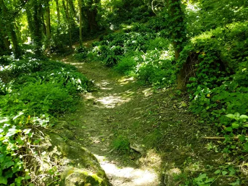
East Cliff and Warren Country Park
Park · 2.6 mi
Park in United Kingdom


Memorial Garden
Park · 0.5 mi
This is a changing memorial garden with the same place and purpose but the flowers change every year
24/7

24 more on the map.
Restaurants and cafes221

The Samuel Peto
Bar and pub · 0.6 mi
23 Rendezvous Street, Folkestone
Su-Th 08:00-00:00; Fr-Sa 08:00-01:00

Annapurna Nepalese Restaurant
Restaurant · Nepalese · 0.4 mi
15 Cheriton Place, Folkestone
Mo-Su 16:00-22:30

Little Rock
Restaurant · Seafood · 1.0 mi
Mo,Tu off; We 12:00-15:00, 17:00-22:00; Th-Sa 11:00-15:00,...
Marleys
Restaurant · British · 0.8 mi
2-4 South Street, Folkestone
Mo-Tu off; We-Fr 12:00-22:00; Sa 09:30-22:30; Su 09:30-15:00
Roni & Rita's
Restaurant · Chicken, Diner, Italian Pizza, Pasta · 0.6 mi
2 Church Street, Folkestone
We-Th 12:00-22:00; Fr-Sa 12:00-23:00; Su 12:00-20:00
Sotirio's Bar & Restaurant
Restaurant · 0.4 mi
2a Bouverie Road West, Folkestone
We-Sa 12:00-23:30; Su 12:00-20:00
209 more on the map.
History
The area of Folkestone has been occupied since at least the Mesolithic era. In 2010, worked flints were discovered below the remains of the Folkestone Roman Villa. The East Cliff area was excavated in 1924 and most recently from 2010 to 2011, producing artefacts from the Mesolithic period through to the Roman era. On the East Cliff, an extensive Iron Age oppidum existed, which produced quern-stones on an almost industrial scale. Those quern-stones, which were used for grinding cereals into flour, were traded for continental exports such as pottery and wine. A modest Roman-style villa was constructed over the Iron Age settlement some time during the 1st century AD, followed by a more luxurious one in about 200 AD. The villa was abandoned during the 3rd or 4th century for unknown reasons.
Read more of the history
In 597 AD, monks, led by Augustine of Canterbury, arrived at Ebbsfleet on the Isle of Thanet, on a mission from Pope Gregory to re-Christianise Britain. He was greeted by the Anglo-Saxon pagan King of Kent, Æthelberht, and his Christian Queen, Bertha. Augustine was granted land in Canterbury, where he built his church and, outside the walls, founded the monastery of St Peter & St Paul, now known as St Augustine's. Æthelberht was succeeded as Anglo-Saxon king of Kent by his son Eadbald, whose daughter Eanswythe refused all offers of marriage. In 630, Eanswythe founded a nunnery on the site of her father's castle near Folkestone by the present parish church of St Mary & St Eanswythe.
Eanswythe died around 640 and was quickly made a saint. Her remains were moved into the chancel of the current church on 12 September 1138, which has since been commemorated as the Feast of St Eanswythe. They became the focus of prayer and pilgrimage, so Eanswythe was quickly adopted as the town's patron. The religious community grew and developed into a monastery until it was dissolved by Henry VIII, and St Eanswythe's remains disappeared. They were rediscovered in June 1885 when workmen, carrying out alterations to the high altar, found a battered lead casket immured in a niche in the north wall of the chancel. Examination by archaeologists at the time, and again in 1981, confirmed that the casket was of Anglo-Saxon origin and the few bone fragments were those of a woman in her early thirties. The relics are still housed in the church, close to where they were discovered, flanked by a pair of small brass candlesticks. St Eanswythe also appears on the town's seal, along with William Harvey, the Folkestone-born 17th-century physician who discovered blood circulation.
A Norman knight held a Barony of Folkestone, which led to its entry as a part of the Cinque Ports in the thirteenth century and, with that, the privilege of being a wealthy trading port. At the start of the Tudor period, it had become a town in its own right. Wars with France meant that defences had to be built, and Folkestone Harbour was built, though the coming of the railways in 1843 had a greater impact on its development.
Dover Hill, the highest point in Folkestone, was a sighting point for the Anglo-French Survey (1784–1790), which measured the precise distance between the Royal Greenwich Observatory and the Paris Observatory. The hill provided a sight-line to the east along the line of the Folkestone Turnpike to Dover Castle, one of the two principal cross-channel observation points, the other being Fairlight Down in Sussex.
Until the 19th century, Folkestone remained a small fishing community with a seafront continually battered by storms and encroaching shingle, making it hard to land boats. In 1807, an act of Parliament, the Folkestone Pier and Harbour Act 1807 (47 Geo. 3 Sess. 2. c. ii), was passed to build a pier and harbour, which was built by Thomas Telford in 1809. By 1820 a harbour area of 14 acres (5.7 hectares) had been enclosed. Folkestone's trade and population grew slightly, but development was still hampered by sand and silt from the Pent Stream. The Folkestone Harbour Company invested heavily in removing the silt but with little success. 1842, the company went bankrupt, and the government put the derelict harbour up for sale. It was bought by the South Eastern Railway (SER), which was then building the London to Dover railway line. George Turnbull was responsible in 1844 for building the Horn pier. Dredging the harbour, and the construction of a rail route down to it, began almost immediately. The town soon became the SER's principal packet station for the Continental traffic to Boulogne. The last ferry ran in 2001.
The Harbour Arm, formerly used solely for port activities, has been extensively restored and developed as a recreational space and promenade to which the public has access, including bars and restaurants, with entertainment at weekends and on some evenings. The former railway station and harbour viaduct have been reconstructed as a successful public walkway and promenade following the full closure of the branch railway in 2014.
From the History section of Folkestone on Wikipedia, under CC BY-SA 4.0.
More about Folkestone
Geography
Folkestone is located where the southern edge of the North Downs escarpment meets the sea. In contrast to the white cliffs at Dover further to the east, the cliffs at Folkestone are composed of greensand belonging to the Folkestone Formation and gault clay. A small stream, Pent Brook, cuts through the cliffs at this point, and provided the original haven for fishermen and cross-channel boats. The cliffs are constantly under attack from the sea, and the original headlands, which once protected the port, long ago ceased to do so. Artificial protection, in the form of breakwaters and piers, have been necessary since the 17th century.
The town is now built on both sides of the original valley: the West Cliff and The Bayle to the West, and the East Cliff on the other side of the stream. The Pent Stream now runs through a culvert from the fire station, at the junction of Radnor Park Road, Park Farm and Pavilion Road, until it reaches the inner harbour. Remains of a quay, dating to the 17th century, were discovered under what is now a public car park, between the Old High Street and the railway viaduct, adjacent to the current harbour. Included in the town is Cheriton, where the Channel Tunnel's northern exit is located; Newington; and Peene.
Economy
Folkestone was at one stage a resort town with a developed shipping trade. With the decline of those industries others have filled the gap. The Dormobile works, car conversion manufacturers were based in the town. Church and Dwight, the US company famous for Arm & Hammer baking soda-based consumer products, has its UK headquarters in the town. Silver Spring Mineral Water Company, was the largest independently owned soft drinks manufacturer in Britain, based in Park Farm, but closed down in 2013.
During the 1980s and 1990s the construction of the Channel Tunnel provided employment, as well as bringing many people to the area, and on completion the running of services still provides work for many. Several insurance firms are based in Folkestone. Some of them used to be involved in the shipping trade but have since diversified into other fields. Saga plc has its headquarters in Folkestone.
Along with other Kent seaside towns, there has been a resurgence in domestic tourism linked to a growing arts scene.
Arts and culture
Folkestone has been home to many galleries over the years. The long-established Metropole Galleries, located in the one-time Metropole Hotel on the Leas, staged year round exhibitions until it closed in 2008. Its place has been largely taken by the Creative Foundation. The Foundation has opened a medium scale theatre, conference and music venue in the heart of the Creative Quarter named Quarterhouse. It offers a year-round programme of live music, comedy, film, talks, theatre and children's entertainment. George's House Gallery and Googie's Art Cafe hold frequent exhibitions by local artists and the Folkestone Art Society, established in 1928, holds three annual art exhibitions and publishes an annual art review of work by local artists. Leas Cliff Hall is the biggest entertainment and function venue in Folkestone with a large choice of concerts, comedy and theatre. An earlier venue the Pleasure Gardens Theatre opened in 1886, later converting into a cinema before closing in 1964.
Education
Schools and colleges in Folkestone include Folkestone Academy (formed by the merger of Hillside School for Boys and Holywell School for Girls in the early 1970s, and formerly known as Wyndgate Secondary School in the 1970s, the Channel High School in the 1980s, and the Channel School in the 1990s); and Turner Free School (opened in 2018 on the site of Pent Valley Technology College, formerly Pent Valley Secondary Modern, formed by the merger of Harcourt Secondary School for Girls and Morehall Secondary School for Boys in the 1970s).
There are two selective state secondary schools: Folkestone School for Girls (formed by the merger of Folkestone Technical High School for Girls and Folkestone Grammar School for Girls in the 1980s) and the Harvey Grammar School for boys. The latter was founded in 1674. These two schools have a common sixth form timetable.
East Kent College have a Folkestone campus providing a variety of courses including Apprenticeships, Hairdressing and Construction.
From 2007 to 2013, the University Centre Folkestone (a joint initiative of Canterbury Christ Church University and University of Greenwich) was located in the town providing a specialism in Performing Arts.
From the Wikipedia article Folkestone, under CC BY-SA 4.0.
Notable people from Folkestone
 William HarveyEnglish physician (1578-1657)Photo: After Daniël Mijtens, Public domain
 Ian Stewartmathematician and authorPhoto: Henry Söderlund, CC BY 4.0
 Richard AshworthBritish politician (born 1947)Photo: Leila Paul, CC BY-SA 3.0
 William Hall-JonesNew Zealand politician (1851-1936)Photo: Unknown photographer, Public domain
 John IngeBishop of Worcester; Bishop of Huntingdon (born 1955)Photo: Roger Harris, CC BY 3.0
 A. E. CoppardEnglish writer (1878–1957)Photo: Lafayette Ltd, Public domain
- Noel ReddingEnglish rock and roll guitarist (1945–2003)
- Jill EllisAmerican soccer coach and executive
- Kitty GordonBritish actress (1878–1974)
- Pete KircherBritish musician
- Mark BarhamEnglish footballer (born 1962)
- Walter TullEnglish professional footballer and army officer (1888-1918)
Born in Folkestone, according to Wikidata (CC0). Each name links to its Wikipedia article.
Where to stay23
Churches and places of worship26
St Augustine's Mission Church
Church · Anglican · 0.7 mi
41 Dover Road, Folkestone
Shopping68
Gas and EV charging4
Schools, colleges and libraries26
Healthcare12
Royal Victoria Hospital and Folkestone Minor Injury Unit
Hospital · 0.4 mi
Map of Folkestone
250 places. The map loads OpenStreetMap tiles when you open it.
Getting there and nearby towns
Lydd Airport (LYX) is the nearest airport with scheduled flights listed in OpenStreetMap, 13 miles away.
- Hythe 4 mi west, about 6 min by car
- Whitstable 20 mi north, about 33 min by car
- Herne Bay 20 mi north, about 33 min by car
- Faversham 20 mi northwest, about 32 min by car
- Ramsgate 21 mi northeast, about 33 min by car
- Saint Peters 22 mi northeast, about 36 min by car
- Margate 23 mi northeast, about 37 min by car
- Broadstairs 23 mi northeast, about 36 min by car
- Sittingbourne 26 mi northwest, about 42 min by car
- Hastings 30 mi southwest, about 48 min by car
Drive times are estimates from straight-line distance, not routes.
Towns near Folkestone


Keep exploring
Local news
Headlines from INDB.
Reviews, tips and questions
Loading what members have shared...
Sources and licences
- GeoNames (CC BY 4.0): population, coordinates, regions and time zone
- Mapillary (see each image): photos
- OpenStreetMap contributors (ODbL 1.0): places, airports, map data
- Wikidata (CC0 1.0): elevation, founding date, time zone, website, landmarks and historic places
- Wikimedia Commons (see each image): photos
- Wikipedia (CC BY-SA 4.0): overview and history text
Photo credits
- Folkestone Aerial, Unknown author, CC BY 2.0
- Leas Cliff Hall, Nixii9, CC BY-SA 3.0
- Castle Hill, Folkestone 1, Alfred Gay at English Wikipedia, CC BY-SA 3.0
- Folkestone library (52460517667), JuliaC2006 from Rochester, UK, CC BY 2.0
- Earlscliffe building exterior, Dukes Education, CC BY-SA 4.0
- Holy Trinity Church, Sandgate Road, Folkestone, Kent, D-G-Seamon, CC BY-SA 2.0
- Sir Keith Park Bust - National Battle of Britain Memorial, Capel-le-Ferne. 29-7-2021 (51639187053), Alan Wilson from Peterborough, Cambs, UK, CC BY-SA 2.0
- Folkestone War Memorial 01, Edgepedia, CC BY-SA 3.0
- Street-level photo, southglos, CC BY-SA 4.0
- Street-level photo, southglos, CC BY-SA 4.0
- Street-level photo, southglos, CC BY-SA 4.0
- Street-level photo, southglos, CC BY-SA 4.0
- Street-level photo, southglos, CC BY-SA 4.0
- Street-level photo, EstSsxKt, CC BY-SA 4.0
- Street-level photo, southglos, CC BY-SA 4.0
- Street-level photo, EstSsxKt, CC BY-SA 4.0
- Street-level photo, EstSsxKt, CC BY-SA 4.0
- Street-level photo, EstSsxKt, CC BY-SA 4.0
- Street-level photo, southglos, CC BY-SA 4.0
- Street-level photo, EstSsxKt, CC BY-SA 4.0
- Street-level photo, vlivyur, CC BY-SA 4.0
- Street-level photo, jkingsleya, CC BY-SA 4.0
Page built November 10, 2026. Spotted a mistake? Tell us or suggest a place.