


Dronfield, United Kingdom
Dronfield is a town of 21,124 people in England, United Kingdom.
Why visit Dronfield
Townapedia lists 5 museums and landmarks, 16 parks and trails, 46 places to eat, 3 places to stay and 1 attraction in and around town.
Highlights include Abbeydale Industrial Hamlet, Bishops' House, Millhouses Park and Oakes Park.
Weather in Dronfield
Forecast from MET Norway (CC BY 4.0). Full forecast
About Dronfield
Dronfield is a town in North East Derbyshire, England, which includes Dronfield Woodhouse and Coal Aston. It lies in the valley of the River Drone between Chesterfield and Sheffield. The Peak District National Park is three miles (4.8 km) to the west. The name comes from the Old English Dranfleld, probably meaning an open land infested with drone bees.
From the Wikipedia article Dronfield (this version), under CC BY-SA 4.0.
Photos of Dronfield

Things to do1

Museums and landmarks5
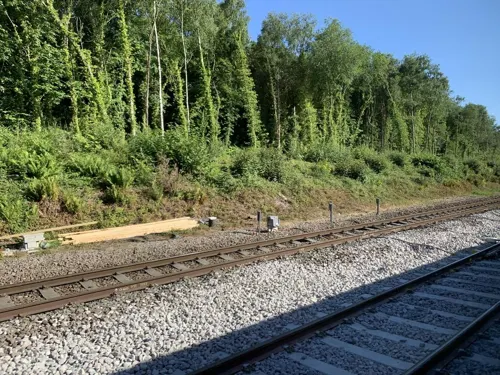
Abbeydale Industrial Hamlet
Museum · 2.6 mi
Hamlet and industrial museum in Sheffield, UK


Parks, trails and playgrounds16

Millhouses Park
Park · 3.0 mi
Public urban park in Sheffield, England

Oakes Park
Park · 2.4 mi
Privately owned park in Sheffield, South Yorkshire, England, UK



4 more on the map.
Restaurants and cafes46
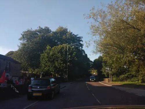



The Snug Coffee and Cake House
Cafe · Coffee Shop, Sandwich, Regional, Italian · 0.8 mi
6 Gorsey Brigg, Dronfield

34 more on the map.
History
Dronfield was in existence before the 1086 Domesday Book, though little is known about its early history. It suffered after the Norman Conquest when William the Conqueror sought to bring the North of England under control. Its name derives from the Old English drān and feld, meaning open land infested with drones (male bees).
The Church of St John the Baptist was built by 1135 when Oscot was rector and the parish of Dronfield covered Little Barlow, Coal Aston, Povey, Holmesfield, Apperknowle, Dore and Totley. The Guild of the Blessed Virgin Mary was established in 1349 in the hall of the chantry priests. However, due to the Dissolution of the Monasteries and the subsequent suppression of the guilds and chantries in 1547, it became a local inn which still operates today as the Green Dragon Inn.
Read more of the history
During the 16th century Dronfield with its sheep farmers had a significant number of families working in the wool trade, engaged in spinning and weaving and also the production and selling of cloth. Soaper Lane, being next to the river, was the centre of the soap-making and tanning industry in the town, with a dye works also situated there. In 1662 Dronfield was granted a market by Charles II, but in the 18th century, due to the proximity of Sheffield and Chesterfield, the market went into decline, however it is still held every Thursday in the rear car park of the civic centre on Farwater Lane.
Between the 16th and 19th centuries Dronfield grew around various industries, the most widespread of which was coal mining, with pits at Stubley being mentioned in the 16th century and a map of Hill Top in the 17th century showing some workings. Further mines were opened at Coal Aston in 1785 and Carr Lane in Dronfield Woodhouse in 1795. The town also benefited from trade with the lead mining and grindstone industries in the Peak District. The wealth of the Rotheram family, who became the Lords of the Manor of Dronfield, was based on the lead trade.
The Wilson-Cammell steelworks was built in the town in 1872–3, following the completion of the Midland Main Line through the town in April 1869. Bessemer steel was first blown at the site in March 1873 and the plant was soon capable of producing 700 tons - mostly as rails - every week. Dronfield became a boom town, but its prosperity was short-lived; although more efficient and profitable than other works in the Sheffield area, its site had limitations that could not compete with low-cost coastal locations, and in 1883 production moved from Dronfield to Workington in Cumberland (now Cumbria). Steelworkers and their families moved too. It is estimated that 1,500 townspeople made the trip to Workington. 'Dronnies', as the people of Workington called the newcomers, formed Workington AFC in 1888.
In 1993 Dronfield Henry Fanshawe School (formerly the 'Dronfield School' and previously 'Dronfield Grammar School') suffered major damage when its 1960s system-built blocks were completely gutted by fire, requiring all firefighting resources from all nearby towns and Sheffield to control the blaze. The historic Victorian quadrangle and library, as well as the sixth-form block, survived. The remains of the modern school were subsequently demolished and mobile cabins were used as classrooms until 1996 when the school was rebuilt.
From the History section of Dronfield on Wikipedia, under CC BY-SA 4.0.
More about Dronfield
Geography
Dronfield is sited in the valley of the River Drone in North East Derbyshire, England. The Drone is a small river that, after flowing through Dronfield, joins the Barlow Brook at Unstone, and then flows into the River Rother at Whittington Moor, Chesterfield.
Dronfield is situated roughly midway between the town of Chesterfield to the south and the city of Sheffield, for which it is a commuter town, to the north. The A61 trunk road Dronfield–Unstone Bypass cuts through the town, although this is not directly accessible from the town centre itself. Instead a network of secondary roads serves local traffic: the B6054, B6056, B6057 and B6158. Dronfield is also served via rail through Dronfield railway station.
Dronfield covers an area of 3,457 acres (13.99 km2) and has as neighbours the villages and hamlets of Unstone, Holmesfield, Barlow, Apperknowle, Hundall, Marsh Lane and Eckington.
Economy
The town has a range of businesses, mainly located on the Callywhite Lane Industrial Estate at the eastern end of the town, and along Wreakes Lane and Stubley Lane northwest of the town centre. The main businesses in the town were originally associated with engineering trades, but over recent years have diversified. William Lees Iron Foundry, manufacturer of machinery parts, moved to Dronfield in 1870 and was responsible for major growth in the town at that time. Until the mid-1970s it specialised in production of malleable iron castings, though much production now is of spheroidal graphite iron.
Major companies with works in Dronfield include Henry Boot PLC, a property development and construction company (the divisions Henry Boot Construction Ltd and Banner Plant Ltd have regional offices in the town), Padley & Venables Ltd, manufacturers of tools for use in drilling, tunnelling, mining, quarrying and construction/demolition, Land Instruments International, international designer and manufacturer of industrial and environmental monitoring instruments (in 2006 this was acquired by AMETEK Inc), and Gunstones Bakery, which was founded in Sheffield in 1862, moved to Dronfield in 1950, taken over by Northern Foods in 1971 and acquired by 2 Sisters in 2011; in 2013 it employed more than 1,400 people.
Arts and culture
Notable events are the annual Dronfield Gala and the Dronfield Woodhouse and Coal Aston well dressings, which are held in July. Dronfest, a music festival, also takes place in the town in the summer months of the year.
Since 1972 Dronfield has been twinned with Sindelfingen in Germany. A park in Dronfield Woodhouse was renamed Sindelfingen Park in the early 1990s to celebrate this partnership. Dronfield Henry Fanshawe School has an annual student exchange with a school in Sindelfingen, which helps establish links between the young people in the two towns.
Dronfield has a library, sports centre, health centre and community centre. There are three parks (Cliffe Park, Sindelfingen Park and Jubilee Park) and several play areas. Cliffe Park has three tennis courts, a basketball court, a children's play area, a bowling green, a meeting room with kitchen, and a multi-use games area with changing rooms. Sindelfingen Park has play areas and basketball courts.
In January 2010 a new £2.5 million sports complex opened at Gosforth Fields, on the old Gosforth School site. Run by three local teams, AFC Dronfield, Dronfield Town & Dronfield RFU, the complex includes a state-of-the-art 3G pitch, 10 full-size pitches, changing facilities and a social area. It was officially opened by Sir Trevor Brooking and John Owen. Gosforth Fields is the home of Dronfield Rugby Club.
Education
Dronfield Henry Fanshawe School on Green Lane takes its intake from all of the eight schools within Dronfield and the surrounding area, occasionally also including pupils from Sheffield and the Chesterfield area. As of November 2015 it had 1,779 pupils.
Dronfield Junior and Infants Schools are the biggest primary schools in Dronfield, reaching more than 600 pupils.
William Levick Primary School had a school roll of 169 pupils as of May 2016.
From the Wikipedia article Dronfield, under CC BY-SA 4.0.
Notable people from Dronfield
 Rick AllenEnglish drummerPhoto: Raph_PH, CC BY 2.0
- Gary CahillEnglish association football player (born 1985)
- Roy GoodallEnglish footballer and manager (1902-1982)
- Alan WardEnglish Test and County cricketer ( 1947-2026)
- Ben AlgarEnglish footballer (born 1989)
- Harry MaskreyEnglish footballer (1880-1927)
- Robert Hendy-FreegardBritish conman
- Edward HousemanEnglish cricketer (1869-1942)
- Jessica Cunninghamactor
- Reg WrightEnglish footballer
Born in Dronfield, according to Wikidata (CC0). Each name links to its Wikipedia article.
Where to stay3
DoubleTree by Hilton Hotel Sheffield Park
Motel and hotel · 1.5 mi
Chesterfield Road South, Sheffield
Churches and places of worship18
Shopping9
Gas and EV charging2
Schools, colleges and libraries15
St Andrew's CofE Methodist (Aided) Primary School
School · Anglican, Methodist · 0.8 mi
Pentland Road, Dronfield
Healthcare4
Map of Dronfield
119 places. The map loads OpenStreetMap tiles when you open it.
Getting there and nearby towns
Nottingham City Airport (NQT) is the nearest airport with scheduled flights listed in OpenStreetMap, 31 miles away.
- Chesterfield 4 mi southeast, about 7 min by car
- Fulwood 5 mi northwest, about 7 min by car
- Sheffield 6 mi north, about 9 min by car
- Staveley 6 mi southeast, about 9 min by car
- Rotherham 10 mi northeast, about 16 min by car
- Matlock 12 mi south, about 19 min by car
- Rawmarsh 12 mi northeast, about 20 min by car
- Shirebrook 13 mi southeast, about 21 min by car
- Stocksbridge 13 mi north, about 22 min by car
- Hoyland Nether 14 mi north, about 22 min by car
Drive times are estimates from straight-line distance, not routes.
Towns near Dronfield


Keep exploring
Local news
Headlines from INDB.
Reviews, tips and questions
Loading what members have shared...
Sources and licences
- GeoNames (CC BY 4.0): population, coordinates, regions and time zone
- Mapillary (see each image): photos
- OpenStreetMap contributors (ODbL 1.0): places, airports, map data
- Wikidata (CC0 1.0): elevation, founding date, time zone, website, landmarks and historic places
- Wikimedia Commons (see each image): photos
- Wikipedia (CC BY-SA 4.0): overview and history text
Photo credits
- Monument, Dronfield, Neil Theasby, CC BY-SA 2.0
- Library, Dronfield, Dave Pickersgill, CC BY-SA 2.0
- 66 711 Wellingborough-Tunstead empties Dronfield 140125, kitmasterbloke, CC BY 2.0
- 66 709 "Sorento" 6F78 Tunstead-Wellingborough Dronfield 140125, kitmasterbloke, CC BY 2.0
- 221 138 1V60 Dronfield 140125, kitmasterbloke, CC BY 2.0
- Bishops House 2011, Chemical Engineer, CC BY-SA 3.0
- Millhouses Park 040504, Richard Newall, CC BY-SA 2.0
- The Oakes Norton, Harold Armitage, Public domain
- St James, Norton, Warofdreams, CC BY-SA 3.0
- 66 709 Sorento close, kitmasterbloke, CC BY 2.0
- Street-level photo, sk53_quint, CC BY-SA 4.0
- Street-level photo, gmc, CC BY-SA 4.0
- Street-level photo, sk53_quint, CC BY-SA 4.0
- Street-level photo, sk53_quint, CC BY-SA 4.0

Page built November 10, 2026. Spotted a mistake? Tell us or suggest a place.