


Why visit Dunkeld
Townapedia lists 65 museums and landmarks, 16 parks and trails, 19 places to eat, 7 places to stay and 21 attractions in and around town.
Highlights include Birnam Arts, Black Linn Falls, Preston Jones Gallery Studio and The Atholl Gallery.
Weather in Dunkeld
Forecast from MET Norway (CC BY 4.0). Full forecast
About Dunkeld
Dunkeld (, Scots: Dunkell, from Scottish Gaelic: Dùn Chailleann, "fort of the Caledonians") is a town in Perth and Kinross, Scotland. The location of a historic cathedral, it lies on the north bank of the River Tay, opposite Birnam. Dunkeld lies close to the geological Highland Boundary Fault, and is frequently described as the "Gateway to the Highlands" due to its position on the main road and rail lines north. Dunkeld has a railway station, Dunkeld & Birnam, on the Highland Main Line, and is about 25 kilometres (15 miles) north of Perth on what is now the A9 road.
From the Wikipedia article Dunkeld (this version), under CC BY-SA 4.0.
Travel tips from other travellers: Dunkeld on Wikivoyage (CC BY-SA 4.0).
Photos of Dunkeld


Things to do21

Birnam Arts
Cinema and theater · 0.6 mi
Arts centre in Birnam, Scotland

Black Linn Falls
Waterfall · 1.3 mi
Waterfall on the River Braan in The Hermitage, Dunkeld, Scotland, UK

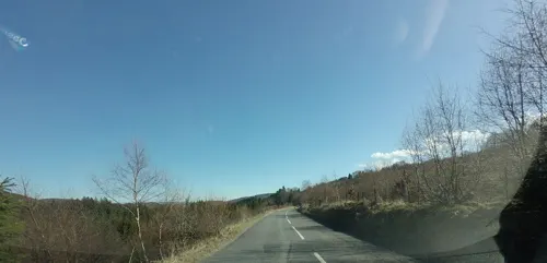
Falls of the Braan
Waterfall · 1.6 mi
Waterfall in Perth and Kinross, Scotland, UK

Hermitage Bridge
Bridge · 1.2 mi
Footbridge in Perth and Kinross, Scotland

Jubilee Bridge
Bridge · 1.5 mi
Bridge in Perth and Kinross, Scotland, UK, carries the A9 road across River Tay


Gallow Hill
Scenic view · 0.4 mi
Site overlooks Blairgowrie Road where hangings took place.
Craig Wood Hill
Scenic view · 0.6 mi
Highest point of the hill with Craig Wood on its south side
Stanley Hill
Scenic view
A popular place for children play historically. Shiochie's Hill as it was previously known is mentioned in the history of the Battle of Dunkeld
9 more on the map.
Museums and landmarks65
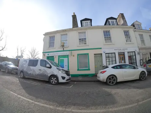
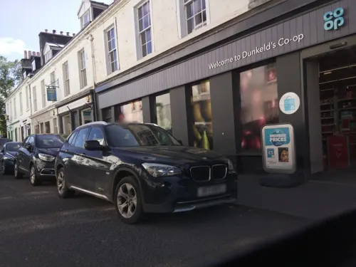
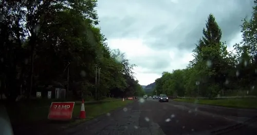

Monument to 6th Duke of Atholl, The Cross, Dunkeld
Monument and historic site
Monument in Perth and Kinross, Scotland, UK
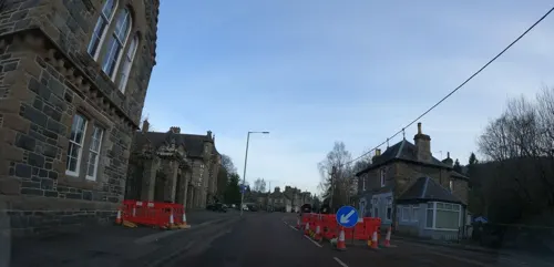
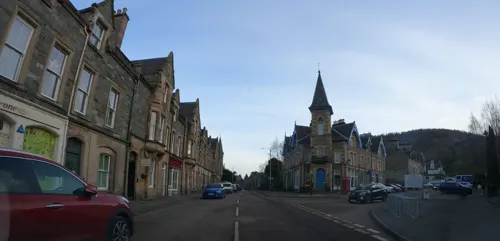



Highland Offroad
Monument and historic site · 0.4 mi
Quadbike and Land Rover experiences outside Dunkeld.
53 more on the map.
Parks, trails and playgrounds16
The Hermitage
Park · 1.4 mi
Park and waterfall in Perth and Kinross, Scotland, UK


4 more on the map.
Restaurants and cafes19
Redwood Wines
Cafe · Regional, Sandwich
Nestled in an old post office, the space evokes the town’s history while looking to the future.
12 Bridge Street, Dunkeld
Tu-Su
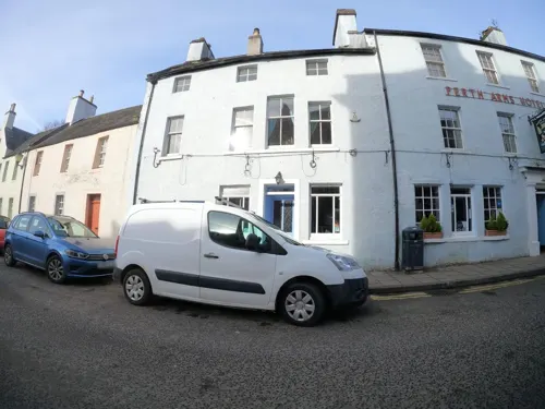
Perth Arms Hotel
Bar and pub
High Street, Dunkeld
Mo,Tu,Th 11:00-23:00, We 15:00-23:00, Fr,Sa 11:00-24:00, Su 12:00-23:00
The Birnam Oak Cafe
Cafe · 0.6 mi
Perth Road, Dunkeld
Mo-Sa 09:30-16:30; Su 10:00-16:00


7 more on the map.
History
The name Dùn Chailleann means Fort of the Caledonii or of the Caledonians. The 'fort' is presumably the hill fort on King's Seat, slightly north of the town (NO 009 430). Both these place-names imply an early importance for the area of the later town and bishop's seat, stretching back into the Iron Age.
Dunkeld (Duncalden and variants in early documents) is said to have been 'founded' or 'built' by Caustantín son of Fergus, king of the Picts (d. 820). This founding likely referred to one of an ecclesiastical nature on a site already of secular importance, and a Pictish monastery is known to have existed on the site. Kenneth I of Scotland (Cináed mac Ailpín) (843–58) is reputed to have brought relics of St Columba from Iona in 849, in order to preserve them from Viking raids, building a new church to replace the existing structures, which may have been constructed as a simple group of wattle huts. The relics were divided in Kenneth's time between Dunkeld and the Columban monastery at Kells, County Meath, Ireland, to preserve them from Viking raids.
Read more of the history
The 'Apostles' Stone', an elaborate but badly worn cross-slab preserved in the cathedral museum, may date to this time. A well-preserved bronze 'Celtic' hand bell, formerly kept in the church of the parish of Little Dunkeld on the south bank of the River Tay opposite Dunkeld, may also survive from the early monastery: a replica is kept in the cathedral museum.
The dedication of the later medieval cathedral was to St Columba. This early church was for a time the chief ecclesiastical site of eastern Scotland (a status yielded in the 10th century to St Andrews). An entry in the Annals of Ulster for 865 refers to the death of Tuathal, son of Artgus, primepscop (Old Irish 'chief bishop') of Fortriu and Abbot of Dunkeld. The monastery was raided in 903 by Danish Vikings sailing up the River Tay, but continued to flourish into the 11th century. At that time, its abbot, Crínán of Dunkeld (d. 1045), married one of the daughters of Máel Coluim mac Cináeda (1005–34) and became the ancestor of later Kings of Scots through their son Donnchad (Duncan I) (1034–40).
The see of Dunkeld was revived by Alexander I (1107–24). Between 1183 and 1189 the newly formed diocese of Argyll was separated from that of Dunkeld, which originally extended to the west coast of Scotland. By 1300 the Bishops of Dunkeld administered a diocese comprising sixty parish churches, a number of them oddly scattered within the sees of St Andrews and Dunblane.
The much-restored cathedral choir, still in use as the parish church, is unaisled and dates to the 13th and 14th centuries. The aisled nave was erected from the early 15th century. The western tower, south porch and chapter house (which houses the cathedral museum) were added between 1450 and 1475. The cathedral was stripped of its rich furnishings after the mid-16th century Reformation and its iconoclasm. The nave and porch have been roofless since the early 17th century. They and the tower in the 21st century are in the care of Historic Environment Scotland.
Below the ceiling vault of the tower ground floor are remnants of pre-Reformation murals showing biblical scenes (c. 1490), one of very few such survivals in Scotland. The clearest to survive is a representation of the Judgement of Solomon. This reflects the medieval use of this space as the Bishop's Court. Within the tower are preserved fragments of stonework associated with the cathedral and the surrounding area, including a Pictish carving of a horseman with a spear and drinking-horn, and a number of medieval grave-monuments.
The cathedral museum is housed in the former chapter house and sacristy, on the north side of the choir. After the Reformation this chamber was used as a burial aisle by the Earls, Marquises and Dukes of Atholl, and contains a number of elaborate monuments of the 17th-early 19th centuries.
Most of the original town was destroyed during the Battle of Dunkeld when, on 21 August 1689, the 26th Foot (Cameronian Regiment), under Lieutenant William Cleland (who died in the clash), successfully fought the Jacobites shortly after the latter's victory at the Battle of Killiecrankie. Holes made by musket-ball strikes during the battle can still be seen in the east gable of the cathedral.
Dr George Smyttan FRSE HEIC (1789-1863) was born and raised in Dunkeld and retained links to Birnam all his life.
The alignment of the town was radically altered in 1809 by the building of a new stone bridge — Dunkeld Bridge — over the River Tay by Thomas Telford at the east end of the town, and the laying out of a new street (Bridge Street–Atholl Street) at right angles to the old alignment.
From the History section of Dunkeld on Wikipedia, under CC BY-SA 4.0.
More about Dunkeld
Arts and culture
Its location on the middle section of the River Tay makes it a hub for salmon and trout angling. A few miles downstream at Caputh, Georgina Ballantine landed the largest salmon ever recorded in Britain.
Dunkeld & Birnam Golf Club is located to the north of Dunkeld and overlooks Loch of the Lowes.
Across the Telford Bridge, the Birnam Highland games take place annually in Little Dunkeld.
From the Wikipedia article Dunkeld, under CC BY-SA 4.0.
Notable people from Dunkeld
 William Cavendish-Bentinck, 6th Duke of PortlandDuke of Portland (1857-1943)Photo: Elliott & Fry, Public domain
- Lord George MurrayBritish bishop (1761-1803)
- James Murray, 1st Baron GlenlyonBritish Army general
- Elizabeth SpenceScottish writer
- Lady Charlotte MurrayScottish botanist, author and artist (1754-1808)
- James MartinScottish philosopher of the Renaissance
- Tom Sinclairfootball player
Born in Dunkeld, according to Wikidata (CC0). Each name links to its Wikipedia article.
Where to stay7
Churches and places of worship5
Shopping11
Gas and EV charging1
Schools, colleges and libraries4
Healthcare2
Map of Dunkeld
151 places. The map loads OpenStreetMap tiles when you open it.
Getting there and nearby towns
Perth Airport (PSL) is the nearest airport with scheduled flights listed in OpenStreetMap, 12 miles away.
- Methven 10 mi south, about 16 min by car
- Perth 13 mi southeast, about 21 min by car
- Invergowrie 21 mi east, about 34 min by car
- Dundee 24 mi east, about 39 min by car
- Falkland 26 mi southeast, about 42 min by car
- Forfar 27 mi east, about 43 min by car
- Ladybank 27 mi southeast, about 43 min by car
- Glenrothes 30 mi southeast, about 48 min by car
- Alloa 32 mi south, about 52 min by car
- Stirling 34 mi southwest, about 54 min by car
Drive times are estimates from straight-line distance, not routes.
Towns near Dunkeld


Keep exploring
Local news
Headlines from INDB.
Reviews, tips and questions
Loading what members have shared...
Sources and licences
- GeoNames (CC BY 4.0): population, coordinates, regions and time zone
- Mapillary (see each image): photos
- OpenStreetMap contributors (ODbL 1.0): places, airports, map data
- Wikidata (CC0 1.0): elevation, founding date, time zone, website, landmarks and historic places
- Wikimedia Commons (see each image): photos
- Wikipedia (CC BY-SA 4.0): overview and history text
Photo credits
- Dunkeld, Bridge Street, Surgery, Victuallers, CC BY-SA 4.0
- Pharmacy, Bridge Street, Dunkeld, Victuallers, CC BY-SA 4.0
- Perth and Kinross Dunkeld 2, PaulT (Gunther Tschuch), CC BY-SA 4.0
- Bishop’s Walk, Dunkeld Cathedral, JeniCorr13, CC0
- Bishop’s Walk, Dunkeld, JeniCorr13, CC0
- 1 Atholl Street, Dunkeld, Victuallers, CC BY-SA 4.0
- COVID-19 notice, Dunkeld Chemist (49675661812), Iain Cameron from Ellon, Scotland, CC BY 2.0
- Dunkeld In Scotland (3), Stevanhogg, CC BY-SA 4.0
- Birnam Institute ca 2003, Grahamstephen, CC BY-SA 3.0
- Dunkeld Bridge, Ammienoot, CC BY-SA 4.0
- Dunkel Cathedral 20090617 choir exterior, Otter, CC BY-SA 3.0
- View of monument of 6th Duke of Atholl from E, Tom Parnell, CC BY-SA 4.0
- Ossian's Hall, The Hermitage, Perth, Rosser1954 Roger Griffith, Public domain
- Ossian's Hall, Perthshire, Rosser1954 Roger Griffith, Public domain
- Birnam Oak, W. L. Tarbert, Public domain
- 2011-06-02 a sun-bathing cat on a bench in Scotland, nina_pic, CC BY 2.0
- Dunkeld, The Hermitage, Black Linn Falls, 01, Daniel Baránek, CC BY-SA 4.0
- Dunkeld, The Hermitage, bridge, 01, Daniel Baránek, CC BY-SA 4.0
- Street-level photo, hobgoblin, CC BY-SA 4.0
- Street-level photo, southglos, CC BY-SA 4.0
- Street-level photo, hobgoblin, CC BY-SA 4.0
- Street-level photo, hobgoblin, CC BY-SA 4.0
- Street-level photo, rudolfmayer, CC BY-SA 4.0
- Street-level photo, hobgoblin, CC BY-SA 4.0
- Street-level photo, tallguy, CC BY-SA 4.0
- Street-level photo, hobgoblin, CC BY-SA 4.0
- Street-level photo, southglos, CC BY-SA 4.0
- Street-level photo, hobgoblin, CC BY-SA 4.0
- Street-level photo, hobgoblin, CC BY-SA 4.0
- Street-level photo, joostjakob, CC BY-SA 4.0
- Street-level photo, joostjakob, CC BY-SA 4.0
- Street-level photo, hobgoblin, CC BY-SA 4.0
- Street-level photo, hobgoblin, CC BY-SA 4.0
- Street-level photo, hobgoblin, CC BY-SA 4.0
- Street-level photo, jjarvis, CC BY-SA 4.0

Page built November 10, 2026. Spotted a mistake? Tell us or suggest a place.