




St Albans, United Kingdom
St Albans is a town of 84,561 people in England, United Kingdom.
Why visit St Albans
Townapedia lists 78 museums and landmarks, 43 parks and trails, 244 places to eat, 13 places to stay and 9 attractions in and around town.
Highlights include The Odyssey Cinema, Southdown Road Skew Bridge, St Alban's Museum + Gallery and St Albans South Signal Box Museum.
Weather in St Albans
Forecast from MET Norway (CC BY 4.0). Full forecast
About St Albans
St Albans is a cathedral city in Hertfordshire, England, east of Hemel Hempstead and west of Hatfield, 20 miles (32 km) north-west of London, 8 miles (13 km) south-west of Welwyn Garden City and 11 miles (18 km) south-east of Luton. St Albans was the first major town on the old Roman road of Watling Street for travellers heading north and became the city of Verulamium. It has a population of 82,146.
From the Wikipedia article St Albans (this version), under CC BY-SA 4.0.
Travel tips from other travellers: St Albans on Wikivoyage (CC BY-SA 4.0).
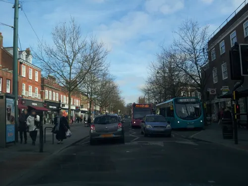
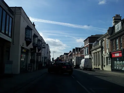
Photos of St Albans


Things to do9
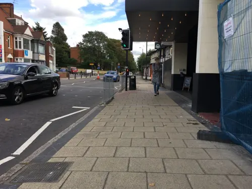

Southdown Road Skew Bridge
Bridge · 4.0 mi
Arch bridge in Harpenden, St. Albans, Hertfordshire, England, UK

The Alban Arena
Cinema and theater
This building is a Talking Building
Civic Centre St Peter's Street, St Albans
Alban Arena
Cinema and theater
Theatre and music venue in St Albans, England

Museums and landmarks78


St Albans South Signal Box Museum
Museum
Ridgmont Road
"Every second Sunday, 2-5pm. Specific Sundays posted 3 months in...

Roman Theatre of Verulamium
Monument and historic site · 1.1 mi
The Roman Theatre of Verulamium is unique. Built in about 140AD it is the only example of its kind in Britain, being a theatre with a...


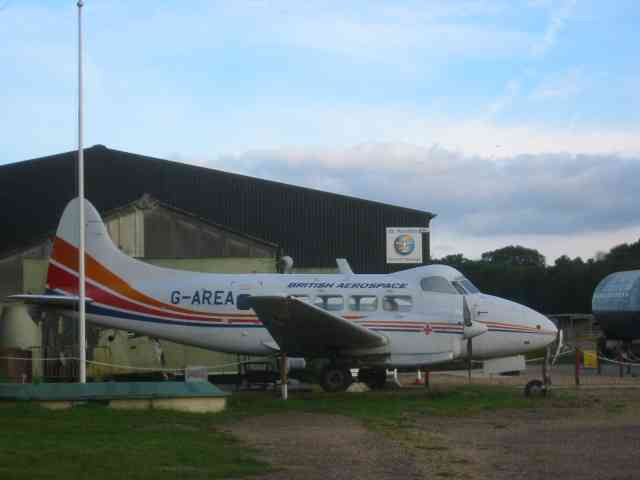
De Havilland Aircraft Museum
Museum · 3.8 mi
Aviation museum in Hertfordshire, United Kingdom

Hypocaust Museum
Museum · 1.0 mi
Museum in the Roman city of Verulamium displaying a mosaic floor heated by a hypocaust

Old Gorhambury House
Museum · 2.6 mi
Country house in St Michael, Hertfordshire, England, UK

Verulamium Museum
Museum · 0.9 mi
Museum in St Albans, United Kingdom
St Michael's Street, St Albans
Mo-Sa 10:00-17:00; Su 14:00-17:00

Beech Bottom Dyke
Monument and historic site · 1.2 mi
Iron Age ditch in St Albans, Hertfordshire, England, UK
66 more on the map.
Parks, trails and playgrounds43

Verulamium Park
Park · 0.8 mi
Park in St Albans, Hertfordshire, England

Broad Colney Lakes
Park · 2.8 mi
Nature reserve in London Colney, Hertfordshire, England, UK


Longspring Wood
Park · 4.3 mi
Small Nature Reserve in Southern England


Watercress Wildlife Site
Park · 0.4 mi
Nature Reserve in St Albans, Hertfordshire, England


Clarence Park, St Albans
Park · 0.4 mi
Sports venue and park in St Albans, UK


31 more on the map.
Restaurants and cafes244

King William IV
Bar and pub · Pub · 1.2 mi
185 Sandridge Road, St Albans
Mo-We, Su 11:00-23:00; Th-Sa 11:00-24:00

Blacksmith's Arms
Bar and pub
56 St Peter's Street, St Albans
Mo-We 10:30-23:00; Th 10:30-00:00; Fr-Sa 10:00-01:00; Su 12:00-23:00
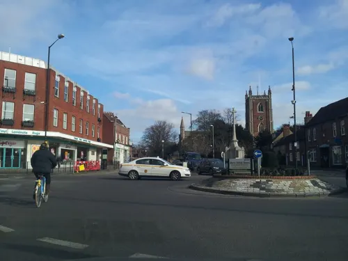
The Beech House
Bar and pub · 0.4 mi
81 St Peter's Street, St Albans
Su-We 08:00-23:00; Th-Sa 08:00-01:00

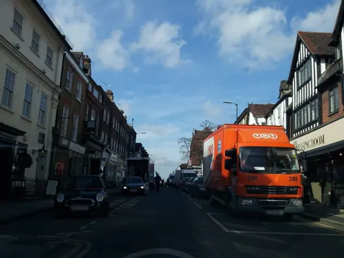
The Peahen
Bar and pub
14 London Road, St Albans
Mo-Tu 09:30-23:00, We-Th 09:30-00:00, Fr-Sa 09:30-01:00, Su 10:00-22:30


The Snug
Bar and pub
1 French Row, St Albans
Mo 12:00-22:00; Tu-We 12:00-23:00; Th 12:00-00:00; Fr 12:00-01:00;...
Waterend Barn
Bar and pub
St Peter's Street, St Albans
Mo-Th 08:00-00:00; Fr-Sa 08:00-01:00; Su 08:00-23:00


232 more on the map.
History
There was an Iron Age settlement known as Verlamion, or Verlamio, near the site of the present city, the centre of Tasciovanus' power and a major centre of the Catuvellauni from about 20 BC until shortly after the Roman invasion of AD 43. The name "Verlamion" is Celtic, meaning "settlement over or by the marsh". The town was on Prae Hill, 2 km (1.2 mi) to the west of modern St Albans, now covered by the village of St Michael's, Verulamium Park and the Gorhambury Estate. Although excavations done in 1996 produced finds which include silver coins from the Roman Republic era dating from 90/80 BC, there was evidence of trade with the Republic and that a settlement already existed on the site 50 years before Julius Caesar attempted to invade Britain. However, it is believed that the tribal capital was moved to the site by Tasciovanus (around 25 to 5 BC). Cunobelinus may have constructed Beech Bottom Dyke, a defensive earthwork near the settlement whose significance is uncertain.
Read more of the history
The Roman city of Verulamium, the second-largest town in Roman Britain after Londinium, developed from the Iron Age settlement and was granted the rank of municipium around AD 50, meaning that its citizens had what were known as "Latin Rights", a lesser citizenship status than a colonia possessed. It grew to a significant town, and as such received the attentions of Boudica of the Iceni in 61, when Verulamium was sacked and burnt on her orders. Excavations preceding the museum's new entrance done in 1996–97 within the centre of the Roman town gave archaeologists the chance to date a black ash layer to 60–65 AD, thus confirming the Roman written record. It grew steadily; by the early 3rd century, it covered an area of about 125 acres (51 ha), behind a deep ditch and wall. Verulamium contained a forum, basilica and a theatre, much of which were damaged during two fires, one in 155 and the other in around 250. These were repaired and continued in use in the 4th century. The theatre was disused by the end of the 4th century. One of the few extant Roman inscriptions in Britain is found on the remnants of the forum (see Verulamium Forum inscription). The town was rebuilt in stone rather than timber at least twice over the next 150 years. Roman occupation ended between 400 and 450 AD.
The body of St Alban was probably buried outside the city walls in a Roman cemetery near the present cathedral. His hillside grave became a place of pilgrimage. Recent investigation has uncovered a basilica there, indicating the oldest continuous site of Christian worship in Great Britain. In 429 Germanus of Auxerre visited the church and subsequently promoted the cult of St Alban.
A few traces of the Roman city remain visible, such as parts of the city walls, a hypocaust – still in situ under a mosaic floor, and the theatre, which is on land belonging to the Earl of Verulam, as well as items in the museum. Further remains beneath nearby agricultural land have only had a few exploratory trenches, which have never been fully excavated and were seriously threatened by deep ploughing, which ceased in 2005 after compensation was agreed. Test trenches in 2003 confirmed that serious damage had occurred to buildings on the northern side of Old Watling Street by deep ploughing. Permission needs to be granted to enable the full extent of the damage to the western half of Verulamium to be investigated.
After the Roman withdrawal the town became the centre of the territory or regio of the Anglo-Saxon Waeclingas tribe.
St Albans Abbey and the associated Anglo-Saxon settlement were founded on the hill outside the Roman city where it was believed St Alban was buried. An archaeological excavation in 1978, directed by Martin Biddle, failed to find Roman remains on the site of the medieval chapter house. As late as the eighth century the Saxon inhabitants of St Albans nearby were aware of their ancient neighbour, which they knew alternatively as Verulamacæstir or, under what H. R. Loyn terms "their own hybrid", Vaeclingscæstir, "the fortress of the followers of Wæcla", possibly a pocket of British-speakers remaining separate in an increasingly Saxonised area.
The medieval town grew on the hill to the east of Wæclingacaester where the Benedictine Abbey of St Albans was founded by Ulsinus in 793. There is some evidence that the original site was higher up the hill than the present building, which was begun in 1077. St Albans Abbey was the principal medieval abbey in England. The scribe Matthew Vickers lived there and the first draft of Magna Carta was drawn up there. It became a parish church after the dissolution of the Benedictine abbey in 1539 and was made a cathedral in 1877.
St Albans School was founded in AD 948. Matthew Paris was educated there and until 2025 it was the only school in the English-speaking world to have educated a Pope (Adrian IV). Now a public school it has, since 1871, occupied a site to the west of the Abbey and includes the 14th-century Abbey Gateway. One of its buildings was a hat factory, a link with the city's industrial past.
On Abbey Mill Lane, the road between the Abbey and the school, are the palaces of the Bishops of St Albans and Hertford and Ye Olde Fighting Cocks, claimed to be the oldest pub in England.
Between 1403 and 1412 Thomas Wolvey was engaged to build a clock tower in the Market Place. It is the only extant medieval town belfry in England. The original bell, named for the Archangel Gabriel sounds F-natural and weighs one ton. Gabriel sounded at 4 am for the Angelus and at 8 or 9 pm for the curfew. The ground floor of the tower was a shop until the 20th century. The first- and second-floor rooms were designed as living chambers. The shop and the first floor were connected by a flight of spiral stairs. Another flight rises the whole height of the tower by 93 narrow steps and gave access to the living chamber, the clock and the bell without disturbing the tenant of the shop.
From the History section of St Albans on Wikipedia, under CC BY-SA 4.0.
More about St Albans
Geography
St Albans has an oceanic climate (Köppen climate classification Cfb) similar to most of the United Kingdom.
Other nearby towns: Borehamwood, Luton, Stevenage, Berkhamsted, Barnet (historically a separate town, part of Greater London since the 1960s)
Nearby villages: Abbots Langley, Kings Langley, Bricket Wood, Colney Heath, Elstree, Frogmore, Lemsford, London Colney, Markyate, Park Street, Radlett, Redbourn, Sandridge, Wheathampstead, Shenley
Arts and culture
St Albans has a cultural life, with regular concerts and theatre productions held at venues including Trestle Arts Base, St Albans Abbey, The Horn, The Pioneer Club, Maltings Arts Theatre, the Alban Arena, the Abbey Theatre, St Peter's Church and St Saviour's Church, given by organisations including St Albans Bach Choir, St Albans Cathedral Choir, St Albans Cathedral Girls' Choir, St Albans Symphony Orchestra, St Albans Chamber Choir, St Albans Chamber Opera, The Company of Ten, St Albans Choral Society, and St Albans Organ Theatre. St Albans is also home to Trestle Theatre Company, who have been creating professional, physical storytelling theatre since 1981. Originally known for their work with masks, Trestle collaborates with UK and international artists to unify movement, music and text into a theatrical experience. The Sandpit Theatre is a theatre attached to Sandringham School which hosts plays throughout the year, mainly performances put on by the pupils of Sandringham School. The school also hosts Best Theatre Arts, a part-time theatre school for children aged 4 to 16. Furthermore, St Albans is home to many music acts such as Enter Shikari, Friendly Fires, Maximum Love, The Zombies, Trash Boat, G.I. Orange, and Your Demise.
Education
St Albans has many state primary and secondary schools, and a number of independent schools.
The law school of the University of Hertfordshire used to be based in Hatfield Road in St Albans until it moved to the university's De Havilland campus in Hatfield in 2011. Hertfordshire County Council purchased the site. The interior of the former law school building has since been refurbished and now forms part of Alban City School, a state-funded Free School for primary aged children, which started taking reception class children in September 2012.
A campus of Oaklands College, a further education college, is also located in Smallford in St Albans.
From the Wikipedia article St Albans, under CC BY-SA 4.0.
Notable people from St Albans
 Adam LallanaEnglish association football playerPhoto: PANNATHORN SUKMANONT, CC BY-SA 2.0
 Tim RiceBritish lyricist and authorPhoto: Thecharmschool, CC BY-SA 4.0
 Sarah Churchill, Duchess of MarlboroughBritish duchess (1660-1744)Photo: Charles Jervas, Public domain
 Mike NewellBritish director and producer (born 1942)Photo: BrokenSphere, CC BY-SA 3.0
 John BallEnglish rebel and priest (1338-1381)Photo: Unknown medieval artist illustrating..., Public domain
 Michael MorpurgoBritish children's writerPhoto: Georges Seguin ( Okki ), CC BY-SA 3.0
 Tim SherwoodEnglish footballer and manager (born 1969)Photo: Brian Minkoff-London Pixels, CC BY-SA 4.0
 Ian WatsonBritish science fiction writer (born 1943)Photo: Salvatore Capalbi from Italy, CC BY-SA 2.0
 Esmé BiancoBritish actressPhoto: Rabbitstalk, CC BY-SA 4.0
- Adrian IVPope from 1154 to 1159
- Jane HawkingBritish author
- John Mandevilleputative author of the 14th-century travel book, The Travels of Sir John Mandeville (1300–1372)
Born in St Albans, according to Wikidata (CC0). Each name links to its Wikipedia article.
Where to stay13
The Samuel Ryder Hotel St. Albans, Tapestry Collection by Hilton
Motel and hotel
27 Holywell Hill, St Albans
Churches and places of worship48
Shopping47
Gas and EV charging10
Schools, colleges and libraries59
St Michael's Church of England Primary School
School · Anglican · 1.0 mi
St Michael's Street, St Albans
Park Street Church of England Voluntary Aided Primary School
School · Anglican · 2.1 mi
Branch Road, St Albans
The Abbey Church of England Voluntary Aided Primary School
School · Anglican · 0.4 mi
Grove Road, St Albans
Healthcare19
Map of St Albans
250 places. The map loads OpenStreetMap tiles when you open it.
Getting there and nearby towns
London Luton Airport (LTN) is the nearest airport with scheduled flights listed in OpenStreetMap, 9 miles away.
- Harpenden 5 mi north, about 8 min by car
- Welwyn Garden City 6 mi northeast, about 10 min by car
- Watford 7 mi south, about 11 min by car
- Bushey 7 mi south, about 12 min by car
- Potters Bar 8 mi southeast, about 12 min by car
- Codicote 8 mi northeast, about 13 min by car
- Barnet 9 mi southeast, about 14 min by car
- Hadley Wood 9 mi southeast, about 15 min by car
- Luton 10 mi north, about 16 min by car
- Rickmansworth 10 mi southwest, about 16 min by car
Drive times are estimates from straight-line distance, not routes.
Towns near St Albans


Keep exploring
Local news
Headlines from INDB.
Reviews, tips and questions
Loading what members have shared...
Sources and licences
- GeoNames (CC BY 4.0): population, coordinates, regions and time zone
- Mapillary (see each image): photos
- OpenStreetMap contributors (ODbL 1.0): places, airports, map data
- Wikidata (CC0 1.0): elevation, founding date, time zone, website, landmarks and historic places
- Wikimedia Commons (see each image): photos
- Wikipedia (CC BY-SA 4.0): overview and history text
Photo credits
- StAlbansCathedral-PS02, Przemysław Sakrajda, CC BY-SA 3.0
- Railway Bridge Harpenden, Alistairirvine, CC BY-SA 3.0
- Verulamium Roman Theatre 2, Rob Hinkley, CC BY-SA 2.0
- De Havilland Aircraft Museum Hertfordshire, Jack Hill, CC BY-SA 2.0
- At Verulamium 2025 021, Photograph by Mike Peel ( www.mikepeel.net )., CC BY-SA 4.0
- Old-Gorhambury-House-20051002-034, Gary Houston, CC0
- St. Mary's Church, Redbourn 33, Simon Burchell, CC BY-SA 4.0
- St Peter's Church, St Albans, Legis at English Wikipedia, Public domain
- St Albans Cathedral Exterior from west, Herfordshire, UK - Diliff, Diliff, CC BY-SA 3.0
- 20040409-003-abbey-gateway, Gary Houston Ghouston 19:20, 5 February 2006 (UTC), CC0
- St Albans Clock Tower, Richard Gillin derivative work: MrPanyGoff, CC BY-SA 2.0
- The Grange, St Albans, December 2021, No Swan So Fine, CC BY-SA 4.0
- St Michael's Manor Hotel, Mupeman, CC BY-SA 4.0
- White-Hart-20031026-005, Gary Houston, CC0
- Cock-St-Albans-20040801-005, Gary Houston, CC0
- St Albans signal box, Matthew Black from London, UK, CC BY-SA 2.0
- St Michael's Church of England Primary School, St Albans, April 2024, No Swan So Fine, CC BY-SA 4.0
- 11 London Road, St Albans, August 2021, No Swan So Fine, CC BY-SA 4.0
- Fleur-de-Lys-St-Albans-20040913-001, Gary Houston, CC0
- Blacksmiths Arms St. Albans 01, Philafrenzy, CC BY-SA 4.0
- King-William-IV-St-Albans-20050920-004, Gary Houston, CC0
- Church of SS Alban and Stephen, St. Alban's, GualdimG, CC BY-SA 4.0
- Colney Heath Local Nature Reserve 7, Dudley Miles, CC BY-SA 4.0
- River Ver in Watercress Wildlife Site, Dudley Miles, CC BY-SA 4.0
- Broad Colney Lakes 5, Dudley Miles, CC BY-SA 4.0
- Wheathampstead LNR 2, Dudley Miles, CC BY-SA 4.0
- The Wick LNR 2, Dudley Miles, CC BY-SA 4.0
- Longspring Wood 5, Dudley Miles, CC BY-SA 4.0
- Mammatus formation clouds, Ian Glover, CC BY-SA 3.0
- Rosie Garland, Stella Wisdom, CC BY-SA 4.0
- St-Albans-Museum-and-Gallery, Acediscovery, CC BY 4.0
- Verulamium-Park-lake-20040313-002, Gary Houston, CC0
- Street-level photo, gness, CC BY-SA 4.0
- Street-level photo, adam2, CC BY-SA 4.0
- Street-level photo, adam2, CC BY-SA 4.0
- Street-level photo, adam2, CC BY-SA 4.0
- Street-level photo, adam2, CC BY-SA 4.0
- Street-level photo, adam2, CC BY-SA 4.0
- Street-level photo, adam2, CC BY-SA 4.0
- Street-level photo, adam2, CC BY-SA 4.0
- Street-level photo, adam2, CC BY-SA 4.0
- Street-level photo, adam2, CC BY-SA 4.0
- Street-level photo, adam2, CC BY-SA 4.0
- Street-level photo, adam2, CC BY-SA 4.0
- Street-level photo, adam2, CC BY-SA 4.0
- Street-level photo, adam2, CC BY-SA 4.0
- Street-level photo, adam2, CC BY-SA 4.0
- Street-level photo, adam2, CC BY-SA 4.0
- Street-level photo, zymurgic, CC BY-SA 4.0
- Street-level photo, adam2, CC BY-SA 4.0
- Street-level photo, adam2, CC BY-SA 4.0
- Street-level photo, adam2, CC BY-SA 4.0


Page built November 10, 2026. Spotted a mistake? Tell us or suggest a place.