


Why visit Eccles
Townapedia lists 16 museums and landmarks, 23 parks and trails, 184 places to eat, 8 places to stay and 16 attractions in and around town.
Highlights include Albert Bridge, Broughton Suspension Bridge, Imperial War Museum North and Latticework Viaducts, Castlefield.
Weather in Eccles
Forecast from MET Norway (CC BY 4.0). Full forecast
About Eccles
Eccles () is a market town in the City of Salford in Greater Manchester, England,
From the Wikipedia article Eccles, Greater Manchester (this version), under CC BY-SA 4.0.
Photos of Eccles


Things to do16

Albert Bridge
Bridge · 3.3 mi
Bridge in Greater Manchester, United Kingdom


Clifton Aqueduct
Bridge · 3.1 mi
Grade II listed bridge in the United Kingdom

Clifton Viaduct
Bridge · 3.1 mi
Grade II listed bridge in Greater Manchester, England, UK

Granada Studios Tour
Monument and historic site · 3.1 mi
Former theme park in Manchester, UK

Manchester Opera House
Cinema and theater · 3.4 mi
Theater in Quay Street, Manchester, England

Media City Footbridge
Bridge · 1.6 mi
Footbridge over the Manchester Ship Canal in the UK

River Irwell Railway bridge
Bridge · 3.0 mi
Grade I listed railway bridge in Manchester and Salford, England


The Lowry
Cinema and theater · 1.8 mi
Arts centre and museum in Salford, England, United Kingdom

Trinity Bridge
Bridge · 3.4 mi
Footbridge in Greater Manchester, United Kingdom
4 more on the map.
Museums and landmarks16

Imperial War Museum North
Museum · 1.7 mi
Military museum in Manchester, England
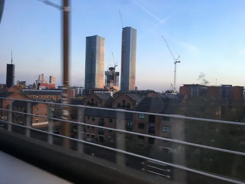
Latticework Viaducts, Castlefield
Monument and historic site · 3.1 mi
Railway viaduct in Manchester, Greater Manchester, England, UK

Manchester Liverpool Road railway station
Monument and historic site · 3.1 mi
Former railway station in Manchester, England

Ordsall Hall
Museum · 2.5 mi
Grade I listed English country house museum in Ordsall, Greater Manchester, United Kingdom

People's History Museum
Museum · 3.3 mi
Grade II listed history museum in Manchester, England, United Kingdom

Science and Industry Museum
Museum · 3.2 mi
Museum in Manchester, England, UK

Lancashire Mining Museum
Museum · 1.3 mi
Mining museum in Greater Manchester, United Kingdom
Salford Museum and Art Gallery
Museum · 2.5 mi
Art museum in Salford, Greater Manchester, United Kingdom

Eccles Community Art Gallery
Museum
Https://www.ecclescommunityartgallery.co.uk/
Unit 4 Boothway, Manchester
St Catherine's, Barton Upon Irwell
Monument and historic site · Anglican · 1.1 mi
4 more on the map.
Parks, trails and playgrounds23
Buile Hill Park
Park · 1.1 mi
Park in Seedley, Salford, Greater Manchester, England, UK

Drinkwater Park
Park · 3.0 mi
Park in Prestwich, Greater Manchester, UK

Longford Park
Park · 3.0 mi
Park in Stretford, Greater Manchester, England, United Kingdom

Peel Park
Park · 2.6 mi
Urban park in Salford, Greater Manchester, England, UK




11 more on the map.
Restaurants and cafes184
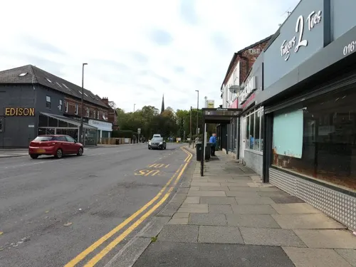

The Waterside
Restaurant · International · 1.2 mi
1 Parrin Lane, Monton
Tu-Th 12:00-21:00; Fr 12:00-21:30; Sa 09:30-11:00,12:00-21:30; Su...

Chiu's Fish and Chips
Restaurant · Chinese · 1.1 mi
323 Liverpool Road, Manchester
Tu-Su 17:00-23:00
Las Iguanas
Restaurant · Latin American · 1.4 mi
Mo-Th 11:00-21:30; Fr-Sa 11:00-22:00; Su 11:00-20:30
Popchop Curry House
Restaurant · Asian, Hong Kongese · 1.1 mi
325 Liverpool Road, Manchester
We-Su 17:00-21:00

The Bluebell
Bar and pub · 1.0 mi
Monton Green, Salford
Mo-Th 09:00-23:00, Fr-Sa 09:00-12:00, Su 09:00-23:00
The Little Chippy
Restaurant · Fish And Chips · 0.7 mi
194 Trafford Road, Salford
Tu-Th 11:30-19:30; Fr 11:30-20:30; Sa 11:30-19:00
Grindsmith
Cafe · Coffee Shop · 1.5 mi
The Garage, Salford
Mo-Fr 07:30-18:00, Sa 09:00-18:00, Su 09:00-17:00
172 more on the map.
History
The derivation of the name is uncertain, but two suggestions have been proposed. The received one is that the Eccles place-name is derived from the Romano-British Ecles or Eglys (eglwys in Welsh means 'church'), which in turn is derived from the Ancient Greek ecclesia via the Latin. Following the arrival in AD 613 of the invading Anglo-Saxons in Lancashire, many existing British place-names, especially rivers and hills (the River Irwell for example), survived intact. The root Ecles, found in several village names, could be an example of this. So, the suggestion is that the word denoted the site of a building, or a ruin featuring the landscape, which was recognised by the Anglo-Saxons as a church. Eccles would then have been a village founded around one such, and so Ecles may be the likely source of the modern name. In Kenyon's Origins of Lancashire (1991), however, the author casts doubt on the further suggestion that native British Church administration survived into Anglo-Saxon times, as there is not an exact correlation between Eccles place-names and pre-Domesday hundreds in south Lancashire.
An alternative etymology is derived from that known to belong to Eccles in Kent, recorded as "Aiglessa" in the Domesday Book of 1086 and so conclusively deriving from the Old English (pre 7th century) æc-læas meaning 'oak pasture'.
Read more of the history
Pre-historic finds in the parish of Eccles include dugout boats found at Barton upon Irwell, an arrowhead, a spear and axes at Winton, which taken together appear to suggest the existence of a hunting and travelling society. Human habitation in the area may extend as far back as 6000 BC, with two separate periods of settlement on Chat Moss, the first around 500 BC and the second during the Romano-British period.
The village may have been founded by refugees from Manchester (Mamucium) during the Diocletianic Persecution in the early 4th century, although excavations in 2001–2005 revealed that the civilian settlement at Manchester had probably been abandoned by the mid-3rd century. Throughout the Dark Ages the parish appears to have been remote enough to be untouched by any local conflicts, while absorbing successive waves of immigrants from nearby towns.
The Manor of Barton upon Irwell once covered a large area; in 1276 it included townships such as Asphull, Halghton, Halliwelle, Farnword, Eccles, Workedele, Withington (latterly Winton), Irwelham, Hulm, Quicklewicke, Suynhul and Swinton. Before this date it would appear to have been even larger, but by 1320 the manor boundaries were described as "Tordhale Siche descending to Caldebroc, then to the pit near Preste Platteforde and then to another pit, then to the ditch of Roger the Clerk, then to the hedge of Richard the Rimeur, then following the hedge to Caldebroc." The manor was originally controlled by the Barton family until about 1292 when by marriage it came into the ownership of the Booth family, who retained it for almost 300 years. In 1586 the Trafford family assumed control of the manor, and established themselves in 1632 at Whittleswick, which was renamed Trafford Park.
The parish of Eccles contained the townships of Barton upon Irwell, Clifton, Pendlebury, Pendleton and Worsley. Toward the end of the Middle Ages the parish had an estimated population of about 4,000 Communicants. Agriculture remained an important local industry, with little change from the Medieval system due to a lack of adequate drainage and fertiliser. No evidence exists to demonstrate the layout of the area, but it would likely have been the same as the surrounding areas of Salford, Urmston and Warrington where oats and barley would have been grown. Local cottage industries included blacksmiths, butchers, thatching, basket weaving, skinning and tanning. Weaving was popular, using linen and wool;merchants traded in corn; badgers bought and sold local produce.
Although the local gentry supported the Royalists, the English Civil War had little effect on the area. Troops would occasionally pass through the parish and there was a skirmish at Woolden, but the only other mention of local involvement was the burial of two (probably) local soldiers in 1643. The Jacobite army passed through in 1745, in its advance and subsequent retreat.
The agriculture of the parish is chiefly confined to grazing, and would be more materially benefited by draining; but the tax upon brick, a most essential article in this process, has been a very great hindrance to it. The use of lime—imported from Wales, and brought by the inland navigations to the neighbourhood of our collieries—has become very general in the improvement of the meadow and pasture lands.
During the 18th century the predominance of textiles in the region is partly demonstrated in the parish registers of 1807, which show that 46 children were baptised with 34 fathers employed as weavers. In Memoirs of seventy years of an eventful life (1852) Charles Hulbert wrote:
The principal employment of the working population of Eccles and vicinity at that time, was the manufacture of Cotton Goods on the home or domestic plan. These were not then, according to my present recollection, more than two Spinning Manufactories in Manchester, Arkwright's with its loft chimney, and Douglas's extensive Works, on the River Irwell, near the Broken bank ... At the period of my first residence in Eccles Parish, I believe the above Mills chiefly supplied the Weavers of Eccles and other parishes with twist for warps, which were purchased by the Master Manufacturers.
From the History section of Eccles, Greater Manchester on Wikipedia, under CC BY-SA 4.0.
More about Eccles
Geography
Eccles is 3.7 miles (6 km) west of Manchester, on the north bank of the Manchester Ship Canal. The area is along a gentle slope from 160 feet (49 m) above sea level to the north, to 60 feet (18 m) above sea at the south, near the Irwell. The underlying geology is made up of New Red Sandstone and pebble beds. The coal measures of the Lancashire coalfield extend south to Monton and Winton. On the surface deposits of clay and loose sands are prevalent throughout the area, along with vegetable moulds formed by rotted vegetation from the previous ice age. These areas have, when drained, provided fertile soil for local agriculture, benefited by the 19th century practice of dumping nightsoil from nearby Manchester.
Parts of the area are within an indicated floodplain. Eccles' climate is generally temperate, like that of the rest of Greater Manchester. The mean highest and lowest temperatures (13.2 °C (55.8 °F) and 6.4 °C (43.5 °F)) are slightly above the national average, while the annual rainfall (806.6 millimetres (31.76 in)) and average hours of sunshine (1394.5 hours) are respectively above and below the national averages.
Economy
To the east of the town centre, the West One retail park was opened in November 2001 at a cost of £53m. It is in competition with the nearby Trafford Centre and Lowry Outlet Mall, and as a result has suffered a loss of trade. Most of its units were abandoned but following the decision by Tesco to scrap plans for a £30m Tesco Extra store in 2013 a number of new openings have improved the retail offering; The Range, Home Bargains, Smyths Toys Superstores., PureGym and Jollyes Petfood Superstore. A Morrisons supermarket is near the town centre. One of the UK's largest online lighting retailers Value lights, is also located in an 80,000 square foot distribution centre in the centre of Eccles.
Arts and culture
Eccles is perhaps best known for the Eccles cake. Dating from the 18th century, they were first sold from a shop owned by James Birch in 1793. Traditionally made in the town from a recipe of flaky pastry, butter, nutmeg, candied peel, sugar and currants, they are sold across the country and exported across the world. They are sometimes referred to as "dead fly pies".
Eccles Wakes (a holiday to celebrate the dedication of the Parish Church) were celebrated annually until 1877, when the tradition was abolished by the Home Secretary. The Wakes were held over three days, beginning on the first Sunday after 25 August.
Education
One of the early schools in Eccles was the 18th century day school in the parish of St. Mary's, south of the Irwell on the de Trafford estate. A Catholic Sunday school was opened in Eccles during the 19th century, in a building in Back Timothy Street (now the location of Eccles Library). Another day school was also opened in cottages on Barton Lane. The first substantial school in the area however was opened in 1851 along Church Street. A boys' school was opened in 1888.
St Patrick's RC High School is currently the best-performing secondary school in Salford, with one of the highest scores in England. The Eccles area contains a number of primary and secondary schools, including (but not limited to) St. Mary's R.C. Primary School, Branwood Preparatory School, New Park High School and Monton Green Primary School.
Eccles College is a further-education college. It opened in 1973 and provides a wide range of A-level and vocational course for school-leavers.
From the Wikipedia article Eccles, Greater Manchester, under CC BY-SA 4.0.
Notable people from Eccles
 Benedict WongBritish actorPhoto: Peter Guenzel, CC BY-SA 4.0
 Danny SimpsonEnglish association football player (born 1987)Photo: Peter Woodentop, CC BY-SA 2.0
 Sarah StoreyBritish swimmer, track and road cyclistPhoto: Albinfo, CC BY-SA 4.0
 George WaringEnglish actorPhoto: Geoffrey waring, CC BY-SA 4.0
- Sydney ChapmanBritish mathematician and geophysicist (1888–1970)
- Linzey CockerEnglish actress
- Gustav AlexanderBritish lacrosse player
- Samia LongchambonEnglish television actress
- Alan HenningBritish humanitarian and taxi driver (1967-2014)
- Joseph WolstenholmeBritish mathematician (1829–1891)
- Pooky QuesnelEnglish actress, screenwriter and singer
- Roy CheethamEnglish footballer (1939-2019)
Born in Eccles, according to Wikidata (CC0). Each name links to its Wikipedia article.
Where to stay8
Churches and places of worship34
Eccles Parish, St Mary the Virgin;St Mary The Virgin
Church · Anglican
Greek Orthodox Church of the Annunciation, Manchester
Church · 3.4 mi
Shopping20
Gas and EV charging11
Schools, colleges and libraries33
Holy Cross and All Saints RC Primary School
School · Roman Catholic · 0.9 mi
Trafford Road, Manchester
Healthcare13
Rosamund Street Medical Centre
Clinic and pharmacy · 1.5 mi
Rosamund Street, Weatherfield
Map of Eccles
250 places. The map loads OpenStreetMap tiles when you open it.
Getting there and nearby towns
Manchester Airport (MAN) is the nearest airport with scheduled flights listed in OpenStreetMap, 9 miles away.
- Swinton 1 mi northwest, about 2 min by car
- Salford 2 mi east, about 3 min by car
- Stretford 2 mi south, about 4 min by car
- Urmston 3 mi south, about 4 min by car
- Manchester 4 mi east, about 6 min by car
- Walkden 4 mi northwest, about 6 min by car
- Sale 4 mi south, about 6 min by car
- Prestwich 4 mi northeast, about 6 min by car
- Kearsley 4 mi northwest, about 6 min by car
- Irlam 5 mi southwest, about 7 min by car
Drive times are estimates from straight-line distance, not routes.
Towns near Eccles


Keep exploring
Local news
Headlines from INDB.
Reviews, tips and questions
Loading what members have shared...
Sources and licences
- GeoNames (CC BY 4.0): population, coordinates, regions and time zone
- Mapillary (see each image): photos
- OpenStreetMap contributors (ODbL 1.0): places, airports, map data
- Wikidata (CC0 1.0): elevation, founding date, time zone, website, landmarks and historic places
- Wikimedia Commons (see each image): photos
- Wikipedia (CC BY-SA 4.0): overview and history text
Photo credits
- Eccles old town hall, Parrot of Doom, CC BY-SA 3.0
- Eccles Metrolink station 1, Keith Williamson, CC BY-SA 2.0
- 2766470 e4f6994d, Stephen Richards, CC BY-SA 2.0
- Broughton bridge, Richerman, CC BY-SA 3.0
- Clifton Aqueduct aerial shot, Parrot of Doom, CC BY-SA 4.0
- Clifton viaduct looking north, Parrot of Doom, CC BY-SA 3.0
- Granada Studios, Pit-yacker at English Wikipedia ( Original text: en:User:Pit-yacker ), CC BY-SA 2.5
- Opera House (Manchester), Tim Green from Bradford, CC BY 2.0
- Salford quays swing bridge, Parrot of Doom, CC BY-SA 3.0
- River Irwell Railway Bridge, Water Street, Manchester, KJP1, CC BY-SA 3.0
- Salford Quays Manchester, The original uploader was Dpaajones at English Wikipedia ., CC BY-SA 3.0
- Granada Studio Tours, Manchester, 2011, Mikey from Wythenshawe, Manchester, UK, CC BY 2.0
- LowryArtsCentre, Bernard Randall, CC BY-SA 3.0
- N2 Trinity Bridge manchester, Jez Smith from Whitefield, Bury, Gtr. Manchester, United Kingdom, CC BY 2.0
- Imperial War Museum 2008cropped, Imperial_War_Museum_2008.jpg : pit-yacker from UK derivative work: IxK85 ( talk ), CC BY-SA 2.0
- Liverpool Road, The original uploader was Pit-yacker at English Wikipedia ., CC BY-SA 2.0
- Ordsall Hall 2014 01, Photograph by Mike Peel ( www.mikepeel.net )., CC BY-SA 4.0
- PeoplesHistoryMuseum, Bernard Randall, CC BY-SA 3.0
- Science and Industry Museum, Science Museum Group, CC BY-SA 4.0
- Peel Park (1), Marnanel, CC BY-SA 3.0
- Victoria Park, Swinton (8179908674), Craig Sunter from Manchester, UK, CC BY 2.0
- All saints church urmston, Parrot of Doom, CC BY-SA 3.0
- Salford rc Cathedral, The_Cathedral_Church_of_St_John_the_Evangelist,_Chapel_Street,_Salford.jpg : Ian Roberts derivative work: Rabanus Flavus, CC BY-SA 2.0
- Benkid77 St George's Church, Manchester 250709, Rept0n1x, CC BY-SA 3.0
- Trinity Church, Salford, Ian Roberts, CC BY-SA 2.0
- St marys parish church eccles greater manchester, Parrot of Doom, CC BY-SA 3.0
- TraffordCentresat, Photograph: NASA, Public domain
- Main Entrance of The Trafford Centre 05, No more horses, CC0
- Drinkwater Park, User:Richerman, CC BY-SA 3.0
- ECC.1, Zack Hallam, CC BY-SA 4.0
- Entrance to Longford Park Stadium, David Dixon, CC BY-SA 2.0
- Lake View Trafford Ecology Park - panoramio, Darren Lewis, CC BY-SA 3.0
- Brownfield Site by Trafford Golf Centre, Stretford, Anthony Shaw, Public domain
- Monton Green Daffodils (6886352054), Craig Sunter from Manchester, UK, CC BY 2.0
- Street-level photo, spatialphil, CC BY-SA 4.0
- Street-level photo, spatialphil, CC BY-SA 4.0
- Street-level photo, ricorico, CC BY-SA 4.0
- Street-level photo, tonys999, CC BY-SA 4.0
- Street-level photo, tonys999, CC BY-SA 4.0
- Street-level photo, mappo2, CC BY-SA 4.0
- Street-level photo, mappo2, CC BY-SA 4.0
- Street-level photo, southglos, CC BY-SA 4.0
- Street-level photo, tonys999, CC BY-SA 4.0
- Street-level photo, adam2, CC BY-SA 4.0
- Street-level photo, mappo2, CC BY-SA 4.0
- Street-level photo, mappo2, CC BY-SA 4.0
- Street-level photo, tonys999, CC BY-SA 4.0


Page built November 10, 2026. Spotted a mistake? Tell us or suggest a place.