


Prestwich, United Kingdom
Prestwich is a town of 31,500 people in England, United Kingdom.
Why visit Prestwich
Townapedia lists 16 museums and landmarks, 36 parks and trails, 92 places to eat, 2 places to stay and 13 attractions in and around town.
Highlights include Broughton Suspension Bridge, Clifton Aqueduct, Heaton Park Tramway and Manchester Jewish Museum.
Weather in Prestwich
Forecast from MET Norway (CC BY 4.0). Full forecast
About Prestwich
Prestwich is a town in the Metropolitan Borough of Bury, Greater Manchester, England, three miles (five kilometres) north of Manchester, three miles (five kilometres) north of Salford and five miles (eight kilometres) south of Bury.
From the Wikipedia article Prestwich (this version), under CC BY-SA 4.0.
Photos of Prestwich


Things to do13


Clifton Aqueduct
Bridge · 1.4 mi
Grade II listed bridge in the United Kingdom

Clifton Viaduct
Bridge · 1.4 mi
Grade II listed bridge in Greater Manchester, England, UK

Outwood Viaduct
Bridge · 2.6 mi
Grade II listed footbridge in Bury, Greater Manchester, England, UK

Ringley Old Bridge
Bridge · 3.2 mi
Grade II* listed bridge in Bolton, Greater Manchester, England, UK

Victoria Theatre, Salford
Cinema and theater · 3.1 mi
Former theatre in Salford, England

Queen's Park Hippodrome, Harpurhey
Cinema and theater · 3.4 mi
Former theatre in Harpurhey, Manchester, England

Heaton Park Animal Centre
Zoo and aquarium · 1.1 mi
The Animal Centre stands on the site of the 19th century glasshouse range that was demolished in the late 20th century. Animals and...
Mo-Su 10:00-16:00

1 more on the map.
Museums and landmarks16

Heaton Park Tramway
Museum · 1.4 mi
This is where passengers would have waited for a tram home after a day in the park. The service ran from 1905 to 1933. The building is...
Jun-Aug Su,PH 12:00-17:00; Dec-Feb Su,PH 12:00-16:00

Manchester Jewish Museum
Museum · 3.2 mi
Museum in Manchester, England, United Kingdom

Museum of Transport, Greater Manchester
Museum · 2.9 mi
Museum in Greater Manchester, England, United Kingdom

Radcliffe Cenotaph
Monument and historic site · 2.7 mi
War memorial in Bury, Greater Manchester, England, UK

Radcliffe Tower
Monument and historic site · 2.4 mi
Grade I listed fortified house in Radcliffe, Greater Manchester, England, United Kingdom

Heaton Hall & Orangery
Monument and historic site · 1.3 mi
Designed in 1772 for Sir Thomas Egerton by architect James Wyatt. the Hall contains a collection of furniture, paintings and musical...

Lancashire Mining Museum
Museum · 3.1 mi
Mining museum in Greater Manchester, United Kingdom
Salford Museum and Art Gallery
Museum · 3.4 mi
Art museum in Salford, Greater Manchester, United Kingdom

Colonnade from Manchester Town Hall
Monument and historic site · 1.1 mi
Originally built at the front of the Old Town Hall in King Street in 1824, the Town Hall Colonnade was moved here in 1912.
Old Stone Sculpture
Monument and historic site · 1.2 mi
Presented by Robert Barnes Esquire in 1859
The Temple
Monument and historic site · 1.4 mi
James Wyatt designed the Temple as an interesting eye-catching feature. It may have been used by Sir Thomas Egerton as an observatory.
4 more on the map.
Parks, trails and playgrounds36

Heaton Park
Park · 1.2 mi
Heaton Park is one of the great 18th century landscape parks of North West England and one of the biggest municipal parks in Europe. It...
sunrise-sunset

Drinkwater Park
Park · 1.1 mi
Park in Prestwich, Greater Manchester, UK

Boggart Hole Clough
Park · 3.3 mi
Park in Manchester, Greater Manchester, UK
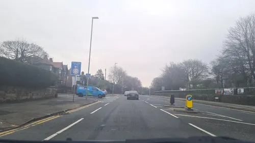
Buile Hill Park
Park · 3.1 mi
Park in Seedley, Salford, Greater Manchester, England, UK

Clifton Country Park
Park · 2.6 mi
Nature reserve in Greater Manchester, England

Peel Park
Park · 3.2 mi
Urban park in Salford, Greater Manchester, England, UK



Philips Park
Park · 1.0 mi
Area of parkland in Prestwich, Greater Manchester, UK
Crumpsall Park
Park · 2.4 mi
Park in Manchester, Greater Manchester, England
24 more on the map.
Restaurants and cafes92
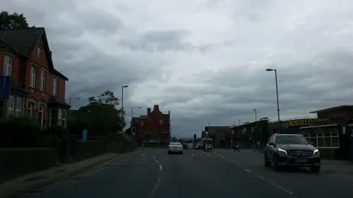
8 Manchester
Restaurant · Chinese · 1.3 mi
260 Bury New Road, Whitefield
Mo-Th 17:00-22:30; Fr 17:00-23:00; Su 12:30-21:30
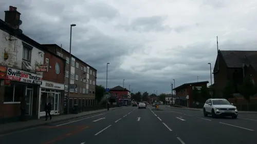
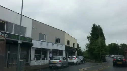


Noshers
Cafe · Coffee Shop · 1.2 mi
84 Kings Road
Mo-Fr,Su 08:00-21:00

Bakers Heaven
Bakery · 1.4 mi
75 Windsor Road
Mo-We 08:00-17:00; Th 08:00-23:00; Fr 08:00-15:00
80 more on the map.
History
Bury New Road roughly follows the line of a Roman road connecting forts at Mamucium (Manchester) and Bremetennacum (Ribchester). It is possible that a Roman fort or encampment was built at "Castle Hill", near the Salford border, mirroring an encampment on Rainsough Hill equidistant from the Roman road. John Booker B.A., 19th century author and curate of the parish church, considered these were agrarian camps built to protect cattle kept in the woods of Broughton and Kersal. The camp was "just to the right of the old road to Bury, immediately beyond Singleton Brook, on the first field in the Parish of Prestwich, which was formerly known as Lowcaster". Roman coins have been found off Bury New Road, near Prestwich Golf Course and some in Prestwich Clough.
Read more of the history
A hoard of 65 silver coins from the reign of King Stephen was found in the Sedgley Park area in 1972. The Prestwich manor emerged in the Middle Ages and in 1212 was assessed as four oxgang of land held by Adam de Prestwich whose father, Robert held it in 1193. The lord of the manor held the advowson for the church. Another Adam de Prestwich settled the manors of Prestwich, Alkrington and Pendlebury on his son John in 1297 but remarried and in 1313 settled the same manors on Thomas de Prestwich, his son by second wife. Thomas de Prestwich had daughters, Margaret who became a nun at Seaton Priory in 1360, but left the convent to marry Robert de Holland, and Agnes who married John de Radcliffe but died childless in 1362. Thomas de Prestwich granted his manors to Richard de Radcliffe for life and after that the manor was held by Richard de Langley. In 1371 Robert de Holland claimed the manor as the right of his wife. Roger de Langley was a minor and ward of the Duke of Lancaster in 1372 when Robert de Holland and a troop of armed men took possession of the manor by force and retained it until 1389. The Langleys regained the manor after 1403.
After Sir Robert Langley's death in 1561 the manor passed to his daughter Margaret, who married John Reddish. Their granddaughter Sarah married Clement Coke and the manor descended in the Coke family, until 1777, when Thomas William Coke, Coke of Norfolk, a leader in the agricultural revolution sold the land in Prestwich to increase his Norfolk estates. The manor was acquired by Peter Drinkwater of Irwell House in 1794 and it descended to his son Thomas who died in 1861. Irwell House and Drinkwater Park was sold to Salford Corporation and Prestwich Council. In 1561 other lands went to Sir Robert's other daughters. Polefield, on higher ground to the north of Prestwich, became a separate estate, with Polefield Hall coming in the 19th century to the Earls of Wilton.
In the hearth tax of 1666 there were 97 hearths in the township, the rector's house was the largest with ten. In the 17th and 18th centuries local government was based on the parish structure. The lord of the manor administered land tenure and inheritance, but law and order was kept by parish constables assisted by the church wardens. The local justices sat in the "Star Chamber" in the Ostrich Inn, now the Church Inn, close to the parish church where the justices' seat can still be seen. The village had stocks which remained in use until 1800.
The settlement grew to serve the parish church making Church Lane the historic centre. In the late 18th century the area was mainly rural with scattered farms and small settlements grew at Great and Little Heaton. The population was estimated at 670. Rooden Lane which became part of Bury Old Road was a centre for hand loom weaving and at Simister and neighbouring Bowlee, silk weaving was established. During the 19th century another settlement grew around the junction of Fairfax Road and Bury New Road along with another village centre on Bury Old Road. The area between these centres remained rural, however, the arrival of the railway in 1881 encouraged affluent merchants from Manchester to build villas and move to the town.
Prestwich Hospital was built as an asylum in 1851 and by 1900 it had grown into the largest asylum in Europe. Sedgley Park Teacher Training College was established in Prestwich after the Faithful Companions of Jesus bought a house to accommodate it in 1903. When Mike Leigh was a lecturer at the Catholic women teachers' training college Sedgley Park he devised and directed two big-cast projects for the Manchester Youth Theatre: Big Basil and Glum Victoria and the Lad with Specs. The National Archives holds records relating to the college.
By 1912 the population had increased to 12,800, and from the 1930s onwards the remaining fields were developed and by 1961 the population reached 31,000 and Prestwich had become a suburb of Manchester.
From the History section of Prestwich on Wikipedia, under CC BY-SA 4.0.
More about Prestwich
Geography
Prestwich lies to the east of the River Irwell and is bounded on the north by Whitefield, on the east by Heaton Park, to the west by the Prestwich Forest Park and the Irwell Valley (Agecroft and Clifton) and to the south by the City of Salford. The two main north–south roads passing from central Manchester to Bury, Bury New Road (A56) and Bury Old Road, traverse the district.
The geology of the area is characterised by carboniferous coal measures of the Manchester Coalfield and sandstone appertaining to the Carboniferous Westphalian C geological age. This is overlain with quaternary glacial drift comprising sand, gravel and boulder clay.
Economy
The high street of Prestwich is centred around the Longfield Centre. The centre, which includes the now-closed Longfield Suite, local library and NHS drop-in centre, is due to be "regenerated" with £100m worth of development work starting in 2024. According to the Sunday Times, the area is an "interesting mix of old and new", with various more upmarket bars and restaurants alongside traditional venues. Many of the local pubs are run by Joseph Holt, and the brewery's first cask ale festival was hosted in the Woodthorpe pub in 2023.
In the Sedgley Park area, there are a number of kosher restaurants and delis.
Prestwich is now considered to be an affluent area and has been called the "Didsbury of North Manchester".
Arts and culture
The Prestwich and Whitefield Guide and The Bury Times are sold in the locality. The Jewish Telegraph is produced and printed in Prestwich.
The Longfield Centre civic hall, which previously had one of the largest sprung floor ballrooms in the north-west of England, was permanently closed in 2021.
There are several private members' clubs in the town, including Prestwich Church Institute, the Carlton Club, and two political clubs – Prestwich Conservative Club and Prestwich Liberal Club.
Education
Prestwich has four secondary schools: The Heys School, St Monica's High School, Parrenthorn High School and Manchester Mesivta School. Two of these are faith schools, with St Monica's being Catholic and Mesivta Jewish. St Monica's featured a Sixth Form centre offering vocational courses from 2011 but the centre was closed down in 2017, so for both A-level and vocational studies the nearest tertiary education providers are both in Bury, Holy Cross College and Bury College.
From the Wikipedia article Prestwich, under CC BY-SA 4.0.
Notable people from Prestwich
 Victoria WoodBritish comedian (1953–2016)Photo: MAG (Mines Advisory Group), CC BY 2.0
 Kevin GodleyBritish musician and music video directorPhoto: Klaus Hiltscher, CC BY-SA 2.0
 Lol CremeBritish musicianPhoto: Klaus Hitscher, CC BY-SA 2.0
 Abbie McManusEnglish football player (born 1993)Photo: James Boyes from UK, CC BY-SA 2.0
 Ivan LewisBritish politician (born 1967)Photo: Chris McAndrew, CC BY 3.0
 Julie StevensBritish actress (1936–2024)Photo: Steve Berry, CC BY-SA 2.0
 Thomas Bayley PotterBritish politician (1817–1898)Photo: Ardfern, CC BY-SA 4.0
- John Aston, Sr.English footballer (1921-2003)
- Marc TierneyBritish footballer (born 1985)
- George Albinsonassociation football player (1897-1975)
- Harold CrawshawFootballer (1912-1975)
- Arlene PhillipsBritish choreographer
Born in Prestwich, according to Wikidata (CC0). Each name links to its Wikipedia article.
Where to stay2
Churches and places of worship42
Greek Orthodox Church of the Annunciation, Manchester
Church · 2.1 mi
Shopping14
Gas and EV charging6
Schools, colleges and libraries23
St Mary's Church of England Aided Primary School, Prestwich
School · Anglican
Rectory Lane, Manchester
Healthcare7
Whitefield Pharmacy
Clinic and pharmacy · 1.3 mi
Unit 3, Ribble Sq Ribble Drive, Whitefield, Manchester
Prestwich Hospital (Edenfield Centre)
Hospital · 0.8 mi
Tottington Lane, Manchester
Map of Prestwich
250 places. The map loads OpenStreetMap tiles when you open it.
Getting there and nearby towns
Manchester Airport (MAN) is the nearest airport with scheduled flights listed in OpenStreetMap, 12 miles away.
- Whitefield 1 mi northwest, about 2 min by car
- Salford 3 mi south, about 5 min by car
- Manchester 4 mi southeast, about 7 min by car
- Swinton 4 mi southwest, about 6 min by car
- Oldham 7 mi east, about 11 min by car
- Bolton 7 mi northwest, about 11 min by car
- Royton 7 mi east, about 11 min by car
- Ramsbottom 8 mi north, about 13 min by car
- Stockport 10 mi southeast, about 16 min by car
- Stalybridge 10 mi east, about 16 min by car
Drive times are estimates from straight-line distance, not routes.
Towns near Prestwich


Keep exploring
Local news
Headlines from INDB.
Reviews, tips and questions
Loading what members have shared...
Sources and licences
- GeoNames (CC BY 4.0): population, coordinates, regions and time zone
- Mapillary (see each image): photos
- OpenStreetMap contributors (ODbL 1.0): places, airports, map data
- Wikidata (CC0 1.0): elevation, founding date, time zone, website, landmarks and historic places
- Wikimedia Commons (see each image): photos
- Wikipedia (CC BY-SA 4.0): overview and history text
Photo credits
- Prestwich Book Festival- Booked Up- Emma Jane Unsworth, Miss Emma Gibbs, CC BY-SA 2.0
- Two trams at Prestwich Metrolink station, Dr Neil Clifton, CC BY-SA 2.0
- Prestwich, St Mary's Church, Iain Peacock, CC BY-SA 2.0
- Broughton bridge, Richerman, CC BY-SA 3.0
- Clifton Aqueduct aerial shot, Parrot of Doom, CC BY-SA 4.0
- Clifton viaduct looking north, Parrot of Doom, CC BY-SA 3.0
- Outwood viaduct from river irwell, Parrot of Doom, CC BY-SA 4.0
- Ringley old bridge, Parrot of Doom, CC BY-SA 3.0
- Former Victoria Theatre, Salford, Barrie Price, CC BY-SA 4.0
- Jewish museum, Richerman, CC BY-SA 3.0
- Museum of Transport in Manchester, Mikey from Wythenshawe, Manchester, UK, CC BY 2.0
- Radcliffe cenotaph, Ingy the Wingy, CC BY-SA 2.0
- Radcliffe tower hdr, Parrot of Doom, CC BY-SA 3.0
- Manchester Town Hall Colonade, Pimlico Badger, CC BY-SA 2.0
- Boggart hole clough, Boggart hole clough Park and woodland, CC BY-SA 4.0
- Peel Park (1), Marnanel, CC BY-SA 3.0
- Victoria Park, Swinton (8179908674), Craig Sunter from Manchester, UK, CC BY 2.0
- All Saints Church, Whitefield, David Ingham from Bury, Greater Manchester, England, CC BY-SA 2.0
- Parish Church of St Mary, Radcliffe, Alexander P Kapp, CC BY-SA 2.0
- Kersal Moor, Richerman at English Wikipedia, Public domain
- St Monica's RC High School Main Enterance, Dopespawed, CC BY-SA 3.0
- Heaton Hall 01, Stephen McKay, CC BY-SA 2.0
- Moor Lane, Jonny Keen, CC BY-SA 4.0
- Irwell Sculpture Trail Lookout, Parrot of Doom, Public domain
- Drinkwater Park, User:Richerman, CC BY-SA 3.0
- The Peninsula Stadium at night - Salford City - Aug 24, Emessem T, CC BY-SA 4.0
- 1 Friday morning (49707822151), Dave Morton, Public domain
- 2 Ghost village (49707821386), Dave Morton, Public domain
- 3 Iceland (49707821356), Dave Morton, Public domain
- Brush Car 623, Heaton Park tramway, Firing up the quattro.... from Manchester, UK, CC BY 2.0
- Street-level photo, lvl5, CC BY-SA 4.0
- Street-level photo, adam2, CC BY-SA 4.0
- Street-level photo, adam2, CC BY-SA 4.0
- Street-level photo, adam2, CC BY-SA 4.0
- Street-level photo, adam2, CC BY-SA 4.0
- Street-level photo, adam2, CC BY-SA 4.0
- Street-level photo, adam2, CC BY-SA 4.0
- Street-level photo, adam2, CC BY-SA 4.0
- Street-level photo, adam2, CC BY-SA 4.0
- Street-level photo, adam2, CC BY-SA 4.0
- Street-level photo, mappo2, CC BY-SA 4.0
- Street-level photo, adam2, CC BY-SA 4.0
- Street-level photo, adam2, CC BY-SA 4.0
- Street-level photo, adam2, CC BY-SA 4.0


Page built November 10, 2026. Spotted a mistake? Tell us or suggest a place.