


Why visit Elswick
Townapedia lists 10 places to eat, 6 places to stay and 2 attractions in and around town.
Highlights include Cartford Bridge.
Weather in Elswick
Forecast from MET Norway (CC BY 4.0). Full forecast
About Elswick
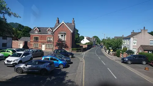
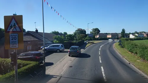
Elswick is a rural village and civil parish on the Fylde peninsula of Lancashire, England. Population estimates for 2024 were 1,151.
From the Wikipedia article Elswick, Lancashire (this version), under CC BY-SA 4.0.
Things to do2

Restaurants and cafes10
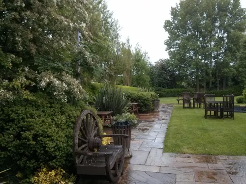
The White Bull
Bar and pub · 1.2 mi
The Square, Preston
Mo-Tu 12:00-22:30; We-Sa 12:00-23:00; Su 12:00-21:00


Where to stay6

Churches and places of worship6

Christ Church
Church · 3.3 mi
Church in Wesham, in the English District of Lancashire, England, UK
St Michael's Church
Church · 3.0 mi
Grade I listed church in St Michael's on Wyre, Lancashire, England, UK

St Anne's Church
Church · 2.2 mi
Church in Singleton, Lancashire, England, UK
History
Elswick was listed in the Domesday Book of 1086 as Edeleswic. In later documents it was recorded variously as Etleswhic, Etheliswyck and Elleswyk. At the time of the Norman Conquest of England in 1066, the township of Elswick—as part of the ancient hundred of Amounderness—was in the possession of Earl Tostig, the brother of King Harold II. Tostig died at the Battle of Stamford Bridge and his lands were subsequently taken over by the Normans. Between 1069 and 1086 William the Conqueror gave Amounderness to Anglo-Norman baron Roger the Poitevin. In the Domesday Book, the area of Elswick was estimated at three carucates of land.
In the 13th century, part of the township of Elswick was owned by the lord of Freckleton, and smaller parts by Warine de Whittingham and Alan de Singleton. In the early 16th century, Henry VII's administrator Edmund Dudley held the township and it was later in the possession of Thomas Stanley, 2nd Earl of Derby.
Read more of the history
Elswick was part of the Ecclesiastical parish of St Michael's on Wyre and Elswick's villagers would have worshipped at St Michael's Church, approximately 5 miles (8 km) away. By 1650 a chapel had been built in the village which at that point was recorded as containing 50 families. It was intended to be a chapel of ease to St Michael's but was neither endowed nor consecrated, possibly because of the turmoil of the English Civil War. The chapel was licensed in 1671 for use as a Nonconformists' meeting place and used initially by Presbyterian worshippers. When this licence was made illegal, the chapel closed and later reopened as a Congregational chapel. In 1753, it was replaced by a new building, which was enlarged in 1838. This in turn was replaced by a chapel built 1873–74 by H. J. Powell, on land given by a Miss Harrison.
In 1902, a sanatorium for smallpox sufferers was built in the village. It was later a treatment centre for tuberculosis patients and then a probation hostel. It is now a private residence.
Between 1951 and 1956 just off the Roseacre Road between Elswick and Roseacre was the site of a VHF fixer station, part of the RAF Western Sector, and was one of a number similar fixed sites managed by nearby RAF Longley Lane. The site contained an octagonal wooden hut with a hand steerable radio mast with two radio receivers of type R1392D,[5] transmitter and telephone line. This hut was protected by a close surrounding octagonal brick wall to provide some bomb blast protection. The station was used to allow each sector to locate RAF or allied aircraft and to help pilots find airfield runways in low cloud weather conditions. The site had three RAF wireless personnel (two were normally on duty) who were billeted in Elswick village. The site closed in around 1956 as the technology was replaced by improved systems.
From the History section of Elswick, Lancashire on Wikipedia, under CC BY-SA 4.0.
More about Elswick
Geography
At 53°50′20″N 2°52′50″W (53.839°, −2.880°), and approximately 240 miles (390 km) north-west of London, Elswick lies on a coastal plain called the Fylde. It is approximately 8.5 miles (14 km) east of the seaside resort of Blackpool, approximately 7 miles (11 km) south-east of Poulton-le-Fylde and about 12 miles (19 km) north-west of its post town, Preston. Nearby villages include Great Eccleston, St Michael's on Wyre and Thistleton.
Elswick has a generally temperate maritime climate like much of the British Isles, with cool summers and mild winters. In nearby Blackpool, there is an annual average rainfall of 871.3 millimetres (34.30 in).
Economy
Historically, Elswick has largely been a rural agricultural community. In the 11th century it had the largest amount of cultivated land in the parish of St Michael. There was also a cottage weaving industry in the village up to the 19th century with villagers weaving flax and then cotton on hand looms. In the 21st century, Elswick is a dormitory village and many residents commute to Preston, Blackpool and Poulton-le-Fylde. The average distance travelled to work for the ward of Elswick and Little Eccleston is approximately 12.4 miles (20.0 km).
In 2001, compared to the rest of the Fylde borough, Elswick had a low proportion of unemployed people, and a low proportion of people in NRS social grade "E" (those at the lowest levels of subsistence). The percentage of unemployed people in the Elswick and Little Eccleston ward was lower than the averages for North West England and England as a whole, although slightly higher than the average for Fylde. There is a higher percentage of self-employed workers in Elswick and Little Eccleston than in Fylde, North West England and England as a whole.
From the Wikipedia article Elswick, Lancashire, under CC BY-SA 4.0.
Schools, colleges and libraries2
St Mary's Catholic Primary School, Great Eccleston
School · Roman Catholic · 1.1 mi
St Mary's Road, Preston
Healthcare1
Map of Elswick
27 places. The map loads OpenStreetMap tiles when you open it.
Getting there and nearby towns
Warton Aerodrome (WRT) is the nearest airport with scheduled flights listed in OpenStreetMap, 6 miles away.
- Great Eccleston 1 mi northeast, about 2 min by car
- Fylde 1 mi west, about 2 min by car
- Poulton-le-Fylde 4 mi west, about 7 min by car
- Wrea Green 4 mi south, about 7 min by car
- Thornton-Cleveleys 6 mi northwest, about 10 min by car
- Warton 6 mi south, about 10 min by car
- Blackpool 7 mi west, about 11 min by car
- Cleveleys 7 mi northwest, about 11 min by car
- Lytham St Annes 8 mi southwest, about 13 min by car
- Preston 9 mi southeast, about 14 min by car
Drive times are estimates from straight-line distance, not routes.
Towns near Elswick


Keep exploring
Local news
Headlines from INDB.
Reviews, tips and questions
Loading what members have shared...
Sources and licences
- GeoNames (CC BY 4.0): population, coordinates, regions and time zone
- Mapillary (see each image): photos
- OpenStreetMap contributors (ODbL 1.0): places, airports, map data
- Wikidata (CC0 1.0): elevation, founding date, time zone, website, landmarks and historic places
- Wikimedia Commons (see each image): photos
- Wikipedia (CC BY-SA 4.0): overview and history text
Photo credits
- Cartford Bridge 2018, Ian Capper, CC BY-SA 2.0
- Christ Church, Wesham, Martin Evans, CC BY-SA 2.0
- Street-level photo, skifans, CC BY-SA 4.0
- Street-level photo, skifans, CC BY-SA 4.0
- Street-level photo, skifans, CC BY-SA 4.0
- Street-level photo, skifans, CC BY-SA 4.0
- Street-level photo, emr, CC BY-SA 4.0
- Street-level photo, skifans, CC BY-SA 4.0
- Street-level photo, emr, CC BY-SA 4.0
Page built November 10, 2026. Spotted a mistake? Tell us or suggest a place.