


Great Eccleston, United Kingdom
Great Eccleston is a town of 1,657 people in England, United Kingdom.
Why visit Great Eccleston
Townapedia lists 11 places to eat, 9 places to stay and 1 attraction in and around town.
Highlights include Cartford Bridge.
Weather in Great Eccleston
Forecast from MET Norway (CC BY 4.0). Full forecast
About Great Eccleston
Great Eccleston is a village and civil parish in Lancashire, England. The village, part of the Fylde coast plain, lies to the south of the River Wyre and the A586 road, approximately 10 miles (16 km) upstream from Fleetwood. At the 2001 census, the parish had a population of 1,473, rising slightly to 1,486 at the 2011 census. It increased again in 2021 Census to 1,773.
From the Wikipedia article Great Eccleston (this version), under CC BY-SA 4.0.
Things to do1

Restaurants and cafes11



Where to stay9

Churches and places of worship5
St Michael's Church
Church · 2.2 mi
Grade I listed church in St Michael's on Wyre, Lancashire, England, UK

St Anne's Church
Church · 2.9 mi
Church in Singleton, Lancashire, England, UK
History
Great Eccleston was listed in the Domesday Book of 1086 as Eglestun. In various 13th-century documents it was recorded as Ecclisto, Ecleston and Great Eccleston. In 1066 when the Normans conquered England, the township of Great Eccleston—then part of the ancient hundred of Amounderness—was in the possession of Tostig Godwinson, the brother of King Harold II. Tostig died at the Battle of Stamford Bridge and his lands were subsequently taken over by the Normans. Between 1069 and 1086 William the Conqueror gave Amounderness to Roger de Poitou, an Anglo-Norman baron. In the Domesday Book, the area of Great Eccleston was estimated at two carucates (ploughlands) of land.
The township was originally part of the ecclesiastical parish of St Michael's on Wyre and Great Eccleston's parishioners would have worshipped there at St Michael's Church. In 1723, a chapel of ease to St Michael's was built in a part of Great Eccleston civil parish called Copp. It was dedicated to St Anne.
From the History section of Great Eccleston on Wikipedia, under CC BY-SA 4.0.
More about Great Eccleston
Geography
At 53°51′18″N 2°52′15.6″W (53.855°, −2.871°), Great Eccleston lies 10 miles (16 km) north-east of Blackpool, approximately 6 miles (10 km) south-east of Poulton-le-Fylde and about 12 miles (19 km) north-west of Preston. Nearby villages include Little Eccleston, Elswick, St Michael's on Wyre and Singleton.
The Fylde Coastal Plain is relatively flat and low–lying, predominantly below 30 m (100 feet) above sea–level, but there is a small knoll called Whitprick Hill roughly halfway between Weston on the B5260 and Wesham that rises to 45 m (148 feet) above sea–level.
Arts and culture
A farmers' market is held in Great Eccleston every month. A weekly general market takes place each week.
The Great Eccleston Agricultural Show is held in the village over two days every July along with Tractor Pulling, which also sees an event held in its own right at the same show ground during the August bank holiday. Horse, steam and agricultural shows have been held in Great Eccleston since the mid-19th century. Like many similar rural events, the Great Eccleston Show waned in popularity and ceased to take place in the 1950s; it was reinstated in 1972. Up to 40,000 people were expected to attend the 2011 show. Displays typically feature livestock, horticulture, country crafts, local produce and agricultural vehicles.
From the Wikipedia article Great Eccleston, under CC BY-SA 4.0.
Schools, colleges and libraries2
Healthcare1
Map of Great Eccleston
29 places. The map loads OpenStreetMap tiles when you open it.
Getting there and nearby towns
Warton Aerodrome (WRT) is the nearest airport with scheduled flights listed in OpenStreetMap, 7 miles away.
- Fylde 2 mi southwest, about 4 min by car
- Poulton-le-Fylde 5 mi west, about 8 min by car
- Thornton-Cleveleys 6 mi west, about 10 min by car
- Wrea Green 6 mi south, about 9 min by car
- Cleveleys 7 mi west, about 11 min by car
- Warton 7 mi south, about 12 min by car
- Blackpool 8 mi west, about 12 min by car
- Fleetwood 8 mi northwest, about 12 min by car
- Preston 9 mi southeast, about 15 min by car
- Lytham St Annes 9 mi southwest, about 15 min by car
Drive times are estimates from straight-line distance, not routes.
Towns near Great Eccleston


Keep exploring
Local news
Headlines from INDB.
Reviews, tips and questions
Loading what members have shared...
Sources and licences
- GeoNames (CC BY 4.0): population, coordinates, regions and time zone
- Mapillary (see each image): photos
- OpenStreetMap contributors (ODbL 1.0): places, airports, map data
- Wikidata (CC0 1.0): elevation, founding date, time zone, website, landmarks and historic places
- Wikimedia Commons (see each image): photos
- Wikipedia (CC BY-SA 4.0): overview and history text
Photo credits
- Western house on southern side of The Square, Great Eccleston, Peter James, CC BY-SA 4.0
- Ferraris Restaurant formerly Willow Cottage, Great Eccleston, Peter James, CC BY-SA 4.0
- Pinfold, Great Eccleston, Peter James, CC BY-SA 4.0
- Cartford Bridge 2018, Ian Capper, CC BY-SA 2.0
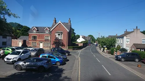
- Street-level photo, skifans, CC BY-SA 4.0
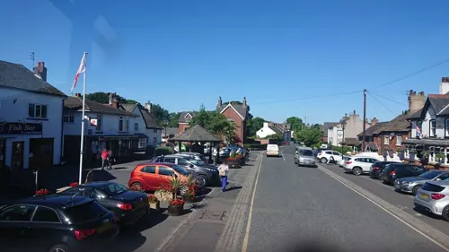
- Street-level photo, skifans, CC BY-SA 4.0
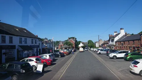
- Street-level photo, skifans, CC BY-SA 4.0
- Street-level photo, skifans, CC BY-SA 4.0
- Street-level photo, skifans, CC BY-SA 4.0
- Street-level photo, emr, CC BY-SA 4.0
Page built November 10, 2026. Spotted a mistake? Tell us or suggest a place.