


Wrea Green, United Kingdom
Wrea Green is a town of 1,373 people in England, United Kingdom.
Why visit Wrea Green
Townapedia lists 2 museums and landmarks, 17 places to eat, 3 places to stay and 1 attraction in and around town.
Highlights include Lytham Hall.
Weather in Wrea Green
Forecast from MET Norway (CC BY 4.0). Full forecast
About Wrea Green
Wrea Green is a village in the Fylde borough of Lancashire, England. It lies about 2 miles (3.2 km) west of Kirkham. Along with the village of Ribby, it forms the civil parish Ribby-with-Wrea.
From the Wikipedia article Wrea Green (this version), under CC BY-SA 4.0.
Travel tips from other travellers: Wrea Green on Wikivoyage (CC BY-SA 4.0).
Things to do1

Museums and landmarks2

Lytham Hall
Museum · 3.4 mi
Grade I listed English country house and museum in Lancashire, England, UK

Restaurants and cafes17
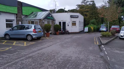

New Fiortune House
Restaurant · Chinese · 1.5 mi
We,Th,Su,Mo 17:00-23:00; Fr,Sa 17:00-23:30


5 more on the map.
Where to stay3


History
A part of the village of Wrea Green existed at the time of the Domesday Book, with the name of Rigbi.
Between 1846 and 1961, the village was served by Wrea Green railway station. In 1897 Wrea Green suffered a plague of sparrows and the Parish Council agreed to pay a halfpenny for every sparrow, sparrow's egg or rat's tail that was collected.
The property at the northern end of Church Row was for many years the office of J. Wareing & Son, a long established farm-building construction company but before this was a sub-branch of the District Bank.
The village surrounds the largest village green in Lancashire, at one side of which is a duck pond, known locally as 'The Dub'.
From the History section of Wrea Green on Wikipedia, under CC BY-SA 4.0.
More about Wrea Green
Education
The school (Ribby-with-Wrea Endowed C.E.) was founded by James Thistleton in 1693. A second school was founded by Nicholas Sharples in 1715. The two trusts were united in 1750. It moved to the current site in 1845, when the church of St Nicholas replaced the Sharples school. The present building, now a primary school, dates from 1893 though it has been expanded.
From the Wikipedia article Wrea Green, under CC BY-SA 4.0.
Churches and places of worship10
Schools, colleges and libraries8
Medlar-with-Wesham Church of England Primary School
School · Anglican · 1.5 mi
Garstang Road, Preston
Healthcare1
Map of Wrea Green
42 places. The map loads OpenStreetMap tiles when you open it.
Getting there and nearby towns
Warton Aerodrome (WRT) is the nearest airport with scheduled flights listed in OpenStreetMap, 2 miles away.
- Fylde 4 mi north, about 6 min by car
- Lytham St Annes 4 mi southwest, about 7 min by car
- Poulton-le-Fylde 5 mi northwest, about 8 min by car
- Blackpool 6 mi northwest, about 10 min by car
- Thornton-Cleveleys 8 mi northwest, about 13 min by car
- Preston 9 mi east, about 14 min by car
- Cleveleys 9 mi northwest, about 14 min by car
- Southport 10 mi southwest, about 16 min by car
- Leyland 11 mi southeast, about 17 min by car
- Fleetwood 11 mi north, about 18 min by car
Drive times are estimates from straight-line distance, not routes.
Towns near Wrea Green


Keep exploring
Local news
Headlines from INDB.
Reviews, tips and questions
Loading what members have shared...
Sources and licences
- GeoNames (CC BY 4.0): population, coordinates, regions and time zone
- Mapillary (see each image): photos
- OpenStreetMap contributors (ODbL 1.0): places, airports, map data
- Wikidata (CC0 1.0): elevation, founding date, time zone, website, landmarks and historic places
- Wikimedia Commons (see each image): photos
- Wikipedia (CC BY-SA 4.0): overview and history text
Photo credits
- Lytham Hall - panoramio, Michael D Beckwith, CC BY 3.0
- Christ Church, Wesham, Martin Evans, CC BY-SA 2.0
- Church, Lytham - DSC07150, Rept0n1x, CC BY-SA 3.0
- Weeton Church, Martin Evans, CC BY-SA 2.0
- St John The Evangelist Church, Mike (KingOfRedArts) Worswick, CC BY-SA 4.0
- Street-level photo, tonys999, CC BY-SA 4.0
- Street-level photo, tonys999, CC BY-SA 4.0
- Street-level photo, tonys999, CC BY-SA 4.0
- Street-level photo, julianlb, CC BY-SA 4.0
Page built November 10, 2026. Spotted a mistake? Tell us or suggest a place.