



Why visit Emneth
Townapedia lists 3 museums and landmarks, 4 places to eat, 1 place to stay and 2 attractions in and around town.
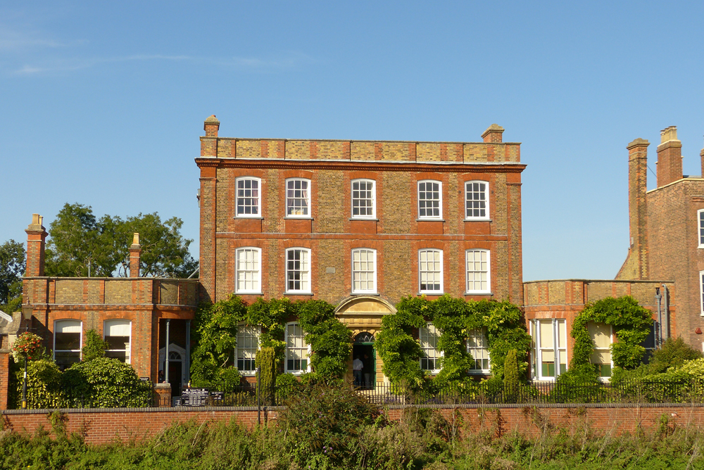
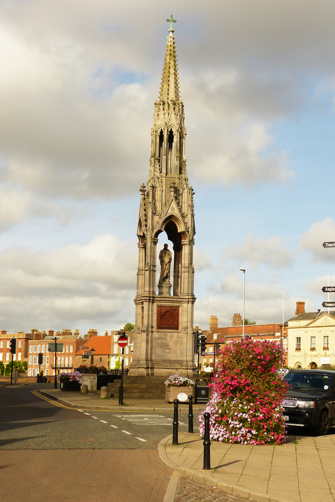
Highlights include Angles Theatre, Clarkson Memorial and Peckover House and Garden.
Weather in Emneth
Forecast from MET Norway (CC BY 4.0). Full forecast
About Emneth
Emneth is a village and civil parish in the English county of Norfolk.
From the Wikipedia article Emneth (this version), under CC BY-SA 4.0.
Things to do2

Angles Theatre
Cinema and theater · 2.6 mi
Theatre in Wisbech, Cambridgeshire, England, UK
Museums and landmarks3

Clarkson Memorial
Monument and historic site · 2.6 mi
Monument in Wisbech, United Kingdom

Peckover House and Garden
Museum · 2.7 mi
Historic house museum in Wisbech, Cambridgeshire, England, UK

Wisbech and Fenland Museum
Museum · 2.5 mi
Museum in Cambridgeshire, England, United Kingdom
Restaurants and cafes4
China Rose
Restaurant · 1.4 mi
106 Elm High Road, Wisbech
Tu-Su 16:30-22:00


Where to stay1
History
Emneth's name is of Anglo-Saxon origin and derives from the Old English for Eana's meeting place or meadow.
Emneth is not featured in the Domesday Book of 1086, probably because in the late-Eleventh Century this area of Norfolk was still flooded.
Emneth was the site of Hagbeach Hall, a medieval manor house demolished in 1887.
Emneth Railway Station opened in 1848 as a stop on the Bramley Line between Watlington and Peterborough railway station. The station closed in 1968 as a result of the Beeching cuts, however, the railway infrastructure still remains as a private residence. Today, the nearest railway station is at Downham Market for the Fen Line between King's Lynn and Peterborough.
From the History section of Emneth on Wikipedia, under CC BY-SA 4.0.
More about Emneth
Geography
According to the 2021 census, Emneth has a population of 2,879 people which shows an increase from the 2,617 people listed in the 2011 census. The parish of Emneth also includes the smaller hamlets of Emneth Hungate and Holly End.
Emneth is bisected by the A47, between Birmingham and Lowestoft, and is close to the course of the River Nene.
From the Wikipedia article Emneth, under CC BY-SA 4.0.
Churches and places of worship3
Shopping1
Schools, colleges and libraries1
Map of Emneth
15 places. The map loads OpenStreetMap tiles when you open it.
Getting there and nearby towns
RAF Marham (KNF) is the nearest airport with scheduled flights listed in OpenStreetMap, 14 miles away.
- Wisbech 3 mi northwest, about 4 min by car
- West Walton 4 mi north, about 7 min by car
- Downham Market 8 mi east, about 12 min by car
- March 8 mi southwest, about 13 min by car
- Clenchwarton 10 mi northeast, about 16 min by car
- King's Lynn 11 mi northeast, about 17 min by car
- Fleet 12 mi northwest, about 20 min by car
- Thorney 13 mi west, about 22 min by car
- Chatteris 14 mi southwest, about 23 min by car
- North Wootton 14 mi northeast, about 22 min by car
Drive times are estimates from straight-line distance, not routes.
Towns near Emneth


Keep exploring
Local news
Headlines from INDB.
Reviews, tips and questions
Loading what members have shared...
Sources and licences
- GeoNames (CC BY 4.0): population, coordinates, regions and time zone
- Mapillary (see each image): photos
- OpenStreetMap contributors (ODbL 1.0): places, airports, map data
- Wikidata (CC0 1.0): elevation, founding date, time zone, website, landmarks and historic places
- Wikimedia Commons (see each image): photos
- Wikipedia (CC BY-SA 4.0): overview and history text
Photo credits
- Angles Theatre, Wisbech, Bearas, CC BY-SA 4.0
- Peckover-house-wisbech, Theyellowtulip, CC BY-SA 3.0
- Šv. Petro bažnyčia Visbičas (Wisbech), Bearas, CC BY-SA 4.0
- St Edmund, Emneth, Norfolk, John Salmon, CC BY-SA 2.0
- Wisbech-clarkson-memorial--, Theyellowtulip, CC BY-SA 3.0
- Street-level photo, adam2, CC BY-SA 4.0
- Street-level photo, adam2, CC BY-SA 4.0
- Street-level photo, adam2, CC BY-SA 4.0
Page built November 10, 2026. Spotted a mistake? Tell us or suggest a place.