


North Wootton, United Kingdom
North Wootton is a town of 2,445 people in England, United Kingdom.
Why visit North Wootton
Townapedia lists 43 museums and landmarks, 38 parks and trails, 144 places to eat, 13 places to stay and 4 attractions in and around town.
Highlights include King's Lynn Arts Centre, Majestic Cinema, Castle Rising and Castle Rising Castle.
Weather in North Wootton
Forecast from MET Norway (CC BY 4.0). Full forecast
About North Wootton
North Wootton is a village, civil parish and electoral ward near the town of King's Lynn in Norfolk, England.
From the Wikipedia article North Wootton, Norfolk (this version), under CC BY-SA 4.0.
Photos of North Wootton


Things to do4
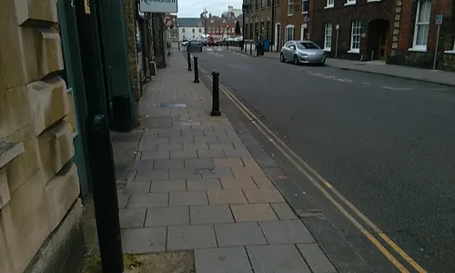
King's Lynn Arts Centre
Cinema and theater · 2.5 mi
Arts centre and theatre in King's Lynn, England, formerly St. George's Guildhall
29 King Street, King's Lynn



Museums and landmarks43

Castle Rising Castle
Monument and historic site · 1.6 mi
Castle in Castle Rising, Norfolk, England, UK

Middleton Mount
Monument and historic site · 4.5 mi
Motte-and-bailey castle in Middleton, King's Lynn and West Norfolk, England, UK

Sandringham House
Museum · 4.6 mi
Royal residence near the village of Sandringham in Norfolk, England, UK

True's Yard Museum
Museum · 2.3 mi
Social history museum in King's Lynn, Norfolk



Red Mount Chapel
Monument and historic site · Catholic · 2.5 mi
2017 May 13-Sep 09 We,Sa,Su 13:00-16:00; 2017 Sep 10 10:00-16:00
31 more on the map.
Parks, trails and playgrounds38

The Walks
Park · 2.5 mi
Park in King's Lynn, Norfolk, England, United Kingdom



26 more on the map.
Restaurants and cafes144
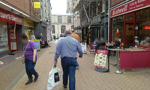
Tipsy Teapot
Restaurant · Burger, Coffee Shop, Sandwich, Chicken, American, Ice Cream · 2.7 mi
Quirky restaurant and Cocktails with upstairs party bar for dancing
9 High Street, King's Lynn
Mo-Th 12:00-23:00; Fr-Sa 12:00-24:00; Su 12:00-18:00
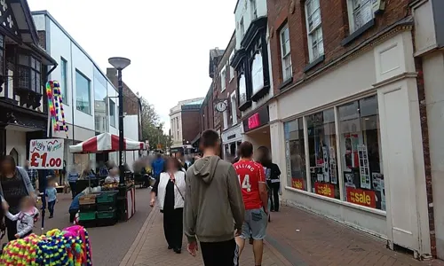

Pearl River
Restaurant · Chinese · 2.3 mi
John Kennedy Road, King's Lynn
Su-Th 12:00-14:00,17:30-23:00; Fr-Sa 12:00-14:00,17:30-23:30

The Sandboy
Bar and pub · 2.8 mi
Quality bar food / Function room / Beer Garden / Play Area / Real Ales
Gayton Road, King's Lynn
Mo-Th 12:00-15:00,17:00-21:00; Fr 12:00-21:00; Sa 12:00-23:00; Su...

Caffè Nero
Cafe · Coffee Shop · 2.5 mi
141 Norfolk Street, King's Lynn
Mo-Sa 07:30-17:30, Su 08:00-17:00
Encore
Bar and pub · 2.4 mi
105 Norfolk Street, King's Lynn
We-Th 17:00-23:00, Fr-Sa 12:00-01:00, Su 12:00-20:00
Ferry Lane Social Club
Bar and pub · 2.6 mi
Ferry Lane, King's Lynn
Th-Sa 12:00-23:00; We 16:00-20:00; Su 12:00-20:00
Nip and Growler Ale House
Bar and pub · 2.5 mi
68 High Street, King's Lynn
Mo-Th 16:00-22:00; Fr,Sa 12:00-23:00; Su 12:00-19:00
132 more on the map.
Where to stay13
Churches and places of worship25
Shopping38
Gas and EV charging7
Schools, colleges and libraries24
Whitefriars Church of England Primary Academy
School · Anglican · 2.9 mi
Whitefriars Road, King's Lynn
Healthcare9
Map of North Wootton
250 places. The map loads OpenStreetMap tiles when you open it.
Getting there and nearby towns
RAF Marham (KNF) is the nearest airport with scheduled flights listed in OpenStreetMap, 11 miles away.
- King's Lynn 3 mi southwest, about 4 min by car
- Clenchwarton 4 mi southwest, about 6 min by car
- Downham Market 12 mi south, about 20 min by car
- West Walton 12 mi southwest, about 20 min by car
- Wisbech 14 mi southwest, about 23 min by car
- Necton 17 mi southeast, about 27 min by car
- Ashill 19 mi southeast, about 31 min by car
- March 22 mi southwest, about 35 min by car
- East Dereham 22 mi east, about 35 min by car
- Boston 23 mi northwest, about 38 min by car
Drive times are estimates from straight-line distance, not routes.
Towns near North Wootton


Keep exploring
Local news
Headlines from INDB.
Reviews, tips and questions
Loading what members have shared...
Sources and licences
- GeoNames (CC BY 4.0): population, coordinates, regions and time zone
- Mapillary (see each image): photos
- OpenStreetMap contributors (ODbL 1.0): places, airports, map data
- Wikidata (CC0 1.0): elevation, founding date, time zone, website, landmarks and historic places
- Wikimedia Commons (see each image): photos
- Wikipedia (CC BY-SA 4.0): overview and history text
Photo credits
- UK North Wootton (Norfolk), Uksignpix, CC BY-SA 3.0
- -2021-05-02 All Saints Drive, North Wootton, Norfolk, David Howard, CC BY-SA 2.0
- Middleton Mount, Martin Pearman, CC BY-SA 2.0
- Sandringham House in Norfolk - aerial image, John Fielding from Norwich, UK, CC BY 2.0
- The Church of St Mary Magdalene, Sandringham, Elliott Brown, CC BY 2.0
- CastleRising-WyrdLight-Wiki, Antony McCallum: Who is the uploader, photographer, full copyright owner and proprietor of WyrdLight.com, CC BY-SA 4.0
- True's Yard King's Lynn, Alienturnedhuman ( talk ), Public domain
- Kings-lynn-cinema, Alienturnedhuman at English Wikipedia, Public domain
- Kings-lynn-greyfriars, Original uploader was Alienturnedhuman at en.wikipedia, Public domain
- King's Lynn, St Nicholas' chapel (32523511143), Jules & Jenny from Lincoln, UK, CC BY 2.0
- All Saints church North Wootton Norfolk (6089949155), David from Colorado Springs, United States, CC BY 2.0
- King's Lynn and West Norfolk - The Church of St John the Evangelist - 20220613151604, FromMorningToMidnight, CC BY-SA 4.0
- CastleRising2-wyrdlight-wiki, Antony McCallum: Who is the uploader, photographer, full copyright owner and proprietor of WyrdLight.com, CC BY-SA 4.0
- Kings-lynn-walks-and-red-mount, Alienturnedhuman at English Wikipedia, Public domain
- -2021-05-02 Mobile communication mast, Nursery Lane, South Wootton, Norfolk, David Howard, CC BY-SA 2.0
- -2021-05-02 South along Nursery Lane, South Wootton, Norfolk, David Howard, CC BY-SA 2.0
- Solar crescents cast by a tree ESA524731, European Space Agency, CC BY-SA 3.0 igo
- Street-level photo, sk53_quint, CC BY-SA 4.0
- Street-level photo, sk53_quint, CC BY-SA 4.0
- Street-level photo, sk53_quint, CC BY-SA 4.0
- Street-level photo, tallguy, CC BY-SA 4.0
- Street-level photo, sk53_quint, CC BY-SA 4.0
- Street-level photo, sk53_quint, CC BY-SA 4.0
- Street-level photo, sk53_quint, CC BY-SA 4.0
- Street-level photo, sk53_quint, CC BY-SA 4.0


Page built November 10, 2026. Spotted a mistake? Tell us or suggest a place.