


Why visit Thorney
Townapedia lists 4 museums and landmarks, 3 parks and trails, 1 place to eat and 1 place to stay in and around town.
Highlights include Thorney Museum, Thorney Abbey and Eye Green Nature Reserve.
Weather in Thorney
Forecast from MET Norway (CC BY 4.0). Full forecast
About Thorney
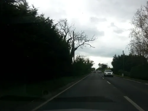
Thorney is a village in the Peterborough unitary authority in the ceremonial county of Cambridgeshire, England. Located around eight miles (13 km) east of Peterborough city centre, on the A47.
From the Wikipedia article Thorney, Cambridgeshire (this version), under CC BY-SA 4.0.
Museums and landmarks4


Parks, trails and playgrounds3


Restaurants and cafes1

Where to stay1
Oversley Lodge Farmhouse Bed and Breakfast
Motel and hotel · 0.8 mi
The Causeway, Peterborough
History
Thorney began as a Saxon settlement in about 500 AD. The existence of Thorney Abbey made the settlement an important ecclesiastical centre, and until 2014 was the most northerly point of the Anglican Diocese of Ely. By 2007 the previous Thorney Abbey church, now the Church of St Mary and St Botolph, was part of the Deanery and Diocese of Peterborough.
Following the Dissolution of the Monasteries the estate became crown property and it was granted to John Russell, 1st Earl of Bedford in 1550. At this time only a few hundred acres of the land was cultivatable. In the 1630s Francis Russell, 4th Earl of Bedford spent a reputed £100,000 draining the fens, bringing almost all of the estate and parish of nearly 18,000 acres (7,284 ha) into agricultural use. A community of Walloon Protestant refugees, originally from areas of Flanders that are now northern France, was settled here in the 17th century with their own church and minister, employing the ruins of the abbey for services in their own language. The Walloons had expertise in fenland drainage. The Russell family's rents from the Thorney estate increased from £300 in 1629 to £10,000 by the early 19th century. The family, whose main seat was at Woburn Abbey in Bedfordshire, occasionally resided at the manor house in Thorney village, which was known as Abbey House. The estate was sold to the tenants in 1910.
Read more of the history
Much of the village was built at the command of the Dukes of Bedford, who wished to have a healthy place in which their estate workers could live. In the mid-19th century many buildings were added to the designs of the architect S.S. Teulon, himself a descendant of Huguenots.
The 7th Duke of Bedford's model agricultural village included a modern water supply and sewerage scheme. The neo-Jacobean Tankyard building, now known as Bedford Hall, included a 96 ft high water tower, erected in 1855, that supplied fresh water to the village. The building houses Thorney Heritage Museum, part of the Greater Fens Museum Partnership.
The windmill on the outskirts dates from 1787 and contains six floors; it originally had six sails. During the war four German prisoners of war used it as a base during the day while working the land.
Thorney railway station was on the old Peterborough to Wisbech line, with an additional station in the parish at Wryde. The station and the line were closed in the early 1960s. Little evidence to suggest a rail link now remains, apart from one set of wooden level crossing gates at the west side of Station Road; these gates are not the original ones, but replicas based on the rotten originals, installed by the developer that built houses on the site of the station yard in the early 2000s. The concrete posts are the originals, however.
On 28 August 1976, a United States Air Force Lockheed C-141 Starlifter, 67–0006, on a flight from McGuire Air Force Base to RAF Mildenhall crashed near the village; the aircraft entered bad weather and the pilots lost control of the aircraft. The accident killed all 18 passengers and crew on board.
A memorial is maintained on Thorney Dyke, for the lost aircrew.
Panavia Tornado ZA605 crashed on Wednesday 10 December 1986. The aircraft had taken off at 6pm for night flying in Scotland and collided at 6.06pm, when turning north. The Tornado hit another Tornado ZA611, which flew back, with part of the wing missing.
The Tornado crossed the A47, and skimmed rooftops, being seen by drivers. Five fire engines attended. The crew went to RAF Hospital Ely.
In 2010, planning permission was given for two wind turbines on land at French Farm, near French Drove in Thorney parish. In 2011 REG WindPower announced plans to install a further four wind turbines at the French Farm site.
As of 2013, other windfarms are proposed at Gores Farm, Willow Hall, Nuts Grove and Wryde Croft.
From the History section of Thorney, Cambridgeshire on Wikipedia, under CC BY-SA 4.0.
Notable people from Thorney
- Jack WatsonBritish actor (1915–1999)
- Agnes CraneBritish palaeontologist and author (1853-1932)
Born in Thorney, according to Wikidata (CC0). Each name links to its Wikipedia article.
Churches and places of worship1
Schools, colleges and libraries3
Map of Thorney
13 places. The map loads OpenStreetMap tiles when you open it.
Getting there and nearby towns
RAF Marham (KNF) is the nearest airport with scheduled flights listed in OpenStreetMap, 28 miles away.
- Whittlesey 4 mi south, about 7 min by car
- Peterborough 7 mi southwest, about 11 min by car
- March 10 mi southeast, about 15 min by car
- Market Deeping 10 mi northwest, about 15 min by car
- Spalding 12 mi north, about 19 min by car
- Wisbech 12 mi east, about 19 min by car
- Chatteris 13 mi southeast, about 21 min by car
- West Walton 13 mi northeast, about 21 min by car
- Bourne 15 mi northwest, about 25 min by car
- Stamford 16 mi west, about 26 min by car
Drive times are estimates from straight-line distance, not routes.
Towns near Thorney


Keep exploring
Local news
Headlines from INDB.
Reviews, tips and questions
Loading what members have shared...
Sources and licences
- GeoNames (CC BY 4.0): population, coordinates, regions and time zone
- Mapillary (see each image): photos
- OpenStreetMap contributors (ODbL 1.0): places, airports, map data
- Wikidata (CC0 1.0): elevation, founding date, time zone, website, landmarks and historic places
- Wikimedia Commons (see each image): photos
- Wikipedia (CC BY-SA 4.0): overview and history text
Photo credits
- Old Post Office Thorney Cambs, Russ Hamer, CC BY-SA 3.0
- Abbey Church of St. Mary the Virgin and St. Botolph Thorney Cambs, Russ Hamer, CC BY-SA 3.0
- Street-level photo, adam2, CC BY-SA 4.0
Page built November 10, 2026. Spotted a mistake? Tell us or suggest a place.