


Why visit Epping
Townapedia lists 11 museums and landmarks, 12 parks and trails, 46 places to eat, 1 place to stay and 2 attractions in and around town.
Highlights include Baldocks, Ladderstile Farmhouse, Church Lane Flood Meadow and Gernon Bushes.
Weather in Epping
Forecast from MET Norway (CC BY 4.0). Full forecast
About Epping
Epping is a market town and civil parish in the Epping Forest District of Essex, England. It lies 17 miles (27 km) north-east of Charing Cross in central London. It is surrounded by the northern end of Epping Forest, and stands on a ridge of land between the River Roding and River Lea valleys.
From the Wikipedia article Epping, Essex (this version), under CC BY-SA 4.0.
Travel tips from other travellers: Epping on Wikivoyage (CC BY-SA 4.0).
Photos of Epping


Things to do2

Museums and landmarks11



Hill Hall
Museum · 2.4 mi
Grade I listed country house in Theydon Mount, Essex, England, UK

Parks, trails and playgrounds12


Thornwood Common Flood Meadow
Park · 1.7 mi
Protected area in Essex, England


Hobbs Cross Golf Centre
Golf course · 1.5 mi
9 hole par 35 The Weal Course & 9 hole Par 27 Valley Course
Hobbs Cross Road, Epping


Restaurants and cafes46
Caffè Nero
Cafe · Coffee Shop
271 High Street, Epping
Mo-Fr 07:00-18:00; Sa 07:30-18:00; Su 08:00-17:30



Bonhomie
Cafe · 1.8 mi
14 Forest Drive, Epping
Mo-Sa 07:30-17:30;Su 08:00-16:00
34 more on the map.
History
The name Epping derives from the Old English yppeingas meaning 'the people of the raised place'.
"Epinga", a small community of a few scattered farms and a chapel on the edge of the forest, is mentioned in the Domesday Book of 1086. However, the settlement referred to is known today as Epping Upland. It is not known for certain when the present-day Epping was first settled. By the mid-12th century a settlement known as Epping Heath (later named Epping Street), had developed south of Epping Upland as a result of the clearing of forest for cultivation. In 1253 King Henry III conveyed the right to hold a weekly market in Epping Street which helped to establish the town as a centre of trade and has continued to the present day (the sale of cattle in the High Street continued until 1961).
Read more of the history
The linear village of Epping Heath developed into a small main-road town and by the early 19th century development had taken place along what is now High Street and Hemnall Street. Hemnall Street was until 1894 in the parish of Theydon Garnon, as was the railway station. Up to 25 stagecoaches and mailcoaches a day passed through the town from London en route to Norwich, Cambridge and Bury St. Edmunds. In the early 19th century, 26 coaching inns lined the High Street. Two survive today as public houses: The George and Dragon and The Black Lion. The advent of the railways ended coach traffic and the town declined, but it revived after the extension of a railway branch line from Loughton in 1865 and the advent of the motor car.
A number of listed buildings, most dating from the 18th century, line both sides of the High Street although many were substantially altered internally during the 19th century. Some of the oldest buildings in the town are at each end of the Conservation Area, such as Beulah Lodge in Lindsey Street (17th century), and a group of 17th- and early 18th-century cottages numbered 98–110 on High Street.
The original parish church, first mentioned in 1177, was All Saints' in Epping Upland, the nave and chancel of which date from the 13th century. In 1833, the 14th-century chapel of St John the Baptist in the High Road was rebuilt in the Gothic Revival style. It became the parish church of Epping by the Epping Church Act 1888 (51 & 52 Vict. c. clii) and was again rebuilt. A large tower was added in 1909.
The town was historically known in the 18th and 19th centuries for the Epping sausage and Epping butter, which is no longer produced.
From the History section of Epping, Essex on Wikipedia, under CC BY-SA 4.0.
More about Epping
Geography
Epping is 17 miles (30 km) north-east of the centre of London, and towards the northern end of Epping Forest on a ridge of land between the River Roding and River Lea valleys. It is 3 miles (5 km) north-east of Loughton, 10 miles (16 km) north of Ilford, 5 miles (8 km) south of Harlow and 11 miles (20 km) north-west of Brentwood. Epping is north of the village of Theydon Bois.
The Town lies north-east of junction 26 (Waltham Abbey, Loughton A121) of the M25 motorway and south-west of junction 7 (Harlow) of the M11 motorway.
Education
Epping St John's School, a Church of England school, is the only mainstream secondary school in Epping.
There are also a number of primary schools including Ivy Chimneys Primary School, Epping Primary School, and Coopersale Hall School.
From the Wikipedia article Epping, Essex, under CC BY-SA 4.0.
Notable people from Epping
 Philip HammondBritish politician (born 1955)Photo: Chris McAndrew, CC BY 3.0
 Dave GahanEnglish singerPhoto: Depeche Mode, CC BY 3.0
 David ByronBritish singer (1947–1985)Photo: Unknown author Unknown author, Public domain
 Antonio PappanoBritish born, Italian naturalized conductor and pianistPhoto: Unknown author Unknown author, Attribution
 Daniel MaysBritish actorPhoto: Soccer Aid for UNICEF, CC BY 3.0
 Henry DoubledayEnglish entomologist and ornithologist (1808-1875)Photo: Unknown author Unknown author, Public domain
 Samantha SmithBritish tennis playerPhoto: Andrew Campbell, CC BY 2.0
 Bob CrowBritish trade union leaderPhoto: Jarvin - Jarle Vines, CC BY-SA 3.0
 Edward DoubledayEnglish entomologist and ornithologist (1810 -1849)Photo: George Henry Ford, CC BY 2.0
 Justin RichardsBritish writerPhoto: Justin Richards, CC BY-SA 3.0
 John Mason GoodBritish writer (1764-1827)Photo: Unknown author, CC BY 4.0
- Mo HayderBritish author of crime and thriller fiction (1962-2021)
Born in Epping, according to Wikidata (CC0). Each name links to its Wikipedia article.
Where to stay1
Churches and places of worship10
Shopping7
Gas and EV charging1
Schools, colleges and libraries8
Coopersale and Theydon Garnon Church of England Voluntary Controlled Primary School
School · Anglican · 1.2 mi
Brickfield Road, Epping
Healthcare4
Map of Epping
102 places. The map loads OpenStreetMap tiles when you open it.
Getting there and nearby towns
London City Airport (LCY) is the nearest airport with scheduled flights listed in OpenStreetMap, 14 miles away.
- Waltham Abbey 5 mi west, about 8 min by car
- Enfield Lock 6 mi west, about 10 min by car
- Waltham Cross 6 mi west, about 10 min by car
- Woodford Green 7 mi southwest, about 12 min by car
- Ponders End 8 mi southwest, about 12 min by car
- Enfield Town 9 mi west, about 14 min by car
- Walthamstow 9 mi southwest, about 15 min by car
- Snaresbrook 9 mi southwest, about 14 min by car
- Ilford 10 mi south, about 16 min by car
- Tottenham 10 mi southwest, about 16 min by car
Drive times are estimates from straight-line distance, not routes.
Towns near Epping


Keep exploring
Local news
Headlines from INDB.
Reviews, tips and questions
Loading what members have shared...
Sources and licences
- GeoNames (CC BY 4.0): population, coordinates, regions and time zone
- Mapillary (see each image): photos
- OpenStreetMap contributors (ODbL 1.0): places, airports, map data
- Wikidata (CC0 1.0): elevation, founding date, time zone, website, landmarks and historic places
- Wikimedia Commons (see each image): photos
- Wikipedia (CC BY-SA 4.0): overview and history text
Photo credits
- B1393 Epping High Street Epping Essex England, Acabashi, CC BY-SA 4.0
- GOC Epping Forest 145 St John the Baptist Church, Epping (51331931643), Peter O'Connor aka anemoneprojectors, CC BY-SA 2.0
- Shops on Epping High Street (6), Essex - April 2021, Mutney, CC BY-SA 4.0
- Shops on Epping High Street (2), Essex - April 2021, Mutney, CC BY-SA 4.0
- St John the Baptist church, Epping, The wub, CC BY-SA 4.0
- St. John's Church tower, Epping, Essex - April 2021, Mutney, CC BY-SA 4.0
- GOC Epping Forest 146 St John the Baptist Church, Epping (51332446419), Peter O'Connor aka anemoneprojectors, CC BY-SA 2.0
- GOC Epping Forest 002 Epping Methodist Church (51294771405), Peter O'Connor aka anemoneprojectors, CC BY-SA 2.0
- Church Lane Flood Meadow 9, Dudley Miles, CC BY-SA 4.0
- Roughtalley's Wood 3, Dudley Miles, CC BY-SA 4.0
- Thornwood Common Flood Meadow 3, Dudley Miles, CC BY-SA 4.0
- Weald Common Flood Meadows south 2, Dudley Miles, CC BY-SA 4.0
- Ambresburg Banks in Epping Forrest in London, August 2013 (1), Chmee2, CC BY-SA 3.0
- Copped Hall west face, Epping, Essex, England 1, Acabashi, CC BY-SA 4.0
- Theydon Oak pub at Coopersale Street hamlet, Essex, England 02, Acabashi, CC BY-SA 4.0
- Queen Victoria, Theydon Bois, CM16 (2792306130), Ewan Munro from London, UK, CC BY-SA 2.0
- St Alban the Martyr's Church, Coopersale from the south, Acabashi, CC BY-SA 4.0
- L11 LT 1927 Standard stock loco at Epping Signalling Museum, Steve Knight, CC BY 4.0
- Bridleway at Gernon Bushes Nature Reserve, Coopersale Essex England, Acabashi, CC BY-SA 4.0
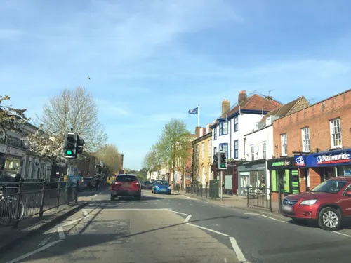
- Street-level photo, essexboy, CC BY-SA 4.0
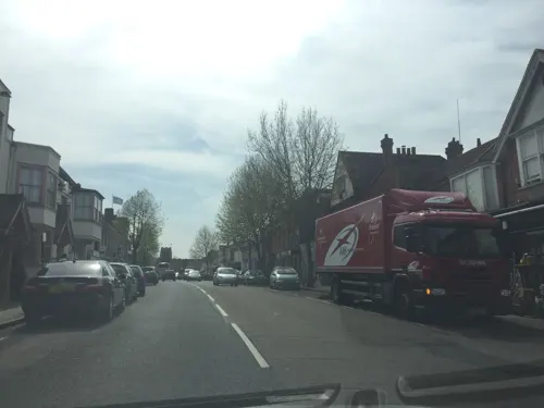
- Street-level photo, essexboy, CC BY-SA 4.0
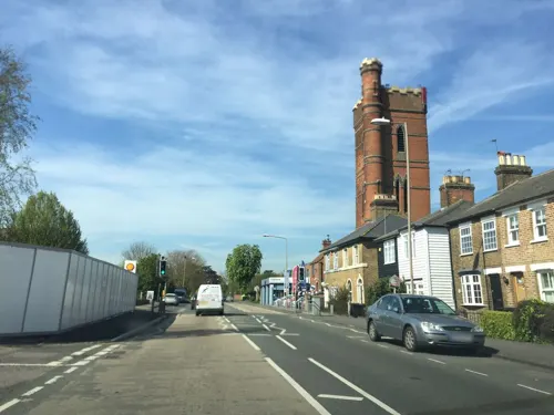
- Street-level photo, essexboy, CC BY-SA 4.0
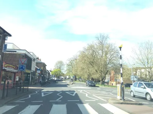
- Street-level photo, wasd42, CC BY-SA 4.0
- Street-level photo, essexboy, CC BY-SA 4.0
- Street-level photo, laye, CC BY-SA 4.0
- Street-level photo, tallguy, CC BY-SA 4.0
- Street-level photo, essexboy, CC BY-SA 4.0
- Street-level photo, essexboy, CC BY-SA 4.0
- Street-level photo, essexboy, CC BY-SA 4.0
- Street-level photo, essexboy, CC BY-SA 4.0
- Street-level photo, essexboy, CC BY-SA 4.0
- Street-level photo, essexboy, CC BY-SA 4.0
- Street-level photo, essexboy, CC BY-SA 4.0
- Street-level photo, essexboy, CC BY-SA 4.0
- Street-level photo, essexboy, CC BY-SA 4.0
- Street-level photo, wasd42, CC BY-SA 4.0
- Street-level photo, essexboy, CC BY-SA 4.0
- Street-level photo, essexboy, CC BY-SA 4.0
- Street-level photo, essexboy, CC BY-SA 4.0
- Street-level photo, essexboy, CC BY-SA 4.0
- Street-level photo, essexboy, CC BY-SA 4.0
- Street-level photo, essexboy, CC BY-SA 4.0
- Street-level photo, essexboy, CC BY-SA 4.0
- Street-level photo, essexboy, CC BY-SA 4.0
- Street-level photo, essexboy, CC BY-SA 4.0

Page built November 10, 2026. Spotted a mistake? Tell us or suggest a place.