


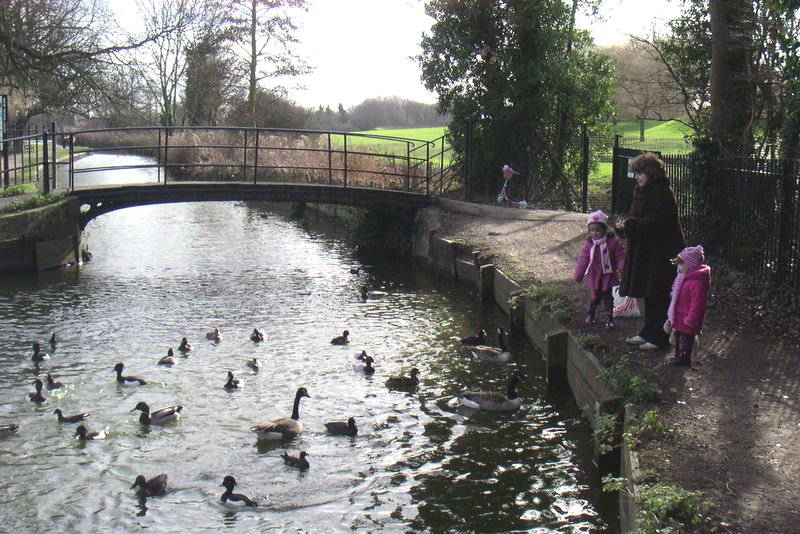
Waltham Cross, United Kingdom
Waltham Cross is a town of 10,000 people in England, United Kingdom.
Why visit Waltham Cross
Townapedia lists 18 museums and landmarks, 30 parks and trails, 102 places to eat and 3 places to stay in and around town.
Highlights include Epping Forest District Museum, Waltham Abbey Royal Gunpowder Mills, Myddelton House Gardens and Cedars Park.
Weather in Waltham Cross
Forecast from MET Norway (CC BY 4.0). Full forecast
About Waltham Cross
Waltham Cross is a town in the Borough of Broxbourne, Hertfordshire, England, located 12 miles (19 km) north of central London. In the south-eastern corner of Hertfordshire, it borders Cheshunt to the north, Waltham Abbey to the east, and Enfield to the south.
From the Wikipedia article Waltham Cross (this version), under CC BY-SA 4.0.
Photos of Waltham Cross


Museums and landmarks18



Forty Hall
Museum · 1.8 mi
Grade I listed historic house museum in the London Borough of Enfield, United Kingdom

Eleanor Cross
Monument and historic site
Eleanor Cross: one of a series of twelve stone monuments topped with crosses erected between 1291 and about 1295 in England from Lincoln...



Elsyng Palace
Monument and historic site · 1.6 mi
Archaeological site in London Borough of Enfield, Greater London, England, UK

6 more on the map.
Parks, trails and playgrounds30


Cedars Park
Park · 0.5 mi
Historic public park originally the site of Theobalds Palace in Hertfordshire, England


River Lee Country Park
Park · 1.5 mi
Protected area in Hertfordshire, England



18 more on the map.
Restaurants and cafes102

The Moon and Cross
Bar and pub
104-106 High Street, Waltham Cross
Mo,Tu,We,Th,Su 08:00-23:00; Fr,Sa 08:00-25:00


Brew Street
Cafe · 0.8 mi
Station Road, Waltham Abbey
We-Fr 09:00-16:00; Sa,Su 09:00-16:30; Mo,Tu off

90 more on the map.
Where to stay3

History
From Roman times, the village of Walthame had been situated next to the River Lea, a tributary of the River Thames, in the ancient parish of Cheshunt in the Hertford hundred of Hertfordshire., and since the building of its Eleanor Cross in the 1290s, was known as the Walthame Cross.
The southern part of Cheshunt was increasingly considered to be part of Waltham Cross, which was formed into a separate ecclesiastical parish in 1855, with its church of the Holy Trinity (since renamed Christ Church) built in 1832, designed by the architect Edward Blore. The road, here long called the High Street, had 'Spital Houses' (Hospitalry Houses) near the county boundary, originally built in 1625 but rebuilt in 1908. In the early 20th century, all along the 2+1⁄4 miles (3.6 km) of the road which Cheshunt and Waltham Cross covered, there were numerous inns and taverns, one or two of which, such as the Four Swans Inn, plied for trade until at least that date from the 17th century, but most of them dated from the 18th century and later.
The town takes its name from the Eleanor Cross which stands in its centre.
Read more of the history
Waltham Cross formed part of Cheshunt Urban District from 1894 to 1974. A suburb of London, the Cheshunt Urban District formed part of the review area for the Royal Commission on Local Government in Greater London, which proposed that it form part of a Greater London borough with Enfield. This proposed borough, however, was abandoned, and the area did not become part of the final Greater London area in 1965. In April 1974, the Cheshunt and Hoddesdon urban district councils merged to form the Borough of Broxbourne.
From the History section of Waltham Cross on Wikipedia, under CC BY-SA 4.0.
More about Waltham Cross
Geography
The town falls within Hertfordshire's Borough of Broxbourne, the metropolitan area of London, and the Greater London Urban Area, with Waltham Abbey to the east, Cheshunt to the north, and Enfield to the south. The M25 motorway runs immediately south of the town, bordering the area of Freezywater. The Waltham Cross post town includes the neighbouring town of Cheshunt and some northern sections of Enfield, including the Holmesdale Estate. Waltham Cross occupies a south-eastern far corner of Hertfordshire so bordering Essex, and its former parent Urban District was dissolved into its present local government unit, the Borough of Broxbourne, in 1974.
Economy
The town centre has a pedestrianised High Street fronted by a mixture of chain stores, independent shops and banks; a covered shopping mall and Fishpools Department Store which specialises in upholstered and fancy furniture and has been in the town since 1899. A general market takes up parts of the street on Wednesdays and Fridays, morphed into occasional entirely French and entirely farmers' markets, season-dependent.
Park Plaza west of the town adjacent to Junction 25 of the M25 hosts one of the world's largest printworks. This produces publications for News International including The Sun, The Times and formerly the News of the World. Employing 200 people on a 23-acre (9.3 ha) site to produce 86,000 newspapers per hour on each of its twelve printing presses (a total capacity of over 1,000,000 newspapers per hour), the plant cost £187 million (part of £650m spending including plants in Knowsley, near Liverpool, and Motherwell, near Glasgow) and replaced the News International press in Wapping.
In 2022 film and TV studio Sunset Studios plan to build a 91-acre site got approved.
The £600M project initially got paused and eventually got cancelled.
From the Wikipedia article Waltham Cross, under CC BY-SA 4.0.
Notable people from Waltham Cross
 Russ BallardEnglish musicianPhoto: Sven Mandel, CC BY-SA 4.0
- Jerry ShirleyBritish drummer
- James BealeBritish track and field athlete
- John HoughtonEnglish pharmacist and author
- Giorgio MazzonEnglish footballer (born 1960)
- Jimmy AndersonBritish boxer
Born in Waltham Cross, according to Wikidata (CC0). Each name links to its Wikipedia article.
Churches and places of worship22
Church of the Holy Cross and St Lawrence (Waltham Abbey Church)
Church · Anglican · 1.4 mi
The Salvation Army - Waltham Abbey
Church · Salvation Army · 1.4 mi
Sewardstone Street, Waltham Abbey
Shopping20
Gas and EV charging5
Schools, colleges and libraries33
St Mary's Church of England High School
School · Anglican · 1.0 mi
Lieutenant Ellis Way, Waltham Cross
Healthcare8
Map of Waltham Cross
241 places. The map loads OpenStreetMap tiles when you open it.
Getting there and nearby towns
London City Airport (LCY) is the nearest airport with scheduled flights listed in OpenStreetMap, 13 miles away.
- Enfield Town 3 mi southwest, about 5 min by car
- Tottenham 6 mi south, about 9 min by car
- Woodford Green 6 mi southeast, about 9 min by car
- Walthamstow 7 mi south, about 11 min by car
- Wood Green 7 mi southwest, about 11 min by car
- Wanstead 8 mi south, about 13 min by car
- Archway 9 mi southwest, about 15 min by car
- Ware 9 mi north, about 14 min by car
- Ilford 10 mi southeast, about 16 min by car
- Islington 11 mi south, about 17 min by car
Drive times are estimates from straight-line distance, not routes.
Towns near Waltham Cross


Keep exploring
Local news
Headlines from INDB.
Reviews, tips and questions
Loading what members have shared...
Sources and licences
- GeoNames (CC BY 4.0): population, coordinates, regions and time zone
- Mapillary (see each image): photos
- OpenStreetMap contributors (ODbL 1.0): places, airports, map data
- Wikidata (CC0 1.0): elevation, founding date, time zone, website, landmarks and historic places
- Wikimedia Commons (see each image): photos
- Wikipedia (CC BY-SA 4.0): overview and history text
Photo credits
- Waltham Cross, Nigel Cox, CC BY-SA 2.0
- Eleanor cross, Waltham Cross (35520484942), Peter O'Connor aka anemoneprojectors, CC BY-SA 2.0
- 2022-02-05 Eleanor Cross, Waltham Cross, The wub, CC BY-SA 4.0
- Forty Hall, Enfield - panoramio, Stu's Images, CC BY-SA 3.0
- Cheshunt Park 10, Dudley Miles, CC BY-SA 4.0
- New River at Enfield Town Park, Smerus, CC BY-SA 3.0
- Tottenham Marshes from Northumberland Park footbridge, Iridescent, CC BY-SA 3.0
- St Andrew's Enfield 02, Philafrenzy, CC BY-SA 4.0
- St James, Enfield Highway, Ruskinmonkey, CC BY-SA 3.0
- St Michael and All Angels church, Enfield 02, Philafrenzy, CC BY-SA 4.0
- 2022-02-12 - Waltham Abbey Church (night), The wub, CC BY-SA 4.0
- St Ignatius College exterior, Enfield, Pjposullivan, CC BY-SA 2.0
- Napoleonic War Association battle reenactment, Unknown author, CC BY 2.5
- Rammey Marsh, Enfield (35465097866), Peter O'Connor aka anemoneprojectors, CC BY-SA 2.0
- St Mary Cheshunt Herts, John Salmon, CC BY-SA 2.0
- Ark John Keats Academy 1, Mx. Granger, CC0
- 2022-02-26 Epping Forest District Museum front, The wub, CC BY-SA 4.0
- Moon & Cross 20170810 132201 (49775728038), Irid Escent, CC BY-SA 2.0
- Geddington Eleanor cross, Lofty at English Wikipedia, CC BY 2.5
- Waltham Abbey Church from southeast 2022-02-26, The wub, CC BY-SA 4.0
- Fishers Green, Footprints, CC BY-SA 2.0
- 66A bus eos, 345 trains, CC BY-SA 4.0
- GOC Cheshunt & Lee Valley 194 Waltham Abbey Cloister Entry (17267077343), Peter O'Connor aka anemoneprojectors, CC BY-SA 2.0
- Flint Arch, Cedars Park, Cheshunt (35520483812), Peter O'Connor aka anemoneprojectors, CC BY-SA 2.0
- View over pond, Myddelton House Gardens, Enfield, Stu's Images, CC BY-SA 3.0
- Cedar's Park flint archway, leading to maze, Martinericbailey, CC BY 4.0
- Albany Park 2, Mx. Granger, CC0
- GOC Cheshunt & Lee Valley 165 Cornmill Meadows (17761835452), Peter O'Connor aka anemoneprojectors, CC BY-SA 2.0
- Street-level photo, rskedgell, CC BY-SA 4.0
- Street-level photo, smsm1, CC BY-SA 4.0
- Street-level photo, rskedgell, CC BY-SA 4.0
- Street-level photo, rskedgell, CC BY-SA 4.0
- Street-level photo, rskedgell, CC BY-SA 4.0
- Street-level photo, rskedgell, CC BY-SA 4.0
- Street-level photo, laye, CC BY-SA 4.0
- Street-level photo, rskedgell, CC BY-SA 4.0
- Street-level photo, rskedgell, CC BY-SA 4.0
- Street-level photo, rskedgell, CC BY-SA 4.0
- Street-level photo, rskedgell, CC BY-SA 4.0
- Street-level photo, rskedgell, CC BY-SA 4.0
- Street-level photo, rskedgell, CC BY-SA 4.0
- Street-level photo, rskedgell, CC BY-SA 4.0
- Street-level photo, rskedgell, CC BY-SA 4.0
- Street-level photo, rskedgell, CC BY-SA 4.0
- Street-level photo, rskedgell, CC BY-SA 4.0
- Street-level photo, rskedgell, CC BY-SA 4.0
- Street-level photo, rskedgell, CC BY-SA 4.0
- Street-level photo, rskedgell, CC BY-SA 4.0
- Street-level photo, laye, CC BY-SA 4.0
- Street-level photo, rskedgell, CC BY-SA 4.0
- Street-level photo, rskedgell, CC BY-SA 4.0
- Street-level photo, rskedgell, CC BY-SA 4.0
- Street-level photo, rskedgell, CC BY-SA 4.0
- Street-level photo, rskedgell, CC BY-SA 4.0


Page built November 10, 2026. Spotted a mistake? Tell us or suggest a place.