


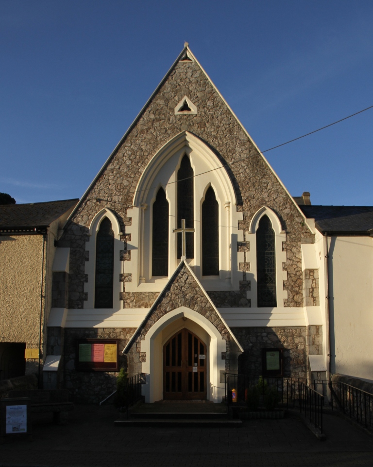

Why visit Exmouth
Townapedia lists 41 museums and landmarks, 27 parks and trails, 135 places to eat, 22 places to stay and 5 attractions in and around town.
Highlights include Exmouth Museum, A la Ronde, East Devon Golf Club and Dawlish Warren National Nature Reserve.
Weather in Exmouth
Forecast from MET Norway (CC BY 4.0). Full forecast
About Exmouth
Exmouth is a port town, civil parish, and seaside resort located on the east bank at the mouth of the River Exe, approximately 11 miles (18 km) southeast of Exeter, in the East Devon district, in the county of Devon, England.
From the Wikipedia article Exmouth (this version), under CC BY-SA 4.0.
Travel tips from other travellers: Exmouth on Wikivoyage (CC BY-SA 4.0).
Photos of Exmouth

Things to do5

Scott Cinemas Exmouth
Cinema and theater · 0.5 mi
7 Rolle Street, Exmouth

Museums and landmarks41


Powderham Castle
Museum · 3.1 mi
Grade I listed historic house museum in Teignbridge, United Kingdom




29 more on the map.
Parks, trails and playgrounds27






15 more on the map.
Restaurants and cafes135


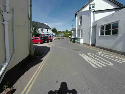
The Swan Inn
Bar and pub · 2.5 mi
The Strand, Exmouth
Mo-Th 12:00-22:00; Fr-Sa 12:00-23:00; Su 12:00-18:00

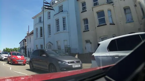
China Garden
Restaurant · Chinese · 0.6 mi
23 Imperial Road, Exmouth
Tu-Sa 12:00-14:00,17:00-22:30; Su 17:30-22:30


Coffee#1
Cafe · Coffee Shop · 0.5 mi
4-6 Chapel Street, Exmouth
Mo-Fr 08:00-18:00; Sa 08:00-18:00; Su 09:00-17:00

123 more on the map.
History
Byzantine coins bearing the mark of Anastasius I, dating from around 498–518, were found on the beach in 1970. Evidence of people living at Exmouth Point goes back to the 11th century, when it was called Lydwicnaesse, meaning "the point of the Bretons".
The two ecclesiastical parishes that now make up Exmouth – Littleham and Withycombe Raleigh – can be traced back to before Saxon times. The name "Exmouth" comes from its position at the mouth of the River Exe estuary. The word "Exe" itself comes from an old Celtic word meaning "fish". For many centuries, the parishes were part of the East Budleigh Hundred.
In 1240, an area known as Pratteshuthe (meaning Pratt’s landing place) was sold to the mayor and citizens of Exeter. This spot was where the estuary’s ferry dock was located. Over time, the name changed to Pratteshide, and later became known as Mona Island. Today, the site is marked by a seating area outside the Glenorchy United Reformed Church, near the Magnolia Shopping Centre.
Read more of the history
For many years, trade through the port was limited—partly because of shallow waters near the quay, but mostly because the city of Exeter owned the dock and controlled all traffic on the estuary. The roads in and out of the area were in poor condition and only occasionally repaired by the parishes they passed through. A more permanent dock was built in 1825, replacing a series of earlier, likely seasonal, docks first seen on maps from 1576 marked as "The Docke". New docks, designed by Eugenius Birch, opened in 1868, and a short railway line connected them to the goods yard. A lively community of around 125 chalets once stood near the docks along the shoreline, but these were later replaced by the Exmouth Quay residential marina.
In earlier times, people found it difficult to settle in the estuary area because of the harsh, exposed conditions. Instead, settlements were more permanent in the more sheltered rural areas nearby. Exmouth started to grow in the 13th century. The land was owned by Morin Uppehille, who gave part of it to a man called John the Miller. John built a windmill on the exposed headland, where he made a living helped by the strong south-west winds. A small cluster of farms, the ferry dock, and the windmill eventually developed into what we now know as Exmouth.
Sir Walter Raleigh (born 1544) began several of his sea voyages from Exmouth Harbour.
In the mid-17th century, the area was attacked by so-called "Turkish pirates" (actually Algerian corsairs), who raided the coasts of Devon and Cornwall. They targeted ships and tried to capture sailors and villagers to sell as slaves in North Africa.
The town became more established in the 18th century and is considered the oldest seaside resort in Devon. With travel to mainland Europe disrupted by the troubles in France, visitors came for the sea views and the popular salt waters, believed to have healing properties. Exmouth gained a reputation as a place where wealthy people went to improve their health. Notable visitors included Lady Byron and her daughter Ada Lovelace. Lady Nelson, the estranged wife of Lord Nelson, also lived in Exmouth and is buried in Littleham Churchyard.
For many years, Exmouth attracted high-class tourists. This changed in 1861 when the railway reached the town, making it accessible to many more people and starting a boom in mass tourism. Much of the town’s current layout dates from this "golden age".
From the History section of Exmouth on Wikipedia, under CC BY-SA 4.0.
More about Exmouth
Geography
The town is defined by the sea and river frontages (each about a mile long), and stretches around 2.5 miles (4 km) inland, along a north-easterly axis. The docks lie at the western corner of this rectangle, where the river passes through a narrow passage into the sea, the mouth of the estuary being nearly closed by Dawlish Warren on the opposite shore of the river. Dawlish Warren is a natural sand spit and is home to rare wildlife and plants, part of which is a nature reserve and restricted access. The sea frontage forms a sandy two mile long beach; at its eastern end, the town is limited by the cliffs of the High Land of Orcombe, a National Trust-owned open space which rises to a peak at Orcombe Point.
Education
The town has eight primary schools, one secondary school, and a school for the deaf.
The Deaf Academy is an independent special school run by Exeter Royal Academy for Deaf Education, a registered charity. It provides education for deaf pupils aged 5 to 16 years with further education post-16 and has residential places. Exeter Royal Academy for Deaf Education bought the site in 2016 and began developing it into a state-of-the-art deaf education centre. In 2020, newly rebranded as The Deaf Academy, the school completed the move from Exeter to Exmouth.
The site had earlier been Rolle College, opened in 1946, and later became the Exmouth campus of the University of Plymouth. In 2008, the University decided to close the college. East Devon MP Hugo Swire discussed the college's closure in Parliament.
From the Wikipedia article Exmouth, under CC BY-SA 4.0.
Notable people from Exmouth
 Pauline CollinsBritish actress (1940–2025)Photo: Eva Rinaldi, CC BY-SA 2.0
 William TidballBritish cyclistPhoto: Nicola, CC BY-SA 4.0
 Hugh Seymour DaviesEnglish musician (1943–2005)Photo: Unknown. Photograph from the Hugh..., CC BY 3.0
 Katrina MatthewsEnglish triathlete compteting at long distancesPhoto: JohnWalterRye, CC BY-SA 4.0
 Ed StewartBritish radio presenterPhoto: Lawson Speedway, Public domain
 William Francis de Vismes KaneEnglish entomologist (1840 – 1918)Photo: Unknown author Unknown author, Public domain
 Rebecca Newmanmusical artistPhoto: Jonathan Fewtrell, CC BY-SA 4.0
 Frederick BondEnglish entomologist (1811-1889)Photo: Unknown author Unknown author, Public domain
- David CarsonBritish film and television director
- Alistair BrammerBritish actor
- James GriggBritish politician (1890-1964)
- Antonio CorbisieroEnglish footballer
Born in Exmouth, according to Wikidata (CC0). Each name links to its Wikipedia article.
Where to stay22
Churches and places of worship28
Parish Church of the Nativity of the Blessed Virgin Mary
Church · 2.5 mi
St Margaret and St Andrew's Church, Littleham, Exmouth
Church · 1.3 mi
Shopping37
Gas and EV charging4
Schools, colleges and libraries17
Withycombe Raleigh Church of England Primary School
School · Anglican · 0.9 mi
Withycombe Village Road, Exmouth
Healthcare13
Dawlish Warren Pharmacy
Clinic and pharmacy · 2.3 mi
1 Dawlish Warren Road, Dawlish Warren
Smith J R & a L
Clinic and pharmacy · 0.8 mi
120 Withycombe Village Road, Exmouth
Withycombe Clinic
Clinic and pharmacy · 0.7 mi
89 Withycombe Village Road, Exmouth
Map of Exmouth
250 places. The map loads OpenStreetMap tiles when you open it.
Getting there and nearby towns
Exeter Airport (EXT) is the nearest airport with scheduled flights listed in OpenStreetMap, 8 miles away.
- Dawlish 4 mi southwest, about 6 min by car
- Teignmouth 6 mi southwest, about 10 min by car
- Exeter 9 mi northwest, about 15 min by car
- Sidmouth 9 mi northeast, about 14 min by car
- Kingsteignton 9 mi southwest, about 15 min by car
- Newton Abbot 11 mi southwest, about 18 min by car
- Torquay 12 mi southwest, about 19 min by car
- Cockington 13 mi southwest, about 20 min by car
- Paignton 15 mi southwest, about 23 min by car
- Honiton 16 mi northeast, about 25 min by car
Drive times are estimates from straight-line distance, not routes.
Towns near Exmouth


Keep exploring
Local news
Headlines from INDB.
Reviews, tips and questions
Loading what members have shared...
Sources and licences
- GeoNames (CC BY 4.0): population, coordinates, regions and time zone
- Mapillary (see each image): photos
- OpenStreetMap contributors (ODbL 1.0): places, airports, map data
- Wikidata (CC0 1.0): elevation, founding date, time zone, website, landmarks and historic places
- Wikimedia Commons (see each image): photos
- Wikipedia (CC BY-SA 4.0): overview and history text
Photo credits
- Exmouth seafront in south devon arp, Photographed by Adrian Pingstone (on a chilly Monday before the school holidays, hence so few people) and placed in the public domain., Public domain
- Exmouth (2021-09-11) 07, Simon Cobb, CC0
- A La Ronde (5523285615), Becks, CC BY 2.0
- Powderham Castle, 2009, raymond cocks, CC BY 2.0
- Dawlish MethodistChurch, Motacilla, CC BY-SA 4.0
- Exmouth Community College, Simon Cobb, CC0
- Lympstone Manor, Maypm, CC BY-SA 4.0
- Manor Hotel, Simon Cobb, CC0
- The Bridgewater Building Society, Simon Cobb, CC0
- Parish Church of St John, the Evangelist, Simon Cobb, CC0
- Peter's Tower, Simon Cobb, CC0
- Exeter Road Community Primary School, Simon Cobb, CC0
- Exmouth 2020-08-01 3, Simon Cobb, CC0
- Exmouth 2020-08-01 7, Simon Cobb, CC0
- Starcross 2020-07-31 36, Simon Cobb, CC0
- Withycombe Raleigh Church of England Primary School, Simon Cobb, CC0
- Lympstone 2020-01-19 (20), Simon Cobb, CC0
- Littleham 2020-06-21 4, Simon Cobb, CC0
- The Beacon Church of England (VA) Primary School, Simon Cobb, CC0
- St Joseph's Catholic Primary School, Exmouth, Simon Cobb, CC0
- Exmouth 2020-08-01 14, Simon Cobb, CC0
- Cockwood (2021-07-31) 08, Simon Cobb, CC0
- Holly Tree Inn, Simon Cobb, CC0
- Lympstone 2020-01-19 (40), Simon Cobb, CC0
- The Grove (1), Simon Cobb, CC0
- Jurassic Coast Cruise - The Bath House, Exmouth (2022-06-18) 07, Simon Cobb, CC0
- Exmouth Museum - 2021-07-04, Jasskurn, CC BY-SA 4.0
- Gaveney House, Simon Cobb, CC0
- Beacon Hill House, Simon Cobb, CC0
- Budleigh Salterton (2020-08-16) 89, Simon Cobb, CC0
- Street-level photo, jasskurn, CC BY-SA 4.0
- Street-level photo, southglos, CC BY-SA 4.0
- Street-level photo, RyanBush, CC BY-SA 4.0
- Street-level photo, jasskurn, CC BY-SA 4.0
- Street-level photo, southglos, CC BY-SA 4.0
- Street-level photo, southglos, CC BY-SA 4.0
- Street-level photo, jasskurn, CC BY-SA 4.0
- Street-level photo, southglos, CC BY-SA 4.0
- Street-level photo, southglos, CC BY-SA 4.0
- Street-level photo, WaggyDog, CC BY-SA 4.0
- Street-level photo, jasskurn, CC BY-SA 4.0


Page built November 10, 2026. Spotted a mistake? Tell us or suggest a place.