


Sidmouth, United Kingdom
Sidmouth is a town of 12,569 people in England, United Kingdom.
Why visit Sidmouth
Townapedia lists 36 museums and landmarks, 16 parks and trails, 43 places to eat, 23 places to stay and 11 attractions in and around town.
Highlights include Scott Cinemas, High Peak, Sidmouth Museum and Sidmouth Toy and Model Museum.
Weather in Sidmouth
Forecast from MET Norway (CC BY 4.0). Full forecast
About Sidmouth
Sidmouth () is a town on the English Channel in Devon, South West England, 14 miles (23 km) southeast of Exeter. With a population of 13,258 in 2021, it is a tourist resort and a gateway to the Jurassic Coast World Heritage Site. A large part of the town has been designated a conservation area.
From the Wikipedia article Sidmouth (this version), under CC BY-SA 4.0.
Travel tips from other travellers: Sidmouth on Wikivoyage (CC BY-SA 4.0).
Photos of Sidmouth

Things to do11



Beer Quarry Caves
Monument and historic site · 5.6 mi
Man-made caves in Devon, England




Museums and landmarks36

Sidmouth Museum
Museum · 0.8 mi
Museum in Sidmouth, England, United Kingdom
Church Street, Sidmouth
Mo-Fr 10:00-16:00; Sa 10:00-13:00



Bicton Park botanical garden
Museum · 3.8 mi
Garden nearby Budleigh Salterton, Devon, England, UK
24 more on the map.
Parks, trails and playgrounds16

Fire Beacon Hill
Park · 4.0 mi
Local Nature Reserve in East Devon, England


Aylesbeare Common RSPB reserve
Park · 4.1 mi
RSPB nature reserve in the United Kingdom


4 more on the map.
Restaurants and cafes43

Swan Inn
Bar and pub · 0.7 mi
37 York Street, Sidmouth
Mo-Th 12:00-22:30; Fr-Sa 12:00-23:00; Su 12:00-22:30


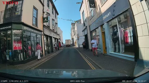



31 more on the map.
History
The origins of Sidmouth pre-date recorded history. The Sid valley has been in human occupation since at least the Iron Age as attested by the presence of Sidbury Castle, and possibly earlier given the presence of Bronze Age burial mounds on Gittisham Hill and Broad Down. The village of Sidbury itself is known to be Saxon in origin with the Church crypt dating to the seventh century. However, the Sid Valley was divided into two ecclesiastical land holdings, with Sidbury and Salcombe Regis being gifted by King Athelstan to Exeter Cathedral, and Sidmouth, which was part of the manor of Otterton, was gifted by Gytha Thorkelsdóttir (the mother of King Harold Godwinson) to the Benedictines at Mont-Saint-Michel.
Sidmouth appears in the Domesday Book of 1086 as Sedemuda, meaning "mouth of the Sid". Like many such settlements, it was originally a fishing village.
Read more of the history
By the 1200s, Sidmouth had expanded to become a market town of similar size to Sidbury and generating more income for the abbot of Mont-Saint-Michel than Otterton. By this time, Sidmouth already had a parish church, as the Otterton Cartulary refers to a grant of 30 acres of land to Guilielmas, the vicar in Sidmouth, as a glebe, and excavations in 2009 during the remodelling of the parish church revealed foundations dating from that time. It is likely that the church was already dedicated to St Giles, as the annual fair was held on his feast day 1 September. According to one of the many blue plaques found around Sidmouth, not far from the church was a chapel dedicated to St Peter built sometime before 1322, the remaining wall of which is now part of Dukes Hotel.
During the 14th century, Sidmouth enjoyed a degree of prosperity from the wine trade and, as part of the manor of Otterton, was transferred by King Henry V from Mont-Saint-Michel to Syon Abbey. King Henry VIII confiscated it again during the dissolution of the monasteries and sold it off, whereafter it changed hands several times before being acquired by the Mainwaring baronets, whose family provided two of the vicars of Sidmouth parish.
Although attempts have been made to construct a harbour, none has succeeded. A lack of shelter in the bay prevented the town's growth as a port. Despite this, a part of the town is known as 'Port Royal' which is likely due to the town's having provided two ships and 67 men to King Edward III during the Hundred Years' War with which to attack Calais. The most concerted effort was a short-lived attempt in the 1830s at the west of the seafront; this included the construction of the Sidmouth Harbour Railway along the seafront and into a tunnel at the cliffs to the east that would have transported stone from Hook Ebb. Only a few traces of the railway and tunnel survive today. The Royal National Lifeboat Institution (RNLI) operated a lifeboat station at Sidmouth between 1869 and 1912.
According to one of the Sid Vale Association Blue Plaques, a fort was built in Sidmouth in 1628, due to fear of a French invasion or naval attack, on the part of the seafront that is known as 'Fortfield' and which is now the cricket pitch.
Another of the Blue Plaques of the Sid Vale Association, confirms that the Old Ship pub (now a Costa Coffee) had operated as a tavern in Sidmouth since the 1400s and was used by smugglers. The infamous Jack Rattenbury, who was born nearby in Beer, Devon operated in the area, and was known to associate with the Mutter family of Ladram Bay (after whom Mutter's Moor on Peak Hill overlooking Sidmouth is named).
Sidmouth remained a village until the fashion for coastal resorts grew in the Georgian and Victorian periods of the 18th and 19th centuries. A number of Georgian and Regency buildings still remain. In 1819, George III's son Edward, Duke of Kent, his wife, and baby daughter (the future Queen Victoria) came to stay at Woolbrook Glen for a few weeks. In less than a month he had died of pneumonia. The house later became the Royal Glen Hotel; a plaque on an exterior wall records the visit. Sidmouth was connected to the railway network in 1874, by a branch line from Sidmouth Junction, which from there called at Ottery St Mary and Tipton St John. This was dismantled in 1967 as a result of the Beeching Axe.
In 2008, Canadian millionaire Keith Owen, who had been on holiday in the town and planned to retire there, bequeathed about £2.3 million to the community's civic society, the Sid Vale Association, upon learning that he had only weeks to live due to lung cancer. The bequest was used as a capital fund to generate an annual interest dividend of around £120,000 for community projects.
From the History section of Sidmouth on Wikipedia, under CC BY-SA 4.0.
More about Sidmouth
Geography
Sidmouth lies at the mouth of the River Sid in a valley between Peak Hill to the west and Salcombe Hill to the east. It is surrounded by the East Devon Area of Outstanding Natural Beauty and is on the Jurassic Coast, a World Heritage Site, and the South West Coast Path. The red-coloured rock of the Otter Sandstone in the cliffs to the west of the town indicates the arid conditions of the Triassic geological period.
Erosion of the cliffs to the east of the river mouth threatens homes and the coastal footpath, and is a serious concern.
The wide esplanade has been a prominent feature since Regency times. A series of southwesterly storms in the early 1990s washed away much of the shingle beach protecting the masonry. A set of artificial rock islands was constructed to protect the sea front, and tons of pebbles were trucked in to replace the beach.
Sidmouth has a number of conservation projects, notably the arboretum which in 2012 designated all land owned by Sidmouth Town Council as 'civic arboretum', the first town in the United Kingdom to do so.
The highest temperature recorded between 1926 and 2017 in Sidmouth is 31.0 °C (87.8 °F) on 10 August 2003, and the coldest is −10.0 °C (14.0 °F) on 1 January 1979.
Economy
The principal revenue is from tourism, with a wide range of hotels and guest houses, as well as self catering accommodation in the local area. Sidmouth is a retirement location, so pensioner spending is another source of income.
The largest employer is East Devon District Council, the headquarters of which are at the former Knowle Hotel. The headquarters were transferred to Honiton in 2019. There is a large independent department store, Fields of Sidmouth, which has been on the same site for over 200 years. There are pubs, restaurants, coffee houses and tea rooms; also an indoor swimming pool, a sports hall at the leisure centre, and a golf course.
Arts and culture
The parish church is dedicated to St Giles and St Nicholas. It was rebuilt in 1860; the architect was William White. Of the medieval structure, only the 15th-century tower has been retained. Oddments of Norman and later stonework were included in the rebuilding. Features of interest include the Duke of Kent Memorial Window, which Queen Victoria gave in 1867, and the reredos by Samuel Sanders Teulon. Parts of the original fabric, such as the windows, were reused by the historian Peter Orlando Hutchinson in building a folly adjoining his house. He was also responsible for saving the stained glass in the vestry. The folly is the Old Chancel in Coburg Terrace which was started by Hutchinson in 1859, in protest over the destruction of the original church fabric during rebuilding.
Sidmouth Museum, next to the church, has local memorabilia, historical artefacts, and geological samples.
The church of All Saints, also Anglican (Taylor, architect, 1837), is in the Early English style with lancet windows and "oddly clumsy" pinnacles. There were also Unitarian, Wesleyan (later Methodist) and Congregational chapels; the Unitarian chapel was founded in the 17th century by Presbyterians and the Wesleyan and Congregational ones in 1837 and 1846 respectively.
Education
Sidmouth College is a comprehensive school which takes children aged between 11 and 18 from as far afield as Exmouth and Exeter. In February 2012, with 852 pupils on the roll, the college was deemed 'Good' by Ofsted. The judgment of improvement in the college's provision followed the previous inspection (May 2009) when it was deemed 'satisfactory'. In the 2005 Ofsted report, when there were 869 students on the roll, it was also deemed 'satisfactory'.
Sidmouth College is situated in the Sid Valley. It admits students from East Devon.
There is one state junior school, which takes children from between the ages of 8 and 11. There are two state infant schools. There is, additionally, a private school: St John's International School (formerly known as the Convent of the Assumption) which takes children from two to 18, including overseas boarders. In 2007, it was taken over by International Education Systems (IES).
Sidmouth International School is an English language school for foreign pupils.
From the Wikipedia article Sidmouth, under CC BY-SA 4.0.
Notable people from Sidmouth
 William Saville-KentBritish biologist (1845-1908)Photo: The photogravure is by Waterlow &..., Public domain
 Charles John CornishEnglish naturalist (1858–1906)Photo: Uncredited photograph, Public domain
 Hope PattenBritish priestPhoto: Unknown author Unknown author, Public domain
- Edmund LeachBritish social anthropologist (1910–1989)
- Constance KentEnglish murderer (1844–1944)
- Francis FulfordAnglo-Catholic Bishop of Montreal (1803-1868)
- Bruce HamiltonBritish Army general
- Owen Batesdarts player (born 2002)
- Sir Walter Barttelot, 3rd BaronetBritish Baronet (1880–1918)
- Sir Walter Barttelot, 2nd BaronetBritish baronet (1855–1900)
- Anne WaltonCanadian swimmer
- Julian Wilsonhorse racing correspondent (1940-2014)
Born in Sidmouth, according to Wikidata (CC0). Each name links to its Wikipedia article.
Where to stay23
Churches and places of worship25
Shopping18
Schools, colleges and libraries12
Sidmouth Church of England Primary School (Manstone Avenue site)
School · Anglican · 0.4 mi
Manstone Avenue, Sidmouth
Sidmouth Church of England Primary School (Vicarage Road site)
School · Anglican · 0.5 mi
Vicarage Road, Sidmouth
Healthcare4
Map of Sidmouth
188 places. The map loads OpenStreetMap tiles when you open it.
Getting there and nearby towns
Exeter Airport (EXT) is the nearest airport with scheduled flights listed in OpenStreetMap, 8 miles away.
- Exeter 13 mi west, about 21 min by car
- Teignmouth 15 mi southwest, about 24 min by car
- Tiverton 18 mi northwest, about 29 min by car
- Street 37 mi northeast, about 1 h by car
- Tavistock 41 mi west, about 1 h by car
- Wells 44 mi northeast, about 1 h 15 min by car
- Plymouth 45 mi southwest, about 1 h 15 min by car
- Yatton 51 mi north, about 1 h 30 min by car
- Cardiff 55 mi north, about 1 h 30 min by car
- Poole 55 mi east, about 1 h 30 min by car
Drive times are estimates from straight-line distance, not routes.
Towns near Sidmouth


Keep exploring
Local news
Headlines from INDB.
Reviews, tips and questions
Loading what members have shared...
Sources and licences
- GeoNames (CC BY 4.0): population, coordinates, regions and time zone
- Mapillary (see each image): photos
- OpenStreetMap contributors (ODbL 1.0): places, airports, map data
- Wikidata (CC0 1.0): elevation, founding date, time zone, website, landmarks and historic places
- Wikimedia Commons (see each image): photos
- Wikipedia (CC BY-SA 4.0): overview and history text
Photo credits
- SidmouthBeach, Touriste, Public domain
- Sidmouth (2022-05-22) 01, Simon Cobb, CC0
- Sidmouth (2022-05-22) 26, Simon Cobb, CC0
- Sidmouth (2022-05-22) 25, Simon Cobb, CC0
- Sidmouth (2022-05-22) 02, Simon Cobb, CC0
- Sidmouth (2022-05-22) 03, Simon Cobb, CC0
- Sidmouth (2026-03-07) 12, Simon Cobb, CC0
- Ottery St Mary Parish Church (5520738082), Robert Cutts from Bristol, England, UK, CC BY 2.0
- Sidmouth (2021-09-12) 25, Simon Cobb, CC0
- Colaton Raleigh (2021-06-05) 51, Simon Cobb, CC0
- Sidmouth (2026-03-07) 33, Simon Cobb, CC0
- BictonChurchDevon, own photo, Public domain
- St Giles and St Nicholas church, Sidmouth, Chris Downer, CC BY-SA 2.0
- Sidmouth (2021-10-10) 15, Simon Cobb, CC0
- Tipton St John (2021-08-14) 16, Simon Cobb, CC0
- Old Ship Inn - Old Fore Street - Sidmouth Devon 2010, Johanning, CC BY-SA 3.0
- Hunters Moon Hotel, Maypm, CC BY-SA 4.0
- Sidmouth (2021-09-12) 84, Simon Cobb, CC0
- Sidmouth (2021-09-12) 02, Simon Cobb, CC0
- Sidmouth (2021-09-12) 72, Simon Cobb, CC0
- Sidmouth (2021-10-10) 18, Simon Cobb, CC0
- Newton Poppleford (2021-06-05) 17, Simon Cobb, CC0
- Otterton (2021-04-25) 51, Simon Cobb, CC0
- Tipton St John (2021-08-14) 13, Simon Cobb, CC0
- Sidbury (2021-08-14) 37, Simon Cobb, CC0
- Sidmouth (2022-05-22) 43, Simon Cobb, CC0
- Sidmouth (2026-03-07) 42, Simon Cobb, CC0
- Tipton St John (2021-08-14) 11, Simon Cobb, CC0
- Sidmouth (2021-04-18) 70, Simon Cobb, CC0
- Sidmouth (2022-05-22) 53, Simon Cobb, CC0
- Sidmouth (2022-05-22) 54, Simon Cobb, CC0
- Sidford (2022-05-22) 01, Simon Cobb, CC0
- 2010-10-07 peak hill sidmouth, Huligan0, CC BY-SA 3.0
- Moor grass gorse and heather, Blokenearexeter, Public domain
- Bulverton (2022-02-26) 03, Simon Cobb, CC0
- London horse-drawn bus, Sidmouth Toy and Model Museum 2025-07-22, Matt Brown, CC BY 4.0
- Donkey Sanctuary, Richard Gillin, CC BY-SA 2.0
- Street-level photo, RyanBush, CC BY-SA 4.0
- Street-level photo, RyanBush, CC BY-SA 4.0
- Street-level photo, RyanBush, CC BY-SA 4.0
- Street-level photo, RyanBush, CC BY-SA 4.0
- Street-level photo, WaggyDog, CC BY-SA 4.0
- Street-level photo, RyanBush, CC BY-SA 4.0
- Street-level photo, RyanBush, CC BY-SA 4.0
- Street-level photo, RyanBush, CC BY-SA 4.0
- Street-level photo, WaggyDog, CC BY-SA 4.0
- Street-level photo, RyanBush, CC BY-SA 4.0
- Street-level photo, RyanBush, CC BY-SA 4.0
- Street-level photo, RyanBush, CC BY-SA 4.0
- Street-level photo, RyanBush, CC BY-SA 4.0
- Street-level photo, RyanBush, CC BY-SA 4.0
- Street-level photo, RyanBush, CC BY-SA 4.0
- Street-level photo, RyanBush, CC BY-SA 4.0
- Street-level photo, RyanBush, CC BY-SA 4.0
- Street-level photo, southglos, CC BY-SA 4.0
- Street-level photo, RyanBush, CC BY-SA 4.0


Page built November 10, 2026. Spotted a mistake? Tell us or suggest a place.