


Farnborough, United Kingdom
Farnborough is a town of 60,652 people in England, United Kingdom.
Why visit Farnborough
Townapedia lists 29 museums and landmarks, 23 parks and trails, 128 places to eat, 14 places to stay and 7 attractions in and around town.
Highlights include Camberley Theatre, Inglis Pipe Bridge, Saint Michael’s Abbey and Aldershot Cenotaph.
Weather in Farnborough
Forecast from MET Norway (CC BY 4.0). Full forecast
About Farnborough
Farnborough is a town located in the Rushmoor district of Hampshire, England. It has a population of around 60,652 as of the 2021 census and is an important centre of aviation, engineering and technology. The town is probably best known for its association with aviation, including Samuel Cody, Farnborough Airport, the Farnborough International Airshow, Royal Aircraft Establishment and the Air Accidents Investigation Branch.
From the Wikipedia article Farnborough, Hampshire (this version), under CC BY-SA 4.0.
Travel tips from other travellers: Farnborough on Wikivoyage (CC BY-SA 4.0).
Things to do7

Camberley Theatre
Cinema and theater · 3.1 mi
400 seat Theatre in Surrey, England


Princes Hall
Cinema and theater · 3.1 mi
Theatre in Aldershot, England

Hippodrome
Cinema and theater · 3.2 mi
Former theatre and cinema in Aldershot, England
Theatre Royal, Aldershot
Cinema and theater · 3.2 mi
Former theatre in Aldershot, England

Museums and landmarks29


Aldershot Cenotaph
Monument and historic site · 3.3 mi
War memorial in Aldershot, Hampshire, England, UK

equestrian statue of the Duke of Wellington
Monument and historic site · 3.0 mi
Statue in Aldershot, Hampshire, England, UK

FAST Museum
Museum · 0.8 mi
Aviation museum in Hampshire, England, United Kingdom

Museum of Military Medicine
Museum · 2.1 mi
Military museum in Mytchett, Surrey, United Kingdom

Royal Army Medical Corps Boer War Memorial
Monument and historic site · 2.8 mi
Sculpture in Rushmoor, Hampshire, England, UK

Royal Army Physical Training Corps Museum
Museum · 2.1 mi
Museum in Aldershot, United Kingdom


Historic 8ft x 6ft Transonic & 11 1/2 ft Low Speed Windtunnels
Monument and historic site · 0.6 mi
O'Gorman Avenue


17 more on the map.
Parks, trails and playgrounds23




Lakeside Park
Park · 2.8 mi
Local nature reserve in Ash, Surrey, England, UK


11 more on the map.
Restaurants and cafes128

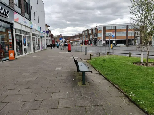
Bliss Restaurant & Bar
Restaurant · Pan-Asian, Nepalese · 1.5 mi
10 The Parade, Frimley
Mo-Su 12:00-22:00
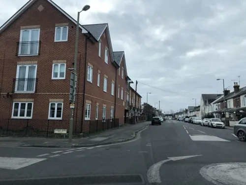
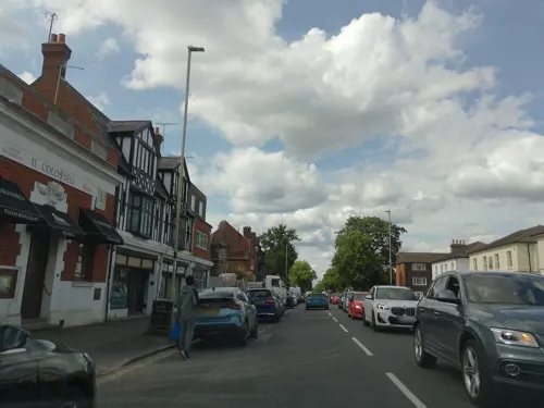
Il Colosseo
Restaurant · Italian · 1.4 mi
18 Alexandra Road, Farnborough
Mo-Sa 12:00-14:00, 18:00-22:00
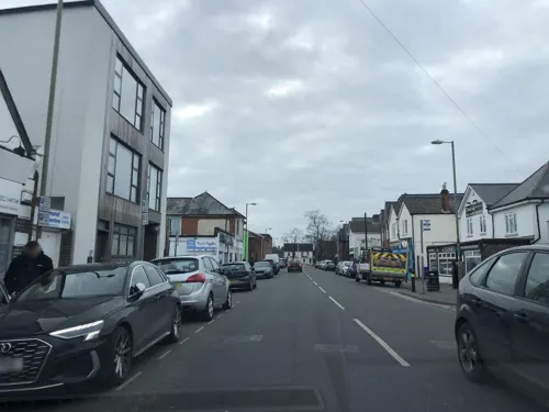
New Golden Rice
Restaurant · Chinese · 1.2 mi
24 Queens Road, Farnborough
Mo-Sa 17:00-22:45; Su 17:00-22:00
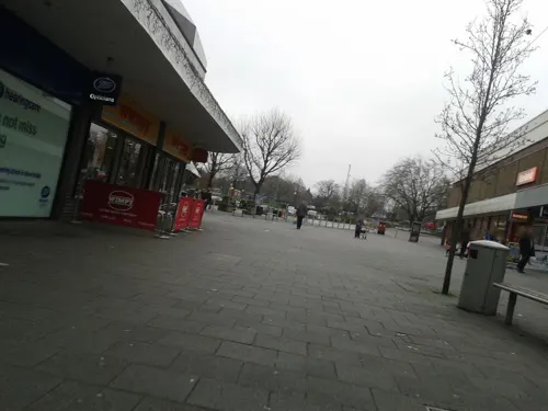
Poppins Restaurant & Cafe
Restaurant · Burger, Sandwich, Fish And Chips, Breakfast, Ice Cream, Juice, Tea, Sausage, Soup, Fries, Pizza
96 Queensmead, Farnborough
Mo-Sa 08:30-17:00; Su 09:30-16:00
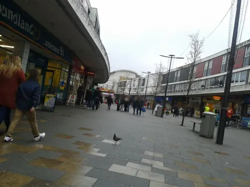

The Tilly Shilling
Bar and pub
24 - 30 Victoria Road, Farnborough
Su-Th 08:00-24:00, Fr,Sa 08:00-01:00

116 more on the map.
History
The earliest evidence of human settlement around Farnborough dates back thousands of years. Archaeologists have uncovered flint tools and other artefacts from the Mesolithic period, indicating the presence of hunter-gatherer communities in the area over 8,000 years ago. During the Neolithic period, the region saw increasing agricultural activity and the development of more permanent settlements. Excavations have revealed the remains of several prehistoric enclosures and barrows within the boundaries of modern-day Farnborough, suggesting it was home to thriving communities in the 4th-2nd millennia BC. The area continued to be inhabited throughout the Bronze Age and Iron Age, with hillforts, field systems and other archaeological evidence indicating the presence of larger, more organised settlements. One notable site is Caesar's Camp, an Iron Age hillfort, located just north of the modern town.
The Roman conquest of Britain in the 1st century AD brought major changes to the local landscape. The Devil's Highway, a key Roman road, passed through what is now Farnborough, linking the provincial capital of Calleva Atrebatum (modern-day Silchester) with the coastal port of Portus Adurni (Portchester). Numerous Roman artefacts and building remains have been discovered within the town, suggesting it was home to a small rural settlement during the Roman period.
Read more of the history
Following the end of Roman rule in the early 5th century, the area was gradually absorbed into the emerging Anglo-Saxon kingdoms. The modern name Farnborough derives from the Old English "Ferneberga", meaning "fern-covered hill".
Farnborough is first recorded in the Domesday Book of 1086, where it is listed as a small hamlet within the larger manor of Crondall. At this time, the settlement was held by the Norman lord, Odin de Windesores, who owned 3 hides of land there. The Domesday entry suggests Farnborough was a relatively insignificant rural village in the late 11th century, with a population estimated at 50-100 people.
Over the following centuries, Farnborough remained a modest agricultural settlement, its economy based around subsistence farming, woodland management and small-scale industry. The manor passed through the hands of various noble families, including the de Farnborough and de Sherborne dynasties.
Farnborough began to grow and develop more rapidly from the late 18th century onwards, driven by improved transportation links and its proximity to the expanding metropolis of London. The construction of the London and South Western Railway in the 1830s, with a station at Farnborough, greatly enhanced the town's accessibility and connectivity. This, combined with its healthy climate and picturesque rural setting, attracted an influx of wealthy London commuters and helped transform Farnborough into more of a suburban residential area.
From 1830 to 1850, Farnborough's population grew from around 400 to over 800, as new housing developments and services were established to cater for the expanding middle-class community. The town's focal point shifted from the historic village core to the area around the railway station, with the construction of new churches, schools, shops and other amenities.
The most transformative event in Farnborough's history came in 1905, when the Royal Engineers moved from Aldershot with their School of Ballooning, to use the open space of Laffan's Plain for development and trials. They were joined by Samuel Cody in 1906, who came to demonstrate his man-lifting kites; he persuaded them to let him build an aeroplane. Cody became the first person to fly in a powered aircraft in Great Britain in 1908. A full-scale replica of this Army Aeroplane No 1 now exists in a pavilion alongside the original Balloon School Headquarters building, now home to the Farnborough Air Sciences Trust (FAST) Aviation Museum.
With the growth of aircraft related activity, the Army Balloon Factory became the Royal Aircraft Factory under civilian control. In 1912, with the formation of the Royal Flying Corps, the headquarters of the Balloon School became the headquarters of the Royal Flying Corps and is now known as Trenchard House. The name of the Royal Aircraft Factory had to be changed in 1918, when the Royal Air Force was formed, becoming the Royal Aircraft Establishment (RAE). This led to Farnborough becoming a globally significant centre for aeronautical research and development.
The establishment of the RAE, and the influx of skilled engineers and technicians it brought, had a profound impact on Farnborough's subsequent growth and character. Major aerospace companies such as Supermarine, Handley Page and De Havilland were attracted to set up factories and facilities in the area, further cementing the town's reputation as a hub of British aviation.
In the decades following the Second World War, Farnborough continued to expand rapidly, with the development of major new business parks, light industrial estates and residential areas to accommodate the growing population. The town also became renowned globally as the host of the biennial Farnborough International Airshow, one of the world's largest and most important aerospace trade events.
From the History section of Farnborough, Hampshire on Wikipedia, under CC BY-SA 4.0.
More about Farnborough
Geography
Farnborough is located in the north-eastern corner of the county of Hampshire, near to the border with Surrey. The town occupies a valley setting, with the main urban area situated between the River Blackwater to the east and higher ground to the west. The topography gradually rises from the valley floor, reaching a maximum elevation of around 90 metres (300 feet) above sea level on the fringes of the town.
Geologically, Farnborough lies on a foundation of London Clay, overlain by deposits of sandy and gravelly Bagshot Beds from the Eocene epoch. The town's soils are generally free-draining and infertile, which historically limited the agricultural potential of the land.
Farnborough forms part of the wider Blackwater Valley conurbation, which includes the neighbouring towns of Aldershot, Camberley, Yateley, Sandhurst and Frimley.
The only naturally occurring significant flowing water, within Farnborough, is Cove Brook.
Farnborough experiences a temperate oceanic climate (Köppen climate classification Cfb), typical of south-eastern England. Summers are generally warm and dry, with average daily high temperatures around 22 °C (72 °F). Winters are mild, with average highs of 8 °C (46 °F) and lows around 2 °C (36 °F).
Economy
Farnborough has a relatively prosperous and affluent economic profile compared to many other parts of the UK. Data from the 2011 census shows that the town has a higher than average proportion of residents employed in managerial, professional and technical occupations.
The median annual household income in Farnborough was estimated at £47,000 as of 2020, significantly above the national average. This reflects the town's high concentration of well-paid jobs in the aerospace, technology and financial services sectors.
Unemployment rates in Farnborough have historically been low, averaging around 3-4% in recent years, compared to national figures of 4-5%. The town also has a highly skilled workforce, with over 40% of residents holding degree-level qualifications or above.
However, like many town centres across the UK, Farnborough has experienced some challenges in recent years when it comes to the health of its traditional retail sector. The rise of on-line shopping and changing consumer habits have led to increasing vacancy rates and declining footfall in the town's main shopping areas.
Education
The town's primary schools include Cove, Bohunt, St Peter’s CofE Junior School and St Patrick's Catholic Primary Schools.
At the secondary level, Farnborough is home to three non-selective, co-educational comprehensive schools: Cove, Bohunt and The Wavell Schools.
In addition to these state-maintained schools, Farnborough also has two independent Roman Catholic secondary schools: Farnborough Hill (girls' school) and Salesian College (boys' school). Both of these selective, single-sex institutions offer education up to sixth form level.
Farnborough is home to two prominent further education institutions:
The Sixth Form College, Farnborough, is a large state-funded sixth form college that draws students from across the local area. It offers a wide range of A-level, vocational and technical qualifications, with around 4,000 enrolments annually. The college was classified as Outstanding by Ofsted in 2021, and regularly achieves above-average results at A-level and has new facilities for subjects such as creative arts, science and sport.
From the Wikipedia article Farnborough, Hampshire, under CC BY-SA 4.0.
Notable people from Farnborough
 Jeremy HardyBritish comedian (1961-2019)Photo: Garry Knight, CC0
 Aimee FullerBritish snowboarderPhoto: JaceMerlyn, CC BY-SA 4.0
 Joseph Henry BlakeBritish chess player (1859-1951)Photo: Unknown author, Public domain
 James GornallEnglish cricketer (1899-1983)Photo: Royal Navy official photographer,..., Public domain
- Pamela HarrimanAmerican diplomat (1920-1997)
- Don BeaumanBritish racing driver (1928-1955)
- John MortimoreEnglish football player/manager (1934–2021)
- Robbe De HertBelgian film director (1942-2020)
- Steve Bennettfootball referee
- Janet WrightCanadian actress (1945-2016)
- Kit FineBritish professor of philosophy and mathematics (1946-)
- Nick PopeBritish UFO writer
Born in Farnborough, according to Wikidata (CC0). Each name links to its Wikipedia article.
Where to stay14
Touch and Go Bed & Breakfast
Motel and hotel · 1.4 mi
21 Haskins Drive, Farnborough
Churches and places of worship27
Shopping22
Gas and EV charging8
Schools, colleges and libraries32
Farnborough Grange Nursery and Infant Community School
School · Anglican · 1.3 mi
Moor Road, Farnborough
St Bernadette's Catholic Primary School
School · Roman Catholic · 0.6 mi
Tile Barn Close, Farnborough
Healthcare8
Map of Farnborough
250 places. The map loads OpenStreetMap tiles when you open it.
Getting there and nearby towns
Farnborough Airport (FAB) is the nearest airport with scheduled flights listed in OpenStreetMap, 1 miles away.
- Frimley 2 mi north, about 3 min by car
- Camberley 3 mi north, about 5 min by car
- Fleet 3 mi west, about 6 min by car
- Sandhurst 4 mi north, about 6 min by car
- Yateley 5 mi northwest, about 7 min by car
- Crowthorne 5 mi north, about 9 min by car
- Woking 9 mi east, about 14 min by car
- Guildford 9 mi southeast, about 14 min by car
- Wokingham 9 mi northwest, about 14 min by car
- Ascot 9 mi northeast, about 14 min by car
Drive times are estimates from straight-line distance, not routes.
Towns near Farnborough


Keep exploring
Local news
Headlines from INDB.
Reviews, tips and questions
Loading what members have shared...
Sources and licences
- GeoNames (CC BY 4.0): population, coordinates, regions and time zone
- Mapillary (see each image): photos
- OpenStreetMap contributors (ODbL 1.0): places, airports, map data
- Wikidata (CC0 1.0): elevation, founding date, time zone, website, landmarks and historic places
- Wikimedia Commons (see each image): photos
- Wikipedia (CC BY-SA 4.0): overview and history text
Photo credits
- Camberley Theatre, Knoll Road, Camberley, Surrey, Mertbiol, CC0
- Inglis Bridge Aldershot 2020, Jack1956, CC BY-SA 4.0
- Princes Hall Aldershot 2016, Jack1956, CC0
- Municipal Gardens Aldershot Cenotaph, Jack1956, CC0
- Wellingtonstatue, The original uploader was Wyrdlight at English Wikipedia ., CC BY-SA 3.0
- Noel Chavasse Memorial, Gaius Cornelius, CC BY-SA 3.0
- RAMC Memorial Aldershot, Jack1956, CC0
- Royal Army Physical Training Corps Museum gallery3, Jack1956, CC0
- Municipal Gardens Aldershot Gates, Jack1956, CC0
- Princes Gardens Aldershot Bandstand, Jack1956, CC0
- Snaky Lane Community Wildlife Area 3, Dudley Miles, CC BY-SA 4.0
- Wesley Chambers, Aldershot, Lewis Hulbert, CC BY-SA 3.0
- AldershotCathedral-2, AldershotCathedral.jpg : JohnArmagh derivative work: Rabanus Flavus, CC BY-SA 3.0
- Holy Trinity Church Aldershot, User:Jack1956, CC0
- New Testament Church of God Aldershot, Jack1956, CC0
- Allsaintsalder-wyrd-29O6-0121, http://www.wyrdlight.com Author: Antony McCallum, CC BY-SA 3.0
- Farnborough Abbey looking gothic, ThunderingTyphoons!, CC BY-SA 4.0
- FarnboroughAbbey, JohnArmagh, CC BY-SA 3.0
- Building R133 02, Lewis Hulbert, CC BY-SA 3.0
- Building Q121 01, Lewis Hulbert, CC BY-SA 3.0
- Farnborough Hill, Lewis Hulbert, CC BY-SA 3.0
- Ye Olde White Hart, Frimley, Simon Burchell, CC BY-SA 4.0
- St Peters Church Farnborough, BabelStone, CC BY-SA 3.0
- Building G1, Lewis Hulbert, CC BY-SA 3.0
- Frimley Church of England Junior School 1, Simon Burchell, CC BY-SA 4.0
- Drake Pavilion, Unknown author, Public domain
- ZJ496 at the FAST Museum (8631013999), Simon Boddy from Maidenhead, Uk, CC BY-SA 2.0
- Street-level photo, cicisxn, CC BY-SA 4.0
- Street-level photo, cyclestreets, CC BY-SA 4.0
- Street-level photo, cyclestreets, CC BY-SA 4.0
- Street-level photo, laye, CC BY-SA 4.0
- Street-level photo, jpennycook, CC BY-SA 4.0
- Street-level photo, laye, CC BY-SA 4.0
- Street-level photo, laye, CC BY-SA 4.0
- Street-level photo, laye, CC BY-SA 4.0
- Street-level photo, laye, CC BY-SA 4.0
- Street-level photo, laye, CC BY-SA 4.0
- Street-level photo, jpennycook, CC BY-SA 4.0
- Street-level photo, jpennycook, CC BY-SA 4.0
- Street-level photo, jpennycook, CC BY-SA 4.0
- Street-level photo, laye, CC BY-SA 4.0
- Street-level photo, cyclestreets, CC BY-SA 4.0
- Street-level photo, cyclestreets, CC BY-SA 4.0
- Street-level photo, cyclestreets, CC BY-SA 4.0
- Street-level photo, laye, CC BY-SA 4.0
- Street-level photo, cyclestreets, CC BY-SA 4.0
- Street-level photo, cyclestreets, CC BY-SA 4.0
- Street-level photo, jpennycook, CC BY-SA 4.0
- Street-level photo, laye, CC BY-SA 4.0
- Street-level photo, laye, CC BY-SA 4.0
- Street-level photo, jpennycook, CC BY-SA 4.0
- Street-level photo, jpennycook, CC BY-SA 4.0
- Street-level photo, laye, CC BY-SA 4.0
- Street-level photo, southglos, CC BY-SA 4.0


Page built November 10, 2026. Spotted a mistake? Tell us or suggest a place.