


Farnworth, United Kingdom
Farnworth is a town of 25,680 people in England, United Kingdom.
Why visit Farnworth
Townapedia lists 4 museums and landmarks, 21 parks and trails, 118 places to eat, 1 place to stay and 5 attractions in and around town.
Highlights include Octagon Theatre, Outwood Viaduct, Bolton Cenotaph and Bolton Museum.
Weather in Farnworth
Forecast from MET Norway (CC BY 4.0). Full forecast
About Farnworth
Farnworth is a town in the Metropolitan Borough of Bolton, Greater Manchester, England, 2 miles (3.2 km) southeast of Bolton, 4 miles south-west of Bury (7 km), and 8 miles (12.9 km) northwest of Manchester.
From the Wikipedia article Farnworth (this version), under CC BY-SA 4.0.
Travel tips from other travellers: Farnworth on Wikivoyage (CC BY-SA 4.0).
Things to do5

Octagon Theatre
Cinema and theater · 2.3 mi
Theatre in Bolton, Greater Manchester, England

Outwood Viaduct
Bridge · 2.8 mi
Grade II listed footbridge in Bury, Greater Manchester, England, UK

Ringley Old Bridge
Bridge · 1.7 mi
Grade II* listed bridge in Bolton, Greater Manchester, England, UK

Museums and landmarks4

Bolton Cenotaph
Monument and historic site · 2.3 mi
Cenotaph in Bolton, Greater Manchester, England, UK

Bolton Museum
Museum · 2.3 mi
Public museum and art gallery in the town of Bolton, Greater Manchester, England

Bolton Steam Museum
Museum · 3.3 mi
Industrial museum in England, United Kingdom

Radcliffe Cenotaph
Monument and historic site · 3.1 mi
War memorial in Bury, Greater Manchester, England, UK
Parks, trails and playgrounds21

Blackleach Country Park
Park · 1.2 mi
Country park in Walkden, Greater Manchester, England

Clifton Country Park
Park · 2.5 mi
Nature reserve in Greater Manchester, England


Moses Gate Country Park
Park · 0.8 mi
Park in Moses Gate, United Kingdom

Queen's Park, Bolton
Park · 2.7 mi
Park in Bolton, Greater Manchester, England, UK

Seven Acres Country Park, Bolton
Park · 2.5 mi
Park in Bolton, United Kingdom

9 more on the map.
Restaurants and cafes118
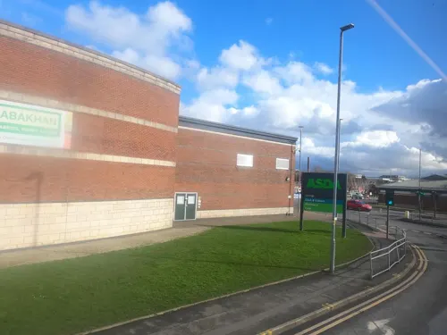


Market Street Tavern
Bar and pub · 1.4 mi
131 Market Street, Manchester

The Hare & Hounds
Bar and pub · 1.2 mi
13 Market Street, Manchester
The Lever Bridge
Bar and pub · 1.5 mi
210 Radcliffe Road, Bolton
106 more on the map.
History
Farnworth derives from the Old English fearn (fern) and worth (an enclosure). Farnworth was recorded as "Farneworth" and "Farnewrth" in 1278 and 1279, and "Ffornword" in a land survey of 1282.
Farnworth was originally a hamlet in Barton. In the 13th century it was held by the Lords of Barton and Manchester. By 1320 Adam Lever, Richard Hulton and Richard Redford held the manor as tenants. Later the manor was acquired by the Hultons of Over Hulton. In 1666 there were 91 hearths in Farnworth liable to pay tax. The commons were enclosed in 1798. There was a watermill on the River Croal.
The town expanded rapidly in the 18th and 19th centuries around the coal mining industry. The collieries were part of an extensive mine complex, the Worsley Navigable Levels whose underground canals stretched from the Delph at Worsley and linked the mines to the Bridgewater Canal. Other industry included iron foundries and cotton mills.
The owner of Farnworth Paper mills, T. B. Crompton, patented a continuous-drying process which contributed to the mechanisation of papermaking in 1821.
Read more of the history
The adjoining open land of Halshaw Moor became an area for recreation for the town, hosting the annual Halshaw Moor Wakes that were described as a saturnalia which was first celebrated in September, 1827, when bull-baiting, badger-baiting, dog fighting, cock fighting, foot racing in almost a state of nudity, grinning through a horse collar, eating a dishful of scalding hot porridge without milk and feeding themselves with their bare hands, and even the more disgusting exhibition of eating a pound of tallow candles, and stripping the wicks through their teeth for wagers, were amongst the orgies on these occasions.
From the History section of Farnworth on Wikipedia, under CC BY-SA 4.0.
More about Farnworth
Geography
Farnworth measures about two miles from east to west, and one from north to south with an area of 1,502 acres (608 ha) on land sloping towards the north-east by the River Croal which forms the boundary. Will Hill Brook forms the northern boundary. The underlying rocks are the coal measures of the Manchester Coalfield. Districts in Farnworth include Dixon Green and New Bury. The town has grown along the Manchester to Bolton road, the A666 and the A575 road to Worsley and Eccles. Plodder Lane, the B6199, goes west past the Royal Bolton Hospital.
Education
Farnworth has nine primary schools and three secondary schools. Harper Green School is home to the Alan Ball Sports Hall, as well as the Peter Kay Theatre. In 2006, Peter Kay filmed a music video at Harper Green with the Scottish band Texas.
From the Wikipedia article Farnworth, under CC BY-SA 4.0.
Notable people from Farnworth
 Richard BancroftBritish Archbishop of CanterburyPhoto: Unidentified painter, Public domain
 Peter KayEnglish actor and stand-up comedian (born 1973)Photo: University of Salford Press Office, CC BY 2.0
 Alfred Mond, 1st Baron MelchettBritish politician (1868-1930)Photo: Henry Walter Barnett, Public domain
 Craig SteadmanEnglish snooker playerPhoto: Benutzer:Bill da Flute, CC BY-SA 3.0
 Mike PollittEnglish footballer (born 1972)Photo: Dan Farrimond, CC BY 2.0
 Simon TongEnglish guitarist and keyboardistPhoto: Rama, CC BY-SA 2.0 fr
 David NorwoodBritish chess playerPhoto: Federació d'Escacs Valls d'Andorra..., CC BY 2.0
- Alan Ball Jr.English footballer and manager (1945-2007)
- Frank FinlayBritish actor (1926–2016)
- Paul MarinerEnglish footballer (1953–2021)
- Tommy BanksEnglish footballer (1929-2024)
- Jason WilcoxEnglish association football player (born 1971)
Born in Farnworth, according to Wikidata (CC0). Each name links to its Wikipedia article.
Where to stay1
Churches and places of worship42
St Stephen and All Martyrs' Church
Church · Anglican · 1.5 mi
178 Radcliffe Road, Bolton
Shopping20
Gas and EV charging9
Schools, colleges and libraries35
St Stephen and All Martyrs' CofE School, Lever Bridge
School · Anglican · 1.5 mi
Radcliffe Road, Bolton
Healthcare10
Map of Farnworth
250 places. The map loads OpenStreetMap tiles when you open it.
Getting there and nearby towns
Manchester Airport (MAN) is the nearest airport with scheduled flights listed in OpenStreetMap, 15 miles away.
- Little Lever 1 mi northeast, about 2 min by car
- Little Hulton 1 mi southwest, about 2 min by car
- Kearsley 1 mi southeast, about 2 min by car
- Bolton 3 mi northwest, about 4 min by car
- Swinton 4 mi southeast, about 6 min by car
- Whitefield 4 mi east, about 7 min by car
- Prestwich 5 mi east, about 8 min by car
- Westhoughton 5 mi west, about 8 min by car
- Salford 6 mi southeast, about 10 min by car
- Manchester 8 mi southeast, about 13 min by car
Drive times are estimates from straight-line distance, not routes.
Towns near Farnworth


Keep exploring
Local news
Headlines from INDB.
Reviews, tips and questions
Loading what members have shared...
Sources and licences
- GeoNames (CC BY 4.0): population, coordinates, regions and time zone
- Mapillary (see each image): photos
- OpenStreetMap contributors (ODbL 1.0): places, airports, map data
- Wikidata (CC0 1.0): elevation, founding date, time zone, website, landmarks and historic places
- Wikimedia Commons (see each image): photos
- Wikipedia (CC BY-SA 4.0): overview and history text
Photo credits
- Farnworth Town Hall, David Ingham from Bury, Greater Manchester, England, CC BY-SA 2.0
- Cenotaph, Farnworth, Bill Boaden, CC BY-SA 2.0
- Alan Ball House, Farnworth, Plucas58, CC BY-SA 4.0
- Octagon Theatre Bolton Front Sidewalk, University of Salford, CC BY 2.0
- Outwood viaduct from river irwell, Parrot of Doom, CC BY-SA 4.0
- Ringley old bridge, Parrot of Doom, CC BY-SA 3.0
- Bolton War Memorial complete, Geni, CC BY-SA 4.0
- Bolton Civic Centre1, The original uploader was Austen Redman at English Wikipedia ., CC BY-SA 2.5
- Bolton Steam Museum front, User:Griffdsp, Public domain
- Radcliffe cenotaph, Ingy the Wingy, CC BY-SA 2.0
- Long curve, Leverhulme park, darcy lever, bolton - panoramio, Mitt Doot, CC BY 3.0
- All Souls Church, Bolton, Margaret Clough, CC BY-SA 2.0
- St George's Church, Bolton, David Dixon, CC BY-SA 2.0
- St John Farnworth, Plucas58, Public domain
- St John's Mosley Common, J3Mrs, CC BY-SA 3.0
- Moses gate 002, Original uploader was Geotek at en.wikipedia, Public domain
- St Matthew's Church, Little Lever, Alexander P Kapp, CC BY-SA 2.0
- St Stephen and all Martyrs, Lever Bridge, Bolton, Plucas58, CC BY-SA 3.0
- Irwell Sculpture Trail Lookout, Parrot of Doom, Public domain
- Bank Street Unitarian Chapel, Bolton (3), Rept0n1x, CC BY-SA 3.0
- Shakespeare public house, Farnworth, Alan Murray-Rust, CC BY-SA 2.0
- Blackleach Country Park 01, SG2012, CC BY 2.0
- War memorial, Queens Park, Bolton, Bill Boaden, CC BY-SA 2.0
- Street-level photo, tonys999, CC BY-SA 4.0
- Street-level photo, tonys999, CC BY-SA 4.0
- Street-level photo, tonys999, CC BY-SA 4.0
- Street-level photo, tonys999, CC BY-SA 4.0
- Street-level photo, tonys999, CC BY-SA 4.0
- Street-level photo, tonys999, CC BY-SA 4.0
- Street-level photo, tonys999, CC BY-SA 4.0
- Street-level photo, tonys999, CC BY-SA 4.0
- Street-level photo, tonys999, CC BY-SA 4.0
- Street-level photo, tonys999, CC BY-SA 4.0
- Street-level photo, tonys999, CC BY-SA 4.0
- Street-level photo, tonys999, CC BY-SA 4.0


Page built November 10, 2026. Spotted a mistake? Tell us or suggest a place.