


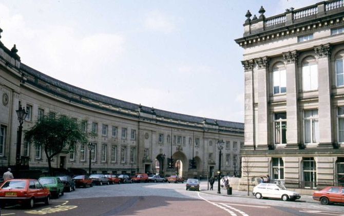

Little Hulton, United Kingdom
Little Hulton is a town of 13,469 people in England, United Kingdom.
Why visit Little Hulton
Townapedia lists 6 museums and landmarks, 17 parks and trails, 122 places to eat, 1 place to stay and 5 attractions in and around town.
Highlights include Octagon Theatre, Ringley Old Bridge, Bolton Cenotaph and Bolton Museum.
Weather in Little Hulton
Forecast from MET Norway (CC BY 4.0). Full forecast
About Little Hulton
Little Hulton is a suburb in the City of Salford, Greater Manchester, England, 3.4 miles (5.5 km) south of Bolton, 7 miles (11.3 km) northwest of Salford, and 9 miles (14.5 km) northwest of Manchester. Within the boundaries of the historic county of Lancashire, Little Hulton is bordered by Farnworth to the north, Walkden to the east and Tyldesley to the south.
From the Wikipedia article Little Hulton (this version), under CC BY-SA 4.0.
Photos of Little Hulton


Things to do5

Octagon Theatre
Cinema and theater · 3.1 mi
Theatre in Bolton, Greater Manchester, England

Ringley Old Bridge
Bridge · 2.5 mi
Grade II* listed bridge in Bolton, Greater Manchester, England, UK
Tyldesley Little Theatre
Cinema and theater · 2.6 mi
Theatre in Tyldesley, England


Museums and landmarks6

Bolton Cenotaph
Monument and historic site · 3.2 mi
Cenotaph in Bolton, Greater Manchester, England, UK

Bolton Museum
Museum · 3.1 mi
Public museum and art gallery in the town of Bolton, Greater Manchester, England

Lancashire Mining Museum
Museum · 2.9 mi
Mining museum in Greater Manchester, United Kingdom

New Hall moated site
Monument and historic site · 2.5 mi
Scheduled monument in Tyldesley, Greater Manchester, England, UK
Waldken Memorial
Monument and historic site · 1.1 mi
The impressive structure was erected in memory of the Countess of Ellesmere, Lady Harriet Egerton. It was moved to its current home next...
Parks, trails and playgrounds17

Blackleach Country Park
Park · 0.9 mi
Country park in Walkden, Greater Manchester, England

Clifton Country Park
Park · 2.9 mi
Nature reserve in Greater Manchester, England


Moses Gate Country Park
Park · 2.0 mi
Park in Moses Gate, United Kingdom

Queen's Park, Bolton
Park · 3.4 mi
Park in Bolton, Greater Manchester, England, UK


5 more on the map.
Restaurants and cafes122

The Bull's Head Hotel
Bar and pub · 0.9 mi
12 High Street, Manchester
Mo,Tu,We,Th,Su 08:00-24:00; Fr,Sa 08:00-25:00



110 more on the map.
History
The earliest remains from Little Hulton were excavated between 2006–2008 by Oxford Archaeology when the remains of Mesolithic flints and a small pit filled with fire-cracked stones were discovered. In addition a later Bronze Age roundhouse 7 metres (23 ft) in diameter and several four post structures were found, dating to between 1480 BC and 1080 BC.
The ancient district of Hulton containing three townships, Over Hulton, Middle Hulton and Little Hulton, was recorded as Helghtun and Hulton in 1235, Hilton in 1278 and 1292, and Hulton in 1292, although Hilton was still used until the 17th century. Historically Little Hulton was a village in the ancient Deane parish, with a chapel sometimes called Peel Chapel. The chief manor was held by the Hultons at Hulton Park in Over Hulton.
Wharton was a subordinate manor that gave its name to the family living there. Later it was owned by the Asshetons of Great Lever and after that the Morts. It was sold to Bridgewater Collieries. Wharton Hall was a two-storey farmhouse built of brick, timber and plaster.
A medieval bloomery was discovered in 2006–2008 during work by Oxford Archaeology dating to between the 12th and 14th centuries. Five possible furnaces were discovered by excavation in addition to several structures and windbreaks.
Read more of the history
In the 13th century Peel or Wicheves, another district in the township, was owned by the Hultons who sold it to the Tyldesleys. Later it was owned by Edmund Fleetwood of Rossall who sold it to the Morts. Joseph Yates of Manchester bought it in the 18th century and his descendants sold it to colliery owner, Ellis Fletcher of Clifton. Peel Hall was reputedly built in 1840 by Matthew Fletcher, from the designs of Sir Charles Barry. It stood on the site of an older stone-built hall which had a moat. Peel Hall became a sanatorium to treat tuberculosis and subsequently a geriatric hospital until it closed in 1990. It was sold to a development company for refurbishment but, despite being a Grade II listed building, was vandalised, became dangerous and was demolished in the mid-1990s. Parts of the property still remain including the ice house which is also a grade II listed building.
Kenyon Peel Hall, was owned by Alexander Rigby in 1600 and he gave it to his son George. It passed to Roger Kenyon of Parkhead through marriage. It was a large timber, stone and brick house which was built in the late 16th century and enlarged in 1617. The house was demolished and the site is occupied by a modern housing estate. Kenyon Peel Hall was about a 1⁄4 mile (0.40 km) south of the ancient highway from Manchester to Bolton.
The main settlement in the eastern part of the area was Wharton Hall. The remains of the hall were excavated in 2006–2008 by Oxford Archaeology and included some substantial remains of walls and footings of an early 17th-century building. Adam Mort acquired Wharton Hall in 1628 and then demolished and rebuilt it, most likely in the following year. Several other post-medieval farmsteads were also uncovered including Cinder Hill and Ashes Farm at Little Hulton, Oliver Fold and Guest Fold within the Cutacre area.
Coal mining and weaving were the major occupations in the mid 19th century.
In 1870 the London and North Western Railway opened a line from Roe Green on the Eccles, Tyldesley and Wigan Railway to serve collieries at Little Hulton and in 1874 an extension to Bolton was opened with passenger services commencing in 1875. The line closed in 1965, and is now an urban cycleway. A 10-foot (3.0 m) wide Roman road was found when the railway was being cut.
Little Hulton was extensively mined from the mid-19th century. Its collieries included Madam's Wood Pits, Brackley, Wharton Hall, Ashton's Field and Peel Hall and most were served by mineral railways. Mine spoil was deposited around the early collieries but in the 20th century the Cutacre tip developed in the valley of the Cutacre Clough and was the dumping ground for mine waste from Brackley and neighbouring Mosley Common Collieries.
The National Coal Board Central Workshops, commonly known as 'Walkden Yard', south of Walkden High Street, close to the Ellesmere Colliery, was partly in Little Hulton. The workshops were built in 1878 by the Bridgewater Collieries as a central works depot providing engineering services for its collieries and the locomotives used on its colliery railway system. It closed as a British Coal workshop in 1986 and is now the site of a housing estate.
UK Coal was granted planning permission to surface mine 900,000 tonnes of coal and rework the Cutacre spoil tip in 2001. The operation was expected to last for four years and began in 2006. The restoration scheme was expected to create more than 250 acres (100 ha) of amenity woodland and wetlands and an area for industrial development. UK Coal and Bolton Council promoted the Middle Hulton portion of Cutacre through the Local Development Framework process and identified it as a key strategic site for development. After operations finished in 2011, the site was restored and landscaped to create an industrial estate covering 212 acres (86 ha) and 580 acres (230 ha) of recreational land.
Before 1949 Little Hulton was a village of around 8,000 people. The land was developed into council housing overspill estates by Worsley Urban District Council to accommodate residents moved there from post-war slum clearance areas. By the end of 1956 over a thousand families had moved to the overspill estate being built at Little Hulton and by 1962 3,060 houses had been built. Little Hulton aimed to create a suburb that would improve the standard of living and create private space, greenspace and a sense of community for the new residents.
The housing estate to the northwest, along the Wigan road, is known as Greenheys. Here the 1894 Ordnance Survey map shows only Greenhey's House and a few roadside houses.
From the History section of Little Hulton on Wikipedia, under CC BY-SA 4.0.
More about Little Hulton
Geography
Little Hulton is the most easterly of the Hulton townships, it covers an area of 1,707 acres (691 ha) rising from 200 feet (61 m) in the south east to 380 feet (120 m) in the north west. The main Manchester to Chorley road, the A6, crosses the town. Much of the area was pasture and meadow on good soil. Sandstone was quarried at Peel Quarry and the underlying rocks are the coal measures of the Manchester Coalfield.
From the Wikipedia article Little Hulton, under CC BY-SA 4.0.
Notable people from Little Hulton
 Shaun RyderBritish singerPhoto: Raph_PH, CC BY 2.0
- Guy ThorneEnglish journalist and novelist (1876-1923)
- Arthur BateEnglish footballer (1908-1993)
- Stan CharltonEnglish association footballer born 1900
- George MaddisonEnglish footballer (1902-1959)
- Fred UrmsonFootballer (1907-1985)
- Tommy BleakleyEnglish footballer
- Henry ParkinsonEnglish footballer (1899-1994)
- Walter RowleyEnglish footballer (1891–1976)
- Harry GrundyEnglish footballer
- Tom JonesEnglish footballer
- Harry Hampson(1918-1942)
Born in Little Hulton, according to Wikidata (CC0). Each name links to its Wikipedia article.
Where to stay1
Churches and places of worship43
Shopping23
Gas and EV charging9
Schools, colleges and libraries34
Healthcare14
Little Hulton Health Centre
Clinic and pharmacy · 0.4 mi
Longshaw Drive, Little Hulton
Map of Little Hulton
250 places. The map loads OpenStreetMap tiles when you open it.
Getting there and nearby towns
Manchester Airport (MAN) is the nearest airport with scheduled flights listed in OpenStreetMap, 14 miles away.
- Little Lever 3 mi northeast, about 4 min by car
- Bolton 4 mi north, about 6 min by car
- Swinton 4 mi southeast, about 6 min by car
- Westhoughton 5 mi west, about 7 min by car
- Whitefield 5 mi east, about 8 min by car
- Prestwich 5 mi east, about 9 min by car
- Salford 6 mi southeast, about 10 min by car
- Manchester 8 mi southeast, about 13 min by car
- Wigan 9 mi west, about 15 min by car
- Ramsbottom 9 mi northeast, about 14 min by car
Drive times are estimates from straight-line distance, not routes.
Towns near Little Hulton


Keep exploring
Local news
Headlines from INDB.
Reviews, tips and questions
Loading what members have shared...
Sources and licences
- GeoNames (CC BY 4.0): population, coordinates, regions and time zone
- Mapillary (see each image): photos
- OpenStreetMap contributors (ODbL 1.0): places, airports, map data
- Wikidata (CC0 1.0): elevation, founding date, time zone, website, landmarks and historic places
- Wikimedia Commons (see each image): photos
- Wikipedia (CC BY-SA 4.0): overview and history text
Photo credits
- St. Edmund, Bridgewater St, Little Hulton (461504) (9453049305), Robert Linsdell from St. Andrews, Canada, CC BY 2.0
- Octagon Theatre Bolton Front Sidewalk, University of Salford, CC BY 2.0
- Ringley old bridge, Parrot of Doom, CC BY-SA 3.0
- Bolton War Memorial complete, Geni, CC BY-SA 4.0
- Bolton Civic Centre1, The original uploader was Austen Redman at English Wikipedia ., CC BY-SA 2.5
- Long curve, Leverhulme park, darcy lever, bolton - panoramio, Mitt Doot, CC BY 3.0
- Moses gate 002, Original uploader was Geotek at en.wikipedia, Public domain
- Chowbent Chapel, J3Mrs ( talk ), CC BY-SA 3.0
- St George's Church, Bolton, David Dixon, CC BY-SA 2.0
- St Anne's Church, Atherton, Margaret Clough, CC BY-SA 2.0
- St George, Tyldesley, north, J3Mrs ( talk ), CC BY-SA 3.0
- St John Farnworth, Plucas58, Public domain
- St John's Mosley Common, J3Mrs, CC BY-SA 3.0
- Irwell Sculpture Trail Lookout, Parrot of Doom, Public domain
- Bank Street Unitarian Chapel, Bolton (3), Rept0n1x, CC BY-SA 3.0
- Roscoe family grave, St Paul's, Peel, Plucas58, CC BY-SA 4.0
- St. Mary's Park, Portland Rd, Walkden (506184) (34052057222), Robert Linsdell from St. Andrews, Canada, CC BY 2.0
- Blackleach Country Park 01, SG2012, CC BY 2.0
- War memorial, Queens Park, Bolton, Bill Boaden, CC BY-SA 2.0
- Street-level photo, tonys999, CC BY-SA 4.0
- Street-level photo, tonys999, CC BY-SA 4.0
- Street-level photo, tonys999, CC BY-SA 4.0
- Street-level photo, tonys999, CC BY-SA 4.0
- Street-level photo, tonys999, CC BY-SA 4.0
- Street-level photo, tonys999, CC BY-SA 4.0
- Street-level photo, tonys999, CC BY-SA 4.0
- Street-level photo, tonys999, CC BY-SA 4.0


Page built November 10, 2026. Spotted a mistake? Tell us or suggest a place.