


Westhoughton, United Kingdom
Westhoughton is a town of 26,260 people in England, United Kingdom.
Why visit Westhoughton
Townapedia lists 3 museums and landmarks, 10 parks and trails, 57 places to eat, 1 place to stay and 1 attraction in and around town.
Highlights include Tyldesley Little Theatre, Gidlow Hall moated site, The White Wall gallery & Framers and Borsdane Wood.
Weather in Westhoughton
Forecast from MET Norway (CC BY 4.0). Full forecast
About Westhoughton
Westhoughton is a town and civil parish in the Metropolitan Borough of Bolton, Greater Manchester, England, 4 miles (6 km) southwest of Bolton, 5 miles (8 km) east of Wigan and 13 miles (21 km) northwest of Manchester.
From the Wikipedia article Westhoughton (this version), under CC BY-SA 4.0.
Travel tips from other travellers: Westhoughton on Wikivoyage (CC BY-SA 4.0).
Things to do1
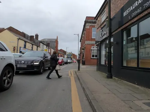
Tyldesley Little Theatre
Cinema and theater · 3.3 mi
Theatre in Tyldesley, England
Museums and landmarks3

Gidlow Hall moated site
Monument and historic site · 1.9 mi
Archaeological site in Wigan, Greater Manchester, England, UK

Parks, trails and playgrounds10





Restaurants and cafes57


The Bank
Restaurant
75-77 Market Street, Bolton
Mo-Th 16:00-23:00; Fr 16:00-01:00; Sa 12:00-01:00; Su 12:00-00:00
The Beer School
Bar and pub
88 Market Street, Bolton
We-Th 15:00-23:00, Fr-Su 12:00-23:00

Self.Westhoughton
Cafe · Coffee Shop
Self is a coffee shop which runs classes, events and sells a range of items including eco-friendly products.
100 Market Street, Bolton
45 more on the map.
History
The name Westhoughton is derived from the Old English, halh (dialectal "haugh") for a nook or corner of land, and 'tun' for a farmstead or settlement – meaning a "westerly settlement in a corner of land". It has been recorded variously as Halcton in 1210, Westhalcton in 1240, Westhalghton in 1292, Westhalton in 1302 and in the 16th-century as Westhaughton and Westhoughton.
The people of Westhoughton are sometimes known as "Howfeners" (from Houghton) or "Keaw-yeds" (cow heads) or "Keawyedners" (a combination of the two), and the town is known as "Keawyed City". Supposed folklore ("re-invented" in the Edwardian period) describes a farmer who found his cow with its head stuck in a five barred gate, and, rather than damage the gate, cut the cow's head off, as the cow cost less than the gate. The village of Tideswell in Derbyshire shares this same legend.
In 1315, a group of men led by Sir William Bradshaigh of Haigh Hall, Sir Henry Lea of Charnock Richard and Sir Adam Banastre met at Wingates to plan a campaign of violence against Sir Robert de Holland of Upholland, chief retainer of the powerful Earl of Lancaster. The campaign came to be known as the Banastre Rebellion and ended with the deaths of most of the main protagonists.
Read more of the history
On 15 December 1642, during the English Civil War, the Battle of Warcock Hill was fought on Westhoughton Common between Lord Derby's Cavalier forces and Parliamentarians. The site of the battle was off the Manchester Road where Wayfaring is today. The Parliamentarians under Captains Bradshaw, Venables and Browne ran into a force of some thousand Royalists from the Wigan garrison under Lord Derby and were forced to surrender. The three captains and 160 men were taken prisoner.
It is believed that Prince Rupert of the Rhine gathered his troops in Westhoughton before the attack and ensuing massacre at Bolton in 1644. Civil War activity is also known to have occurred around the site of Hunger Hill and a sword claimed to be from the time of the Civil War was discovered in the garden of one of the cottages at Pocket Nook in Chew Moor during the 1950s.
On 25 March 1812, a group of Luddites burned Rowe and Dunscough's Westhoughton Mill. Twelve people were arrested on the orders of William Hulton, the High Sheriff of Lancashire. James Smith, Thomas Kerfoot, John (or Job) Fletcher and Abraham Charlston, were sentenced to death for their part in the attack. The Charlston family claimed that Abraham was only 12 years old; but he was not reprieved. The men were publicly hanged outside Lancaster Castle on 13 June 1812. It was reported that Abraham cried for his mother on the scaffold. By this time, however, hanging of those under 18 was rare and of those under 16, in practice, abolished. Nine others were transported to Australia. The riots are commemorated by a blue plaque on the White Lion public house opposite the mill site.
In 1891, the Rose Hill Doubling Mill had 8,020 spindles and Higson and Biggs' Victoria Mill had 40,000 spindles.
Bolton Road Mill housed 564 looms weaving shirtings and Perseverance Mill had 600 looms manufacturing twills, sateens and plain cotton cloth. The looms in John Chadwick's Silk Mills produced broad silks, tie silks, scarves and handkerchiefs. The Lancashire Hosiery Company produced vests. Thomas Welch was a calico printer at the Green Vale Print Works.
The family of William Hulton of Hulton Park owned many small collieries from the 16th-century. After 1828 the pits at Chequerbent were served by the Bolton and Leigh Railway. The Hulton Colliery Company sank Chequerbent Colliery in 1892 and Bank Pit Nos 1–4 between 1897 and 1901. The company mined the Trencherbone, Plodder and Arley seams. Bank Pit No 3, known as the Pretoria Pit, was the site of one Britain's worst coal-mining disasters when on 21 December 1910, 344 men and boys died in an explosion of firedamp. The Pretoria Pit Disaster was the third worst in British mining history, after the 1866 Barnsley Oaks Disaster in Yorkshire, which killed 361 miners, and the 1913 Senghenydd Colliery Disaster in Glamorgan, which killed 439. A memorial erected in 1910 is Grade II listed.
In 1896, the Wigan Coal and Iron Company's Eatock Pits employed 484 underground and 89 surface workers whilst the Hewlett Pits, at Hart Common, employed 981 underground and 182 on the surface.
From the History section of Westhoughton on Wikipedia, under CC BY-SA 4.0.
More about Westhoughton
Geography
Westhoughton covers an area of 4,341 acres (1,757 ha) and has an average breadth of over 2 miles (3.2 km) from north-east to south-west, and an extreme length of nearly 3.5 miles (5.6 km) from northwest to south-east. The highest ground at over 480 feet (150 m) is to the north east with the land sloping downwards to the south-west. The lowest point at about 120 feet (37 m) is in the extreme southerly corner. Borsdane Brook separates the township from Aspull, another brook divides it from Hindley joining a stream which rises on the northern edge of Westhoughton and flows south through Leigh to Glazebrook. The town incorporates several former villages and hamlets including railway stations including Wingates, White Horse, Over Hulton, Four Gates (or Fourgates), Chequerbent, Hunger Hill, Snydale, Hart Common, Marsh Brook, Daisy Hill and Dobb Brow.
Local Nature Reserves are located at Hall Lee Bank Park, Cunningham Clough, and Eatock Lodge at Daisy Hill.
Education
The long established St John's, Wingates CE Primary & Fourgates County Primary schools were closed in 2004 following amalgamation to form The Gates CP School. Westhoughton CP School closed in 2008. An earlier round of reorganisation saw the closure of Hart Common Primary School and opening of St George's on The Hoskers, and the closure of the tiny County Primary at White Horse which is now a private nursery.
From the Wikipedia article Westhoughton, under CC BY-SA 4.0.
Notable people from Westhoughton
 Nicky HuntEnglish footballer (born 1983)Photo: Paul W, CC BY-SA 4.0
 Maxine PeakeBritish actressPhoto: Brian Minkoff-London Pixels, CC BY-SA 4.0
 Ruth MadeleyBritish actressPhoto: Sarran Hamilton, CC BY-SA 4.0
 Charles MosesAustralian public servant (1900-1988)Photo: Max Dupain, Public domain
- Robert ShawBritish actor and writer (1927–1978)
- Francis LeeEnglish footballer (1944–2023)
- Dick Pollardcricketer (1912-1985)
- Jack BrutonEnglish footballer and manager (1903-1986)
- John Frankland RigbyBritish mathematician
- Joe ClareFootballer (1910-1987)
- Samuel MarshEnglish footballer (1879-?)
- Peter DitchfieldBritish historian and priest (1854-1930)
Born in Westhoughton, according to Wikidata (CC0). Each name links to its Wikipedia article.
Where to stay1
Churches and places of worship19
Shopping7
Gas and EV charging2
Schools, colleges and libraries10
Healthcare3
Map of Westhoughton
113 places. The map loads OpenStreetMap tiles when you open it.
Getting there and nearby towns
Manchester Airport (MAN) is the nearest airport with scheduled flights listed in OpenStreetMap, 17 miles away.
- Bolton 4 mi northeast, about 7 min by car
- Wigan 5 mi west, about 7 min by car
- Whitefield 9 mi east, about 15 min by car
- Salford 11 mi southeast, about 17 min by car
- St Helens 11 mi southwest, about 18 min by car
- Warrington 11 mi south, about 18 min by car
- Manchester 13 mi east, about 20 min by car
- Blackburn 14 mi north, about 23 min by car
- Preston 17 mi northwest, about 27 min by car
- Oldham 17 mi east, about 27 min by car
Drive times are estimates from straight-line distance, not routes.
Towns near Westhoughton


Keep exploring
Local news
Headlines from INDB.
Reviews, tips and questions
Loading what members have shared...
Sources and licences
- GeoNames (CC BY 4.0): population, coordinates, regions and time zone
- Mapillary (see each image): photos
- OpenStreetMap contributors (ODbL 1.0): places, airports, map data
- Wikidata (CC0 1.0): elevation, founding date, time zone, website, landmarks and historic places
- Wikimedia Commons (see each image): photos
- Wikipedia (CC BY-SA 4.0): overview and history text
Photo credits
- Westhoughton Town Hall front, David Dixon, CC BY-SA 2.0
- 110-112, Market Street, Westhoughton, Plucas58, CC BY-SA 4.0
- The Red Lion, Westhoughton (461404) (9455658324), Robert Linsdell from St. Andrews, Canada, CC BY 2.0
- St. Bartholomew's, Westhoughton (461406) (9452884191), Robert Linsdell from St. Andrews, Canada, CC BY 2.0
- Westhoughton C of E Primary School, Plucas58, CC BY-SA 4.0
- Cut Mark- Westhoughton, Victoria Street, Ray Hutchings, CC BY-SA 4.0
- Chowbent Chapel, J3Mrs ( talk ), CC BY-SA 3.0
- St Anne's Church, Atherton, Margaret Clough, CC BY-SA 2.0
- St George, Tyldesley, north, J3Mrs ( talk ), CC BY-SA 3.0
- St Michael's Church, Howe Bridge, Margaret Clough, CC BY-SA 2.0
- Tyldesley Top Chapel, J3Mrs, CC BY 3.0
- St James' Church, Daisy Hill, David Long, CC BY-SA 2.0
- Church Of St. John The Evangelist,Westhoughton, Bolton. 3, Barrie Price, CC BY-SA 4.0
- Westhoughton Library, David Dixon, CC BY-SA 2.0
- Street-level photo, mappo2, CC BY-SA 4.0
- Street-level photo, mappo2, CC BY-SA 4.0
- Street-level photo, mappo2, CC BY-SA 4.0
- Street-level photo, tonys999, CC BY-SA 4.0
- Street-level photo, mappo2, CC BY-SA 4.0


Page built November 10, 2026. Spotted a mistake? Tell us or suggest a place.