


Whitefield, United Kingdom
Whitefield is a town of 23,545 people in England, United Kingdom.
Why visit Whitefield
Townapedia lists 11 museums and landmarks, 28 parks and trails, 82 places to eat, 2 places to stay and 7 attractions in and around town.
Highlights include Clifton Aqueduct, Clifton Viaduct, Radcliffe Cenotaph and Radcliffe Tower.
Weather in Whitefield
Forecast from MET Norway (CC BY 4.0). Full forecast
About Whitefield
Whitefield is a town in the Metropolitan Borough of Bury, Greater Manchester, England. It lies on undulating ground above the Irwell Valley, along the south bank of the River Irwell, 3 miles (4.8 km) southeast of Bury, and 5 miles (8.0 km) northwest of Manchester. Prestwich and the M60 motorway lie just to the south. In 2001 it had a population of 23,283.
From the Wikipedia article Whitefield, Greater Manchester (this version), under CC BY-SA 4.0.
Travel tips from other travellers: Whitefield on Wikivoyage (CC BY-SA 4.0).
Things to do7

Clifton Aqueduct
Bridge · 1.7 mi
Grade II listed bridge in the United Kingdom

Clifton Viaduct
Bridge · 1.7 mi
Grade II listed bridge in Greater Manchester, England, UK

Daisyfield Viaduct
Bridge · 2.8 mi
Stone structure crossing the Manchester, Bolton and Bury Canal and River Irwell in Bury, Greater Manchester, England

Outwood Viaduct
Bridge · 1.4 mi
Grade II listed footbridge in Bury, Greater Manchester, England, UK

Ringley Old Bridge
Bridge · 2.4 mi
Grade II* listed bridge in Bolton, Greater Manchester, England, UK


Museums and landmarks11

Radcliffe Cenotaph
Monument and historic site · 1.4 mi
War memorial in Bury, Greater Manchester, England, UK

Radcliffe Tower
Monument and historic site · 1.0 mi
Grade I listed fortified house in Radcliffe, Greater Manchester, England, United Kingdom

Bury Castle
Monument and historic site · 3.0 mi
Castle in Greater Manchester, England, UK

Bury War Memorial
Monument and historic site · 3.0 mi
War memorial in Bury, UK

Lancashire Fusiliers War Memorial
Monument and historic site · 2.9 mi
War memorial in Bury, UK

Peel Memorial
Monument and historic site · 3.0 mi
Statue in Bury, Greater Manchester, England, UK

Bury Art Museum
Museum · 2.9 mi
Museum, archives, and gallery in Bury, Lancashire, England, United Kingdom
The Fusilier Museum
Museum · 2.9 mi
War museum in Moss Street, Bury, Lancashire, UK

LYR1
Monument and historic site · 1.5 mi
Boundary stone for Lancashire and Yorkshire Railway Company.
Parks, trails and playgrounds28

Clifton Country Park
Park · 2.1 mi
Nature reserve in Greater Manchester, England

Drinkwater Park
Park · 2.0 mi
Park in Prestwich, Greater Manchester, UK


Moses Gate Country Park
Park · 3.3 mi
Park in Moses Gate, United Kingdom


Philips Park
Park · 1.2 mi
Area of parkland in Prestwich, Greater Manchester, UK

16 more on the map.
Restaurants and cafes82
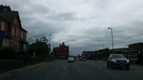
8 Manchester
Restaurant · Chinese
260 Bury New Road, Whitefield
Mo-Th 17:00-22:30; Fr 17:00-23:00; Su 12:30-21:30
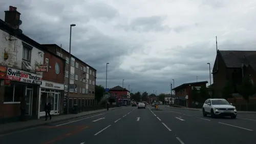
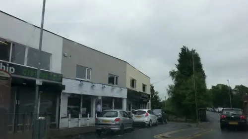
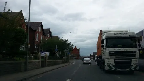


70 more on the map.
History
There are several theories for the origin of the place name, discussed in two local history publications. One, published in John Wilson's A History of Whitefield (1979), is that the name is derived from the Flemish weavers who used to lay out their fabrics to bleach in the sun (a process known as tentering). Although Wilson doubts this, believing it to be chronologically inaccurate, another theory relies on the fact that historically, Whitefield has been a farming community of open fields, and that the name is a corruption of "Wheat-fields". A third is that the name refers to a field of white flowers, evidenced by the existence of the area of Lily Hill Street.
In Remains, Historical and Literary, Connected with the Palatine Counties of Lancaster and Chester (1861), the will of a John Rhodes describes leaving ownership of land in Whitefield Moore in Pilkington, to his son.
Read more of the history
In Elizabethan times, Whitefield was mostly moorland and until the 19th century existed, along with the districts of Ringley, Unsworth and Outwood, as part of the Manor of Pilkington. In the 15th century the Pilkington family who, during the Wars of the Roses, supported the House of York, owned much of the land around the parish. Thomas Pilkington was at this time lord of many estates in Lancashire including the Manor of Bury. In 1485 Richard III was killed in the Battle of Bosworth. The Earl of Richmond, representing the House of Lancaster, was crowned Henry VII. Sir William Stanley may have placed the crown upon his head. As a reward for the support of his family, on 27 October 1485 Henry made Thomas Stanley the Earl of Derby. Thomas Pilkington was attainted, and in February 1489 Earl Thomas was given many confiscated estates including those of Pilkington, which included the township of Pilkington, and Bury. With their seat at Knowsley Hall, the Earls of Derby were by and large absentee landlords who appointed agents to manage their interests in the area, unlike the Earls of Wilton whose lands at Prestwich bordered the area and who oversaw events on their estate and dispensed charity from Heaton Hall.
Over the centuries, hamlets grew at Besses o' th' Barn, Lily Hill, Four Lane Ends (now the junction around Moss Lane and Pinfold Lane), Stand and Park Gate (now the junction around Park Lane and Pinfold Lane). These now form the area known as Whitefield. Besses o' th' Barn was for some time known as Stone Pale and a small street of that name still exists.
From the History section of Whitefield, Greater Manchester on Wikipedia, under CC BY-SA 4.0.
More about Whitefield
Geography
At 53°33′7″N 2°17′57″W (53.552°, −2.299°), Whitefield lies on the west side of the conjunction of the M60 and M66 motorways, and south of the River Irwell. The larger towns of Bury and Middleton lie to the north and east respectively. For purposes of the Office for National Statistics, Whitefield forms part of the Greater Manchester Urban Area, with Manchester city centre itself 5 miles (8.0 km) south-southeast of Whitefield.
Localities within Whitefield include Besses o' th' Barn, Hillock, Lily Hill, Park Lane, Stand and to the south of the M60 motorway and separated by it from the rest of the township is Kirkhams.
Economy
In 1906 the following textile bleaching, dyeing and finishing businesses existed in Whitefield: John Brierley (at Spring Clough); W.E. Buckley & Co Ltd (Hollins Vale); R.& A. Chambers Ltd (Spring Waters); Thomas L. Livesey Ltd (Hollins Vale); Mark Fletcher & Sons Ltd (Moss Lane Mills, having been founded in Little Lever in 1854); William Hampson (Besses); Kilner Croft Dyeing Co Ltd (Unsworth); Whitefield Velvet & Cord Dyeing Co Ltd (Crow Oak Works); and Philip Worrall (Hollins Vale).
At the same time there were five cotton manufacturers in the area: J.G. Clayton and Nelson, Greenhalgh & Co (both at Albert Mills, on what was then Workhouse Lane); Lord, Frears & Bro. (Whitefield New Mill); Francis Mather (Whitefield Mill); and Worthington & Co (Victoria Mills, Unsworth). There were also two smallware manufacturers in the area, being Prestwich Smallware Co (on Hardmans Green, Besses) and the Victoria Smallware Co on Narrow Lane. There were also at least two firms in the building trade: John Jackson & Son, builder and joiners, on Livesey Street; and F.M. & H. Nuttall, builders and stonemasons, who were on Moss Lane and later had their stoneyard adjoining the west side of Whitefield railway station.
Arts and culture
One local newspaper that covers the area of Whitefield (as well as neighbouring Prestwich and Radcliffe) is the Advertiser, (one of the GMWN Greater Manchester Weekly News newspapers) a weekly freesheet based in Salford. The other local paper (not distributed freely, door to door) is the Prestwich and Whitefield Guide.
Sedgley Park R.U.F.C. play their home matches at their Park Lane ground, and were in National Division One until the end of the 2008–09 season.
Besses o' th' Barn Band, and subsequently its associated boys' band, has existed in the area since at least 1818, at which time it had converted from a string band to a reed band. Its founders were John, James and Joseph Clegg – three brothers who were manufacturers of cotton products at Besses o' th' Barn – and for this reason it was for a time known as Clegg's Reed Band. Originally using a room called the mangle room, attached to the old barn at Besses which was pulled down in the 1880s, it has had its headquarters on Moss Lane since 1884. At the peak of its fame in the early 1900s this band, by now using brass instruments, undertook numerous prestigious engagements, including world tours lasting well in excess of 12 months at a time.
From the Wikipedia article Whitefield, Greater Manchester, under CC BY-SA 4.0.
Notable people from Whitefield
 Cecil Howard GreenAmerican geophysicist and businessman (1900–2003)Photo: A.T. Service, CC BY-SA 3.0
 Marcus SheffIsraeli-British chief executive officer & journalistPhoto: GHK54, CC BY-SA 4.0
 Derek HiltonBritish musicianPhoto: Nzwriter, CC BY-SA 4.0
- Dodie SmithEnglish children's novelist and playwright (1896–1990)
- David BallFootballer (born 1989)
- Warren HeggCricket player of England. (born 1968)
- Arthur WarburtonEnglish footballer (1903-1978)
- Rob GoldstoneBritish journalist
- Craig SkinnerEnglish footballer (born 1970)
- Norman McVickerEnglish cricketer (1940-2008)
- David LeeEnglish footballer born in 1967
- Mark PhilipsBritish politician; (1800-1873)
Born in Whitefield, according to Wikidata (CC0). Each name links to its Wikipedia article.
Where to stay2
Churches and places of worship35
Shopping12
Gas and EV charging5
Schools, colleges and libraries25
Radcliffe Hall Church of England Methodist Primary School
School · Anglican, Methodist · 1.2 mi
Bury Street, Manchester
St Bernadette's Roman Catholic Primary School
School · Roman Catholic · 0.7 mi
Abingdon Avenue, Manchester
St Mary's Church of England Aided Primary School, Prestwich
School · Anglican · 1.4 mi
Rectory Lane, Manchester
Healthcare7
Whitefield Pharmacy
Clinic and pharmacy · 1.0 mi
Unit 3, Ribble Sq Ribble Drive, Whitefield, Manchester
Prestwich Hospital (Edenfield Centre)
Hospital · 1.5 mi
Tottington Lane, Manchester
Map of Whitefield
214 places. The map loads OpenStreetMap tiles when you open it.
Getting there and nearby towns
Manchester Airport (MAN) is the nearest airport with scheduled flights listed in OpenStreetMap, 14 miles away.
- Salford 4 mi south, about 7 min by car
- Manchester 5 mi southeast, about 9 min by car
- Bolton 6 mi northwest, about 10 min by car
- Oldham 7 mi east, about 12 min by car
- Stockport 11 mi southeast, about 18 min by car
- Wigan 14 mi west, about 22 min by car
- Warrington 16 mi southwest, about 26 min by car
- Blackburn 16 mi northwest, about 25 min by car
- Wilmslow 16 mi south, about 25 min by car
- Burnley 17 mi north, about 28 min by car
Drive times are estimates from straight-line distance, not routes.
Towns near Whitefield


Keep exploring
Local news
Headlines from INDB.
Reviews, tips and questions
Loading what members have shared...
Sources and licences
- GeoNames (CC BY 4.0): population, coordinates, regions and time zone
- Mapillary (see each image): photos
- OpenStreetMap contributors (ODbL 1.0): places, airports, map data
- Wikidata (CC0 1.0): elevation, founding date, time zone, website, landmarks and historic places
- Wikimedia Commons (see each image): photos
- Wikipedia (CC BY-SA 4.0): overview and history text
Photo credits
- Whitefield - All Saints Parish Church, Stand, Alexander P Kapp, CC BY-SA 2.0
- All Saints Church, Whitefield, David Ingham from Bury, Greater Manchester, England, CC BY-SA 2.0
- Clifton Aqueduct aerial shot, Parrot of Doom, CC BY-SA 4.0
- Clifton viaduct looking north, Parrot of Doom, CC BY-SA 3.0
- Manchester bolton and bury canal, daisyfield viaduct 2, Parrot of Doom at English Wikipedia, Public domain
- Outwood viaduct from river irwell, Parrot of Doom, CC BY-SA 4.0
- Ringley old bridge, Parrot of Doom, CC BY-SA 3.0
- Radcliffe cenotaph, Ingy the Wingy, CC BY-SA 2.0
- Radcliffe tower hdr, Parrot of Doom, CC BY-SA 3.0
- Bury Castle moat wall, Chemical Engineer, CC BY-SA 4.0
- Bury War Memorial, Peter Broster, CC BY 4.0
- Lancashire Fusiliers memorial, Gallipoli Garden, Bury (5), Rept0n1x, CC BY-SA 3.0
- Peel Memorial statue - Bury, Christian David, CC BY-SA 4.0
- Manchester Town Hall Colonade, Pimlico Badger, CC BY-SA 2.0
- Moses gate 002, Original uploader was Geotek at en.wikipedia, Public domain
- Victoria Park, Swinton (8179908674), Craig Sunter from Manchester, UK, CC BY 2.0
- Bury Parish Church, David Ingham from Bury, Greater Manchester, England, CC BY-SA 2.0
- Prestwich, St Mary's Church, Iain Peacock, CC BY-SA 2.0
- Holy Trinity Church, Bury, Alexander P Kapp, CC BY-SA 2.0
- Parish Church of St Mary, Radcliffe, Alexander P Kapp, CC BY-SA 2.0
- St Margarets Church, Prestwich, Richerman ( talk ) 22:17, 26 January 2008 (UTC), CC BY 3.0
- St Matthew's Church, Little Lever, Alexander P Kapp, CC BY-SA 2.0
- Irwell Sculpture Trail Lookout, Parrot of Doom, Public domain
- Drinkwater Park, User:Richerman, CC BY-SA 3.0
- Street-level photo, adam2, CC BY-SA 4.0
- Street-level photo, adam2, CC BY-SA 4.0
- Street-level photo, lvl5, CC BY-SA 4.0
- Street-level photo, adam2, CC BY-SA 4.0
- Street-level photo, adam2, CC BY-SA 4.0
- Street-level photo, adam2, CC BY-SA 4.0
- Street-level photo, adam2, CC BY-SA 4.0
- Street-level photo, adam2, CC BY-SA 4.0
- Street-level photo, adam2, CC BY-SA 4.0
- Street-level photo, adam2, CC BY-SA 4.0
- Street-level photo, adam2, CC BY-SA 4.0
- Street-level photo, lvl5, CC BY-SA 4.0
- Street-level photo, skifans, CC BY-SA 4.0


Page built November 10, 2026. Spotted a mistake? Tell us or suggest a place.