


Why visit Fowey
Townapedia lists 19 museums and landmarks, 9 parks and trails, 35 places to eat, 11 places to stay and 5 attractions in and around town.
Highlights include Readymoney Cove, St Catherine's Point Light, Fowey Town Museum and Saint Catherine's Castle.
Weather in Fowey
Forecast from MET Norway (CC BY 4.0). Full forecast
About Fowey
Fowey ( FOY; Cornish: Fowydh [ˈfɔʊɪð] , meaning beech trees) is a port town and civil parish at the mouth of the River Fowey in south Cornwall, England, United Kingdom. The town has been in existence since well before the Norman invasion, with the local church first established some time in the 7th century; the estuary of the River Fowey forms a natural harbour which enabled the town to become an important trading centre. Privateers also made use of the sheltered harbourage. The Lostwithiel and Fowey Railway brought China clay here for export.
From the Wikipedia article Fowey (this version), under CC BY-SA 4.0.
Travel tips from other travellers: Fowey on Wikivoyage (CC BY-SA 4.0).
Photos of Fowey


Things to do5

Readymoney Cove
Beach · 0.6 mi
Beach and cove near Fowey, in Cornwall, England, UK




Museums and landmarks19


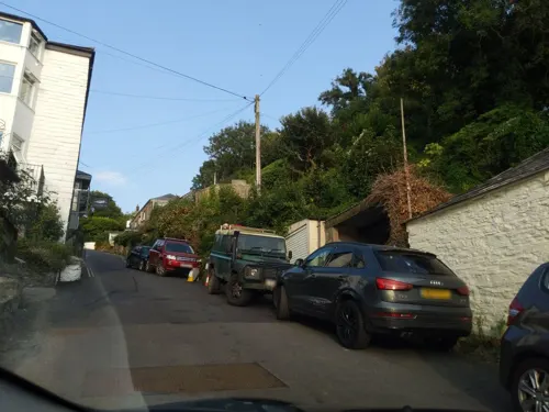
Ferryside
Monument and historic site · 0.4 mi
The author Daphne du Maurier wrote The Loving Spirit, published in 1931, at this former boatyard on the River Fowey in Bodinnick. It had...


Erected to the Memory of Sir Arthyr T. Quiller-Couch
Monument and historic site · 0.5 mi
7 more on the map.
Parks, trails and playgrounds9




Restaurants and cafes35
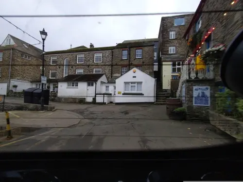
The Lugger Inn
Bar and pub · British · 0.5 mi
5 Fore Street, Fowey
Mo-Sa 11:30-23:00; Su 11:30-18:00




23 more on the map.
History
The Domesday Book survey at the end of the 11th century records manors at Penventinue and Trenant, and a priory was soon established nearby at Tywardreath. c. 1300 the prior granted a charter to people living in Fowey itself. This medieval town ran from a north gate near Boddinick Passage to a south gate at what is now Lostwithiel Street; the town extended a little way up the hillside and was bounded on the other side by the river where merchants had their houses backing onto the waterfront. The natural harbour allowed trade to develop with continental Europe and local ship owners often hired their vessels to the king to support various wars, although the town also developed a reputation for piracy, as did many others at this time. A group of privateers known as the 'Fowey Gallants' were given licence to seize enemy vessels during the Hundred Years' War.
Read more of the history
In the 14th century the harbour was defended by 160 archers; after these were withdrawn, two blockhouses were built, one on each side of the harbour entrance. Despite these defences the town was attacked by Breton pirates in 1457. Place House, by the church, was successfully defended against the French but subsequently strengthened. This building still exists, but much remodelled. A small castle was built on St Catherine's Point, the western side of the harbour entrance, around 1540. The defences proved their worth when a Dutch attack was beaten off in 1667.
The people of Fowey generally sided with the Royalists during the English Civil War, but in 1644 the Earl of Essex brought a Parliamentarian army to Lostwithiel and occupied the peninsula around Fowey. In August, a Royalist army surrounded Essex's troops and King Charles I himself viewed Fowey from Hall Walk above Polruan, where he came close to being killed by a musket shot. On 31 August, the Parliamentarian cavalry forced their way through the Royalist lines and retreated towards Saltash, leaving the foot soldiers to be evacuated by sea from Fowey. Essex and some officers did indeed escape, but the majority of the force surrendered a few days later near Golant and were then marched to Poole, but most died before reaching there.
There was a Barbary raid on Fowey in 1645, with 240 men, women, and children captured as slaves.
The fortunes of the harbour became much reduced, with trade going to Plymouth and elsewhere instead. Fishing became more important, but local merchants were often appointed as privateers and did some smuggling on the side. Tin, copper and iron mines, along with quarries and china clay pits became important industries in the area, which led to improvements at rival harbours. West Polmear beach was dug out to become Charlestown harbour circa 1800, as was Pentewan in 1826. Joseph Austen shipped copper from Caffa Mill Pill above Fowey for a while before starting work on the new Par harbour in 1829. Fowey had to wait another forty years before it saw equivalent development, but its natural deep-water anchorage and a rail link soon gave it an advantage over the shallow artificial harbours nearer to the mines and china clay works. Meanwhile, a beacon tower was erected on the Gribben Head by Trinity House to improve navigation into Fowey and around Par bay.
The Fowey Harbour Commissioners were established by an Act of Parliament in 1869, to develop and improve the harbour. On 1 June in that year, the 7 ft (2,134 mm) broad gauge Lostwithiel and Fowey Railway was opened to new jetties situated above Carne Point, and in 1873, the 4 ft 8+1⁄2 in (1,435 mm) standard gauge Cornwall Minerals Railway (CMR) opened a line from Newquay and Par to further jetties between Caffa Mill Pill and Carne Point. Both of these railways initially carried just goods, but on 20 June 1876, a passenger station was opened on the CMR on land reclaimed from Caffa Mill Pill. The Lostwithiel line closed at the end of 1879 but was reopened by the CMR as a standard gauge line in 1895, and the short gap between the two lines at Carne Point was eliminated. Passenger trains from Par were withdrawn after 1934 and from Lostwithiel in 1965. The Par line was subsequently converted to a dedicated roadway for lorries bringing china clay from Par after which all trains had to run via Lostwithiel.
The Royal National Lifeboat Institution established Fowey Lifeboat Station near the Town Quay in 1922 to replace an earlier station at Polkerris. This was replaced in 1997, by a new facility in Passage Street. Two lifeboats are stationed at Fowey: Maurice and Joyce Hardy, a Trent Class all weather boat that is kept afloat opposite the lifeboat station, and Olive Two, an IB1 inshore lifeboat kept inside the station and launched by davit.
Fowey was the main port for loading ammunition for the US 29th Division that landed on Omaha Beach on D Day during the Second World War. There was a munitions siding at Woodgate Pill just north of Fowey, originally built for the Great War conflict.
From the History section of Fowey on Wikipedia, under CC BY-SA 4.0.
More about Fowey
Geography
Fowey is a small town, civil parish and cargo port at the mouth of the River Fowey in south Cornwall, England. It is at the entrance to a large flooded valley created after the last ice age by the melt waters that caused the sea level to rise dramatically, creating a large natural harbour which is navigable for its last seven miles.
Fowey is in the South Coast (Eastern Section) of the Cornwall Area of Outstanding Natural Beauty. It lies at the end of the Saints' Way and has ferries across the river to Polruan (foot) and Bodinnick (vehicle). There are many historic buildings in the town, including the ruins of St Catherine's Castle, while Readymoney Cove possesses a local beach.
Besides the town of Fowey itself, the parish includes the coastal area between the mouth of the River Fowey and St Austell Bay, including Gribben Head and the small settlements of Menabilly, Polkerris, Polmear and Readymoney.
At the time of the 2001 census, Fowey had a population of 2,273. This had increased slightly at the 2011 census to 2,395. The Fowey electoral ward had a population of 4,690 in 2011.
Economy
Fowey has thrived as a port for hundreds of years, initially as a trading and naval town, then as the centre for china clay exports. Today Fowey is busy with trawlers and yachts. Tourism is also an important source of income, contributing £14m to the local economy and accounting for more than half of the jobs in the town.
Arts and culture
Fowey has been the inspiration for many authors, including Sir Arthur Quiller-Couch ('Q'), who lived in the town in retirement, and Daphne du Maurier. The du Maurier Festival Society runs the Fowey Festival of Arts and Literature each May, the month of her birth.
Various visual artists have had close connection with Fowey and lived there, including Fred Yates (painter), Andrew Litten Amanda Hoskin who primarily paints the local coastline. and Mabel Lucie Attwell. Fowey holds an annual Christmas craft market.
An engraving of a painting by Thomas Allom entitled Fowey Harbour, St. Saviour's Chapel & Polruan Castle together with a poetical illustration by Letitia Elizabeth Landon, which recounts the repelling of the French 'out of her house' (that is, Place House) in Fowey by the wife of 'Thomas Treury, the 2d' in her husband's absence, around the time of Henry 6th, was published in Fisher's Drawing Room Scrap Book, 1832.
Education
Fowey has two schools: Fowey Primary School and Fowey River Academy, both of which are in Windmill Road. Fowey Grammar School, for which its architect Silvanus Trevail received a silver medal, was demolished in 1999.
From the Wikipedia article Fowey, under CC BY-SA 4.0.
Notable people from Fowey
 Antony HewishEnglish physicist and radio astronomer (1924–2021)Photo: AIP Emilio Segrè Visual Archives,..., Attribution
 Hugh PetersEnglish preacher, political advisor and soldierPhoto: Gustavus Ellinthorpe Sintzenich, Public domain
 John Whitehead PeardBritish soldierPhoto: Thomas Nast, Public domain
- Mary BryantCornish convict sent to Australia
- Philip JohnsEnglish cricketer (born 1956)
- John Poad DrakeEnglish inventor and artist (1794–1883)
- Percy VarcoEnglish footballer (1902-1982)
- Charlie RundleBritish footballer (1923-1997)
- Aileen DaviesEnglish singer and actress (1902–1981)
Born in Fowey, according to Wikidata (CC0). Each name links to its Wikipedia article.
Where to stay11
Churches and places of worship11
Shopping18
Schools, colleges and libraries3
Healthcare1
Map of Fowey
112 places. The map loads OpenStreetMap tiles when you open it.
Getting there and nearby towns
Cornwall Airport Newquay (NQY) is the nearest airport with scheduled flights listed in OpenStreetMap, 17 miles away.
- Polperro 5 mi east, about 8 min by car
- St Austell 6 mi west, about 10 min by car
- Mevagissey 8 mi southwest, about 13 min by car
- Bodmin 10 mi north, about 16 min by car
- Saint Stephen 12 mi west, about 19 min by car
- Probus 14 mi west, about 23 min by car
- Pensilva 15 mi northeast, about 24 min by car
- Truro 19 mi west, about 31 min by car
- Saltash 19 mi east, about 30 min by car
- Plymouth 22 mi east, about 35 min by car
Drive times are estimates from straight-line distance, not routes.
Towns near Fowey


Keep exploring
Local news
Headlines from INDB.
Reviews, tips and questions
Loading what members have shared...
Sources and licences
- GeoNames (CC BY 4.0): population, coordinates, regions and time zone
- Mapillary (see each image): photos
- OpenStreetMap contributors (ODbL 1.0): places, airports, map data
- Wikidata (CC0 1.0): elevation, founding date, time zone, website, landmarks and historic places
- Wikimedia Commons (see each image): photos
- Wikipedia (CC BY-SA 4.0): overview and history text
Photo credits
- Fowey (2021-09-07) 103, Simon Cobb, CC0
- Fowey (2021-09-07) 102, Simon Cobb, CC0
- Houses on Lostwithiel Street, Fowey, Cornwall - February 2024, Mutney, CC0
- View up Lostwithiel Street, Fowey, Cornwall - February 2024, Mutney, CC0
- Plantation Gardens, Lostwithiel Street, Fowey, Cornwall - February 2024, Mutney, CC0
- Stonework detail, Place Road, Fowey, Cornwall - February 2024, Mutney, CC0
- Old Embassy House, Lostwithiel Street, Fowey, Cornwall - February 2024, Mutney, CC0
- Ghost signs, Lostwithiel Street, Fowey, Cornwall - February 2024, Mutney, CC BY 4.0
- The Safe Harbour Inn, Fowey, Cornwall - February 2024 (2), Mutney, CC0
- Semi-detached houses, Place Road, Fowey, Cornwall - February 2024, Mutney, CC0
- Cobbs Well and the The Safe Harbour Inn, Fowey, Cornwall - February 2024, Mutney, CC0
- Street furniture at the top of Browns Hill, Fowey, Cornwall - February 2024, Mutney, CC0
- Fowey (2021-09-07) 99, Simon Cobb, CC0
- The Safe Harbour Inn, Fowey, Cornwall - February 2024 (1), Mutney, CC0
- Post box at the top of Browns Hill, Fowey, Cornwall - February 2024, Mutney, CC0
- Fowey 2, Jowaninpensans, CC BY-SA 4.0
- The Coach House, Place Road, Fowey, Cornwall - February 2024, Mutney, CC0
- Houses on Daglands Road, Fowey, Cornwall - February 2024 (4), Mutney, CC0
- Detached house, Daglands Road, Fowey, Cornwall - February 2024, Mutney, CC0
- Fowey (2021-09-07) 36, Simon Cobb, CC0
- Fowey (2021-09-07) 38, Simon Cobb, CC0
- Lansallos Church, Theroadislong, CC BY-SA 4.0
- St Winnow Parish Church, Keithpoole at English Wikipedia, Public domain
- Readymoney Cove, Crispin Purdye, CC BY-SA 2.0
- St Catherine's Castle and Polruan, Nilfanion, CC BY-SA 4.0
- Fowey (2021-09-07) 50, Simon Cobb, CC0
- King of Prussia pub, Town Quay, Fowey, Cornwall - February 2024, Mutney, CC0
- Fowey (2021-09-07) 100, Simon Cobb, CC0
- Fowey (2021-09-07) 02, Simon Cobb, CC0
- Fowey (2021-09-07) 48, Simon Cobb, CC0
- Stcatherinescastle, Ulli1105, CC BY 3.0
- Houses on Daglands Road, Fowey, Cornwall - February 2024 (1), Mutney, CC0
- Street-level photo, WaggyDog, CC BY-SA 4.0
- Street-level photo, WaggyDog, CC BY-SA 4.0
- Street-level photo, WaggyDog, CC BY-SA 4.0
- Street-level photo, WaggyDog, CC BY-SA 4.0
- Street-level photo, WaggyDog, CC BY-SA 4.0
- Street-level photo, WaggyDog, CC BY-SA 4.0
- Street-level photo, WaggyDog, CC BY-SA 4.0
- Street-level photo, WaggyDog, CC BY-SA 4.0
- Street-level photo, WaggyDog, CC BY-SA 4.0
- Street-level photo, WaggyDog, CC BY-SA 4.0
- Street-level photo, WaggyDog, CC BY-SA 4.0
- Street-level photo, WaggyDog, CC BY-SA 4.0
- Street-level photo, WaggyDog, CC BY-SA 4.0
- Street-level photo, WaggyDog, CC BY-SA 4.0
- Street-level photo, WaggyDog, CC BY-SA 4.0
- Street-level photo, WaggyDog, CC BY-SA 4.0
- Street-level photo, WaggyDog, CC BY-SA 4.0
- Street-level photo, WaggyDog, CC BY-SA 4.0
- Street-level photo, WaggyDog, CC BY-SA 4.0
- Street-level photo, WaggyDog, CC BY-SA 4.0
- Street-level photo, WaggyDog, CC BY-SA 4.0
- Street-level photo, WaggyDog, CC BY-SA 4.0
- Street-level photo, WaggyDog, CC BY-SA 4.0


Page built November 10, 2026. Spotted a mistake? Tell us or suggest a place.