


Why visit Polperro
Townapedia lists 7 museums and landmarks, 6 parks and trails, 33 places to eat, 10 places to stay and 1 attraction in and around town.
Highlights include Bridge Over East Looe River And Lamp Standards, Polperro Heritage Museum of Smuggling & Fishing, Old Guildhall Museum and Gaol and Looe Island.
Weather in Polperro
Forecast from MET Norway (CC BY 4.0). Full forecast
About Polperro
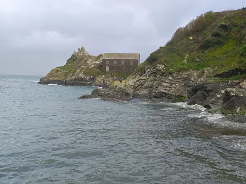
Polperro (Cornish: Porthpyra, meaning Pyra's cove) is a large village, civil parish, and fishing harbour within the Polperro Heritage Coastline in south Cornwall, England, United Kingdom. Its population is around 1,554.
From the Wikipedia article Polperro (this version), under CC BY-SA 4.0.
Travel tips from other travellers: Polperro on Wikivoyage (CC BY-SA 4.0).
Things to do1
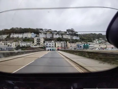
Bridge Over East Looe River And Lamp Standards
Bridge · 3.4 mi
Road bridge in Looe, Cornwall, England, UK
Museums and landmarks7
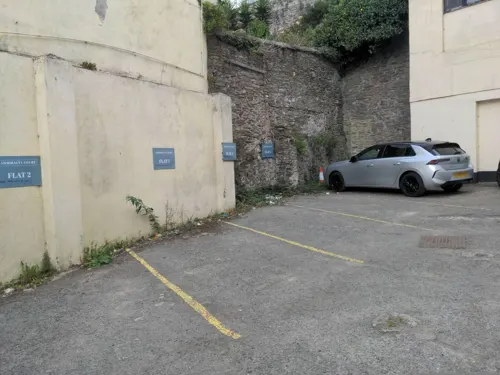
Old Guildhall Museum and Gaol
Museum · 3.4 mi
Former guildhall, now a museum, in East Looe, Cornwall, England, UK
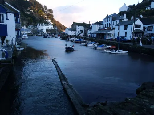


Parks, trails and playgrounds6

Looe Island
Park · 3.1 mi
A small island a mile from the mainland town of Looe off Cornwall, England.


Restaurants and cafes33



Bean & Scone
Cafe · Cake, Local, Sandwich, Coffee Shop, Ice Cream
The Coombes
Mo-Su 10:00-18:00


21 more on the map.
History
The name Polperro derives from the Cornish Porthpyra, meaning harbour named after Pyran. However Ekwall suggests that "Pyra" or "Pira" may not be a personal name and suggests that "Perro" could be a name for the stream. Early forms are Portpira, 1303, and Porpira, 1379. The chapel of St Peter de Porthpyre is mentioned in 1398 and the following forms are recorded from the reign of King Henry VIII: Polpyz explained as "fish-pool" (probably a literal error for Polpyr), Poulpirrhe, Poul Pier and Poulpyrre (in John Leland's account).
Polperro, since medieval times, fell under the jurisdiction of two ancient and separate manors, those of Raphael in the parish of Lansallos, west of the River Pol which runs through the middle of the village, and Killigarth to the east in the parish of Talland, mentioned in the Domesday Book.
As early as the 13th century Polperro was a recognised fishing settlement and its first known record is in a Royal Ordinance of 1303.
Read more of the history
The date of the building of Polperro's older quay is uncertain but Jonathan Couch (writing in the mid-19th century) considered that it is either the one mentioned by John Leland (who wrote in the first half of the 16th century) or one built upon the same site. It was probably built under the patronage of the lord of the manor of Raphael who owned the harbour and its rights. Polperro's newer quay, also of unknown antiquity, is sited almost on an east-west alignment a little further out to sea. It was built before 1774 when it suffered much damage in a storm, following which Thomas Long, of Penheale and lord of the manors of Raphael and Lansallos, paid for its repair.
Parts of the harbour were rebuilt after destruction by a violent storm on 19 and 20 January 1817, when thirty large boats, two seiners and many smaller boats were destroyed with many parts of the village including the Green and Peak Rock were consumed by the sea waters and a number of houses were swept away. The damage was estimated at £2,000 but there were no deaths. This storm, with hurricane-force winds, caused damage to property from Plymouth to Land's End; the fishing boats at Polperro ″shared in the common calamity and exposed the unhappy sufferers to distress from which the industry of years can scarcely be expected to relieve them″.
In November 1824 the worst ever storm occurred: three houses were destroyed, the whole of one pier and half the other were swept away and nearly 50 boats in the harbour were dashed to pieces. Of the six boats that survived, only one of which was a Gaffer. Polperro's new pier was designed to afford better protection for the future. The East Indiaman Albemarle was blown ashore with a valuable cargo of diamonds, coffee, pepper, silk and indigo on 9 December 1708 near Polperro (the precise location of the wreck is yet to be discovered).
Jonathan Couch was the village doctor for many years, and wrote the history of the village as well as various works of natural history (particularly on ichthyology). The History of Polperro, 1871, was published after his death by his son, Thomas Quiller Couch, with many abridgements since. Couch contributed two series of articles to the periodical Notes and Queries – The Folklore of a Cornish Village 1855 and 1857, and these were incorporated in the History of Polperro, to which he also contributed a sketch of his father's life. The welfare of the fishermen and the prosperity of the fisheries were in his care together with his medical and scientific work.
Polperro's beauty has long been a magnet for artists. The celebrated Austrian painter Oskar Kokoschka, upon discovering Polperro, spent a year in the village between 1939 and 1940. It also features as a location for filming the TV drama series, Doc Martin and Beyond Paradise.
Smuggling is understood to have prospered since Polperro developed as a port in the 12th century. It reached its zenith in the late 18th century when Britain's wars with America and France precipitated the high taxation of many imported goods, making it worthwhile for the local fishermen to boost their income by the covert importation of spirits, tobacco and other goods from Guernsey and elsewhere. By the late 18th century, much of the success of the smuggling trade through Polperro was controlled by Zephaniah Job (1749–1822), a local merchant who became known as the 'Smugglers' Banker'.
A more organised Coast Guard service was introduced in the 19th century together with the deterrent of stiff penalties, leading to much less smuggling. Part of the South West Coast Path was originally used by Revenue Officers as they patrolled the coast in search of smugglers. Whilst the South West Coast Path is maintained by the National Trust, the foreshore belongs to the Duchy of Cornwall.
In 1807, on Commander Warwick Lake's HMS Recruit, Robert Jeffery, a Polperroite, was found to have stolen his midshipman's beer, and Lake, in a fit of pique, ordered him to be marooned on the island of Sombrero off Anguilla. Jeffery was born in Fowey but moved to Polperro before joining the merchant navy and then being press-ganged into the Royal Navy.
Some months later, Lake's commanding officer Sir Alexander Cochrane learned of what had happened and immediately ordered Lake to retrieve Jeffery. When Recruit arrived at Sombrero, Jeffery could not be found. Eventually the story got out and Lake was discharged from the Royal Navy by court martial for his actions. As it turned out, Jeffery had been rescued by an American ship and was discovered in Massachusetts three years later, working as a blacksmith; he was repatriated to Britain and awarded compensation.
From the History section of Polperro on Wikipedia, under CC BY-SA 4.0.
More about Polperro
Economy
Tourism became Polperro's main industry during the 20th century. The village is accessible by air via Plymouth or Newquay, by train via Looe railway station, by road and by boat. It was estimated that the village received about 25,000 visitors a day during summer in the 1970s. Visitors are no longer permitted to drive cars into the village, having to leave them in the main car park at Crumplehorn to the north of the village and walk through the half-mile length of the village to its harbour. The village's quaint but narrow streets make driving difficult. There are horse and cart rides and were previously milk floats disguised as trams for those who prefer not to walk. The milk floats have been replaced by tuk-tuks.
From the Wikipedia article Polperro, under CC BY-SA 4.0.
Notable people from Polperro
- Jonathan CouchBritish naturalist, ichthyologist and scientific illustrator (1789-1870)
- Richard Quiller CouchBritish naturalist (1816-1863)
- William RendleBritish antiquarian
Born in Polperro, according to Wikidata (CC0). Each name links to its Wikipedia article.
Where to stay10
Churches and places of worship6
Shopping17
Schools, colleges and libraries1
Healthcare1
Map of Polperro
82 places. The map loads OpenStreetMap tiles when you open it.
Getting there and nearby towns
Cornwall Airport Newquay (NQY) is the nearest airport with scheduled flights listed in OpenStreetMap, 22 miles away.
- St Austell 11 mi west, about 18 min by car
- Bodmin 13 mi northwest, about 21 min by car
- Saltash 14 mi northeast, about 23 min by car
- Plymouth 17 mi east, about 27 min by car
- Plymstock 19 mi east, about 31 min by car
- Wembury 20 mi east, about 32 min by car
- Tavistock 22 mi northeast, about 36 min by car
- Truro 24 mi west, about 39 min by car
- Newquay 25 mi west, about 40 min by car
- Falmouth 27 mi southwest, about 44 min by car
Drive times are estimates from straight-line distance, not routes.
Towns near Polperro


Keep exploring
Local news
Headlines from INDB.
Reviews, tips and questions
Loading what members have shared...
Sources and licences
- GeoNames (CC BY 4.0): population, coordinates, regions and time zone
- Mapillary (see each image): photos
- OpenStreetMap contributors (ODbL 1.0): places, airports, map data
- Wikidata (CC0 1.0): elevation, founding date, time zone, website, landmarks and historic places
- Wikimedia Commons (see each image): photos
- Wikipedia (CC BY-SA 4.0): overview and history text
Photo credits
- Polperro 5, Mick Knapton, CC BY-SA 3.0
- Looe island, Pyrotek at English Wikipedia, Public domain
- Lansallos Church, Theroadislong, CC BY-SA 4.0
- Church in Looe, Alistair Young, CC BY 2.0
- St Mary's Church, East Looe 01, Andrewrabbott, CC BY-SA 4.0
- 1140743-AltarandWindow, Jarkeld, CC BY-SA 4.0
- 1140795-Millhouse-CrumplehornInn, Jarkeld, CC BY-SA 4.0
- Street-level photo, WaggyDog, CC BY-SA 4.0
- Street-level photo, emol007, CC BY-SA 4.0
- Street-level photo, WaggyDog, CC BY-SA 4.0
- Street-level photo, WaggyDog, CC BY-SA 4.0
- Street-level photo, WaggyDog, CC BY-SA 4.0
- Street-level photo, WaggyDog, CC BY-SA 4.0
- Street-level photo, WaggyDog, CC BY-SA 4.0
- Street-level photo, WaggyDog, CC BY-SA 4.0
- Street-level photo, WaggyDog, CC BY-SA 4.0
- Street-level photo, WaggyDog, CC BY-SA 4.0
Page built November 10, 2026. Spotted a mistake? Tell us or suggest a place.