
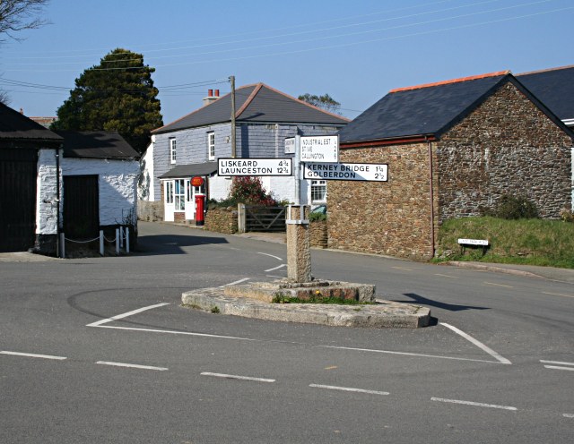


Why visit Pensilva
Townapedia lists 27 museums and landmarks, 2 places to eat and 2 attractions in and around town.
Highlights include Stara Bridge, Caradon Hill, Hurlers Stone Circles and King Doniert's Stone.
Weather in Pensilva
Forecast from MET Norway (CC BY 4.0). Full forecast
About Pensilva
Pensilva (Cornish: Pennsilva) is a village in the civil parish of St Ive and Pensilva, in east Cornwall, England, United Kingdom. It is at OS grid ref SX291697 about four miles (6 km) northeast of Liskeard. Nearby settlements include Charaton Cross and Middlehill.
From the Wikipedia article Pensilva (this version), under CC BY-SA 4.0.
Things to do2


Museums and landmarks27

Hurlers Stone Circles
Monument and historic site · 2.1 mi
Group of three stone circles in Cornwall, England, UK

King Doniert's Stone
Museum · 3.3 mi
Celtic illustrated stone in Cornwall

Rillaton Barrow
Monument and historic site · 2.2 mi
Barrow in England

Trethevy Quoit
Monument and historic site · 1.9 mi
Dolmen in the Cornwall, England, UK


Craddock Moor stone circle
Monument and historic site · 2.8 mi
Stone circle on Bodmin Moor, Cornwall, England
Rule's Shaft Engine House (South Caradon Mine)
Monument and historic site · 1.2 mi
15 more on the map.
Restaurants and cafes2

Trevallick's Farm Shop & Tea Room
Cafe · 0.5 mi
Tea room, farm shop, arts and crafts, Cornish gins, local produce

Churches and places of worship3

Schools, colleges and libraries2
Map of Pensilva
36 places. The map loads OpenStreetMap tiles when you open it.
Getting there and nearby towns
Cornwall Airport Newquay (NQY) is the nearest airport with scheduled flights listed in OpenStreetMap, 26 miles away.
- Saltash 11 mi southeast, about 17 min by car
- Lifton 11 mi northeast, about 18 min by car
- Tavistock 12 mi east, about 20 min by car
- Polperro 13 mi south, about 21 min by car
- Bodmin 14 mi west, about 22 min by car
- Plymouth 15 mi southeast, about 24 min by car
- Delabole 16 mi northwest, about 26 min by car
- Plymstock 17 mi southeast, about 28 min by car
- Tintagel 18 mi northwest, about 30 min by car
- St Austell 19 mi southwest, about 31 min by car
Drive times are estimates from straight-line distance, not routes.
Towns near Pensilva


Keep exploring
Local news
Headlines from INDB.
Reviews, tips and questions
Loading what members have shared...
Sources and licences
- GeoNames (CC BY 4.0): population, coordinates, regions and time zone
- OpenStreetMap contributors (ODbL 1.0): places, airports, map data
- Wikidata (CC0 1.0): elevation, founding date, time zone, website, landmarks and historic places
- Wikimedia Commons (see each image): photos
- Wikipedia (CC BY-SA 4.0): overview and history text
Photo credits
- PensilvaCrossroadsCornwall, Tony Atkin, CC BY-SA 2.0
- Hurlers 04, Olaf Tausch, CC BY 3.0
- King-donierts-stone, TinWidget at English Wikipedia, CC BY 3.0
- Rillaton Cup, Fæ, CC BY-SA 3.0
- Trethevy quoit cornwall01, JimChampion, CC BY-SA 3.0
- Caradon Hill, Cornwall-9077, Raimond Spekking, CC BY-SA 4.0
- Stara Bridge, Jeromesh, CC BY-SA 4.0
- South Caradon mine (50260270292), chris lovelock, CC BY 2.0
Page built November 10, 2026. Spotted a mistake? Tell us or suggest a place.