
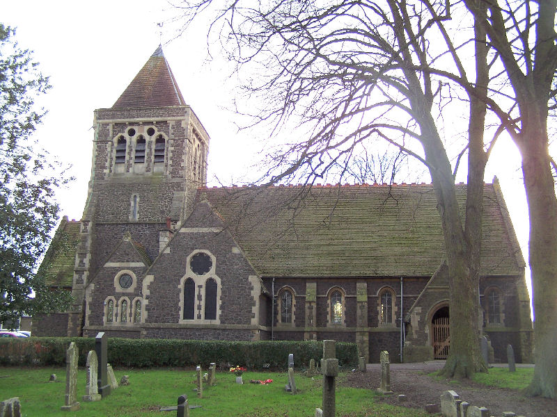


Glenfield, United Kingdom
Glenfield is a town of 10,000 people in England, United Kingdom.
Why visit Glenfield
Townapedia lists 21 museums and landmarks, 19 parks and trails, 30 places to eat, 3 places to stay and 5 attractions in and around town.
Highlights include Braunstone Gate Bridge, Curve, Abbey Pumping Station Museum and Belgrave Hall.
Weather in Glenfield
Forecast from MET Norway (CC BY 4.0). Full forecast
About Glenfield
Glenfield is a large village and former civil parish, now in the parish of Glenfields, in the Blaby district of Leicestershire, England. At the 2011 Census, Glenfields had a population of 9,643.
From the Wikipedia article Glenfield, Leicestershire (this version), under CC BY-SA 4.0.
Things to do5


Leicester Haymarket Theatre
Cinema and theater · 2.7 mi
Theatre in Leicester, England

Little Theatre, Leicester
Cinema and theater · 2.9 mi
Theatre in Leicester, England, originally a Baptist chapel

Sue Townsend Theatre
Cinema and theater · 2.7 mi
Theatre and music venue in Leicester, England
Museums and landmarks21

Abbey Pumping Station Museum
Museum · 2.8 mi
Local Authority Museum in the East Midlands, United Kingdom

Belgrave Hall
Museum · 3.1 mi
Queen Anne-style Grade II* listed building in Belgrave, Leicester, England, UK
City Gallery
Museum · 2.9 mi
Contemporary art gallery in Leicester, England, UK, closed 2010


Groby Castle
Monument and historic site · 1.8 mi
Castle in Leicestershire, England, UK

Haymarket Memorial Clock Tower
Monument and historic site · 2.7 mi
Clock tower in City of Leicester, Leicestershire, England, UK

Jewry Wall Museum
Museum · 2.4 mi
Museum in Leicester, England, United Kingdom

King Richard III Visitor Centre
Museum · 2.6 mi
Museum in Leicester, England

Leicester Abbey
Monument and historic site · 2.4 mi
Grade I listed building in Leicester, Leicestershire, England, UK

Leicester Castle
Monument and historic site · 2.5 mi
Castle in Leicester, England, UK

Leicester Guildhall
Museum · 2.5 mi
Grade I listed seat of local government, and museum, in Leicester, United Kingdom

Leicester Museum & Art Gallery
Museum · 3.1 mi
Museum in Leicester, England, United Kingdom
9 more on the map.
Parks, trails and playgrounds19


Aylestone Meadows
Park · 3.2 mi
Nature reserve in Leicester, England.


Kirby Frith Nature Reserve
Park · 0.8 mi
Local Nature Reserve in Leicester, United Kingdom



7 more on the map.
Restaurants and cafes30
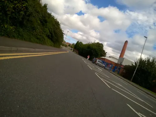




18 more on the map.
History
The name "Glenfield" means "clean field", possibly suggesting that it was clear of weeds.
Glenfield is mentioned in the Domesday Book of 1086, at which time it lay in Guthlaxton hundred and contained 12 households.
The village was greatly enlarged between the 1920s and the 1950s when the Faire Estate was built. In the 1980s and 1990s, another large estate was built on former farmland behind Ellis Park.
Glenfield was the site of the first station from Leicester West Bridge on the Leicester and Swannington Railway, opened on 17 July 1832 as the world's third steam railway. Just before reaching the station, the line passed through Glenfield Tunnel, which was built by Robert Stephenson and was, at 1 mile 36 yards, the world's longest railway tunnel at the time. The Glenfield end of the tunnel can still be seen.
In 1931 the parish had a population of 1,590. On 1 April 1935 the parish was abolished to form "Glenfields".
From the History section of Glenfield, Leicestershire on Wikipedia, under CC BY-SA 4.0.
Notable people from Glenfield
- Charles ThrosbyAustralian explorer, pioneer and parliamentarian
- William ParkinsEnglish cricketer (1925-1969)
- James EllisBritish politician (1829–1901)
Born in Glenfield, according to Wikidata (CC0). Each name links to its Wikipedia article.
Where to stay3
Churches and places of worship28
Church of the Annunciation of Our Lady of the Newarke
Church · 2.5 mi
Shopping5
Gas and EV charging3
Schools, colleges and libraries22
Healthcare12
Map of Glenfield
148 places. The map loads OpenStreetMap tiles when you open it.
Getting there and nearby towns
East Midlands Airport (EMA) is the nearest airport with scheduled flights listed in OpenStreetMap, 14 miles away.
- Leicester 3 mi east, about 4 min by car
- Mountsorrel 5 mi north, about 8 min by car
- Oadby 5 mi southeast, about 9 min by car
- Syston 6 mi northeast, about 10 min by car
- Shepshed 9 mi northwest, about 15 min by car
- Melton Mowbray 15 mi northeast, about 25 min by car
- Hartshill 15 mi southwest, about 25 min by car
- Market Harborough 16 mi southeast, about 26 min by car
- Coventry 21 mi southwest, about 34 min by car
- Nottingham 21 mi north, about 34 min by car
Drive times are estimates from straight-line distance, not routes.
Towns near Glenfield


Keep exploring
Local news
Headlines from INDB.
Reviews, tips and questions
Loading what members have shared...
Sources and licences
- GeoNames (CC BY 4.0): population, coordinates, regions and time zone
- Mapillary (see each image): photos
- OpenStreetMap contributors (ODbL 1.0): places, airports, map data
- Wikidata (CC0 1.0): elevation, founding date, time zone, website, landmarks and historic places
- Wikimedia Commons (see each image): photos
- Wikipedia (CC BY-SA 4.0): overview and history text
Photo credits
- Glenfield, Kev747 at English Wikipedia, CC BY-SA 3.0
- Braunstone Gate Bridge, Tim Hallam, CC BY-SA 2.0
- Curve Leicester full panorama, NotFromUtrecht, CC BY-SA 3.0
- Leicester Haymarket Theatre entrance, Cordyceps-Zombie, CC BY-SA 4.0
- Teatr Mały w Leicester, Kris1973, CC BY-SA 4.0
- Phoenix Arts Centre Leicester, NotFromUtrecht, CC BY-SA 3.0
- Abbey Pumping station, Jonnic1 at English Wikipedia, Public domain
- GasMuseumMay2010, Chemical Engineer, Public domain
- Groby Castle plan, Charles Wall, Public domain
- Leicester clock tower May2010, NotFromUtrecht, CC BY-SA 3.0
- Jewry Wall ruins panorama 3, NotFromUtrecht, CC BY-SA 3.0
- Dynasty Death and Discovery, Richard III museum entrance, RobinLeicester, CC BY-SA 4.0
- Abbeyruins Leicester, Kev747 at English Wikipedia, CC BY-SA 3.0
- Brama wjazdowa do zamku od strony zewnętrznej, Kris1973, CC BY-SA 4.0
- Leicester Guildhall, NotFromUtrecht, CC BY-SA 3.0
- New Walk Museum main entrance, NotFromUtrecht, CC BY-SA 3.0
- Abbey Park Leicester entrance gate, NotFromUtrecht, CC BY-SA 3.0
- Deer in Bradgate Park, Duncharris, CC BY-SA 3.0
- Goss Meadows 7, Dudley Miles, CC BY-SA 4.0
- Nelson Mandela Park, Joshuajohnlee ., CC BY 3.0
- Sheet Hedges Wood 2, Dudley Miles, CC BY-SA 4.0
- The Orchards Nature Reserve 2, Dudley Miles, CC BY-SA 4.0
- All Saints Church - widok od południowej strony, Kris1973, CC BY-SA 4.0
- 188565 Leicester St Andrews Church 2, Simon Armstrong, CC BY-SA 3.0
- St Mark's Church, Leicester, south side, Grahamrob, CC BY-SA 3.0
- St Mary de Castro from Castle Yard, NotFromUtrecht, CC BY-SA 3.0
- HolyTrinityLeicester t, User:Pjparkinson, Public domain
- St Margaret's church, Leicester, NotFromUtrecht, CC BY-SA 3.0
- StMarysChurchAnsteyLeics, Michig, CC BY-SA 3.0
- Kirby Frith Nature Reserve 4, Dudley Miles, CC BY-SA 4.0
- Newarke church arches DMU heritage centre, Leicester, RobinLeicester, CC BY-SA 4.0
- Belgrave Hall, Leicester, RobinLeicester, CC BY-SA 4.0
- Western park teniss courts, http-www.leicestertravel.co.uk - panoramio, Leicester Holyday, CC BY 3.0
- Street-level photo, trigpoint, CC BY-SA 4.0
- Street-level photo, toby, CC BY-SA 4.0
- Street-level photo, cyclestreets, CC BY-SA 4.0
- Street-level photo, adam2, CC BY-SA 4.0
- Street-level photo, toby, CC BY-SA 4.0
- Street-level photo, toby, CC BY-SA 4.0
- Street-level photo, trigpoint, CC BY-SA 4.0
- Street-level photo, cyclestreets, CC BY-SA 4.0
- Street-level photo, toby, CC BY-SA 4.0
- Street-level photo, trigpoint, CC BY-SA 4.0
- Street-level photo, toby, CC BY-SA 4.0
- Street-level photo, trigpoint, CC BY-SA 4.0
- Street-level photo, trigpoint, CC BY-SA 4.0
- Street-level photo, trigpoint, CC BY-SA 4.0
- Street-level photo, toby, CC BY-SA 4.0
- Street-level photo, trigpoint, CC BY-SA 4.0
- Street-level photo, toby, CC BY-SA 4.0
- Street-level photo, trigpoint, CC BY-SA 4.0
- Street-level photo, toby, CC BY-SA 4.0
- Street-level photo, toby, CC BY-SA 4.0


Page built November 10, 2026. Spotted a mistake? Tell us or suggest a place.