
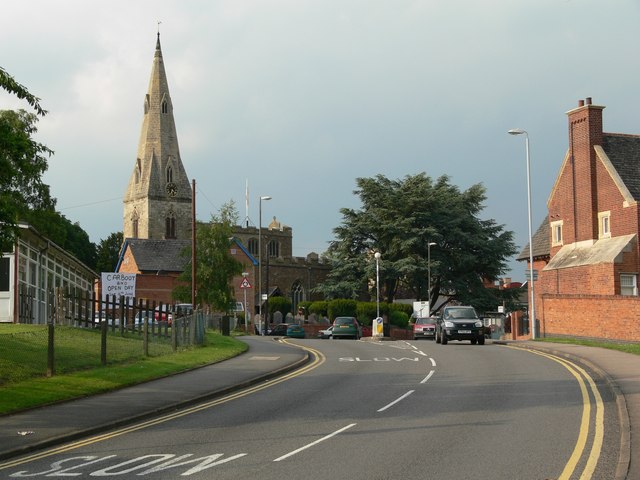


Why visit Oadby
Townapedia lists 18 museums and landmarks, 28 parks and trails, 76 places to eat, 4 places to stay and 7 attractions in and around town.
Highlights include Braunstone Gate Bridge, Curve, Arch of Remembrance and City Gallery.
Weather in Oadby
Forecast from MET Norway (CC BY 4.0). Full forecast
About Oadby
Oadby is a town in the borough of Oadby and Wigston in Leicestershire, England, located 4 miles (6.4 km) south-east of Leicester on the A6 road. Leicester Racecourse is situated on the border between Oadby and Stoneygate. The University of Leicester Botanical Garden is in Oadby. Oadby had a population of 23,849 in 2011, and like its neighbour Wigston is made up of five wards.
From the Wikipedia article Oadby (this version), under CC BY-SA 4.0.
Things to do7


De Montfort Hall
Cinema and theater · 2.1 mi
Music and performance venue in Leicester, United Kingdom

Leicester Haymarket Theatre
Cinema and theater · 3.0 mi
Theatre in Leicester, England

Little Theatre, Leicester
Cinema and theater · 2.6 mi
Theatre in Leicester, England, originally a Baptist chapel

Sue Townsend Theatre
Cinema and theater · 2.8 mi
Theatre and music venue in Leicester, England

Museums and landmarks18

Arch of Remembrance
Monument and historic site · 2.0 mi
War memorial in Leicester, Leicestershire, England, UK
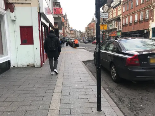
City Gallery
Museum · 2.6 mi
Contemporary art gallery in Leicester, England, UK, closed 2010


Haymarket Memorial Clock Tower
Monument and historic site · 2.9 mi
Clock tower in City of Leicester, Leicestershire, England, UK

Jewry Wall Museum
Museum · 3.1 mi
Museum in Leicester, England, United Kingdom

King Richard III Visitor Centre
Museum · 2.9 mi
Museum in Leicester, England

Leicester Castle
Monument and historic site · 3.0 mi
Castle in Leicester, England, UK

Leicester Guildhall
Museum · 3.0 mi
Grade I listed seat of local government, and museum, in Leicester, United Kingdom

Leicester Museum & Art Gallery
Museum · 2.4 mi
Museum in Leicester, England, United Kingdom

Newarke Houses Museum
Museum · 2.9 mi
Public museum in Leicester, England, United Kingdom
Ratae Corieltauvorum
Monument and historic site · 3.1 mi
Former Roman town on the site of Leicester
6 more on the map.
Parks, trails and playgrounds28


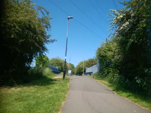
Aylestone Meadows
Park · 3.2 mi
Nature reserve in Leicester, England.


Victoria Park
Park · 1.9 mi
Public park in Leicester, Leicestershire, England, UK


The Gallops Golf Course
Golf course · 0.9 mi
Mo-Su 08:00-20:00 Summer; Open 7:00 sa-su; Close 21:00 weekday;...
16 more on the map.
Restaurants and cafes76
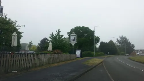
Grange Farm
Bar and pub · 1.4 mi
Florence Wragg Way, Leicester
Mo-We 11:30-22:30; Th-Sa 11:30-23:00; Su 11:30-22:30

Bella Italia
Restaurant · Italian · 1.4 mi
297-299 Leicester Road, Wigston
Mo-Fr 06:30-22:00; Sa-Su 07:00-22:00

Anatolia
Restaurant · Turkish · 1.0 mi
14 Allandale Road, Leicester
Mo-Th 18:00-23:00; Fr-Sa 18:00-00:00

Costa
Cafe · Coffee Shop · 0.5 mi
29-31 The Parade, Leicester
Mo-Sa 07:30-18:00; Su 08:30-17:30

Ethel Bakery Oadby
Bakery · 0.5 mi
26 The Parade
Mo-Sa 07:00-18:00; Su 10:00-16:00
Tigers Rolls
Cafe · 0.8 mi
38B Kenilworth Drive, Leicester
Mo-Fr 07:30-14:00; Sa 08:00-12:00; Su off
Coffee Obsessive
Cafe · 1.0 mi
53 Francis Street, Leicester
Mo-Fr 08:00-16:00; Sa,Su 09:00-16:00; PH 09:00-16:00
Honey and Haven
Cafe · 0.4 mi
41D The Parade
Mo-Th 09:00-18:00; Fr-Sa 09:00-20:00; Su 10:00-18:00
Jennos Cafe
Cafe · 1.1 mi
Washbrook Lane, Leicester
Mo-Fr 08:30-17:30; Sa 08:30-18:00; Su 09:00-17:00
64 more on the map.
History
There has been a habitation in Oadby since an Anglian settlement in the early Anglo-Saxon period. Though the name Oadby is Danish (meaning "Outi's dwelling") it must have existed long before the Danish invasions as is shown by the existence of a pagan Anglian cemetery. The original Anglian name has been lost. In 1760, on Brocks Hill, evidence of an Anglian burial ground was discovered. The Middle Angles came under the rule of the kings of Mercia and were later conquered by the Danish invaders. Oadby is one of seventy Danish settlements in Leicestershire ending with "-by", which means village or settlement. Its name probably came from Old Norse Auðarbýr = "Auði's settlement". Danish rule continued until 920, when King Alfred the Great won his battles against the Danes: the Oadby area is supposed to be the site of at least one of these battles.
Read more of the history
In the Domesday Book, 1086, Oadby's name was recorded as Oldebi. Other early forms are Oladebi, Outheby (Feet of Fines, 1199), Onderby and, finally, Oadby. When King Harold had been defeated, William the Conqueror gave Oadby to Hugh de Grandmesnil, Governor of Leicestershire, who founded the parish church of Oadby on the site of the present St Peter's Church. The tenants of the manor of Oadby were Roger who held one and half carucates, and Countess Judith who held 9 carucates and 2 bovates, and 30 acres of meadow. On the Countess's land were 46 socmen, eleven bordars and three serfs; two carucates were let to Robert de Buci. The manor was held in 1444 by William Ferrers; in 1457 it was held by William Grey, Lord Ferrers of Groby. In 1541 the manor was held by John Waldron; his successor John Waldron sold it in 1629 to Sir John Lombe. In 1831 the main landed proprietors were the trustees of the late George Wyndham (patrons of the vicarage), George Legh Keck (lord of the manor) and Thomas Pares.
Oadby remained a small settlement until the late 19th century when it became a fashionable suburb for the businessmen of Leicester, such as the factory owners of Leicester's shoe and stocking manufacturers. Many substantial houses were built in Oadby, some of which are now used by the University of Leicester.
Stoughton Road in Oadby contains two sets of houses of historical interest. Some of the Framework Knitters Homes date back to 1909, while the North Memorial Homes, financed by Sir Jonathan North (former Mayor of Leicester), were built in 1927 and opened in the same year by the Prince of Wales. As well as a series of houses, the North Memorial Homes site also houses the North Memorial Hall, built in a neo-Georgian style, which has been leased to Oadby Evangelical Free Church since 1974.
In the late 19th century Oadby town centre was focused along Leicester Road, The Parade and London Road. The oldest properties and locations can be found at the Wigston Road, London Road junction through to the Glen Road (A6) junction. Some of the 19th century buildings that remain are the cottages and shops (including Wilson B Ragg Butchers & Gingerbread Cottage bakers) along London Road through to Glen Road.
Expansion of Oadby took place rapidly in the 20th century and was still continuing in 2017. Many residential developments have been constructed, and the population in 2011 reached 23,849.
In the early 20th century, the Travellers Rest (located near to the London Road Glen Road junction) was torn down in 1939 and replaced by The Oadby Owl on a neighbouring site. Both inns were run by Walter Cufflin (a descendant of James Hawker).
From the History section of Oadby on Wikipedia, under CC BY-SA 4.0.
More about Oadby
Education
Oadby is the home of Beauchamp College (formerly Kibworth Beauchamp Grammar School) and Gartree High School, both of which were attended by John Deacon of Queen. The town also has Oadby Manor High School. The University of Leicester has its halls of residence in the northern part of the town.
From the Wikipedia article Oadby, under CC BY-SA 4.0.
Notable people from Oadby
- Ralph WardEnglish footballer and manager (1911-1983)
- Philip VestyBritish racewalker
- Stu WilliamsonBritish photographer
- Frank Westongolfer (1894-1963)
Born in Oadby, according to Wikidata (CC0). Each name links to its Wikipedia article.
Where to stay4
Churches and places of worship52
Clarendon Park Congregational Church
Church · Congregational · 1.4 mi
Shopping11
Gas and EV charging4
Schools, colleges and libraries34
Healthcare14
Map of Oadby
248 places. The map loads OpenStreetMap tiles when you open it.
Getting there and nearby towns
East Midlands Airport (EMA) is the nearest airport with scheduled flights listed in OpenStreetMap, 19 miles away.
- Leicester 3 mi northwest, about 5 min by car
- Syston 5 mi north, about 9 min by car
- Shepshed 14 mi northwest, about 23 min by car
- Oakham 15 mi east, about 25 min by car
- Coventry 23 mi southwest, about 37 min by car
- Stapleford 23 mi north, about 37 min by car
- Nottingham 24 mi north, about 39 min by car
- Northampton 26 mi south, about 42 min by car
- Derby 27 mi northwest, about 44 min by car
- Burton upon Trent 27 mi northwest, about 44 min by car
Drive times are estimates from straight-line distance, not routes.
Towns near Oadby


Keep exploring
Local news
Headlines from INDB.
Reviews, tips and questions
Loading what members have shared...
Sources and licences
- GeoNames (CC BY 4.0): population, coordinates, regions and time zone
- Mapillary (see each image): photos
- OpenStreetMap contributors (ODbL 1.0): places, airports, map data
- Wikidata (CC0 1.0): elevation, founding date, time zone, website, landmarks and historic places
- Wikimedia Commons (see each image): photos
- Wikipedia (CC BY-SA 4.0): overview and history text
Photo credits
- OadbyTown-4, Mat Fascione, CC BY-SA 2.0
- Braunstone Gate Bridge, Tim Hallam, CC BY-SA 2.0
- Curve Leicester full panorama, NotFromUtrecht, CC BY-SA 3.0
- De Montfort Hall, NotFromUtrecht, CC BY-SA 3.0
- Leicester Haymarket Theatre entrance, Cordyceps-Zombie, CC BY-SA 4.0
- Teatr Mały w Leicester, Kris1973, CC BY-SA 4.0
- Phoenix Arts Centre Leicester, NotFromUtrecht, CC BY-SA 3.0
- War Memorial Leicester, Summer 2009, NotFromUtrecht, CC BY-SA 3.0
- GasMuseumMay2010, Chemical Engineer, Public domain
- Leicester clock tower May2010, NotFromUtrecht, CC BY-SA 3.0
- Jewry Wall ruins panorama 3, NotFromUtrecht, CC BY-SA 3.0
- Dynasty Death and Discovery, Richard III museum entrance, RobinLeicester, CC BY-SA 4.0
- Brama wjazdowa do zamku od strony zewnętrznej, Kris1973, CC BY-SA 4.0
- Leicester Guildhall, NotFromUtrecht, CC BY-SA 3.0
- New Walk Museum main entrance, NotFromUtrecht, CC BY-SA 3.0
- Newarke Houses Museum Leicester, NotFromUtrecht, CC BY-SA 3.0
- Knighton Spinney 4, Dudley Miles, CC BY-SA 4.0
- Lucas Marsh 2, Dudley Miles, CC BY-SA 4.0
- Humberstone Park LNR 6, Dudley Miles, CC BY-SA 4.0
- Nelson Mandela Park, Joshuajohnlee ., CC BY 3.0
- Victoria Park Leicester from Queens Road, NotFromUtrecht, CC BY-SA 3.0
- Clarendon Park Congregational Church, Tom Parnell, CC BY-SA 4.0
- All Saints Church - widok od południowej strony, Kris1973, CC BY-SA 4.0
- 188565 Leicester St Andrews Church 2, Simon Armstrong, CC BY-SA 3.0
- St Mark's Church, Leicester, south side, Grahamrob, CC BY-SA 3.0
- St Mary de Castro from Castle Yard, NotFromUtrecht, CC BY-SA 3.0
- Masjid Umar, Leicester (cropped), NotFromUtrecht, CC BY-SA 3.0
- Evington War Memorial 2011, Chemical Engineer, Public domain
- Street-level photo, adam2, CC BY-SA 4.0
- Street-level photo, adam2, CC BY-SA 4.0
- Street-level photo, adam2, CC BY-SA 4.0
- Street-level photo, adam2, CC BY-SA 4.0
- Street-level photo, rskedgell, CC BY-SA 4.0
- Street-level photo, adam2, CC BY-SA 4.0
- Street-level photo, trigpoint, CC BY-SA 4.0
- Street-level photo, cyclestreets, CC BY-SA 4.0
- Street-level photo, southglos, CC BY-SA 4.0
- Street-level photo, gness, CC BY-SA 4.0
- Street-level photo, toby, CC BY-SA 4.0
- Street-level photo, adam2, CC BY-SA 4.0
- Street-level photo, toby, CC BY-SA 4.0
- Street-level photo, trigpoint, CC BY-SA 4.0
- Street-level photo, southglos, CC BY-SA 4.0
- Street-level photo, toby, CC BY-SA 4.0
- Street-level photo, cyclestreets, CC BY-SA 4.0
- Street-level photo, toby, CC BY-SA 4.0
- Street-level photo, trigpoint, CC BY-SA 4.0
- Street-level photo, southglos, CC BY-SA 4.0
- Street-level photo, adam2, CC BY-SA 4.0


Page built November 10, 2026. Spotted a mistake? Tell us or suggest a place.