


Glyn-neath, United Kingdom
Glyn-neath is a town of 5,419 people in Wales, United Kingdom.
Why visit Glyn-neath
Townapedia lists 16 museums and landmarks, 3 parks and trails, 15 places to eat, 1 place to stay and 12 attractions in and around town.
Highlights include Sgwd Henrhyd, Craig Y Llyn, Foel Chwern and Coelbren Roman Fort.
Weather in Glyn-neath
Forecast from MET Norway (CC BY 4.0). Full forecast
About Glyn-neath
Glynneath (Welsh: Glyn-nedd 'valley of the River Neath'; also spelt Glyn-neath and Glyn Neath) is a town, community and electoral ward lying on the River Neath in the county borough of Neath Port Talbot, Wales. It was formerly in the historic county of Glamorgan. Glynneath ward covers only part of the community, with some 840 electors included in the neighbouring ward of Blaengwrach.
From the Wikipedia article Glynneath (this version), under CC BY-SA 4.0.
Things to do12



Melincourt Falls
Waterfall · 4.8 mi
Waterfall in Neath Port Talbot, Wales

Museums and landmarks16

Dinas Silica Mine
Monument and historic site · 2.2 mi
Underground silica mine extending 900m x 450m

Foel Chwern
Monument and historic site · 2.0 mi
Archaeological site in United Kingdom
4 more on the map.
Parks, trails and playgrounds3



Restaurants and cafes15

Sgwd Gwladys
Restaurant · 1.2 mi
Pontneathvaughan Road
Mo-Tu 09:00-17:00; We 09:00-22:00; Th-Sa 09:00-23:00; Su 09:00-18:00

The Meat & Greet Co
Cafe · 2.4 mi
Roman Road, Banwen
Mo off; Tu off; We-Th 12:00-14:30,18:00-22:00; Fr-Sa...

3 more on the map.
Notable people from Glyn-neath
 The AnchoressWelsh multi-instrumentalist, songwriter and author Catherine Anne DaviesPhoto: Sven Mandel, CC BY-SA 4.0
 Max BoyceWelsh comedian and folk singerPhoto: Alan Hughes, CC BY-SA 2.0
 Leslie HardmanBritish orthodox rabbi and army chaplain (1913-2008)Photo: No 5 Army Film & Photographic Unit,..., Public domain
- Tom HallettWelsh professional footballer (born 1939)
- Ken EliasWelsh artist (born 1944)
- Rosser Beynonmusician (1811 -1876)
- Steve HamerFootball chairman
- Dai EdwardsWelsh rugby league and rugby union footballer (1896-1960)
- David Morgan EvansWelsh rugby union and rugby league footballer (1911-1941)
- William Alexanderrugby player, born 1874 (1874–1937)
- Emlyn WaltersWelsh rugby union and rugby league footballer
- Glyn ProsserWelsh rugby union and rugby league footballer (1907-1972)
Born in Glyn-neath, according to Wikidata (CC0). Each name links to its Wikipedia article.
Where to stay1
Churches and places of worship8
Shopping3
Gas and EV charging2
Schools, colleges and libraries6
Healthcare1
Map of Glyn-neath
67 places. The map loads OpenStreetMap tiles when you open it.
Getting there and nearby towns
Swansea Airport (SWS) is the nearest airport with scheduled flights listed in OpenStreetMap, 22 miles away.
- Resolven 4 mi southwest, about 7 min by car
- Seven Sisters 4 mi west, about 7 min by car
- Hirwaun 5 mi east, about 7 min by car
- Ystalyfera 7 mi west, about 11 min by car
- Aberdare 8 mi east, about 12 min by car
- Treorchy 8 mi southeast, about 12 min by car
- Rhondda 9 mi southeast, about 15 min by car
- Neath 10 mi southwest, about 16 min by car
- Maesteg 10 mi south, about 16 min by car
- Merthyr Tydfil 10 mi east, about 17 min by car
Drive times are estimates from straight-line distance, not routes.
Towns near Glyn-neath


Keep exploring
Local news
Headlines from INDB.
Reviews, tips and questions
Loading what members have shared...
Sources and licences
- GeoNames (CC BY 4.0): population, coordinates, regions and time zone
- Mapillary (see each image): photos
- OpenStreetMap contributors (ODbL 1.0): places, airports, map data
- Wikidata (CC0 1.0): elevation, founding date, time zone, website, landmarks and historic places
- Wikimedia Commons (see each image): photos
- Wikipedia (CC BY-SA 4.0): overview and history text
Photo credits
- GlynneathTownHall, Darren Wyn Rees, CC BY-SA 3.0
- Sgwd Henrhyd, Daimack at English Wikipedia, Public domain
- Craig-y-Llyn, Craig Thomas, CC BY 4.0
- Rhondda Cynon Taf - Dinas Silica Mine - 20241113142702, MDBWC, CC BY-SA 4.0
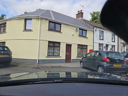
- Street-level photo, toho, CC BY-SA 4.0
Page built November 10, 2026. Spotted a mistake? Tell us or suggest a place.