




Why visit Aberdare
Townapedia lists 4 museums and landmarks, 10 parks and trails, 83 places to eat, 3 places to stay and 7 attractions in and around town.
Highlights include Pont-y-Cafnau, Coliseum Theatre, Cynon Valley Museum & Gallery and Aberdare Cenotaph.
Weather in Aberdare
Forecast from MET Norway (CC BY 4.0). Full forecast
About Aberdare
Aberdare ( ab-ər-DAIR; Welsh: Aberdâr ) is a town in the Cynon Valley area of Rhondda Cynon Taf, Wales, at the confluence of the Rivers Dare (Dâr) and Cynon. Aberdare has a population of 39,550 (mid-2017 estimate). Aberdare is 4 miles (6 km) south-west of Merthyr Tydfil, 20 miles (32 km) north-west of Cardiff and 22 miles (35 km) east-north-east of Swansea. During the 19th century it became a thriving industrial settlement, which was also notable for the vitality of its cultural life and as an important publishing centre.
From the Wikipedia article Aberdare (this version), under CC BY-SA 4.0.
Travel tips from other travellers: Aberdare on Wikivoyage (CC BY-SA 4.0).
Things to do7


Coliseum Theatre
Cinema and theater · 0.5 mi
Theatre and cinema in Aberdare, Wales
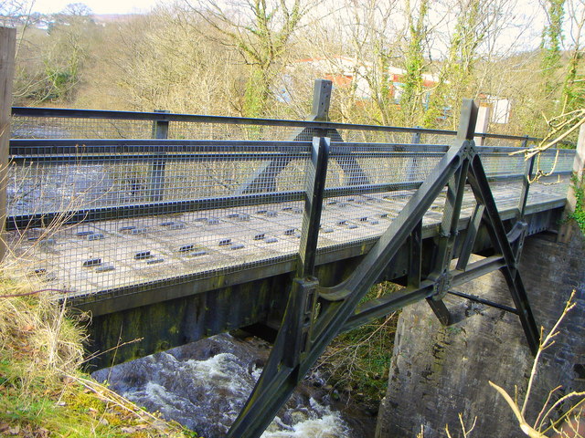
Iron Tram Bridge, Robertstown
Bridge · 0.6 mi
Grade II listed building in Aberdare

Museums and landmarks4


Parks, trails and playgrounds10





Restaurants and cafes83
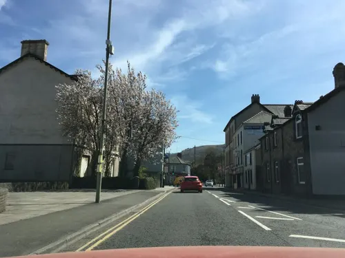
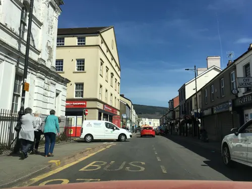


Jac's Music Venue
Bar and pub
Wind Street, Aberdare
Mo-Th off; Fr 16:00-23:30; Sa 14:00-23:30; Su 14:00-23:00

The Ynyscynon Inn
Restaurant · 1.1 mi
Cwmbach Road
Mo-We 12:00-15:00,18:00-23:00; Th 12:00-15:00,18:00-00:00; Fr,Sa...
Coco’s Coffee and Kitchen
Cafe
Coco's is a family-run coffee brand based in the Welsh Valleys. Great food - brunch, lunch, some evenings and Sunday dinner - coffee, cake.
42-43 High Street
Lewis Street Cafe
Cafe · 1.2 mi
Lewis Street, Aberdare
Mo-Sa 08:30-16:00
71 more on the map.
History
There are several cairns and the remains of a circular British encampment on the mountain between Aberdare and Merthyr. This may have led to the mountain itself being named Bryn-y-Beddau (hill of graves) although other local traditions associate the name with the Battle of Hirwaun Wrgant.
Aberdare lies within the commote (cwmwd) of Meisgyn, in the cantref of Penychen. The area is traditionally given as the scene of the battle of Hirwaun Wrgant, where the allied forces of the Norman Robert Fitzhamon and Iestyn ap Gwrgant, the last Welsh prince of Glamorgan, defeated Rhys ap Tewdwr, prince of Dyfed. The battle is thought to have started at Aberdare, with the areas now known as Upper and Lower Gadlys (The battle Court(s)), traditionally given as each armies' headquarters.
The settlement of Aberdare dates from at least this period, with the first known reference being in a monastic chapter of 1203 concerning grazing right on Hirwaun Common. It was originally a small village in an agricultural district, centred around the Church of St John the Baptist, said to date from at least 1189. By the middle of the 15th century, Aberdare contained a water mill in addition to a number of thatched cottages, of which no evidence remains.
Read more of the history
Aberdare grew rapidly in the early 19th century through two major industries: first iron, then coal. A branch of the Glamorganshire Canal (1811) was opened to transport these products; then the railway became the main means of transport to the South Wales coast. From the 1870s onwards, the economy of the town was dominated by the coal mining industry, with only a small tinplate works. There were also several brickworks and breweries. During the latter half of the 19th century, considerable improvements were made to the town, which became a pleasant place to live, despite the nearby collieries. A postgraduate theological college opened in connection with the Church of England in 1892, but in 1907 it moved to Llandaff.
With the ecclesiastical parishes of St Fagan's (Trecynon) and Aberaman carved out of the ancient parish, Aberdare had 12 Anglican churches and one Catholic church, built in 1866 in Monk Street near the site of a cell attached to Penrhys monastery; and at one time there were over 50 Nonconformist chapels (including those in surrounding settlements such as Cwmaman and Llwydcoed). The services in the majority of the chapels were in Welsh. Most of these chapels have now closed, with many converted to other uses. The former urban district included what were once the separate villages of Aberaman, Abernant, Cwmaman, Cwmbach, Cwmdare, Llwydcoed, Penywaun and Trecynon.
From the History section of Aberdare on Wikipedia, under CC BY-SA 4.0.
More about Aberdare
Arts and culture
Aberdare, during its boom years, was considered a centre of Welsh culture: it hosted the first National Eisteddfod in 1861, with which David Williams (Alaw Goch) was closely associated. The town erected a monument in the local park to commemorate the occasion. A number of local eisteddfodau had long been held in the locality, associated with figures such as William Williams (Carw Coch) The Eisteddfod was again held in Aberdare in 1885, and also in 1956 at Aberdare Park, where the Gorsedd standing stones still exist. At the last National Eisteddfod held in Aberdare in 1956 Mathonwy Hughes won the chair. From the mid 19th century, Aberdare was an important publishing centre where a large number of books and journals were produced, the majority of which were in the Welsh language.
The Coliseum Theatre is Aberdare's main arts venue, containing a 600-seat auditorium and cinema. It is situated in nearby Trecynon and was built in 1938 using miners' subscriptions.
The Second World War poet Alun Lewis was born near Aberdare in the village of Cwmaman; there is a plaque commemorating him, including a quotation from his poem The Mountain over Aberdare.
Education
The state of education in the parish was a cause for concern during the early industrial period, as is illustrated by the reaction to the 1847 Education Reports. Initially, there was an outcry, led by the Rev Thomas Price against the comments made by the vicar of Aberdare in his submission to the commissioners. However, on closer reflection, the reports related the deficiencies of educational provision, not only in Aberdare itself but also in the communities of the valleys generally. In so doing they not only criticised the ironmasters for their failure to provide schools for workers' children but also the nonconformists for not establishing British Schools. At the ten schools in Aberdare there was accommodation for only 1,317 children, a small proportion of the population. Largely as a result of these criticisms, the main nonconformist denominations worked together to establish a British School, known locally as Ysgol y Comin, which was opened in 1848, accommodating 200 pupils. Funds were raised which largely cleared the debts and the opening of the school was marked by a public meeting addressed by Price and David Williams (Alaw Goch).
From the Wikipedia article Aberdare, under CC BY-SA 4.0.
Notable people from Aberdare
 Jo WaltonWelsh Canadian writerPhoto: Fazalmajid, CC BY-SA 4.0
 Sir Harry Llewellyn, 3rd BaronetBritish equestrian (1911–1999)Photo: photographer of IOC, Public domain
 Lyn EvansWelsh physicistPhoto: Maximilien Brice, CC BY-SA 3.0
 Alice GriffithsWelsh football player (born 2001)Photo: James Boyes from UK, CC BY 2.0
 Isaak DaviesWelsh footballerPhoto: Timmy96, CC0
 Maria LeijerstamBritish racing driver and athletics competitorPhoto: Maria leijerstam, CC BY-SA 3.0
- Henry Bruce, 1st Baron AberdareBritish nobleman and politician (1815–1895)
- Sarah ThomasWelsh field hockey midfield and forward player
- Ken JonesWelsh footballer (1936-2013)
- Alun LewisWelsh poet (1915–1944)
- Jimmy MichaelWelsh racing cyclist (1877–1904)
- Alwyn WilliamsBritish geologist (1921–2004)
Born in Aberdare, according to Wikidata (CC0). Each name links to its Wikipedia article.
Where to stay3
Churches and places of worship50
Shopping10
Gas and EV charging2
Schools, colleges and libraries24
Healthcare2
Map of Aberdare
195 places. The map loads OpenStreetMap tiles when you open it.
Getting there and nearby towns
Cardiff Airport (CWL) is the nearest airport with scheduled flights listed in OpenStreetMap, 22 miles away.
- Rhondda 4 mi south, about 6 min by car
- Merthyr Tydfil 4 mi northeast, about 6 min by car
- Mountain Ash 4 mi southeast, about 6 min by car
- Treharris 7 mi southeast, about 11 min by car
- Nelson 8 mi southeast, about 13 min by car
- Pontypridd 9 mi southeast, about 15 min by car
- Gelligaer 9 mi southeast, about 14 min by car
- Bargoed 9 mi east, about 15 min by car
- Tredegar 10 mi northeast, about 15 min by car
- Ebbw Vale 11 mi northeast, about 18 min by car
Drive times are estimates from straight-line distance, not routes.
Towns near Aberdare


Keep exploring
Local news
Headlines from INDB.
Reviews, tips and questions
Loading what members have shared...
Sources and licences
- GeoNames (CC BY 4.0): population, coordinates, regions and time zone
- Mapillary (see each image): photos
- OpenStreetMap contributors (ODbL 1.0): places, airports, map data
- Wikidata (CC0 1.0): elevation, founding date, time zone, website, landmarks and historic places
- Wikimedia Commons (see each image): photos
- Wikipedia (CC BY-SA 4.0): overview and history text
Photo credits
- Aberdare-View from road to Ferndale, andy dolman, CC BY-SA 2.0
- Aberdare Banner, John Lord, CC BY-SA 2.0
- Pont y Cafnau iron rail bridge and aqueduct, John Wilson, CC BY-SA 2.0
- Darevalleycountrypark-photo-by-aberdare-blog, Darren Wyn Rees at Aberdare Blog, CC BY-SA 4.0
- Trecynon St Fagans Church by Aberdare Blog, Darren Wyn Rees, CC BY-SA 3.0
- Y tu mewn i gapel Bethania, Aberpennar, GeraintTudur2, CC BY-SA 3.0
- Bethania Aberdare in 2014, Macs15, CC BY-SA 3.0
- Calfaria, Aberdare, now closed, in 2014, Macs15, CC BY-SA 3.0
- Siloa, capel yr Annibynwyr, Aberdâr, GeraintTudur2, CC BY-SA 3.0
- Lord Merthyr Aberdare Park by Aberdare Blog, Darren Wyn Rees at Aberdare Blog, CC BY-SA 3.0
- Street-level photo, southglos, CC BY-SA 4.0
- Street-level photo, southglos, CC BY-SA 4.0
- Street-level photo, southglos, CC BY-SA 4.0
- Street-level photo, southglos, CC BY-SA 4.0
- Street-level photo, southglos, CC BY-SA 4.0


Page built November 10, 2026. Spotted a mistake? Tell us or suggest a place.