



Merthyr Tydfil, United Kingdom
Merthyr Tydfil is a town of 43,820 people in Wales, United Kingdom.
Why visit Merthyr Tydfil
Townapedia lists 13 museums and landmarks, 10 parks and trails, 130 places to eat, 8 places to stay and 4 attractions in and around town.
Highlights include Pont-y-Cafnau, Vue Merthyr Tydfil, Joseph Parry's Cottage and Cyfarthfa Castle Museum & Art Gallery.
Weather in Merthyr Tydfil
Forecast from MET Norway (CC BY 4.0). Full forecast
About Merthyr Tydfil
Merthyr Tydfil (Welsh: Merthyr Tudful) is the main town in Merthyr Tydfil County Borough, Wales, administered by Merthyr Tydfil County Borough Council. It is about 23 miles (37 km) north of Cardiff. Often called just Merthyr, it is said to be named after Tydfil, daughter of King Brychan of Brycheiniog, who according to legend was slain at Merthyr by pagans about 480 CE. Merthyr generally means "martyr" in modern Welsh, but here closer to the Latin martyrium: a place of worship built over a martyr's relics.
From the Wikipedia article Merthyr Tydfil (this version), under CC BY-SA 4.0.
Travel tips from other travellers: Merthyr Tydfil on Wikivoyage (CC BY-SA 4.0).
Photos of Merthyr Tydfil


Things to do4




Museums and landmarks13



Oriel Bothy Gallery
Museum · 0.9 mi
Art gallery & artists workshop Home to Beacons Bees Merthyr Nats
Cyfarthfa Park, Merthyr Tydfil

Technology
Monument and historic site · 0.4 mi
Public Art Installation by Charles Sainsbury
1 more on the map.
Parks, trails and playgrounds10


Holocaust Remembrance Garden
Park
Gated public garden, with seating, planting and wildlife features .(key available from Merthyr Library)


Restaurants and cafes130

Frankie & Benny's
Diner · American · 0.6 mi
8, Merthyr Tydfil
Mo-Th 11:30-21:00; Fr-Sa 11:30-22:00; Su 11:30-21:00

New Crown Inn
Restaurant
28 High Street, Merthyr Tydfil
Mo off; Tu-We 12:00-23:00; Th-Sa 12:00-24:00; Su 12:00-23:00


The Happy Piggy
Restaurant · Breakfast, Burger
125 High Street, Merthyr Tydfil
Mo-Fr 09:00-17:00
118 more on the map.
History
Peoples migrating north from Europe had lived in the area for many thousands of years. The archaeological record starts from about 1000 BCE with the Celts. From their language, the Welsh language developed. Hillforts were built during the Iron Age and the tribe that inhabited them in the south of Wales was called the Silures, according to Tacitus, the Roman historian of the Roman invaders.
The Romans arrived in Wales by about 47–53 CE and established a network of forts, with roads to link them. They had to fight hard to consolidate their conquests, and in 74 CE they built an auxiliary fortress at Penydarren, overlooking the River Taff. It covered an area of about three hectares, and formed part of the network of roads and fortifications; remains were found underneath the Merthyr Town F.C. football ground. A road ran north–south through the area, linking the southern coast with Mid Wales and Watling Street via Brecon. Parts of this and other roads, including Sarn Helen, can be traced and walked.
Read more of the history
The Silures resisted this invasion fiercely from their mountain strongholds, but the Roman army eventually prevailed. In time, relative peace was established, and the Penydarren fortress was abandoned by about 120 CE. This was bad for the local economy, which had come to rely upon supplying the fortress with beef and grain, and imported items such as oysters from the coast. The Romans had intermarried with local women and many auxiliary veterans had settled on farms locally.
With the decline of the Roman Empire, Roman legions were withdrawn about 380 CE. By 402, the Roman army in Britain consisted mostly of Germanic troops and local recruits; the cream of the army had been withdrawn to the continent of Europe. Sometime in that period, Irish Dalriadans (Scots) and Picts attacked and breached Hadrian's Wall. During the 4th and 5th centuries the coasts of Cambria (Wales) had been subject to the raids of Irish pirates, in much the same way as the south and east coasts of Britain had been raided by Saxon pirates from across the North Sea. Around the middle of the 5th century, Irish settlements had been established around Swansea, the Gower Peninsula, Carmarthenshire, and in Pembrokeshire and eventually petty kingdoms were established as far inland as Brecon.
The Latin language and some Roman customs and culture became established before the withdrawal of the Roman army. The Christian religion was introduced throughout much of Wales by the Romans, but locally it may have been introduced later by monks from Ireland and France, who made their way into the region following rivers and valleys.
Local tradition holds that, around 480 CE, a girl called Tydfil, daughter of a local chieftain named Brychan, was an early local convert to Christianity, and was murdered by either Welsh or Saxon pagans, and buried in the town. The girl was considered a martyr after her death. Merthyr translates to "martyr" in English, and tradition holds that when the town was founded, the name was chosen in her honour. A church was eventually built on the traditional site of her burial.
For several hundred years the valley of the River Taff was heavily wooded, with a few scattered farms on the mountain slopes. Norman barons moved in after the Norman Conquest of England, but by 1093 they occupied only the lowlands; the uplands remained in the hands of the local Welsh rulers. There were conflicts between the barons and the families descended from the Welsh princes, and control of the land passed to and fro in the Welsh Marches. During this time Morlais Castle was built two miles north of the town.
No permanent settlement was formed until well into the Middle Ages. People continued to be self-sufficient, living by farming and later by trading. Merthyr was little more than a village. An ironworks existed in the parish in the Elizabethan period, but it did not survive beyond the early 1640s at the latest. In 1754, it was recorded that the valley was almost entirely populated by shepherds. Farm produce was traded at a number of markets and fairs, notably the Waun Fair above Dowlais.
Merthyr was close to reserves of iron ore, coal, limestone, timber and water, making it an ideal site for ironworks. Small-scale iron working and coal mining had been carried out at some places in South Wales since the Tudor period, but in the wake of the Industrial Revolution the demand for iron led to the rapid expansion of Merthyr's iron operations. By the peak of the revolution, the districts of Merthyr housed four of the greatest ironworks in the world: Dowlais Ironworks, Plymouth Ironworks, Cyfarthfa Ironworks and Penydarren. The companies were mainly owned by two dynasties, the Guest and Crawshay families.
Starting in the late 1740s, land within the Merthyr district was gradually being leased for the smelting of iron to meet the growing demand, with the expansion of smaller furnaces dotted around South Wales. By 1759, with the management of John Guest, the Dowlais Ironworks was founded. This would later become the Dowlais Iron Company and also the first major works in the area. Following the success at Dowlais, Guest took a lease from the Earl of Plymouth which he used to build the Plymouth Ironworks. However, this was less of a success until the arrival in 1763 of a "Cumberland ironmaster, Anthony Bacon, who leased an area of eight miles by five for £100 a year on which he started the Cyfarthfa Ironworks and also bought the Plymouth Works". After the death of Anthony Bacon in 1786, the ownership of the works passed to Bacon's sons, and was divided between Richard Hill, their manager and Richard Crawshay. Hill now owned the Plymouth Iron Works and Crawshay the works at Cyfarthfa. The fourth ironworks was Penydarren, built by Francis Homfray and his son Samuel Homfray in 1784.
From the History section of Merthyr Tydfil on Wikipedia, under CC BY-SA 4.0.
More about Merthyr Tydfil
Arts and culture
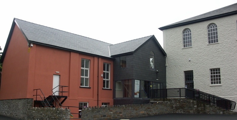
The town's many cultural events include local poets and writers holding poetry evenings and music festivals organised at Cyfarthfa Castle and Park. Menter Iaith Merthyr Tudful (the Merthyr Tydfil Welsh Language Initiative) has successfully transformed the Zoar Chapel and adjacent vestry building in Pontmorlais into a community arts venue, Canolfan Soar and Theatr Soar, which run a programme of performance events and activities in both Welsh and English, together with a cafe and a bookshop specialising in local interest and Welsh language books and CDs.
Merthyr Tydfil Housing Association, in partnership with Canolfan Soar, has raised funds to turn the Pontmorlais area into a cultural quarter. With references to the 1831 Merthyr Rising and red bricks for its frontage, an arts and creative industries centre named Redhouse Cymru was launched in Merthyr Tydfil Town Hall on Saint David's Day 2014. The town's several choirs – Dowlais Male Voice Choir, Ynysowen Male Voice Choir, Treharris Male Voice Choir, Merthyr Tydfil Ladies Choir, Con Voce, Cantorion Cyfarthfa, St David's Church Choir, St David's Choral Scholars, Merthyr Aloud and Tenovus – perform locally and abroad and in the media.
From the Wikipedia article Merthyr Tydfil, under CC BY-SA 4.0.
Notable people from Merthyr Tydfil
 John HughesWelsh businessman, founder of DonetskPhoto: Unknown author Unknown author, Public domain
 Joseph ParryWelsh composer (1841–1903)Photo: Frederic Griffith died 1917. The..., Public domain
 Samuel GriffithAustralian politician (1845–1920)Photo: State Library of Queensland, Public domain
 Anna Maria BennettWelsh novelist writing in EnglishPhoto: K. Mackenzie (after T. Braine), Public domain
 Gordon DaviesWelsh footballer (born 1955)Photo: Timmy96, CC0
 William Berry, 1st Viscount CamroseBritish newspaper publisher (1879-1954)Photo: Bain News Service, Public domain
 Steve JenkinsWelsh footballer (born 1972)Photo: Barnet Football Club, CC BY 3.0
- Ian WatkinsWelsh musician and sex offender (1977–2025)
- Timothy EvansBritish man wrongly convicted of murder (1924-1950)
- Johnny OwenWelsh boxer (1956–1980)
- Mark PembridgeWelsh footballer (born 1970)
- Merryl Wyn DaviesWelsh Muslim scholar
Born in Merthyr Tydfil, according to Wikidata (CC0). Each name links to its Wikipedia article.
Where to stay8
Churches and places of worship22
Shopping15
Gas and EV charging2
Schools, colleges and libraries19
Healthcare7
Ivor Street Health Centre
Clinic and pharmacy · 1.3 mi
Ivor Street, Merthyr Tydfil
Map of Merthyr Tydfil
230 places. The map loads OpenStreetMap tiles when you open it.
Getting there and nearby towns
Cardiff Airport (CWL) is the nearest airport with scheduled flights listed in OpenStreetMap, 24 miles away.
- Mountain Ash 4 mi south, about 7 min by car
- Tredegar 6 mi east, about 9 min by car
- Rhondda 7 mi southwest, about 11 min by car
- Treharris 7 mi southeast, about 10 min by car
- Nelson 8 mi southeast, about 12 min by car
- Pontypridd 10 mi south, about 16 min by car
- Pontypool 15 mi east, about 24 min by car
- Risca 15 mi southeast, about 25 min by car
- Maesteg 15 mi southwest, about 25 min by car
- Cardiff 20 mi southeast, about 33 min by car
Drive times are estimates from straight-line distance, not routes.
Towns near Merthyr Tydfil


Keep exploring
Local news
Headlines from INDB.
Reviews, tips and questions
Loading what members have shared...
Sources and licences
- GeoNames (CC BY 4.0): population, coordinates, regions and time zone
- Mapillary (see each image): photos
- OpenStreetMap contributors (ODbL 1.0): places, airports, map data
- Wikidata (CC0 1.0): elevation, founding date, time zone, website, landmarks and historic places
- Wikimedia Commons (see each image): photos
- Wikipedia (CC BY-SA 4.0): overview and history text
Photo credits
- Hen Neuadd y Dref Merthyr, Robin Drayton, CC BY-SA 2.0
- Pont y Cafnau iron rail bridge and aqueduct, John Wilson, CC BY-SA 2.0
- Abernant St Matthews Church, Nick Earl, CC BY-SA 2.0
- Ynysgau Chapel, Unknown author, Public domain
- Canolfan Soar, Merthyr Tudful, Daicaregos, CC BY-SA 4.0
- Merthyr Tydfil Cyfarthfa and Gardens, User:Perceval, Public domain
- Cartref Joseph Parry, Trehywel, CC BY-SA 4.0
- St David's Church, Merthyr Tydfil, Richard Rogerson, CC BY-SA 2.0
- Vue Cinema Merthyr Tydfil, Sionk, CC BY-SA 4.0
- Bwthyn Joseph Parry, Jaggery, CC BY-SA 2.0
- Delyth Jewell at the third AUOB Cymru National March for Welsh Independence 7 September 2019 - Delyth Jewell, Llywelyn2000, CC BY-SA 4.0
- Third AUOB Cymru National March for Welsh Independence 7 September 2019 05, Llywelyn2000, CC BY-SA 4.0
- Crys-T Gwrth-Ffasgaeth - Anti-Fascist T-shirt at the AUOB march for Independence at Merthyr, Wales, Llywelyn2000, CC BY-SA 4.0
- Iain Black at the third AUOB Cymru National March for Welsh Independence 7 September 2019 20, Llywelyn2000, CC BY-SA 4.0
- Third AUOB Cymru National March for Welsh Independence 7 September 2019 04, Llywelyn2000, CC BY-SA 4.0
- Third AUOB Cymru National March for Welsh Independence 7 September 2019 02, Llywelyn2000, CC BY-SA 4.0
- Delyth Jewell at the third AUOB Cymru National March for Welsh Independence 7 September 2019 14, Llywelyn2000, CC BY-SA 4.0
- Third AUOB Cymru National March for Welsh Independence 7 September 2019 03, Llywelyn2000, CC BY-SA 4.0
- Third AUOB Cymru National March for Welsh Independence 7 September 2019 21, Llywelyn2000, CC BY-SA 4.0
- Third AUOB Cymru National March for Welsh Independence 7 September 2019 19, Llywelyn2000, CC BY-SA 4.0
- Third AUOB Cymru National March for Welsh Independence 7 September 2019 07, Llywelyn2000, CC BY-SA 4.0
- Third AUOB Cymru National March for Welsh Independence 7 September 2019 18, Llywelyn2000, CC BY-SA 4.0
- Delyth Jewell (cropped), Llywelyn2000, CC BY-SA 4.0
- Third AUOB Cymru National March for Welsh Independence 7 September 2019 13, Llywelyn2000, CC BY-SA 4.0
- Third AUOB Cymru National March for Welsh Independence 7 September 2019 06, Llywelyn2000, CC BY-SA 4.0
- Neville Southall at the third AUOB Cymru National March for Welsh Independence 7 September 2019, Llywelyn2000, CC BY-SA 4.0
- Iain Black at the third AUOB Cymru National March for Welsh Independence 7 September 2019 09, Llywelyn2000, CC BY-SA 4.0
- Leanne Wood at third AUOB Cymru National March for Welsh Independence 7 September 2019 22, Llywelyn2000, CC BY-SA 4.0
- Third AUOB Cymru National March for Welsh Independence 7 September 2019 08, Llywelyn2000, CC BY-SA 4.0
- Neville Southall at the third AUOB Cymru National March for Welsh Independence 7 September 2019 17, Llywelyn2000, CC BY-SA 4.0
- Barn at Pandy Farm, Sionk, CC BY-SA 4.0
- Cyfarthfa Park Fountain, Stevieb3945, CC BY-SA 4.0
- Street-level photo, editid, CC BY-SA 4.0
- Street-level photo, trigpoint, CC BY-SA 4.0
- Street-level photo, trigpoint, CC BY-SA 4.0
- Street-level photo, southglos, CC BY-SA 4.0
- Street-level photo, trigpoint, CC BY-SA 4.0


Page built November 10, 2026. Spotted a mistake? Tell us or suggest a place.